Posted on Oct 1, 2016
0

Posted on Oct 1, 2016

0 0

7km

Distance

2.5hrs

Time

450m

Ascent

1022m

Highest point

3/10

Difficulty

Best season icon (Hokkaido Wilds)
Jun-Oct

Best season

Mt. Tarumae has excellent bang for your buck when it comes to effort vs. reward. Due to it being an active volcano whose slopes mainly consist of volcanic ash and rock, there are no trees, affording massive views across Lake Shikotsu, the Chitose Plains, and the Pacific Ocean. During the peak hiking season, a huge line of cars forms as hopeful climbers wait to drive to the small parking lot at the trailhead half way up the mountain. Pair a Mt. Tarumae hike with an overnight cycle trip from Sapporo, and you can beat the crowds, and cycle up the gravel road at your pleasure.

Last updated Jul 13, 2021

Route Map

Need to know details

Location

This hiking route up Mt. Tarumae is on the southern side of Lake Shikotsu, about 50km south of Sapporo City. The trailhead location is here, but weekend traffic up to the small parking area often requires a walk (or cycle) up the gravel road from here (in this case, add on an extra half hour to the trip).

General notes

As mentioned above, this route has great bang-for-your-buck for views vs. effort getting those views. If you’re on you bike, consider staying the previous night in the Tarumaeso Riders’ House (here) or the Morappu Campground (here).

Route Timing
Up | 1hrs
Down | .75hrs

Bank on about 1 hour from trailhead to the Mt. Higashiyama summit, and then another 40 minutes back down. If walking around the caldera rim, allow another hour on top of this.

Route

The route is not marked perse, but the track is well defined.

Transport

Public transport:

There is no public transport to the trailhead. The closest you’ll get using public transport is Shikotsu Village by bus from Chitose City (Lake Shikotsu village bus stop here), about 12km from the trailhead. The bus from Chitose City is expensive enough that if you rent a cheap car and split the cost between a few of you, it would be cheaper than the bus.

By car: 

There is some parking at the trailhead here, but on the weekends it can get very crowded.

Hut(s)

None

Physical maps
GSI Topo Map: Tarumaezan (樽前山) – map no. NK-54-14-12-2

NOTE: The GSI 1/25000 topo map(s) above can be purchased for 350yen each from Kinokuniya bookstore next to Sapporo Station or online (in Japanese).

route safety

While this mountain is well suited for beginners (even kids!), there are few defining features up the top. If the weather were to close in with thick fog, it would be entirely possible to get disoriented.

  • Notify the police of your backcountry plans online using Compass – instructions here.

Weather forecast

Windy.com weather forecast for Tarumae-zan

Onsen nearby

For cheap-and-cheerful, try the Kyuka-no-Mura Shikotsuko (休暇の村支笏湖) here. They don’t have an outdoor bath, but they’re open later (till 5pm) than any other onsen in the area. For something more upmarket, Mizu-no-Uta (水の歌), here, can’t be beaten. The onsen on its own is about 1,000yen per person, but their 2,000yen buffet lunch and onsen set is a pretty good deal, so consider booking ahead and treating yourself (NOTE: The price indicated on the Japanese page is 2,000yen, on the English page it says 3,240yen…we’ve only ever paid 2,000yen).

Extra Resources
  • See The Hokkaido Hiking Logs’ report here from an alternative route up Mt. Tarumae – in winter.

Guide Options

If you’d like to hike this route and/or explore other hikes in the central Hokkaido area together with a local certified guide, get in touch with Yasuko Kikuchi. Born and raised in Hokkaido, she’s a JMGA-certified guide now based in Sapporo. Her outdoor experience is broad and worldwide, having worked as a Canadian Ski Patrol member, and has sumitted a number of 6,000m+ peaks around the world. She speaks good English. In addition to Yasuko, also see a full list of English-speaking Hokkaido Mountain Guides Association (HMGA) guides on the HMGA website here

Support us

Like this content? Buy the HokkaidoWilds.org team a coffee. 50% of tips go to the Hokkaido Wilds Foundation.

Show Full Route Notes Close Route Notes

Route Trip Notes

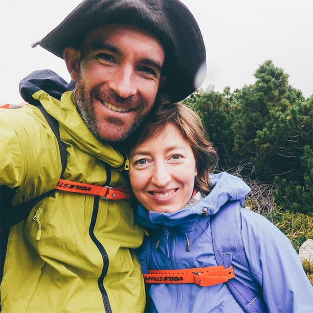
The previous night we had stayed at the excellent Tarumaeso Riders’ house, so we were away by 8am this morning on our bikes, in order to meet another 6 friends who would meet us at the trailhead to Mt Tarumae at 9:30am. We had a 7km uphill ride from the riders’ house to get there. Despite the uphill we were happy we were on bikes, enjoying the autumn colors and forest light.

It transpired that the two cars with the others would end up arriving 30 minutes late, by which time the highest-altitude car-park was full. They had to settle for the lower carpark which necessitated an extra 45 minute walk. This meant that the cycling trio started up the hill ahead.

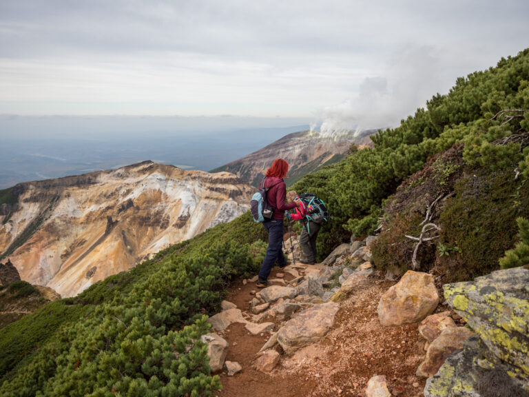
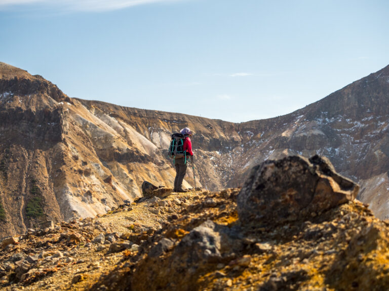
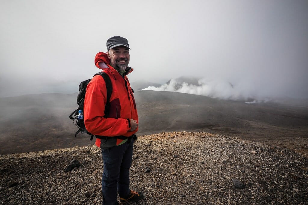
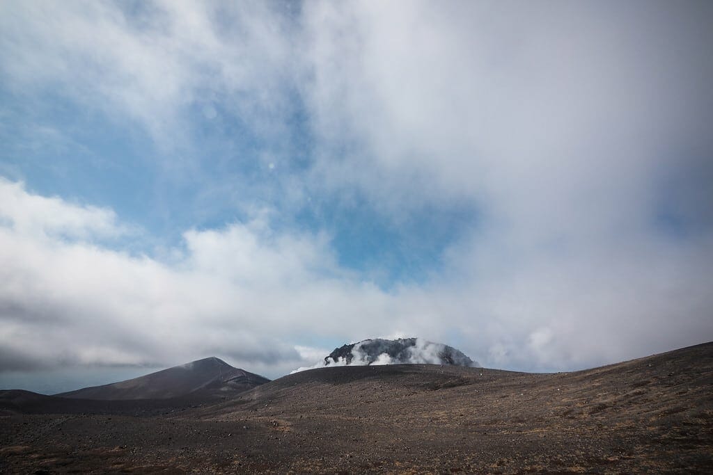
Reveling in the early clear views, including the smoking cork protruding from the floor of Mt Tarumae’s very active-looking crater.

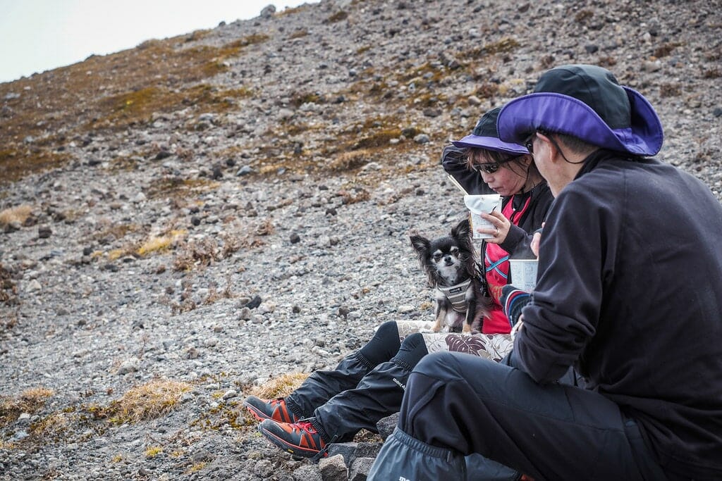
Apart from the smoking depths of the crater, among the more curious curiosities was a couple hiking with their intrepid chihuahua.

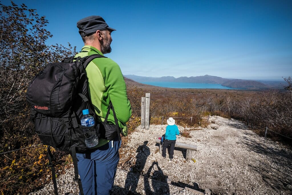
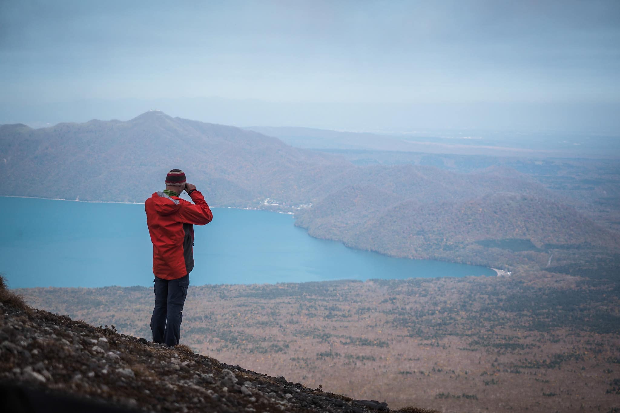
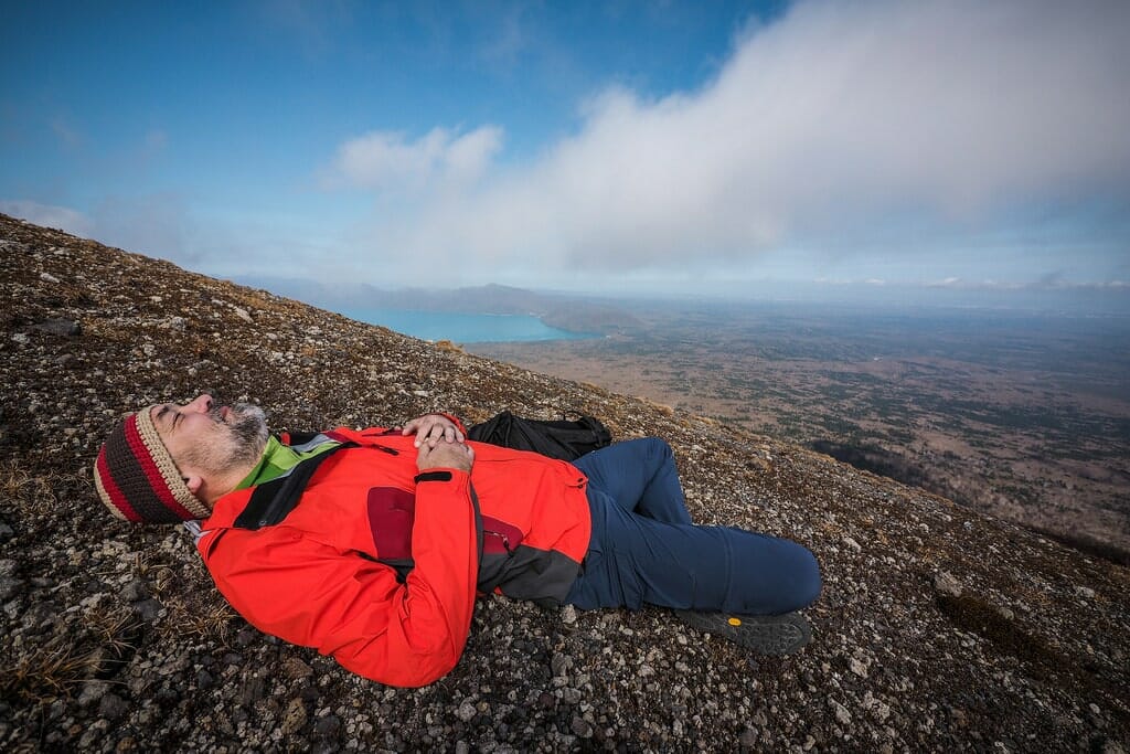
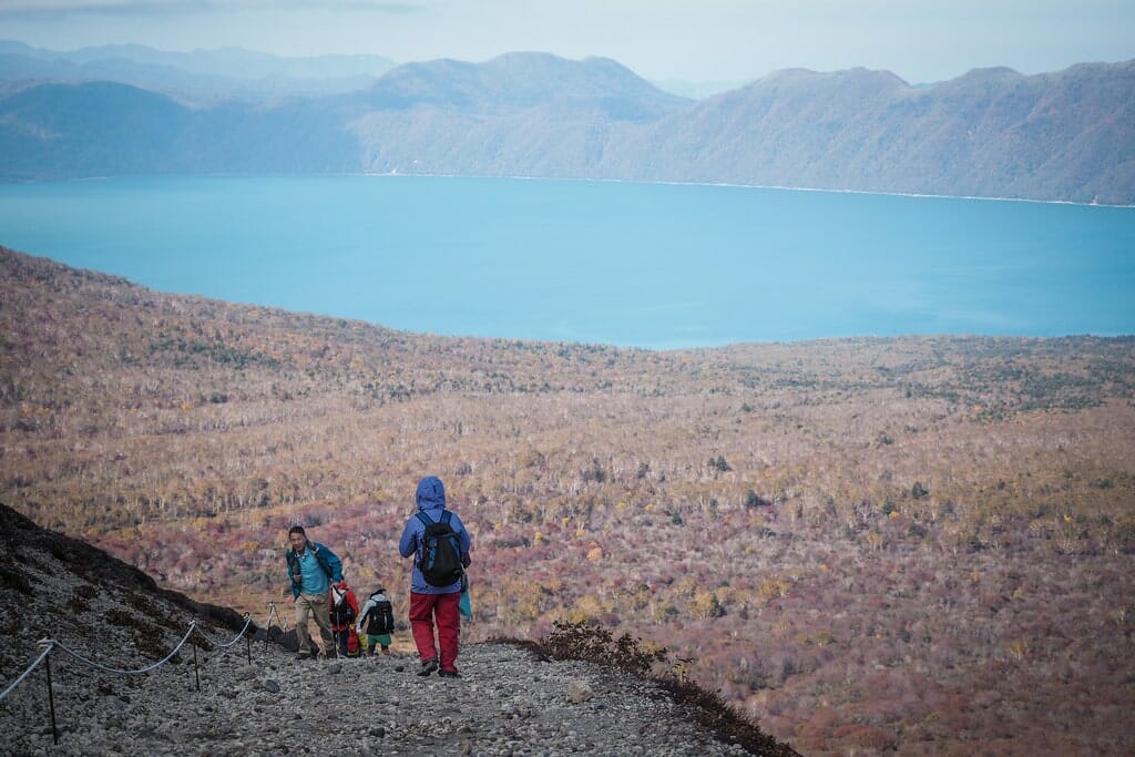
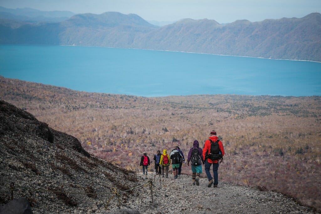
The view across Lake Shikotsu and the Chitose plains was equally enticing. And the wait for the other hikers in our group allowed for some relaxing downtime.

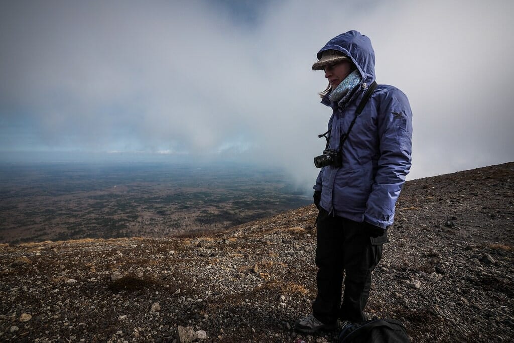
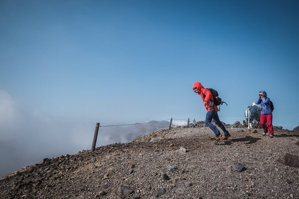
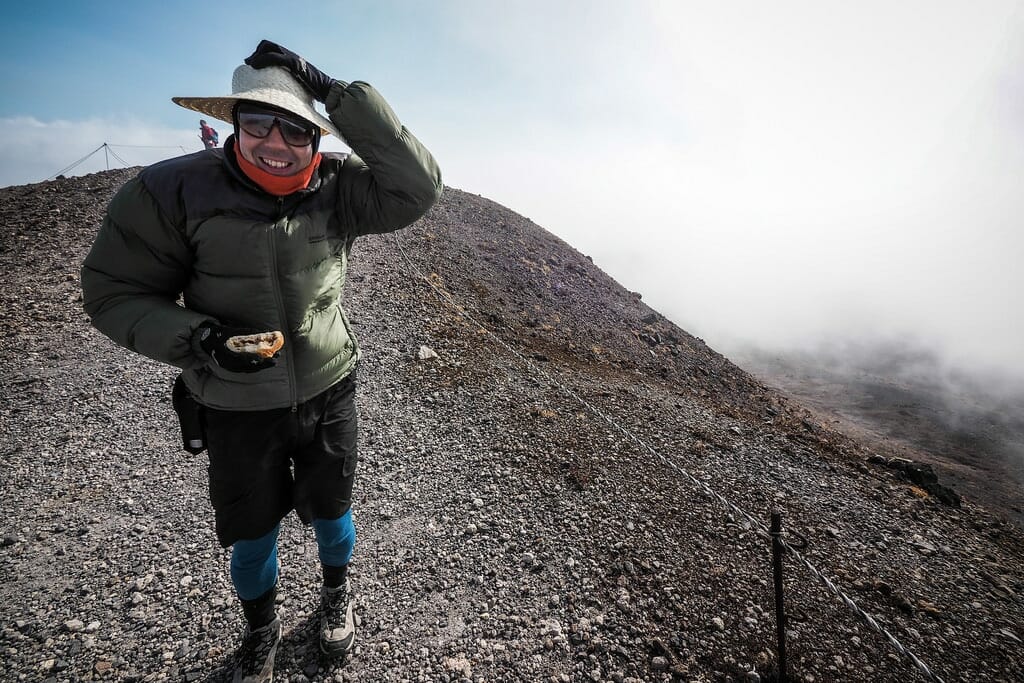
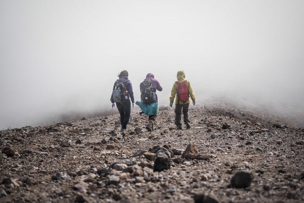
By the time the others had arrived an hour later, however, cloud cover had increased and the wind had picked up, requiring all layers on deck. The way down was the kind of wind-speed that gets the heart pumping. So much so that we wondered if the chihuahua made it off the mountain by means other than flying.

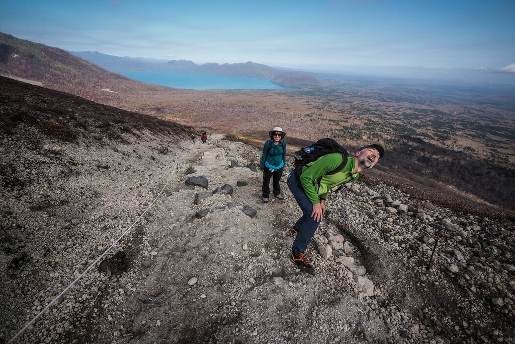
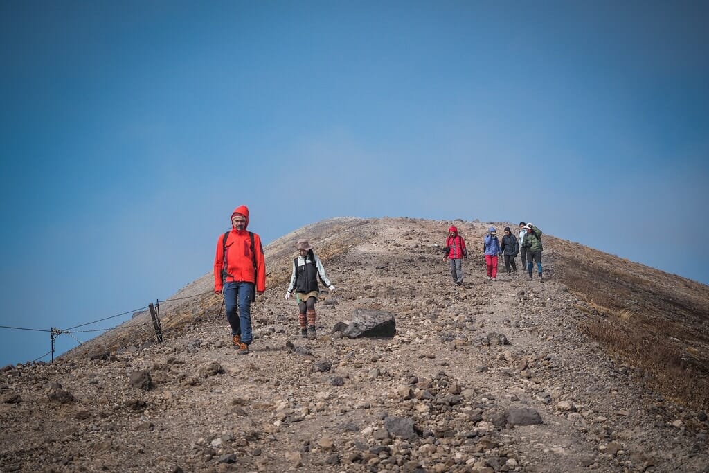
Luckily for the whole troupe, the views on the way down were just as spectacular as on the way up.

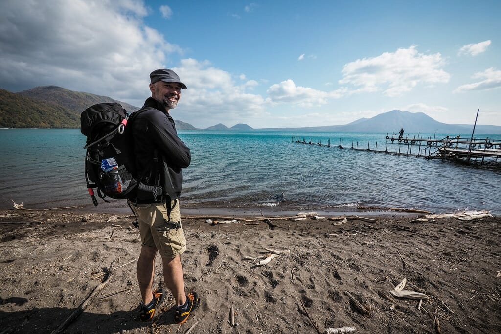
Leaving the others with their 45 minute walk down the gravel road to the lower car park, Haidee, Dirk and I jumped on our bikes for a fast downhill ride to Shikotsu Spa, where we would meet up again for an onsen hotspring.

We somehow managed to miss the others at the onsen, and only ended up seeing them again once they were finished…in the mean time, while we thought we were still waiting for them to arrive at the onsen, we managed to see a taiko drum performance in the spa town center.

It was dark by the time we made the 4km bike ride back to the riders’ house…exhausted from a very full day.


See the Sapporo-Tarumae cycle route here >>

Comments | Queries | Reports

Done this Tarumae-zan route? Thinking of doing it? Please post any feedback or queries here. Thanks!

Leave a Reply

Your email address will not be published. Required fields are marked *

This site uses Akismet to reduce spam. Learn how your comment data is processed.

See More Like this

Printable Tarumae-zan Topomap

TOPO DOWNLOAD (PDF, 17.8MB)

Download may take some time

Hokkaido Wilds Foundation

We’ve got affiliate links on HokkaidoWilds.org to help fund the Hokkaido Wilds foundation.

The Foundation gets a small commission on sales from affiliate links, but we only link to stuff we think is worth checking out for people keen on the outdoors in Hokkaido and Japan.

The Hokkaido Wilds Foundation is a fund where 100% of funds are donated to Hokkaido volunteer groups involved in sustainable, safe, and responsible access to the Hokkaido outdoors.

Learn more here

ADVANCED FILTERS

Filter by location

About Filters

REGION: The general mountain/geographical region the route is in.

BEST MONTH(S): Time of year a route is suited to visiting. Some pop all season, some are more limited.

DIFFICULTY: How strenuous a route is, and how technical it is. Full details here.

FREERIDE/SKITOUR: Very subjective, but is a route more-of-a-walk-than-a-ski or the other way around? Some routes are all about the screaming downhill (freeride), some are more about the hunt for a peak or nice forest (ski-tour). Some are in between. 

MAIN ASPECT: Which cardinal direction the primary consequential slope is facing, that you might encounter on the route. More details here.

ROUTE TAGS: An eclectic picking of other categories that routes might belong to.

SEARCH BY LOCATION: You can find routes near your current location – just click on the crosshairs (). You may need to give permission to HokkaidoWilds.org to know your GPS location (don’t worry, we won’t track you). Or, type in a destination, such as Niseko or Sapporo or Asahikawa etc.

Please let us know how we can make it easier to narrow down your search. Contact Rob at rob@hokkaidowilds.org with your suggestions.

Tarumae-zan Hiking Difficulty Rating

Category

Grade

Points

Strenuousness

Vertical Gain

C

30

Time ascending

D

0

Technicality

Altitude

B

6

Hazards

D

Navigation

D

Totals

36/100

GRADES range from A (very difficult) to D (easy). Hazards include exposure to avalanche and fall risk. More details here. Rating rubric adapted from Hokkaido Yukiyama Guidebook 北海道雪山ガイド.