Shakotan-dake Northeastern Ridge Spring Ski Touring

積丹岳 | Poro-ru-par

Posted on Mar 19, 2017
41 0
NE
Posted on Mar 19, 2017
41 0
NE
16km

Distance

5 hours

Time

1060m

Ascent

1255m

Highest point

6/10
Difficulty
Snow Icon | Hokkaido Wilds
Mar-May

Best season

GPX

KML

TOPO

GSI

Shakotan-dake (積丹岳, 1255m) is the great hulk of a mountain at the end of the Shakotan Peninsula (積丹半島) north of Niseko and west of Sapporo City. It is a spring skiing staple in southern Hokkaido, with a gorgeous gradual approach, and some excellent open-slope skiing from the summit. The summit offers expansive views of the Japan Sea, with the Mashike Range far in the distance to the northeast. To the south are views of Iwanai, Raiden-yama, Yotei-zan, and the Niseko Range.

Last updated Apr 2, 2021

Topomap

Route Map

Need to know details

Location

This route starts not too far from the tip of Shakotan Peninsula (here), about 80km northwest of Sapporo City, past Otaru City.

General notes

Most often, Mt. Shakotan is skied in spring when the rough weather of the Shaoktan Peninsula’s deep winter has died down – you can happily ski this mountain well into May. It’s not impossible to ski this peak in deep winter – be prepared for a long, gradual, deep-snow approach. Unfortunately the Shakotan Hut is no longer available for winter use (due to structural safety concerns).

  • Other attractions: The historic Nikka Whiskey Yoichi Distillery (location) is on the way back to Sapporo (near the Yoichi JR Train Station), and they offer free tastings. Very much worth a visit!
Hut
Shakotan Hut (full details here)

Available for use from around the end of April each year till November, Shakotan Hut provides an excellent base from which to explore peaks such as Mt. Shakotan-dake (積丹岳 – 1,255m) or Mt. Yobetsu (余別岳 – 1,298m) on the Shakotan Peninsula. You can drive there in summer, and in winter, it’s about 40 minutes from the end of the snow-cleared section of dirt road. Shakotan Hut is a public-transport accessible hut, free to use for overnight stays. As far as Hokkaido mountain huts go, it is a luxurious one – running spring water, a kerosene stove, and a large tatami living area.

Route details

There are no route markers on this route. Park well to the side of the road, as far up the hut access road as the snow will allow. In deep winter, the road is cleared up till the water station, around here. Skin the first 40 minutes or so to the hut (closed in winter). From the hut, carry on southwest into the forest. The forest is relatively thick for the first half hour or so, before slowly thinning out to more well spaced old-growth trees. The route essentially follows the summer trail all the way to the summit. At just below 900m, you’ll now be beyond the treeline for the remaining 45 minutes or so to the summit – this can be very exposed to the wind. There’s a final steep 50m ‘step’ up to the summit approaching from the east – in early spring it may pay to carry ski crampons in case of hard ice. Return the way you came.

Route Timing
Up | 3.5hrs
Down | 1hrs

About 40 minutes from trailhead to hut, then 3 hours from hut to summit. Bank on just over an hour for the descent.

Transport

Public transport:

You’ll want to catch the Number 21 bus from Yoichi JR Station, bound for Cape Kamuisaki, and get off at the bus stop called tozan-guchi (登山口) which is stop number 52 (counting from Otaru Station). Bus stop location is around 43.308076, 140.553185, and will likely take around an hour from Yoichi Station. Check at tourist info at Sapporo Station before you head off for season timetable information.

By car:

There is a small area to park cars just before the forestry road starts here. Later in the season, it is sometimes possible to drive almost all the way to Shakotan Hut, but don’t bank on it. Respect roped-off roads.

Physical maps
Print: HokkaidoWilds.org 1:25,000 TOPOMAP+
Niseko Backcountry map: Buy on Amazon.co.jp | See companion site for more purchase options
Official Topo Map: Yobetsu (余別) – map no. NK-54-20-9-1
Official Topo Map 2: Mikuni (美国) – map no. NK-54-20-5-3

NOTE: The official 1/25000 topo map(s) above can be purchased for 350yen from Kinokuniya bookstore next to Sapporo Station or online (in Japanese).

Aspect
The main aspect skiers are exposed to on the descent and/or ascent is Northeast. Therefore, keep an eye on the weather forecast a few days ahead of your trip to monitor wind, snow, and temperature. Also, since this route is in the general vicinity of the Shiribeshi area, consider looking at the Japan Avalanche Network avalanche bulletins (updated Tuesdays, Thursdays, Saturdays at 8am) or the daily Niseko Avalanche Information website. These may give extra insight into avalanche conditions in the greater area around the route.

Snow and
route safety

When I mentioned to Mr. Hirata, the hutkeeper of Ginreiso Hut, that I was planning on going to Shakotan-dake, he said I would die. I’d been there before, and didn’t die, but I can see where he is coming from – Shakotan-dake is often buffeted by howling winds direct from the Japan Sea, so you’ll need to choose your weather window wisely. The Yuki-yama Guide (ISBN: 978-4894538047) suggests leaving this area alone in mid-winter, and waiting till mid-March for more stable weather.

Shakotan-dake Northeastern Ridge Spring Ski Touring Difficulty Rating

Category

Grade

Points

Strenuousness

Vertical Gain

A

40

Time ascending

C

3

Technicality

Altitude

B

6

Hazards

C

6

Navigation

C

6

Totals

61/100

GRADES range from A (very difficult) to D (easy).  More details here. Rating rubric adapted from Hokkaido Yukiyama Guidebook 北海道雪山ガイド.

Weather forecast

Windy.com weather forecast for Shakotan-dake
Onsen nearby

Misaki-no-yu (location), 10km further around the cape, has as amazing outdoor bath area with expansive views across the ocean, with breakers crashing onto the shore far below the cliff. They also have a large restaurant with pizza, fries and burgers, espresso-based coffee, and a large relaxation room. Next to the onsen is the Shakotan Blue Distillery (gin and absinthe). On the way back to Sapporo, there’s the small but cheerful Furubira Onsen (location), which is nice, but the ocean-view outdoor bath is only open from the end of April.

Extra Resources
  • See the write-up (in Japanese) from p. 242 of the Yuki-yama Guide (ISBN: 978-4894538047).
  • Also see an earlier route report here.

Guide Options

If you’d like to ski this route and/or explore other Niseko areas together with a local certified guide, get in touch with Yasuko Kikuchi. Born and raised in Hokkaido, she’s a JMGA-certified guide now based in Sapporo. Her outdoor experience is broad and worldwide, having worked as a Canadian Ski Patrol member, and has sumitted a number of 6,000m+ peaks around the world. She speaks good English. In addition to Yasuko, also see a full list of English-speaking Hokkaido Mountain Guides Association (HMGA) guides on the HMGA website here

Support us

Like this content? Buy the HokkaidoWilds.org team a coffee. 50% of tips go to the Hokkaido Wilds Foundation.

Show Full Route Notes Close Route Notes

Route Trip Notes

Route blurb from the Hokkaido Yukiyama Guide (2015), p. 186 (translated by Hokkaido Wilds)

Shakotan-dake and the nearby Yobetsu-dake are the great captains of the Shakotan Peninsula. There’s a hiking trail, so it’s a popular mountain in the summer too. The mountain sits on the Japan sea, so the blizzards in deep winter are fierce; it’s a tough peak in winter. Generally, Shoktan-dake is climbed in the spring snow months, and this guide assumes you are too. The upper open slopes and a gentle approach is well suited to spring skiing. Skiers will enjoy the relaxed downhill ski on the return.

“Enjoy a massive 1,100m ski descent on Mt. Shakotan which, along with Mt. Yobetsu, is a big boss of the Shakotan Peninsula. There’s a hiking trail on Mt. Shakotan, so people also climb it in summer. In mid-winter, owing to the fact that it is right next to the Japan Sea, it is an extremely difficult climb with its fierce blizzards. People generally climb Mt. Shakotan in the spring once the weather has become more stable. With gentle slopes and large open aspects higher up, it is perfect for enjoying spring skiing.” Yuki-yama Guide, 2015, p. 186

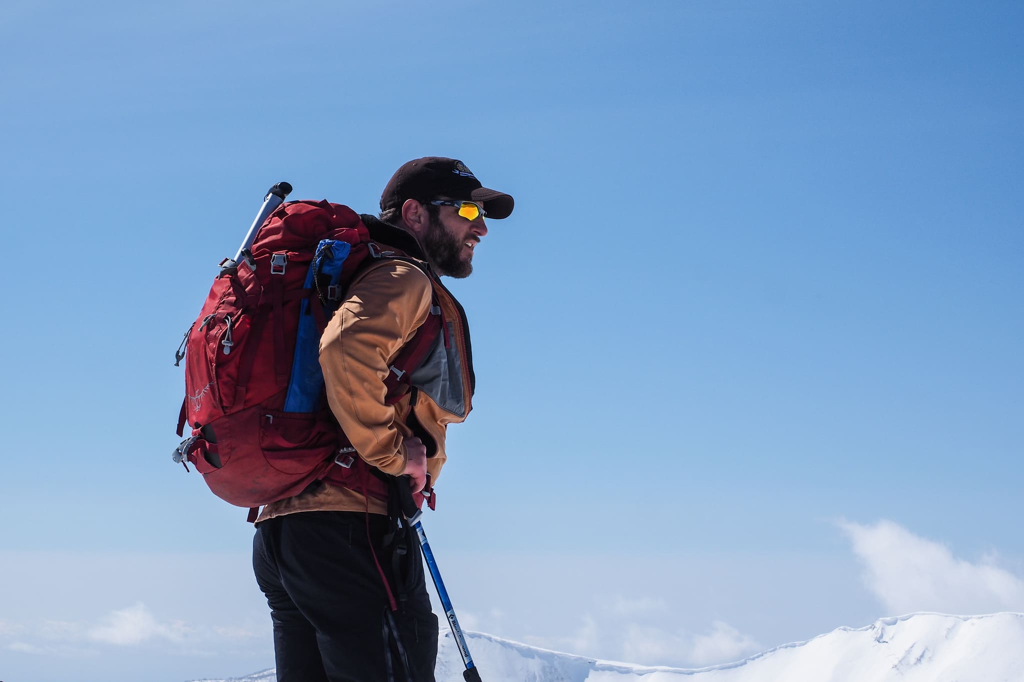
Mt. Shakotan can easily be accessed and climbed as a day-trip from Sapporo City, as I’ve done before. But, making the most of the excellent Shakotan Hut, three of us from Sapporo climbed Mt. Mekunnai on Saturday (report here), and then made the 2hr drive to the Mt. Shakotan trailhead so that we could stay at the hut and climb Mt. Shakotan on Sunday.

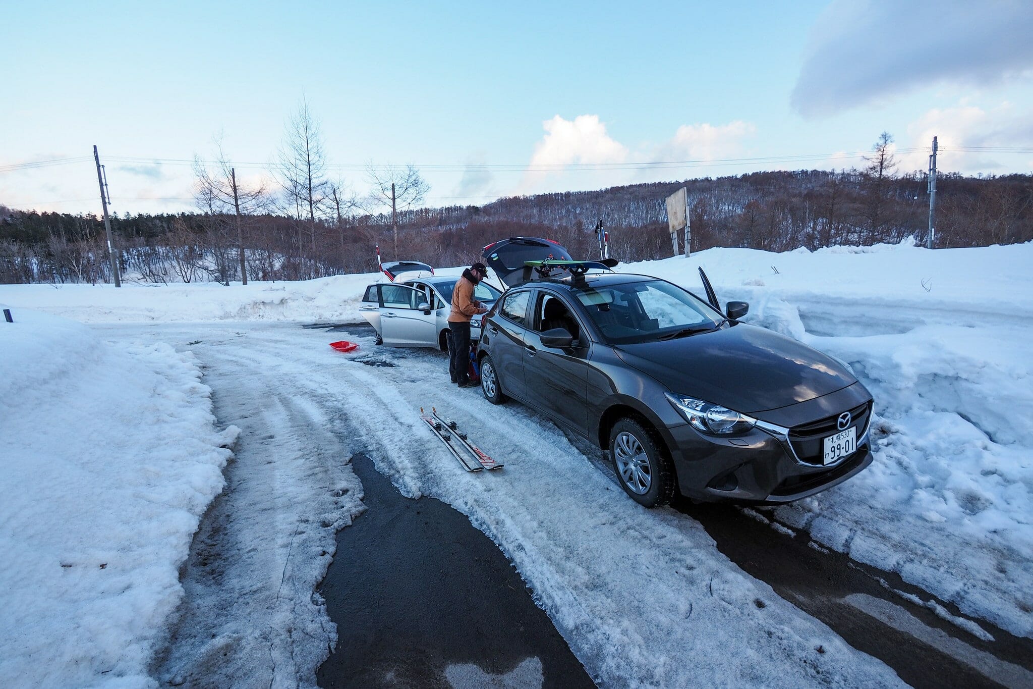
I had told Andy and Hiro that it would be an easy skin up an uncleared forestry road to the hut. Indeed, this is the route marked in the Yuki-yama Guide and was the route I’d done a few years back. With this in mind, I figured it would be perfectly OK to arrive at the trailhead relatively late, potentially getting to the hut after dark. Hiro had the right idea based on that information – he had prepared a sled to haul his gear up to the hut along the snow-bound road.

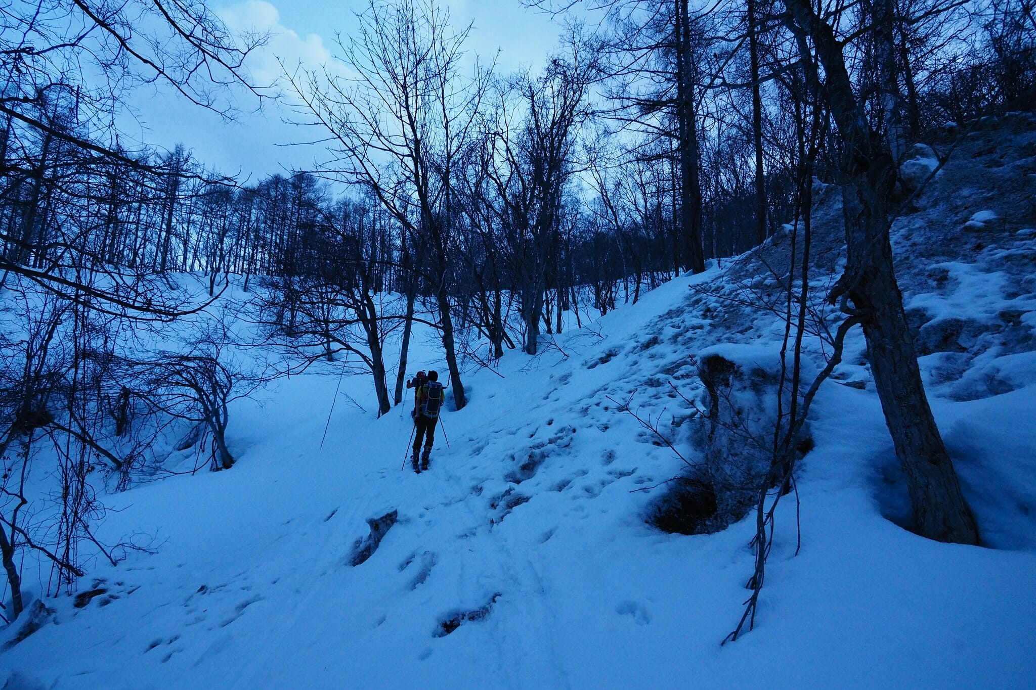
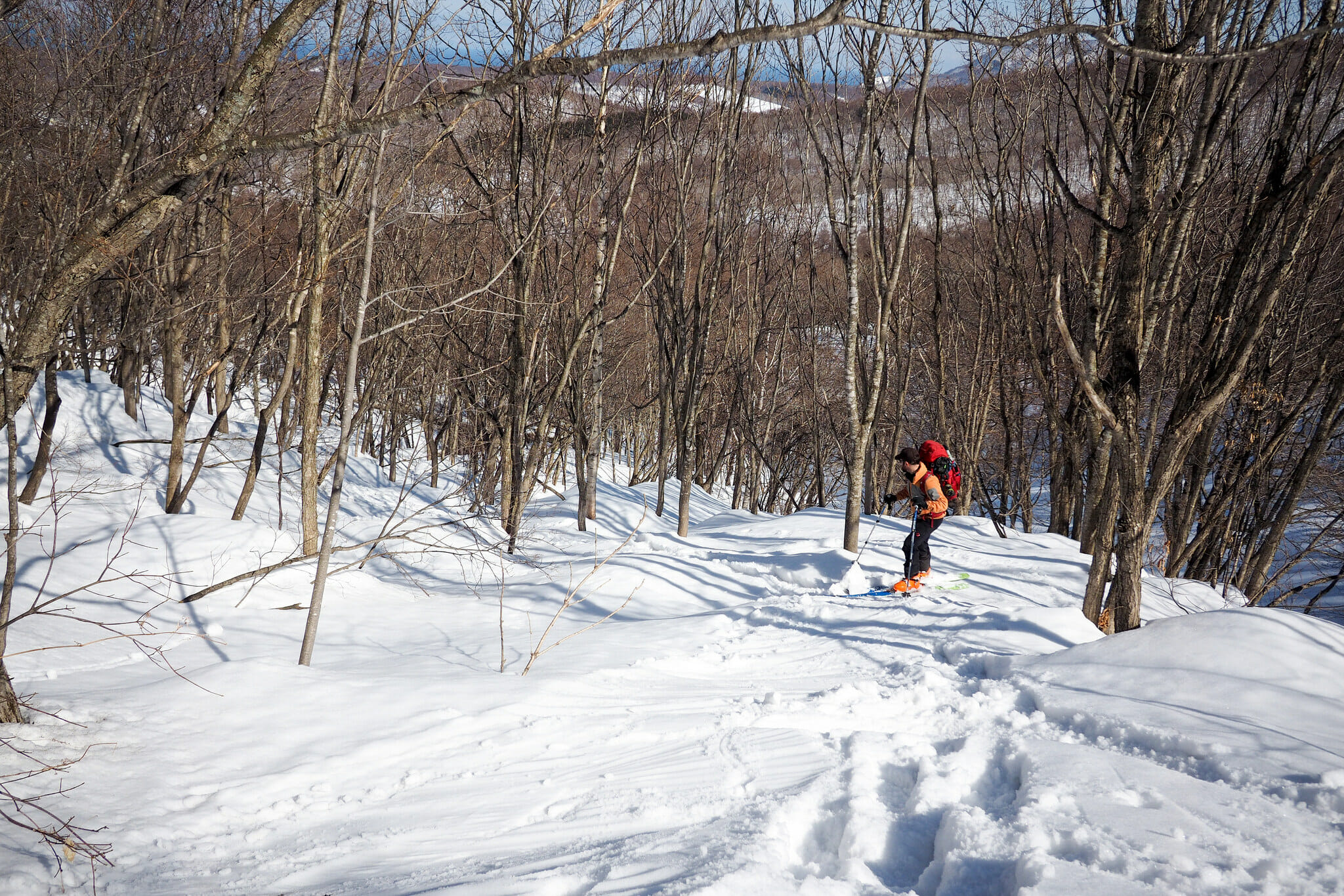
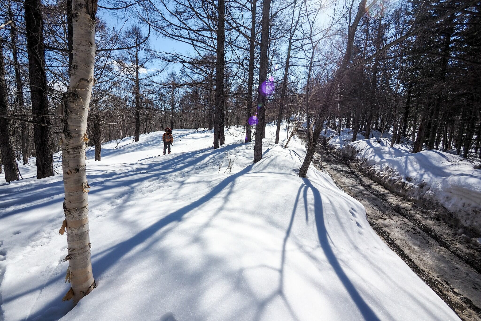
The reality was somewhat different, with the forestry road cleared of at least 1m of snow, right down to the gravel. It would be impossible to ski on it, so we were forced to follow a route along the west of the snaking forestry road, at times having to gingerly clamber over debris from the road-clearing.

With daylight fading fast – we had set off from the trailhead at 5:30pm – it would end up taking us about 1hr 15mins to get to the hut after abandoning Hiro’s sled soon after setting off, and taking turns carrying the now unwieldy extra luggage. It was a comfort having the GPS track, overlaid on the Japan official topographical maps using the Geographica App (iPhone | Android) on Andy’s phone, so that we at least knew we were headed in the right direction, and had a map location of the hut (other apps for displaying official Japanese topographical maps here).

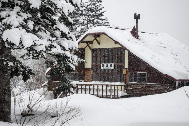
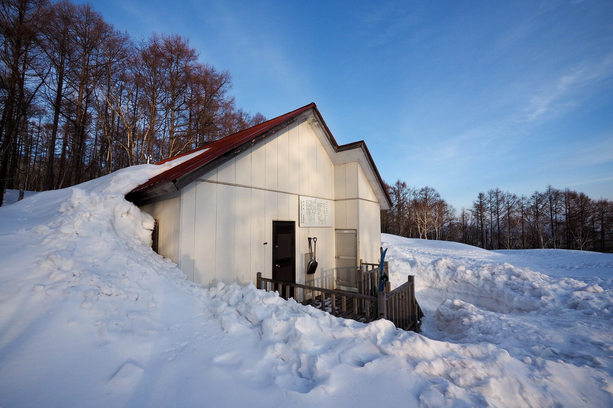
It was sweet relief to arrive at the hut at almost 7pm. We quickly got the stove running (English PDF instructions here), and settled in for a relaxing remaining evening. On the menu was a Hokkaido classic – Genghis Khan.

The delightfully quiet hut allowed us to sleep in till 6am – one of the best sleeps I’ve had in a mountain hut. 

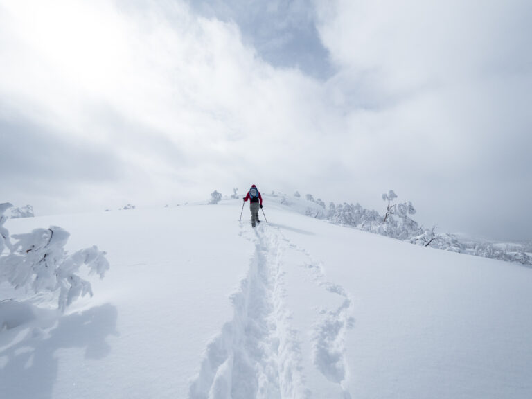
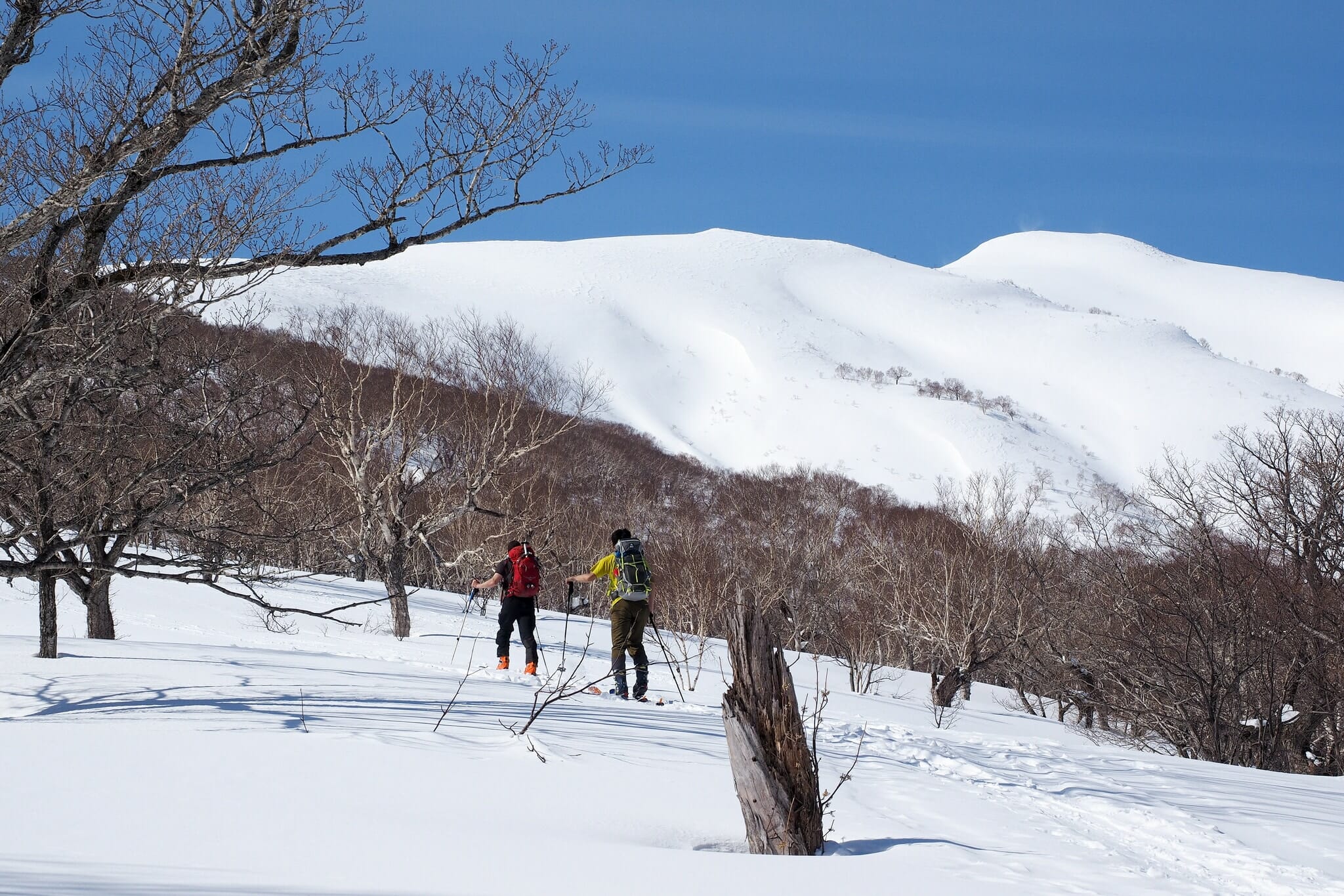
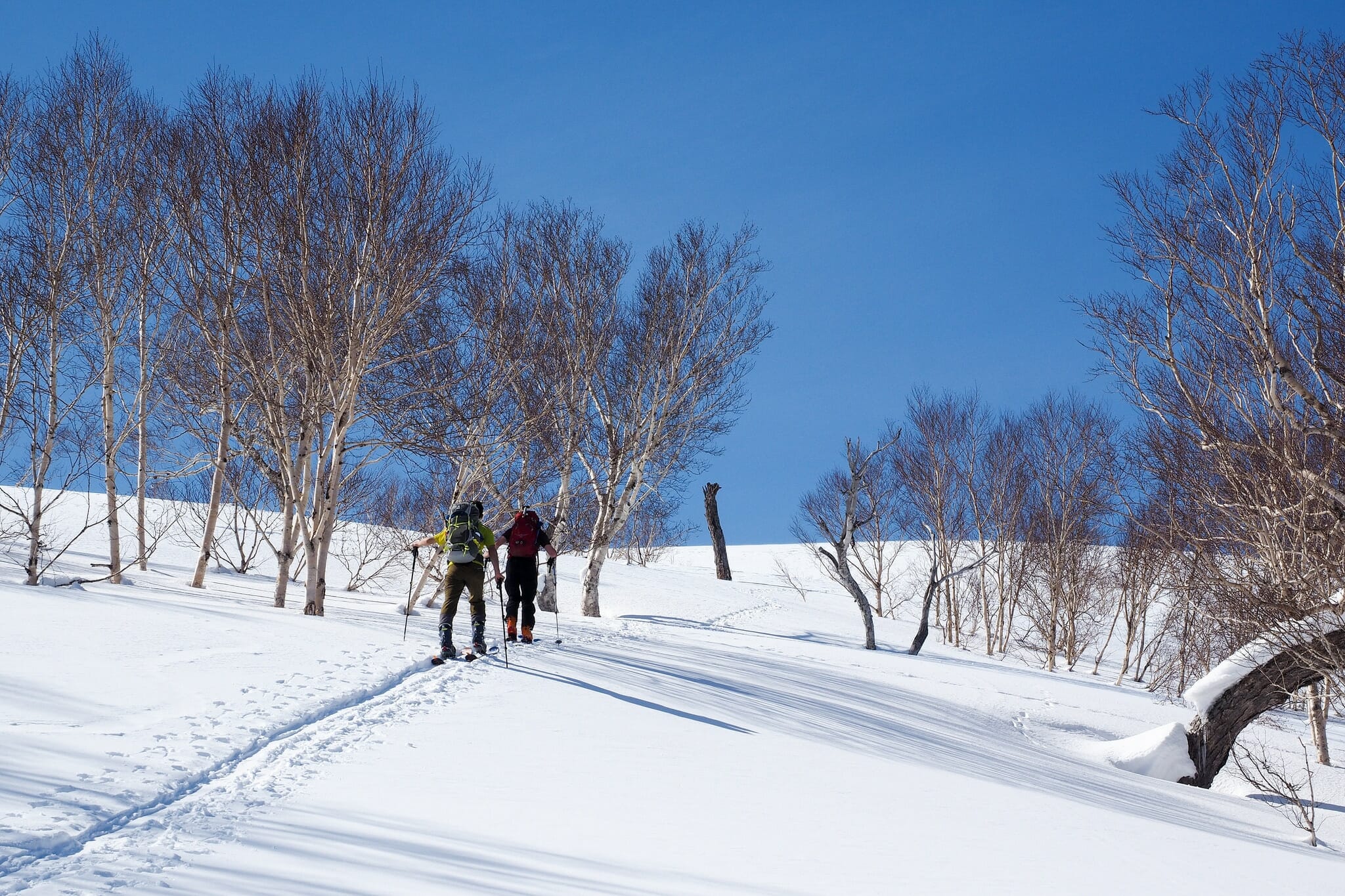
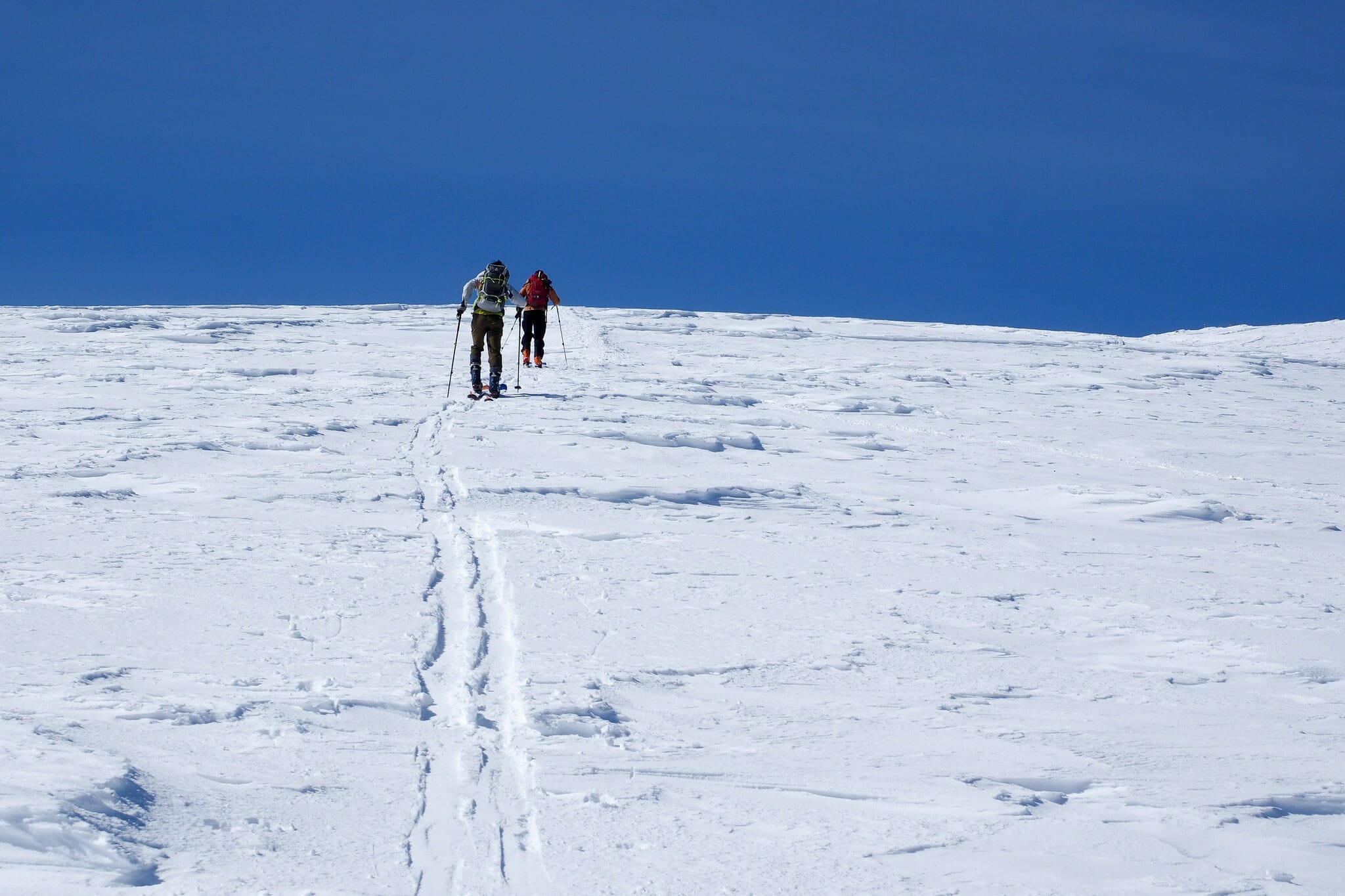
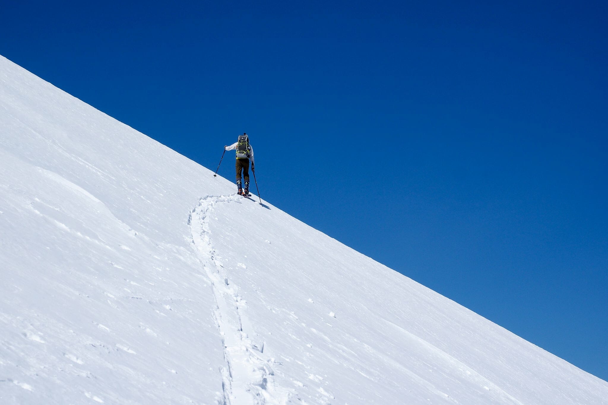
After a large breakfast of crepes we left our large packs in the hut and set off towards the summit of Mt. Shakotan. Before long, we were all in our t-shirts – it was well and truly spring weather.

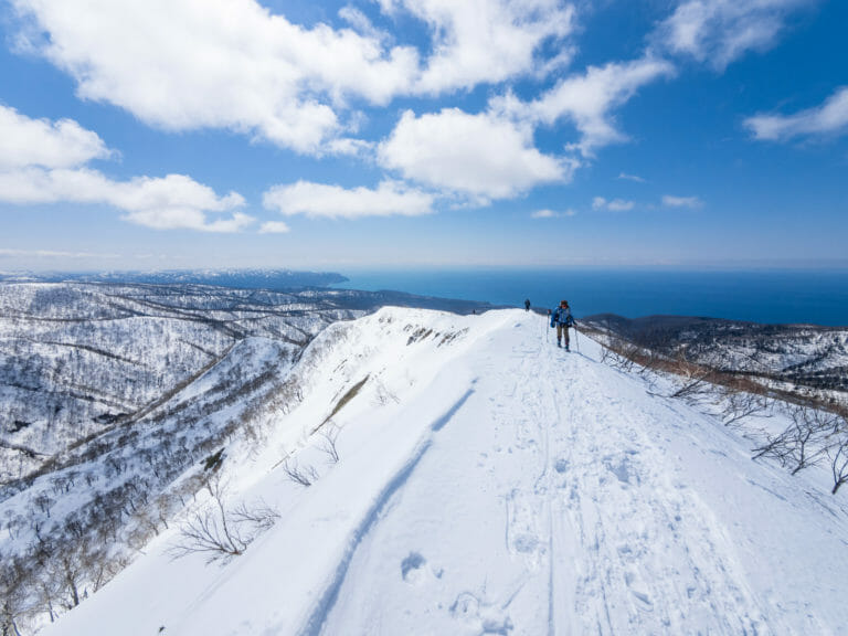
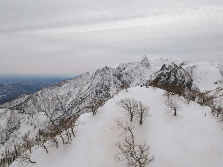
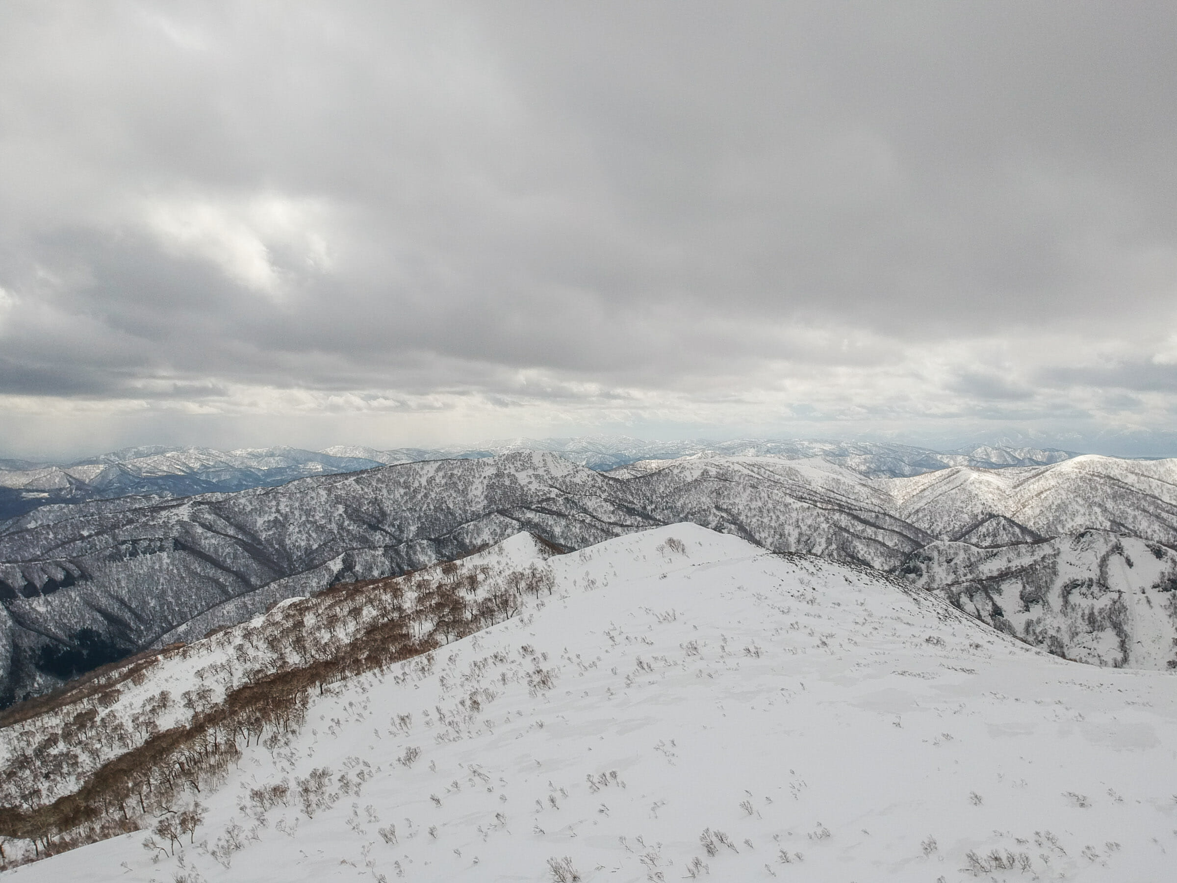
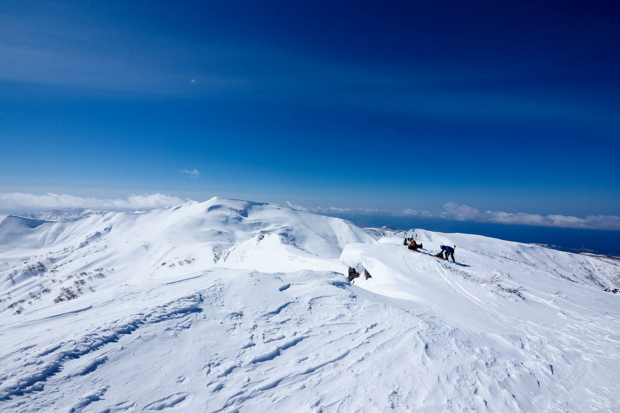
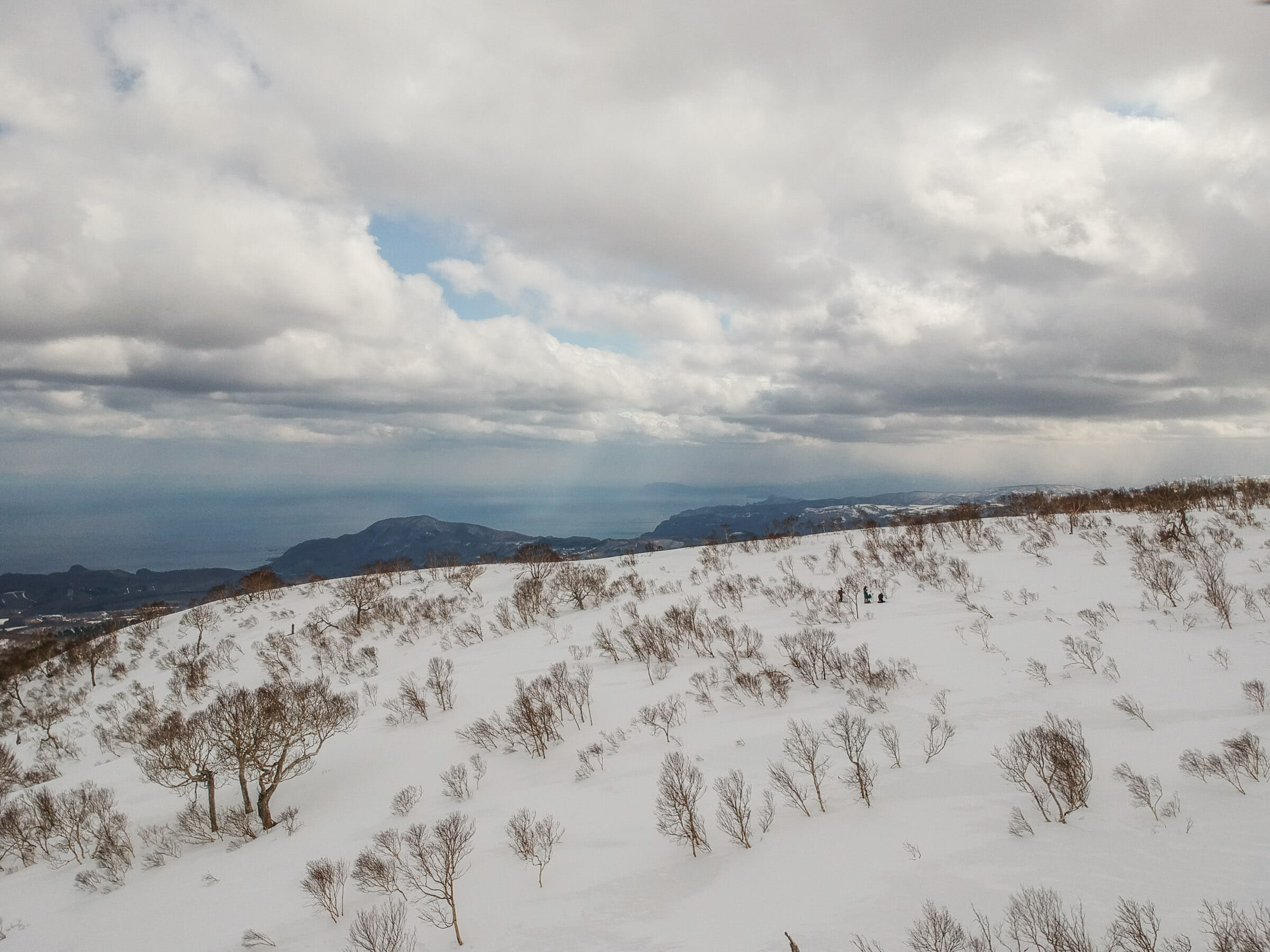
The upper ridge was a fickle beast, rising up to false summits and giving us peeks here and there of the scenery on the other side. The summit finally yielded and gave us expansive views over Mt. Yobetsu, the Japan Sea coast, and back towards Mt. Yotei and the Niseko Range, where we had been just a day ago.

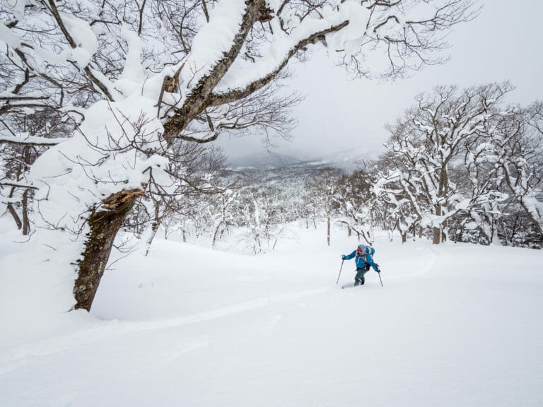
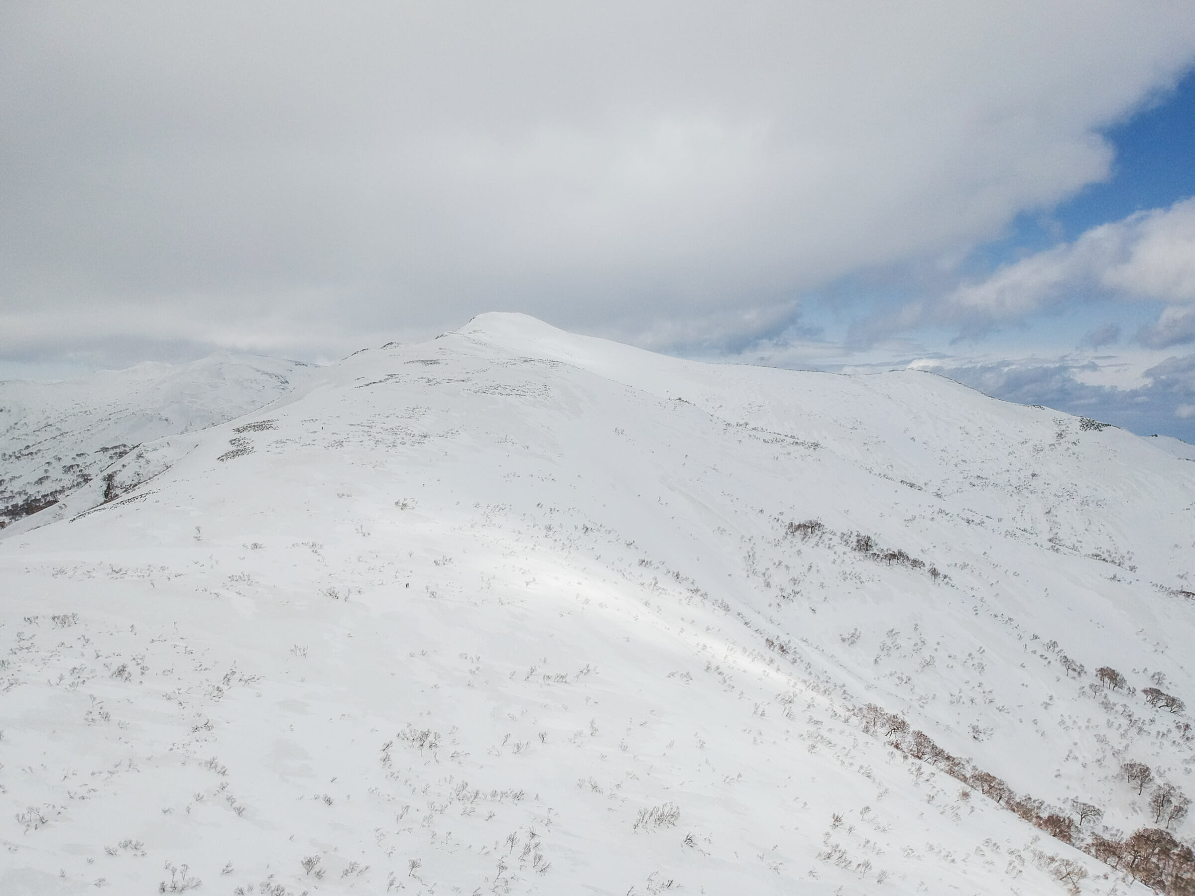
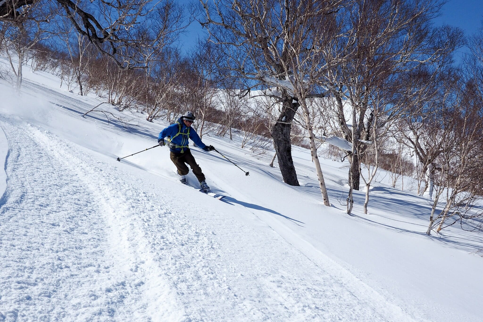
The way down got properly interesting only once we’d clattered our way down to around 970m across sastrugi-like wind-blown snow. From there, it was glorious tree skiing on even, consistent spring snow.

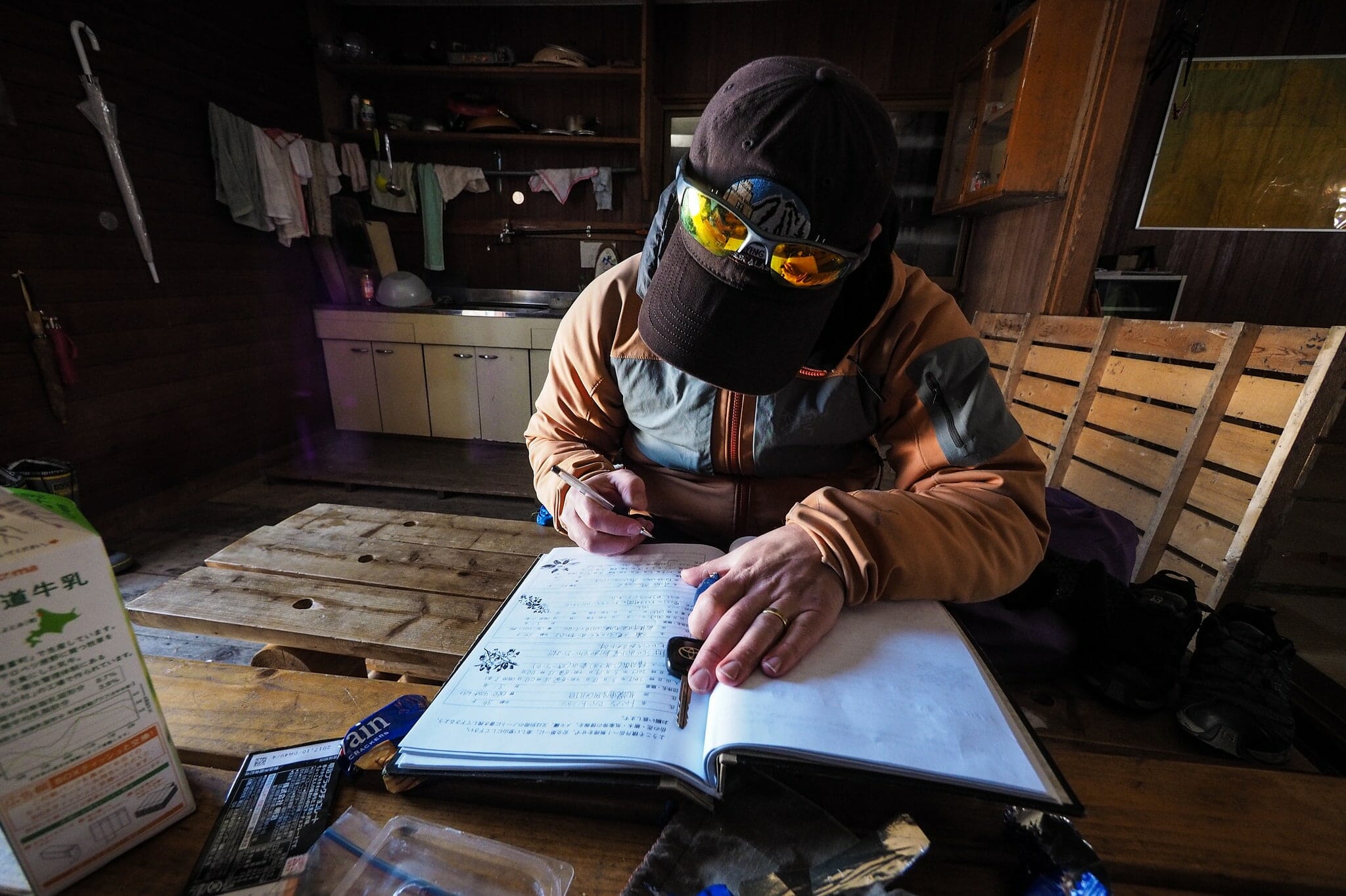
Once back at the hut we packed up, signed the guestbook…And braved the tightly-treed traverse-descent along side the cleared gravel road.

Back at the cars, a group of snowboarders, some with their snowboards attached sideways on their packs, some pulling sleds full of gear and food, were just heading off. 10 minutes later, just as we were pulling away, we noticed them returning to their van…I can only imagine that they must have been re-considering their strategy for getting their gear to the hut.

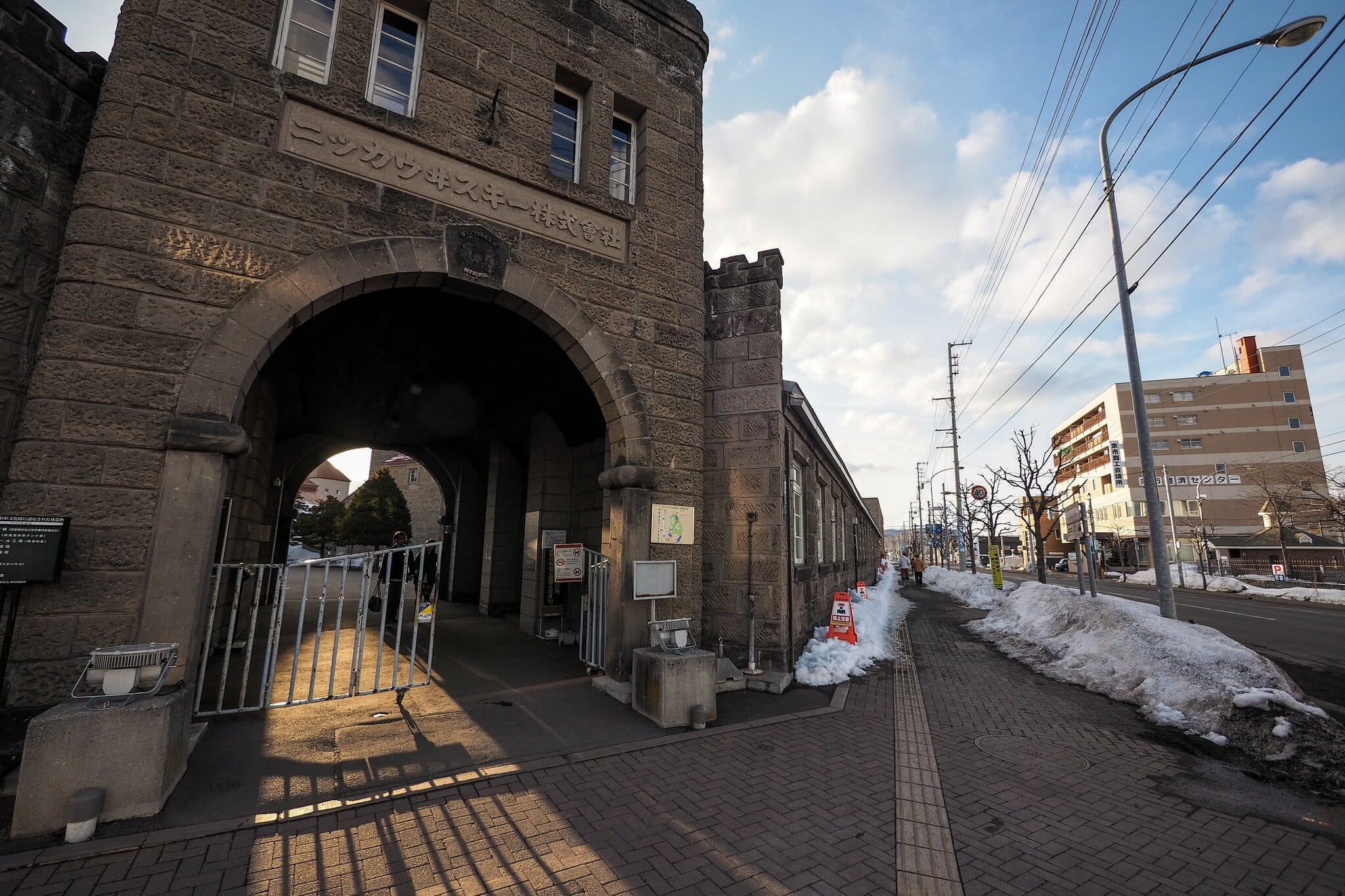
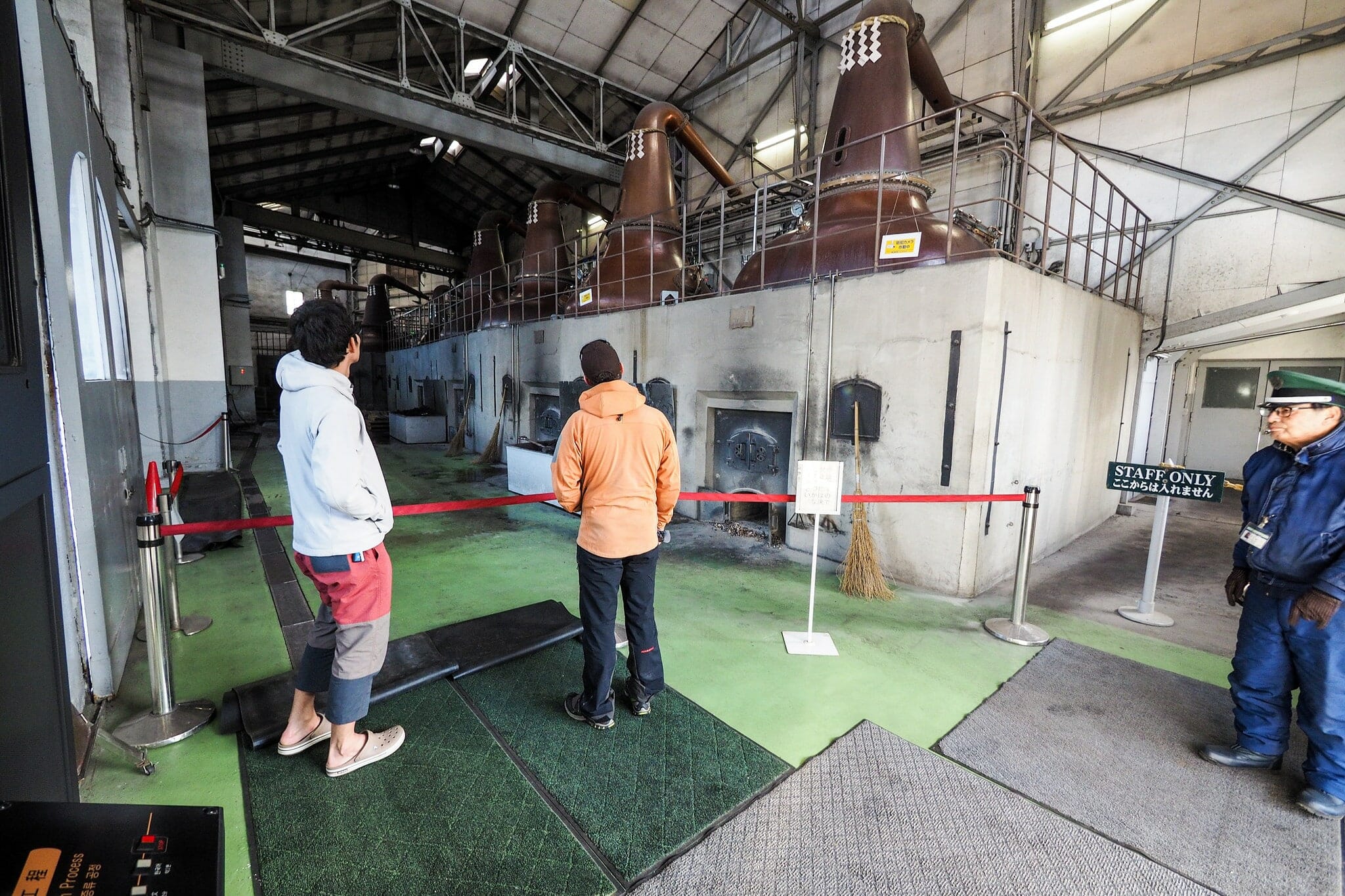
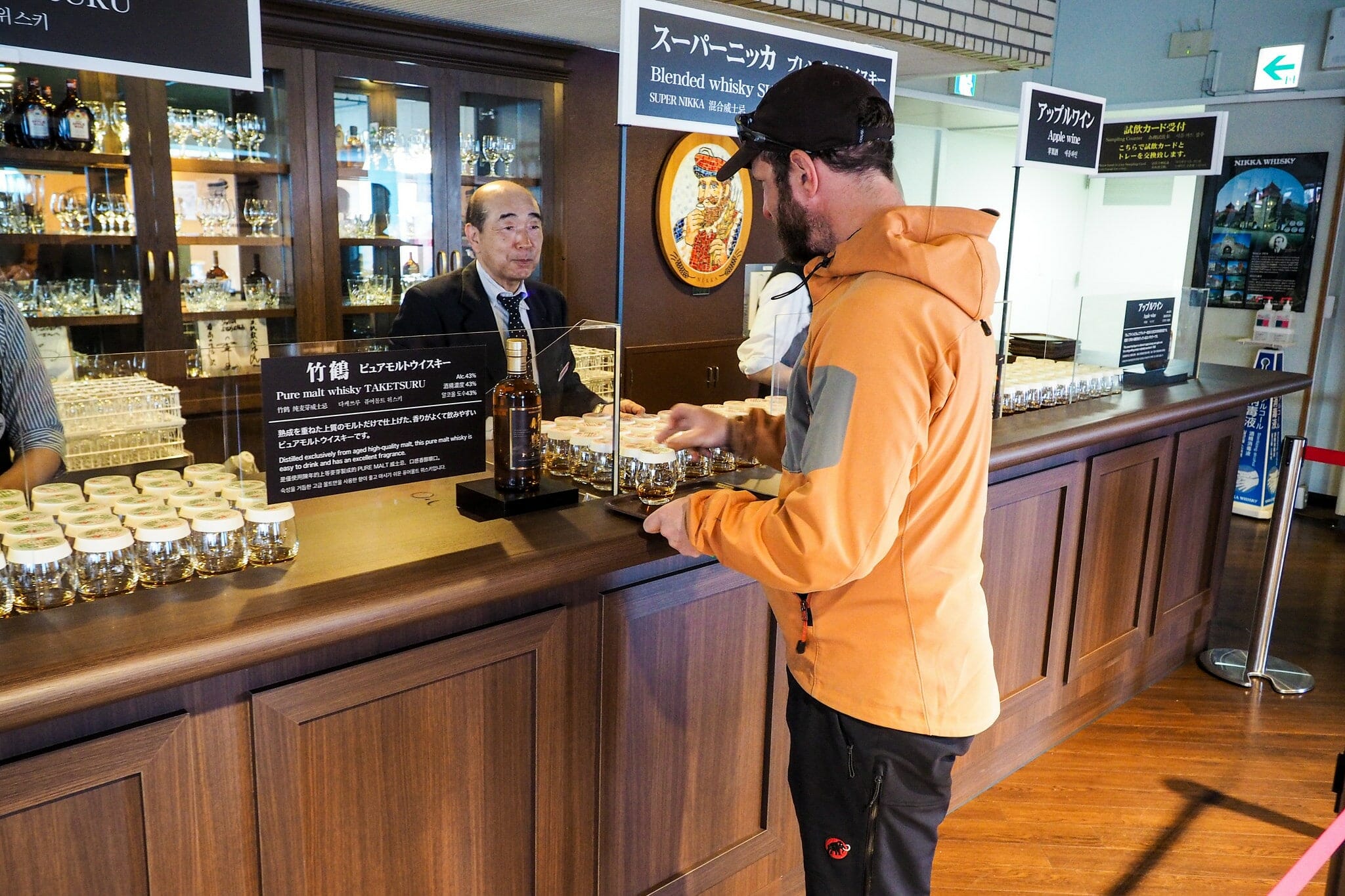
Seeing as Andy is a bit of a whiskey fan, we dropped in at the Nikka whiskey distillery on the way back to Sapporo. This historic distillery has free tastings…alas Hiro and I were driving, so had to enjoy watching Andy enjoying the offerings.

Comments | Queries | Reports

Done this route to Shakotan-dake, or others nearby? Thinking of doing it? Please post any feedback, reports, or queries here. Thanks!

Leave a Reply

Your email address will not be published. Required fields are marked *

This site uses Akismet to reduce spam. Learn how your comment data is processed.

See More Like this

Printable Shakotan-dake Topomap

TOPO DOWNLOAD (PDF, 13.7MB)

Download may take some time

Hokkaido Wilds Foundation

We’ve got affiliate links on HokkaidoWilds.org to help fund the Hokkaido Wilds foundation.

The Foundation gets a small commission on sales from affiliate links, but we only link to stuff we think is worth checking out for people keen on the outdoors in Hokkaido and Japan.

The Hokkaido Wilds Foundation is a fund where 100% of funds are donated to Hokkaido volunteer groups involved in sustainable, safe, and responsible access to the Hokkaido outdoors.

Learn more here

ADVANCED FILTERS

Filter by location

About Filters

REGION: The general mountain/geographical region the route is in.

BEST MONTH(S): Time of year a route is suited to visiting. Some pop all season, some are more limited.

DIFFICULTY: How strenuous a route is, and how technical it is. Full details here.

FREERIDE/SKITOUR: Very subjective, but is a route more-of-a-walk-than-a-ski or the other way around? Some routes are all about the screaming downhill (freeride), some are more about the hunt for a peak or nice forest (ski-tour). Some are in between. 

MAIN ASPECT: Which cardinal direction the primary consequential slope is facing, that you might encounter on the route. More details here.

ROUTE TAGS: An eclectic picking of other categories that routes might belong to.

SEARCH BY LOCATION: You can find routes near your current location – just click on the crosshairs (). You may need to give permission to HokkaidoWilds.org to know your GPS location (don’t worry, we won’t track you). Or, type in a destination, such as Niseko or Sapporo or Asahikawa etc.

Please let us know how we can make it easier to narrow down your search. Contact Rob at rob@hokkaidowilds.org with your suggestions.

Shakotan-dake Northeastern Ridge Spring Ski Touring Difficulty Rating

Category

Grade

Points

Strenuousness

Vertical Gain

A

40

Time ascending

C

3

Technicality

Altitude

B

6

Hazards

C

6

Navigation

C

6

Totals

61/100

GRADES range from A (very difficult) to D (easy). Hazards include exposure to avalanche and fall risk. More details here. Rating rubric adapted from Hokkaido Yukiyama Guidebook 北海道雪山ガイド.