Posted on Dec 9, 2017
49 2
NEN
Posted on Dec 9, 2017
49 2
NEN
6.2km

Distance

3.5 hours

Time

580m

Ascent

629m

Highest point

3.5/10
Difficulty
Snow Icon | Hokkaido Wilds
Dec-Mar

Best season

Step off the Japan Rail train, walk 10 minutes, and start skinning. Arguably, that is one of the greatest attractions of Mt. Shioya-maruyama (塩谷丸山, 629m). The train station in question is Shioya JR Station, and it is only a one-hour train trip from Sapporo Station. From the top of Mt. Shioya-maruyama you’ll have 360 degree views across the Ishikari Bay, Otaru City, and the Shakotan Peninsula. Despite its diminutive stature, Mt. Shioya-maruyama has some great (albeit short) mellow skiing, and is well suited to beginners wanting to gain experience.

Last updated Apr 2, 2021

Route Map

Need to know details

Location

This route starts (here) just south of the JR Shioya train station, about half way between Sapporo and Otaru.

General notes

The appeal of this hill for people just starting out in the winter backcounty is its relative low altitude and length of time on the mountain. Note that the lower half of the route is in quite dense woods. This will likely be a challenge for even intermediate skiers, but distances are short; consider it training for other low-lying destinations in Hokkaido. The upper slopes, including the gully on the downhill skiier’s right are good for a couple of laps.

Hut
None
Route details

There are no route markers.

Route Timing
Up | 2hrs
Down | 1.1hrs

About 2 hours from trailhead to summit, and just over an hour back down.

Transport

Public transport:

This route is very accessible by public transport. Take the Airport Rapid Express from Sapporo Station to Otaru Station (43 mins). From Otaru Station, change to the local train bound for Yoichi (余市). Shioya Station (塩谷駅) is the first stop after Otaru (10 mins). It is a 1km walk from the station to the end of the snow-clearing (around here).

By car:

If arriving by car, the most official carpark is the Shioya Station carpark, just across the road from the station (here). There may also be clear areas further up the road towards the trailhead, but please don’t park anywhere in the way of locals’ access and snow-clearing areas.

Physical maps
Official Topo Map: Otaruseibu (小樽西部) – map no. NK-54-20-1-2

NOTE: The official 1/25000 topo map(s) above can be purchased for 350yen from Kinokuniya bookstore next to Sapporo Station or online (in Japanese).

Aspect
The main aspect skiers are exposed to on the descent and/or ascent is Northeast. Other aspects that may also be encountered while following the route outlined on this page include: North. Therefore, keep an eye on the weather forecast a few days ahead of your trip to monitor wind, snow, and temperature. Also, since this route is in the general vicinity of the Shiribeshi area, consider looking at the Japan Avalanche Network avalanche bulletins (updated Tuesdays, Thursdays, Saturdays at 8am) or the daily Niseko Avalanche Information website. These may give extra insight into avalanche conditions in the greater area around the route.

Snow and
route safety

The main risk noted in the Hokkaido Yukiyama Guide is that from 450m in altitude, the route is relatively featureless – if visibility is low, it would be best to turn back at this point.

  • Notify the police of your backcountry plans online using Compass – instructions here.

Shioya-Maruyama Backcountry Difficulty Rating

Category

Grade

Points

Strenuousness

Vertical Gain

C

30

Time ascending

D

0

Technicality

Altitude

D

0

Hazards

D

0

Navigation

C

6

Totals

36/100

GRADES range from A (very difficult) to D (easy).  More details here. Rating rubric adapted from Hokkaido Yukiyama Guidebook 北海道雪山ガイド.

Weather forecast

Windy.com weather forecast for Shioya-Maruyama
Onsen nearby

Asari Onsen area is the best bet, if heading back to Sapporo by car. Hana-no-Yu has a large eatery on the second floor, so would be good if you want to pair an  onsen with some cheap and cheerful onsen food. Hotel Musashitei is open relatively late in the day for day visitors, and Classe Hotel up the road a bit also has a nice onsen.

Extra Resources
  • See the write-up (in Japanese) in the Yuki-yama Guide (ISBN: 978-4894538047) from page 86-89.

Guide Options

If you’d like to ski this route and/or explore other hills around Sapporo together with a local certified guide, get in touch with either Wataru Nara or Yasuko Kikuchi. They’re both Hokkaido born-and-bred Sapporo-based JMGA-certified guides. They both cut their teeth on peaks including those around Sapporo City and have taken part in major international expeditions. In addition, see a full list of English-speaking Hokkaido Mountain Guides Association (HMGA) guides on the HMGA website here

Support us

Like this content? Buy the HokkaidoWilds.org team a coffee. 50% of tips go to the Hokkaido Wilds Foundation.

Show Full Route Notes Close Route Notes

Route Trip Notes

Route blurb from the Hokkaido Yukiyama Guide (2015), p. 86 (translated by Hokkaido Wilds)

Despite being a low-altitude mountain, from its summit, Mt. Shioya-maruyama boasts 360 degree views to Shakotan, Mashike, Yubari, and the Niseko range. In summer, it is busy with hikers. Recently, it has become known as a place where powder snow can be enjoyed after only a short climb. This has attracted not only climbers but also telemark skiiers and snowboarders.


Mt. Shioya-Maruyama would have likely missed my radar as a place to ski, had it not been early December, and I was chomping at the bit to get out for a ski tour. The guidebook suggested that Mt. Shioya-maruyama was suitable for ski touring from late December, but this year (2017), we’d already had a fair amount of early season snow. So I figured we’d have a good chance to break in our legs for the season on this relatively easy hill.

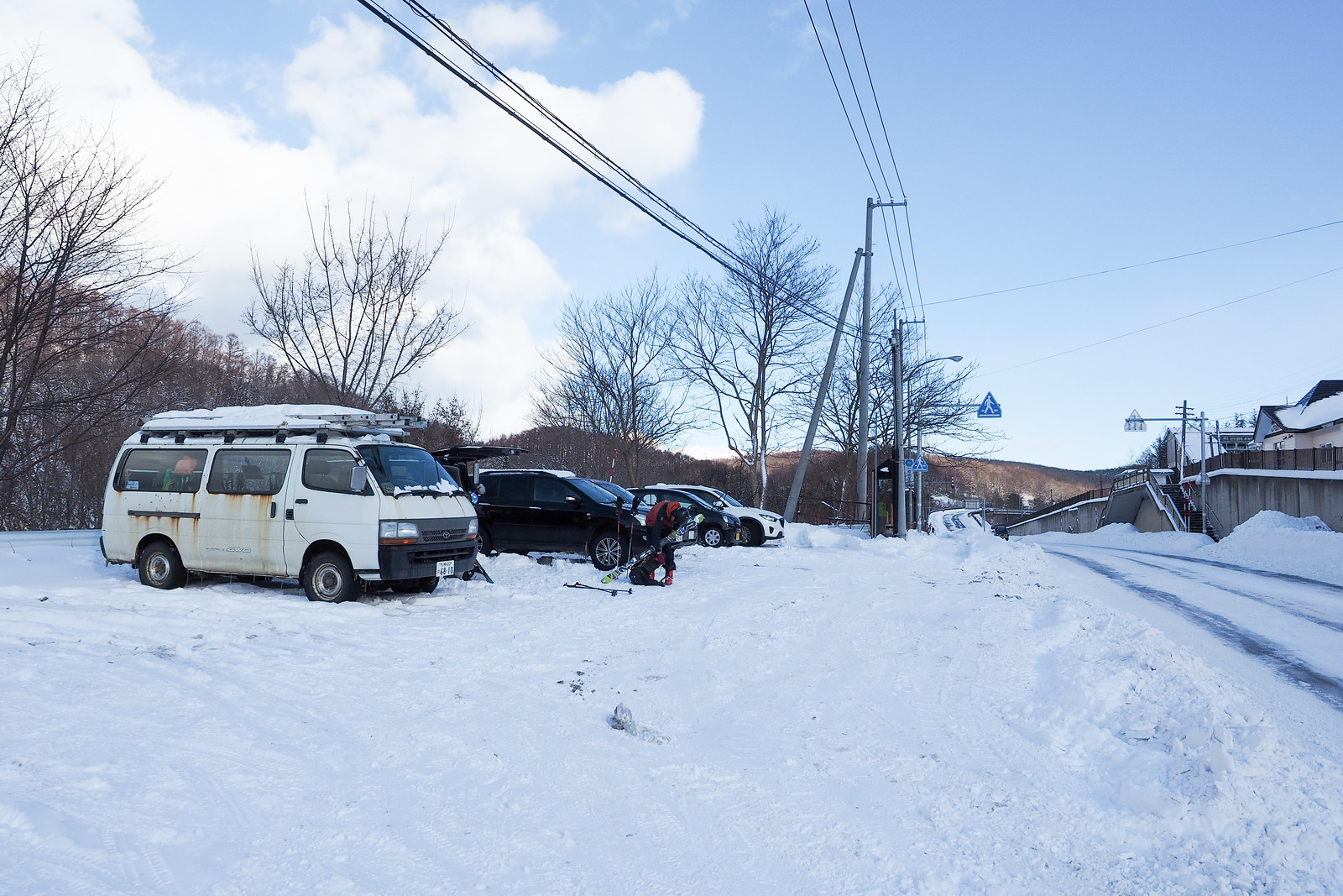
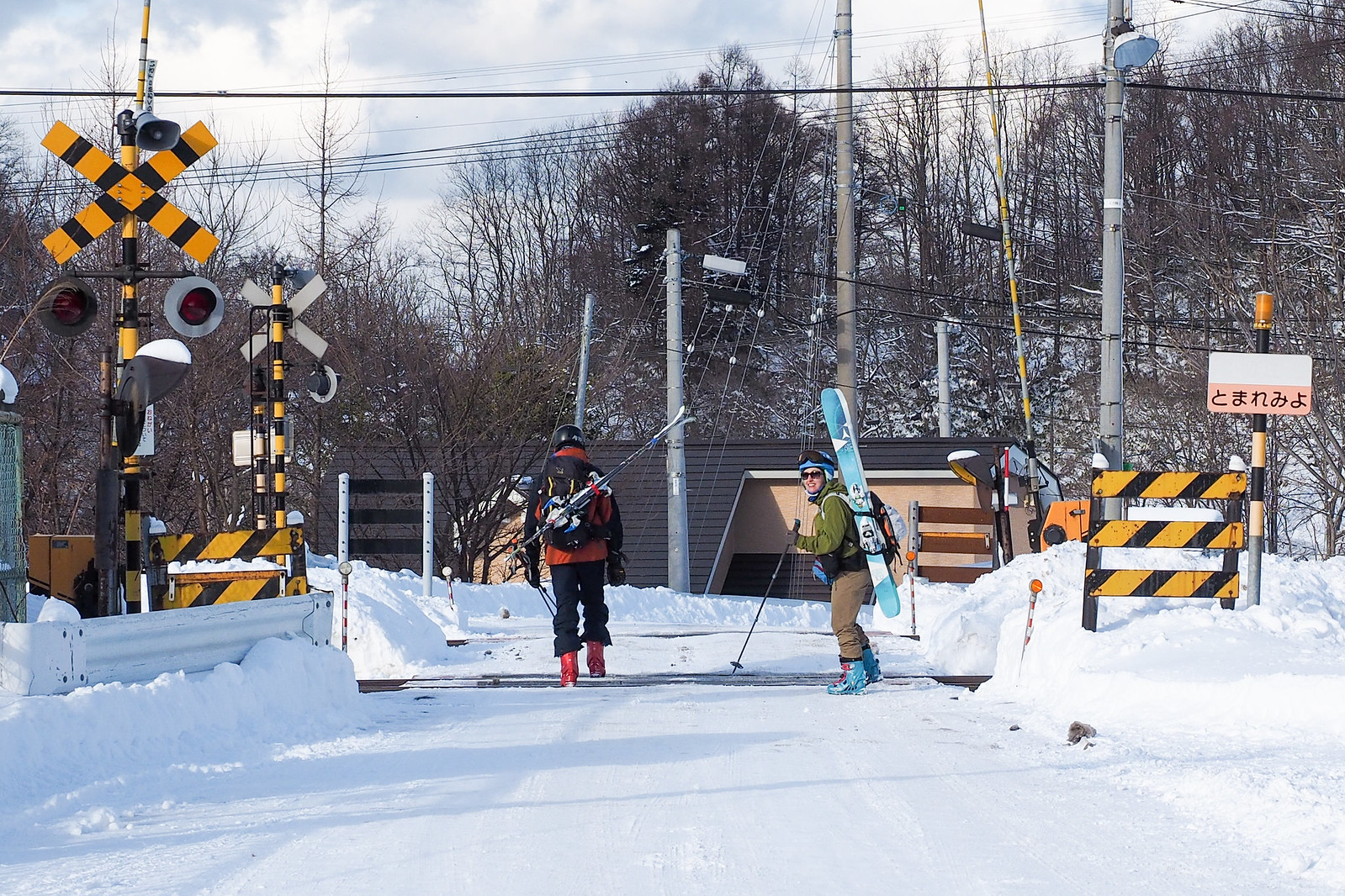
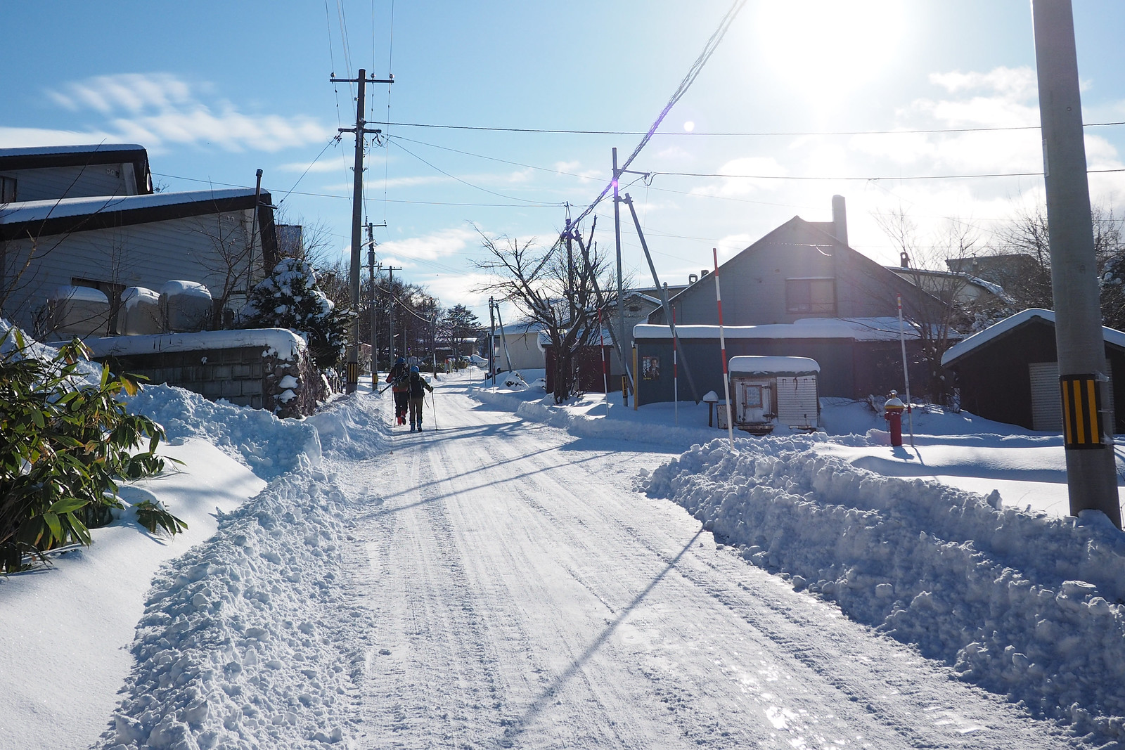
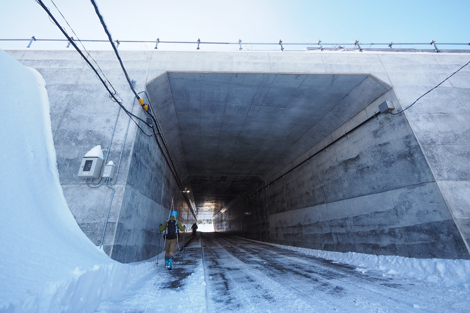
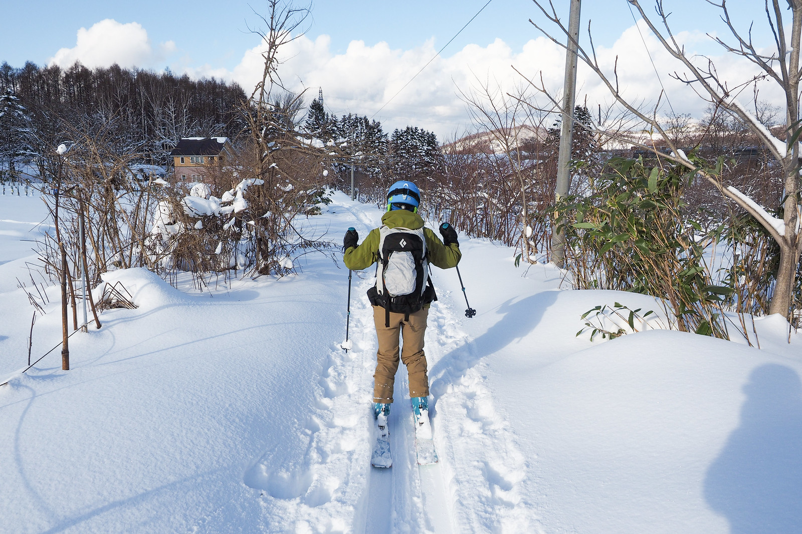
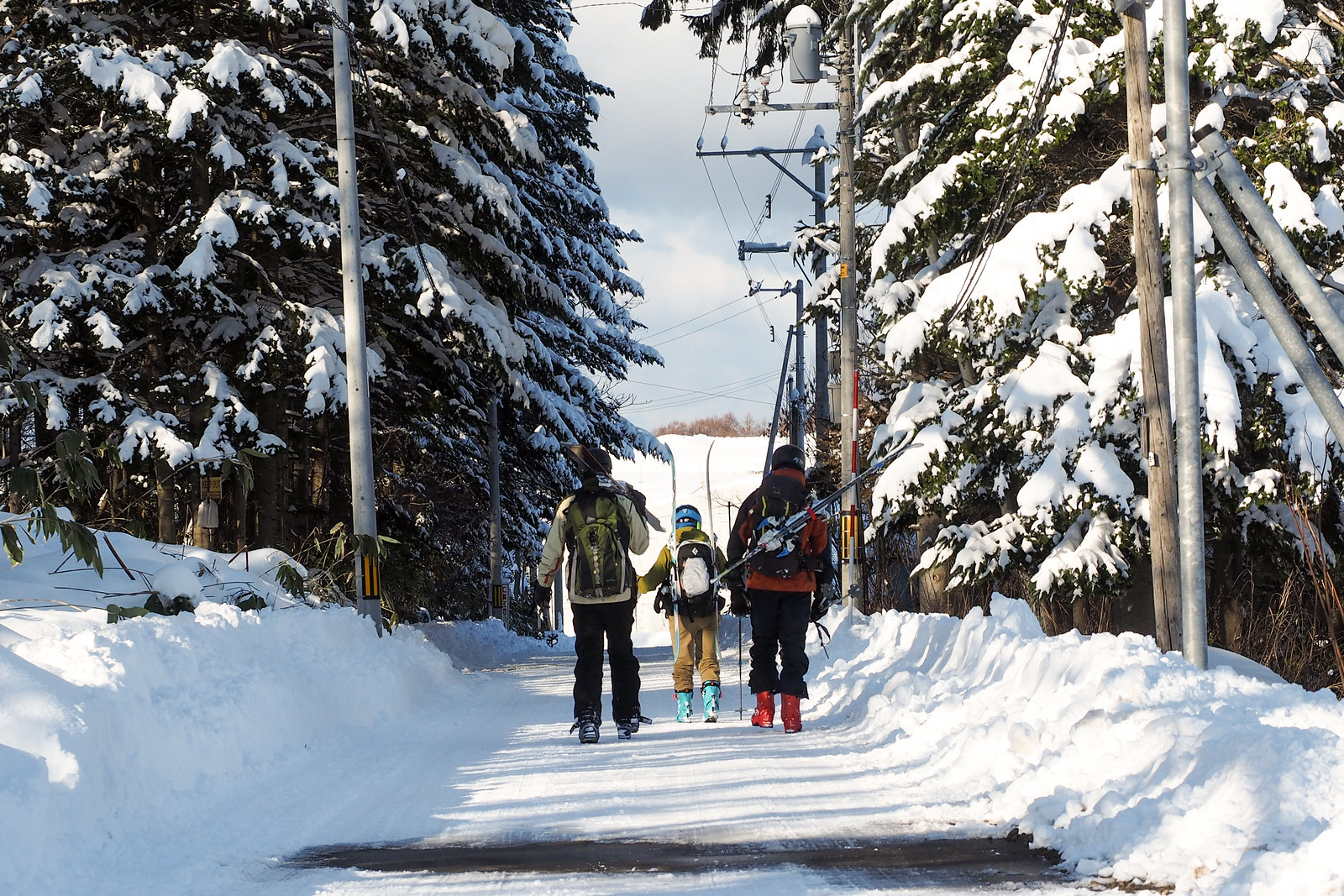
So Haidee, Rick and I (and Tom, who met us on the hill), drove out to Shioya Station for a Saturday outing. We parked at the Shioya Station carpark, and walked 10 minutes (about 1km) to the trailhead (here).

Mt. Shioya-Maruyama Ski Touring (Otaru, Hokkaido, Japan)

Mt. Shioya-Maruyama Ski Touring (Otaru, Hokkaido, Japan)

Mt. Shioya-Maruyama Ski Touring (Otaru, Hokkaido, Japan)

Mt. Shioya-Maruyama Ski Touring (Otaru, Hokkaido, Japan)

Mt. Shioya-Maruyama Ski Touring (Otaru, Hokkaido, Japan)

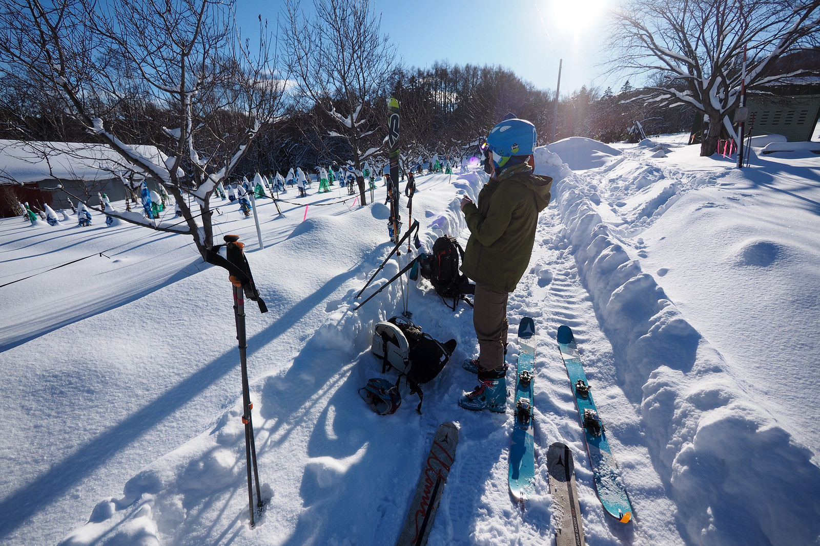
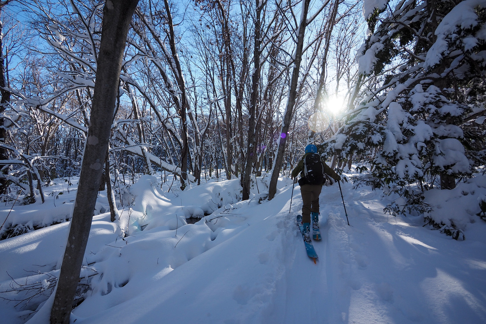
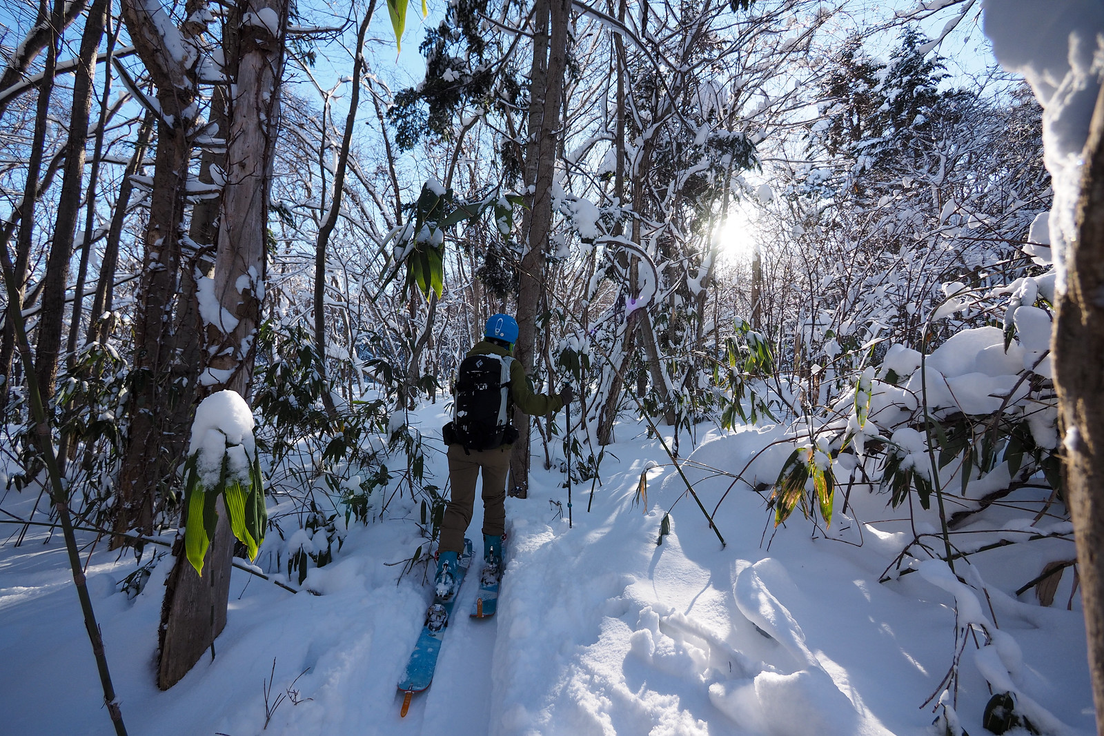
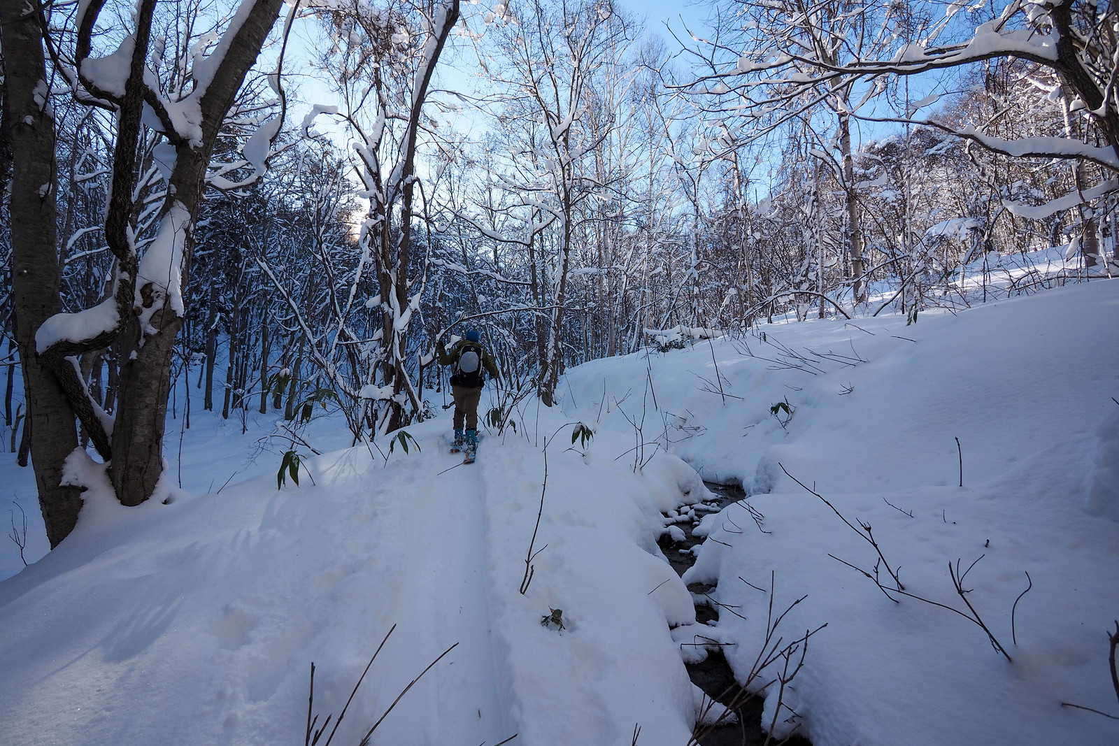
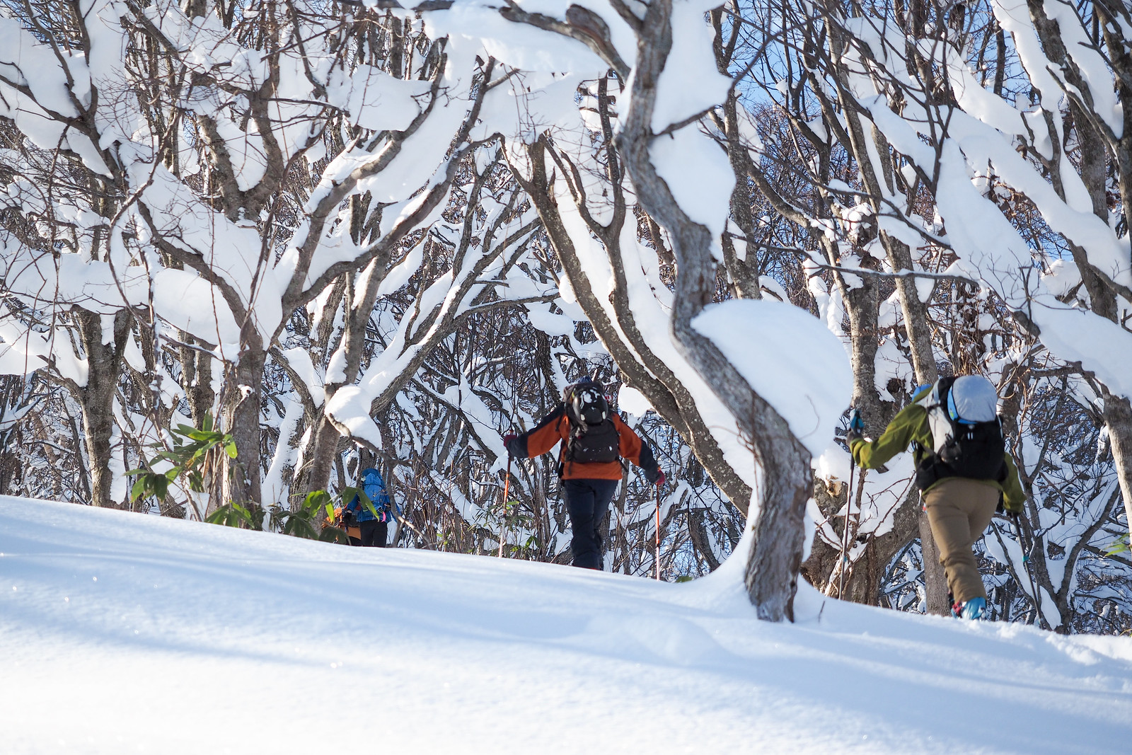
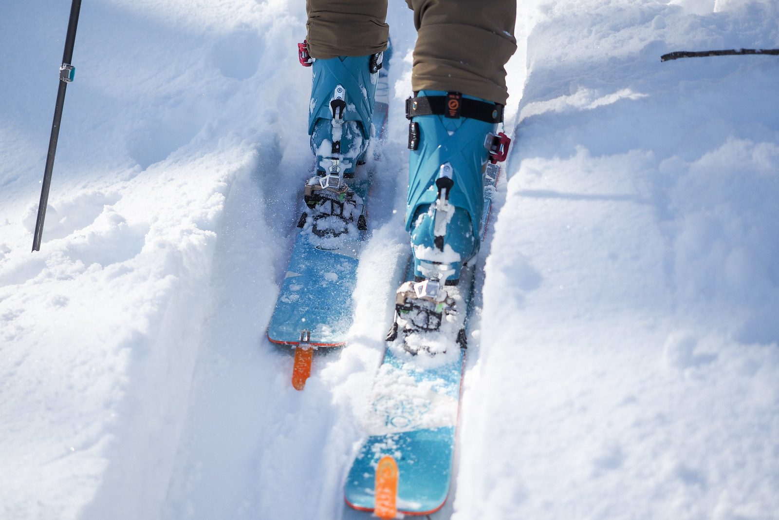
From the trailhead, the winter route up the mountain (which is different from the summer trail) follows an old forestry road for 500m or so before turning right onto an even older forestry road. This y-intersection is often marked with pink tape. From here the route weaves its way through relatively thick woods, dodging windfall and vines. Because we did this route in early December, there was still a lot of sasa bamboo sticking up out of the snow. Old fallen tree-trunks were also only just buried enough not to get snagged on them. Later in the season with more of a base, it would be much easier to navigate without needing to concentrate on getting tripped up by the undergrowth.

Mt. Shioya-Maruyama Ski Touring (Otaru, Hokkaido, Japan)

Mt. Shioya-Maruyama Ski Touring (Otaru, Hokkaido, Japan)

Mt. Shioya-Maruyama Ski Touring (Otaru, Hokkaido, Japan)

Once at the terminus of the main gully heading south, there is a small steep climb from around 250m to a small plateau at 300m. Once on the plateau, it is a further 50m or so before the steepest climb of the route, up to about 400m in altitude. This second steep climb will test your kick-turn skills.

Mt. Shioya-Maruyama Ski Touring (Otaru, Hokkaido, Japan)

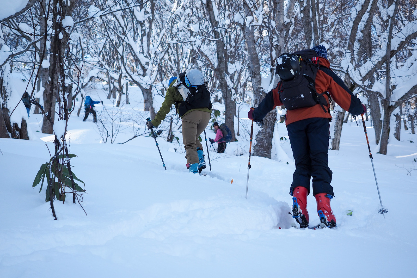
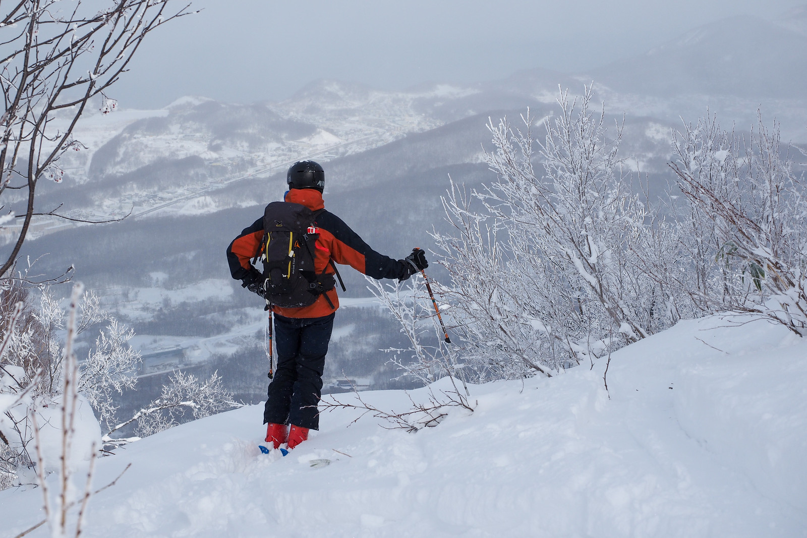
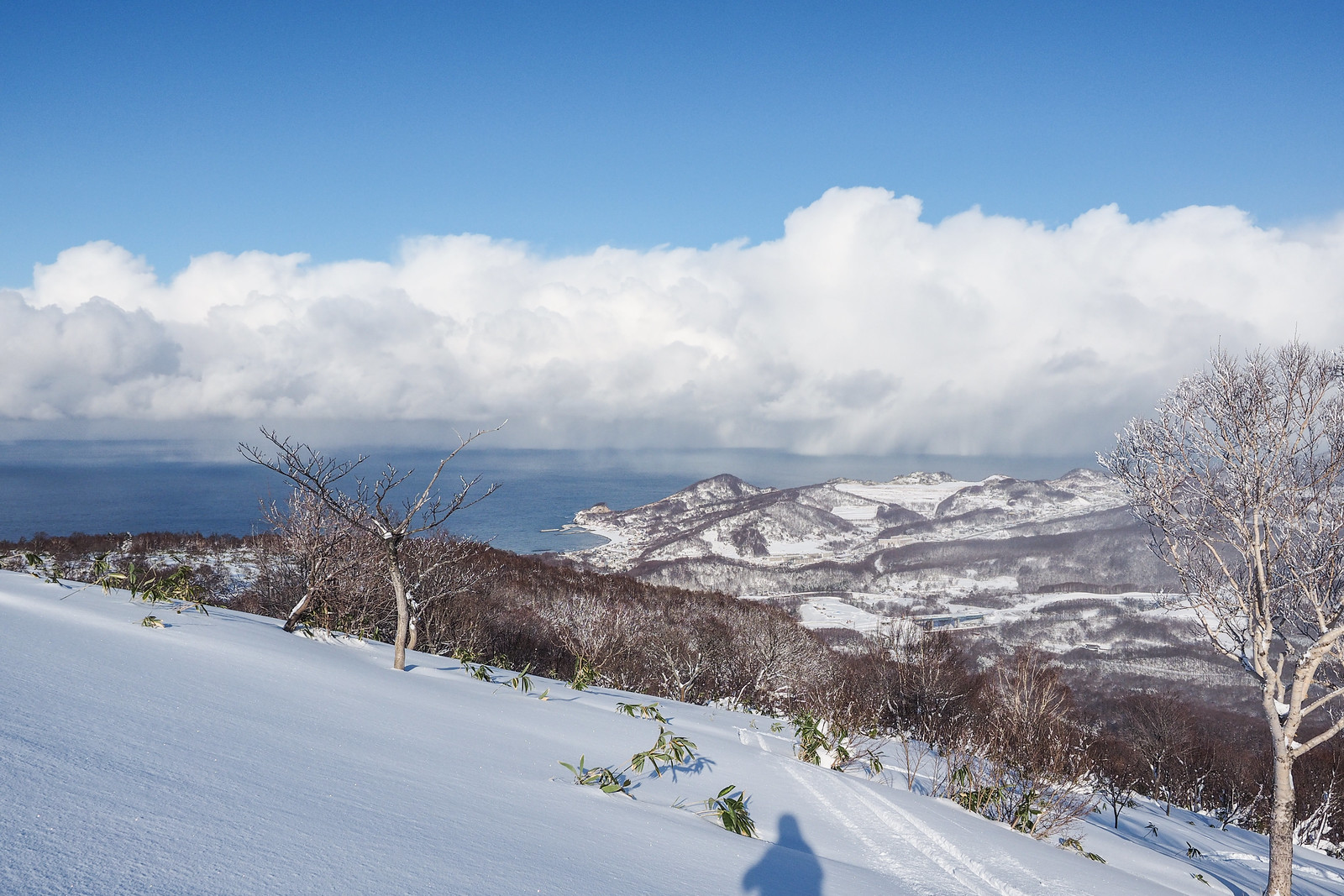
Luckily for us, there was another party about 30 minutes ahead of us, so they had done the hard work of breaking trail. Once out of the woods at around 400m, the terrain opens up with beautiful stands of well-spaced trees, and when the weather is clear, there are great views across the Ishikari Bay.

Mt. Shioya-Maruyama Ski Touring (Otaru, Hokkaido, Japan)

Mt. Shioya-Maruyama Ski Touring (Otaru, Hokkaido, Japan)

Photo by Rick Siddle

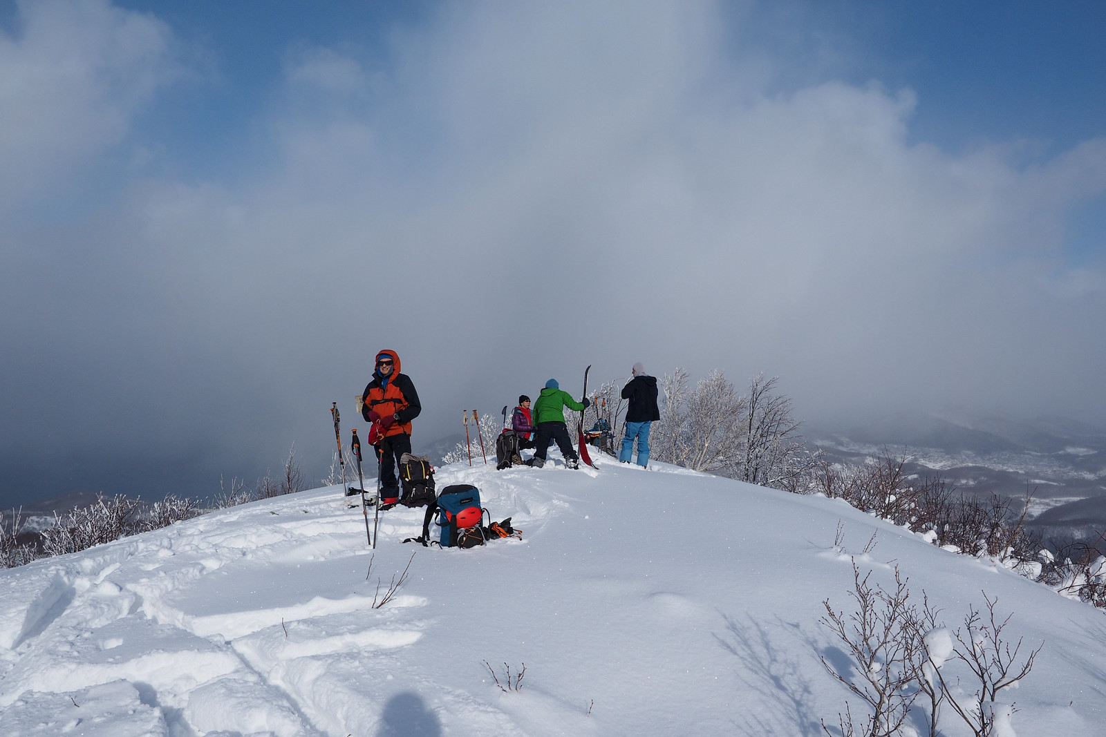
The very top of Mt. Shioya-Maruyama is in fact a bit of a rocky outcrop. The only practical way up to the summit in winter is to wrap around about 20m to the western side of the rocks, and skin up a narrow passage between two of those outcrops. Once on the top, you’ll have a clear view 360 degrees. Unfortunately for us, the glorious clear weather we’d had all the way up closed in just as we hit the summit. The light snow was just as the weather forecast had told us, so we hurriedly transitioned, keen to get off the summit in case the weather packed in completely.

Photo by Rick Siddle

Mt. Shioya-Maruyama Ski Touring (Otaru, Hokkaido, Japan)

As Murphy’s Law would have it, no sooner had we dropped off the summit than the weather cleared again. We were happy to meet up with Tom, however, who had hurried to the trailhead behind us after a malfunctioning alarm clock gave him a later start from Sapporo.

Mt. Shioya-Maruyama Ski Touring (Otaru, Hokkaido, Japan)

Mt. Shioya-Maruyama Ski Touring (Otaru, Hokkaido, Japan)

Mt. Shioya-Maruyama Ski Touring (Otaru, Hokkaido, Japan)

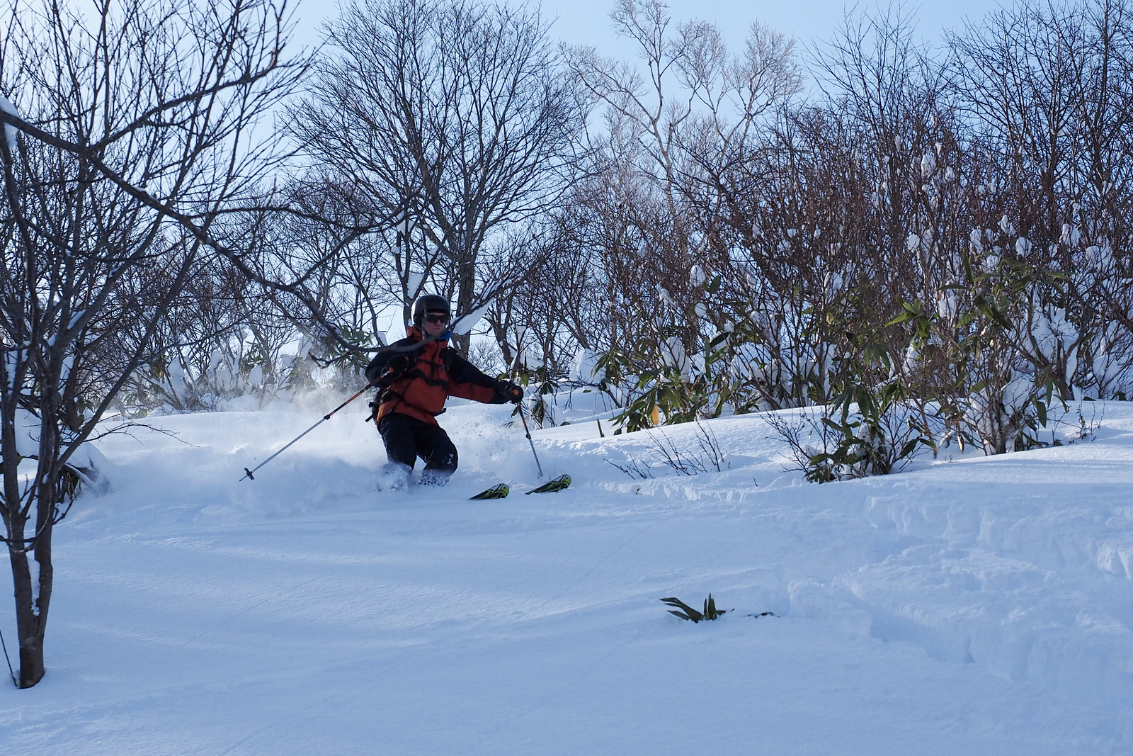
Had we been a little more motivated, we would have donned our skins again for another couple of laps of the upper section of Mt. Shioya-Maruyama. We opted instead to continue back down, rather apprehensive about the messy tangle of undergrowth further down. Despite our concerns, it ended up being a technical but not impossible task weaving through the trees. Certainly later in the season it would be a more straight forward run down. Once on the forestry road, it was just a matter of locking into the skin track and whizzing back to the trailhead for the walk back to the cars.

Mt. Shioya-Maruyama Ski Touring (Otaru, Hokkaido, Japan)

Mt. Shioya-Maruyama Ski Touring (Otaru, Hokkaido, Japan)

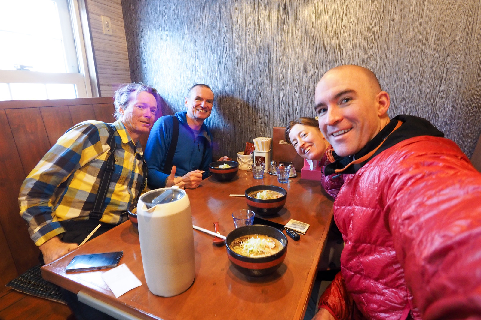
We finished the day off with a very late (3pm) lunch at one of Rick’s highest-rated ramen joints in Sapporo, Yoshiyama Shoten (吉山商店), on the main road on the way into Teine Ward (here). Their goma-miso (sesame miso) ramen is highly recommended!

Mt. Shioya-Maruyama Ski Touring (Otaru, Hokkaido, Japan)

Comments | Queries | Reports

Done this route to Shioya-Maruyama, or others nearby? Thinking of doing it? Please post any feedback, reports, or queries here. Thanks!

2 thoughts on “Shioya-Maruyama Backcountry”

  1. What a fun route. I can only recommend it. Easy access powder snow. The last 100m elevation gain is in open terrain. At the top of the hill you will have a nice view of the sea. The descent offers a bit of open terrain and amazing tree skiing.

Leave a Reply

Your email address will not be published. Required fields are marked *

This site uses Akismet to reduce spam. Learn how your comment data is processed.

See More Like this

Printable Shioya-Maruyama Topomap

TOPO DOWNLOAD (PDF, 20.4MB)

Download may take some time

Hokkaido Wilds Foundation

We’ve got affiliate links on HokkaidoWilds.org to help fund the Hokkaido Wilds foundation.

The Foundation gets a small commission on sales from affiliate links, but we only link to stuff we think is worth checking out for people keen on the outdoors in Hokkaido and Japan.

The Hokkaido Wilds Foundation is a fund where 100% of funds are donated to Hokkaido volunteer groups involved in sustainable, safe, and responsible access to the Hokkaido outdoors.

Learn more here

ADVANCED FILTERS

Filter by location

About Filters

REGION: The general mountain/geographical region the route is in.

BEST MONTH(S): Time of year a route is suited to visiting. Some pop all season, some are more limited.

DIFFICULTY: How strenuous a route is, and how technical it is. Full details here.

FREERIDE/SKITOUR: Very subjective, but is a route more-of-a-walk-than-a-ski or the other way around? Some routes are all about the screaming downhill (freeride), some are more about the hunt for a peak or nice forest (ski-tour). Some are in between. 

MAIN ASPECT: Which cardinal direction the primary consequential slope is facing, that you might encounter on the route. More details here.

ROUTE TAGS: An eclectic picking of other categories that routes might belong to.

SEARCH BY LOCATION: You can find routes near your current location – just click on the crosshairs (). You may need to give permission to HokkaidoWilds.org to know your GPS location (don’t worry, we won’t track you). Or, type in a destination, such as Niseko or Sapporo or Asahikawa etc.

Please let us know how we can make it easier to narrow down your search. Contact Rob at rob@hokkaidowilds.org with your suggestions.

Shioya-Maruyama Backcountry Difficulty Rating

Category

Grade

Points

Strenuousness

Vertical Gain

C

30

Time ascending

D

0

Technicality

Altitude

D

0

Hazards

D

0

Navigation

C

6

Totals

36/100

GRADES range from A (very difficult) to D (easy). Hazards include exposure to avalanche and fall risk. More details here. Rating rubric adapted from Hokkaido Yukiyama Guidebook 北海道雪山ガイド.