Posted on Feb 17, 2018
75 2
NE
Posted on Feb 17, 2018
75 2
NE
4km

Distance

4.5 hours

Time

400m

Ascent

1500m

Highest point

6.5/10
Difficulty
Snow Icon | Hokkaido Wilds
Dec-Apr

Best season

GPX

KML

TOPO

GSI

NOTE: Parking is an ongoing issue at the Furano-dake entry point. Parking on the road is illegal. The parking area is often full, so get to the trailhead early to avoid having to clear your own spot. Alternatively, park just 1.5km down the road at the Fukiage Onsen carpark – plenty of space, and on the return enjoy Hokkaido’s best wild onsen. Public transport is also available.

Mt. Furano (富良野岳 - 1,912m) is a formidable mountain, whose peak is only accessible in winter by mountaineers with extensive experience. The lower reaches on its northwest aspect, however, offer some great accessible skiing up to around the 1,500m mark. In particular, the broad northwest ridge - the "Giant Ridge" - offers access to some relatively safe ridge-line skiing. In this route guide, I outline a 4.5 hour return trip up to the 1,500m point and back on the Giant Ridge.

Last updated Jan 23, 2024

Topomap

Route Map

Need to know details

Location

Furano-dake is the final tall peak before the Daistsuzan Range in central Hokkaido terminates in the south of the range. Note that the Daisetsuzan Range is the moniker for the 80km north-to-south range in totality, while the Tokachi Range refers to the southern half of the Daisetsuzan Range, with Furnao-dake at it’s southern terminus. This route starts and finishes at the main, busy winter trailhead for Furano-dake here, at the turn-off to Hakuginso Lodge.

General notes

This is a popular route on this side of the Tokachi Range for a couple of reasons. One is its accessibility and close vicinity to Tokachi Onsen hotsprings and the popular Fukiage Onsen hot springs area. Another reason for its popularity is the ability to enjoy really good quality powder snow in most conditions; the lush conifer forests below the treeline help protect the slopes from the high winds common in the area.

Hut
Hakuginso Lodge (full details here)

Hakuginso Lodge (吹上温泉保養センター白銀荘, 1,020m) is a beautiful lodge perfectly situated for access to a number of excellent ski touring and hiking routes in the Tokachi region of the Daisetsu National Park. As a base for backcountry ski touring, it is second to none. Accessible by car, and already at just over 1,000m in altitude, the lodge has some of the driest powder snow in Hokkaido on its doorstep. The onsen at the lodge and just down the road are also second to none. All this for a paltry 3,100yen (3,250yen in the winter) a night.

Route details

This route is not marked. If starting from the carpark, walk downhill on the main road about 50m, and clamber over the snowbank on the left. It’s a short and sharp steep drop down to the riverbed below. Mid-season should see most of the creek covered. Earlier and later may require a quick creek-crossing. Once across the creek, wrap your way south-ish around the spur to a small gully, and follow this up to around 1000m. From there, cross the gully to gain the Giant Ridge, and follow this uphill to around the 1500m point, or where the snow deteriorates. As mentioned above, it is rare for skiers to ascend anywhere near the summit of Furano-dake via this route, as the snow and climbing conditions deteriorate considerably. This route returns via the same up-route.

Route Timing
Up | 2hrs
Down | 1hrs

About 2 hours from the trailhead to the 1,500m point on the Giant Ridge. Just under an hour back to the trailhead.

Transport

Public transport:

From JR Kami-Furano Train Station (上富良野駅; location), there is a bus, run by the Kami-Furano Town Bus company, that runs to the Hakuginso Lodge. You’ll want to catch the tokachidake-onsen-yuki (十勝岳温泉行き) bus from the train station and get off at the Okinakouen (翁公園前) bus stop; location). The Okinakouen bust stop is right at the winter trailhead for Furano-dake. As of January 2023, there were three buses per day there (08:52, 12;49, 16:31) and three returning (9:54, 13:44, 17:33). Timetable here. The fare is around 500yen one way, and it takes around 30 minutes. Note that skis should be packed in a bag of some sort . We use simple plastic ski bags on buses here, as they back down to nothing when touring.

By car:

There is a parking area enough for about 6-7 cars across the road from the trailhead here, just at the turnoff to Fukiage Onsen. Note that this parking area can often be full. Under no circumstances should cars be parked on the road at the intersection, or on the road leading towards Fukiage Onsen. If the car park is full, either dig your own space (allow 15 mins), or carry on along the road 2km to the Fukiage Onsen carpark (here). The Fukiage Onsen carpark may be the preferred choice – it’s only 20 minutes extra skin back to the trailhead, and when you return, you’re in prime position to enjoy one of Hokkaido’s best wild onsen. As this area becomes more popular, parking at the trailhead here is becoming more of an issue – see the post by the Kamifukai here.

Physical maps
Official Topo Map: Tokachi-dake (十勝岳) – map no. NK-54-7-8-2

NOTE: The official 1/25000 topo map(s) above can be purchased for 350yen from Kinokuniya bookstore next to Sapporo Station or online (in Japanese).

Aspect
The main aspect skiers are exposed to on the descent and/or ascent is North. Other aspects that may also be encountered while following the route outlined on this page include: East. Therefore, keep an eye on the weather forecast a few days ahead of your trip to monitor wind, snow, and temperature. Also, since this route is in the general vicinity of the Furano area, consider looking at the Furano Avalanche Center (on Facebook). They issue sporadic observations throughout the season which may give extra insight into avalanche conditions.

Snow and
route safety

The main risk noted in the Hokkaido Yukiyama Guide (ISBN: 978-4894538047), is the avalanche risk in the valley directly north (to the skier’s right) of the Giant Ridge. Other route guides I’ve seen, such as in the Yama-suki 100zan (ISBN: 978-4635470063), mention that valley as a good option for the downhill, but only in very stable snow conditions.

  • Furano area avalanche report: There’s currently no official, daily region-wide avalanche bulletin for the Daisetsuzan Range, but the Furano Avalanche Center occasionally posts observations from the greater Furano area.
  • Notify the police of your backcountry plans online using Compass – instructions here.
  • Avalanche hazard map from the local Kamifurano mountain safety advocacy group Kamifu-kai, here (PDF backup here).

Furano-dake’s Giant Ridge Ski Touring Difficulty Rating

Category

Grade

Points

Strenuousness

Vertical Gain

C

30

Time ascending

D

0

Technicality

Altitude

A

10

Hazards

B

12

Navigation

B

12

Totals

64/100

GRADES range from A (very difficult) to D (easy).  More details here. Rating rubric adapted from Hokkaido Yukiyama Guidebook 北海道雪山ガイド.

Weather forecast

Windy.com weather forecast for Furano-dake
Onsen nearby

The Ryounkaku inn at the end of the road at Tokachi Onsen has one of the best views from their open-air hot springs that I’ve ever seen. If you’d rather go full dirtbag, then head along the road towards the Hakuginso Lodge and try out the mixed-gender open-air wild hot springs, Fukiage Onsen, here. The ultra-affordable Hakuginso Lodge (details here, location here) also has a really nice, large outdoor onsen area, with mixed bathing (swimsuits required for the mixed bathing area).

Extra Resources
  • A write-up (in Japanese) in the Yuki-yama Guide (ISBN: 978-4894538047) from page 376‐379.
  • Another write-up in Japanese in the Yama-suki 100zan (ISBN: 978-4635470063) from p. 35.

Guide Options

If you’d like to ski this route and/or explore other peaks in central Hokkaido together with a local certified guide, get in touch with Yasuko Kikuchi. Born and raised in Hokkaido, she’s a JMGA-certified guide now based in Sapporo. Her outdoor experience is broad and worldwide, having worked as a Canadian Ski Patrol member, and has sumitted a number of 6,000m+ peaks around the world. She speaks good English, and can arrange transport to and from central Hokkaido. In addition to Yasuko, also see a full list of English-speaking Hokkaido Mountain Guides Association (HMGA) guides on the HMGA website here

Support us

Like this content? Buy the HokkaidoWilds.org team a coffee. 50% of tips go to the Hokkaido Wilds Foundation.

Show Full Route Notes Close Route Notes

Route Trip Notes

Route blurb from the Hokkaido Yukiyama Guide (2015), p. 376 (translated by Hokkaido Wilds)

Mt. Furano is famous for its alpine flowers, and is well-known for its norther-ridge winter climbing route up to Hoko Rock. Despite this, few climbers head for the peak in winter. It is adored by backcountry-lovers for its deep powder snow on the Giant Ridge, with its giant conifers protecting the slopes from the winter winds. Adding to that is the frigid cold air from the Furano Basin, which translates into unparalleled snow quality. The upper reaches of Mt. Furano get into the realm of ice axes and crampons, so here we showcase a route up to around 1,500m.

With a day-job, there isn’t much leeway for picking the days for ski touring trips based on the weather, so we had our fingers crossed for some good weather on the weekend we’d chosen to head from Sapporo to Hakuginso Lodge in the Tokachi Ranges (lodge details here). On day one we’d try out the Giant Ridge route up Mt. Furano.

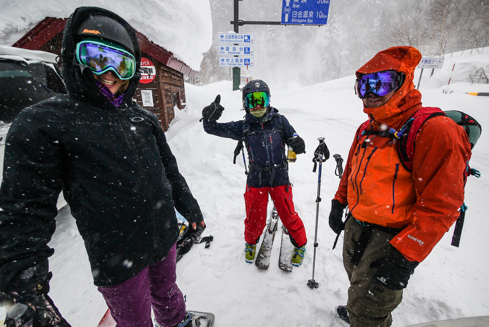
With us for this trip were some new friends all the way from Scotland. Alan and Emma had emailed me asking about some of the huts around Sapporo, and I offered that they come with us on our trip to Hakuginso Lodge. They’d got some great powder skiing earlier in the week in Hakuba, so would the promise of even better snow in Hokkaido live up to expectations?

Mt. Furano backcountry ski touring (Hokkaido, Japan)

Based purely on the weather forecast, the weekend was not looking particularly promising. Saturday – the day we’d planned to head up Mt. Furano – was forecast for strong winds around midday. We decided to push on with the plan anyway, however, since the guidebook promised some respite from the wind once among the large conifer trees on the slopes. We would climb up as far as safely possible, and if nothing else get a bit of exercise after the long 3 hour drive from Sapporo.

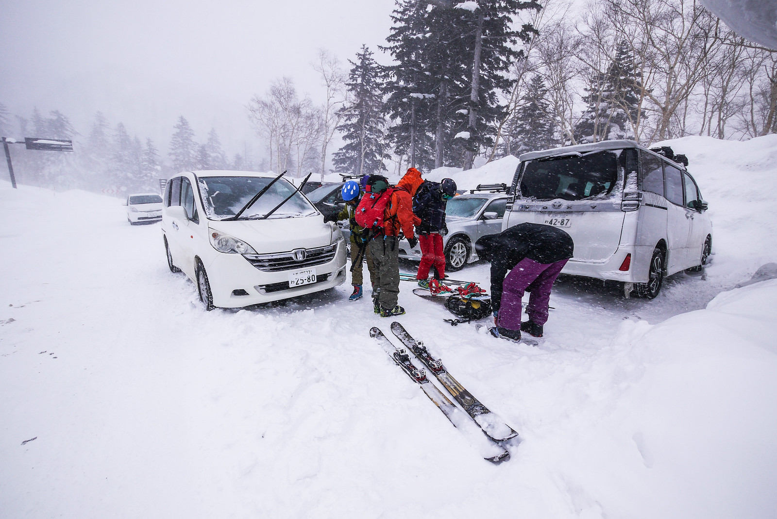
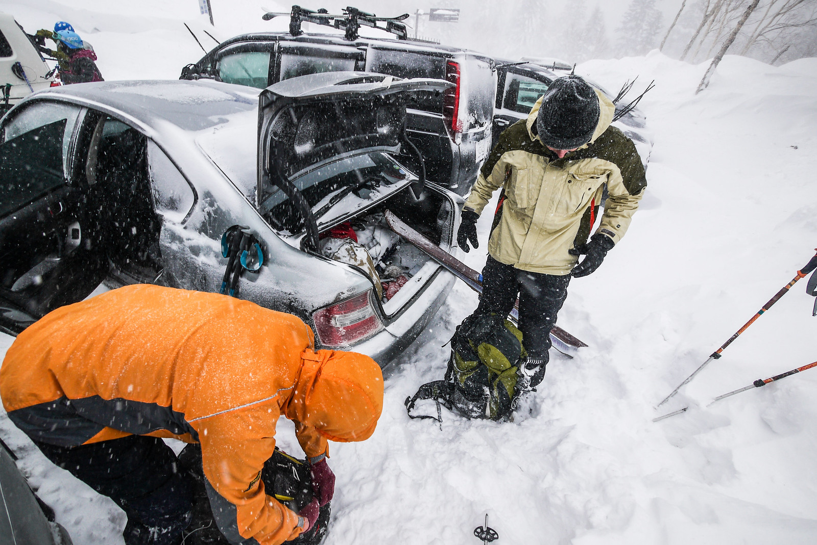
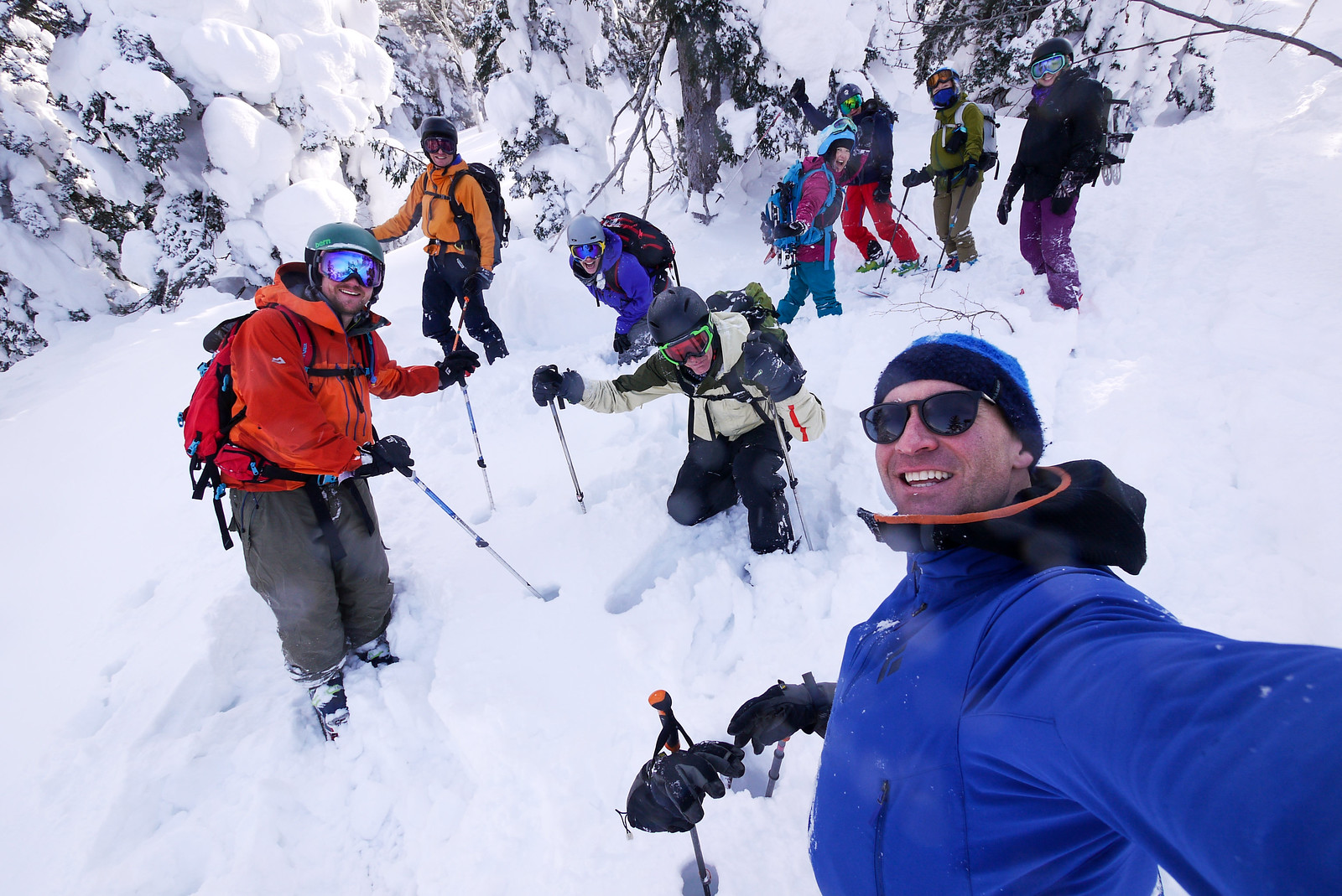
In all, we had 9 in our group: three snowboarders (two on snowshoes) and six skiers. We all converged on the trailhead at around 10:30am, and the weather forecast was playing our to the letter. Very strong winds blew snow into every nook and cranny.

Spirits were high, however. We just needed to get into the shelter of the trees, and everything would (hopefully) be OK.

Mt. Furano backcountry ski touring (Hokkaido, Japan)

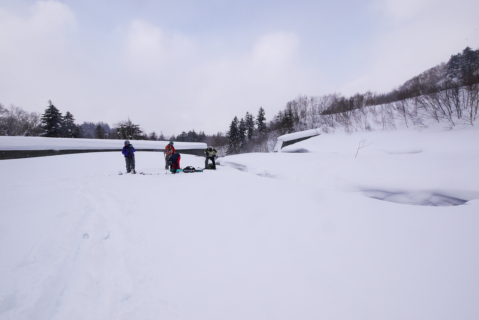
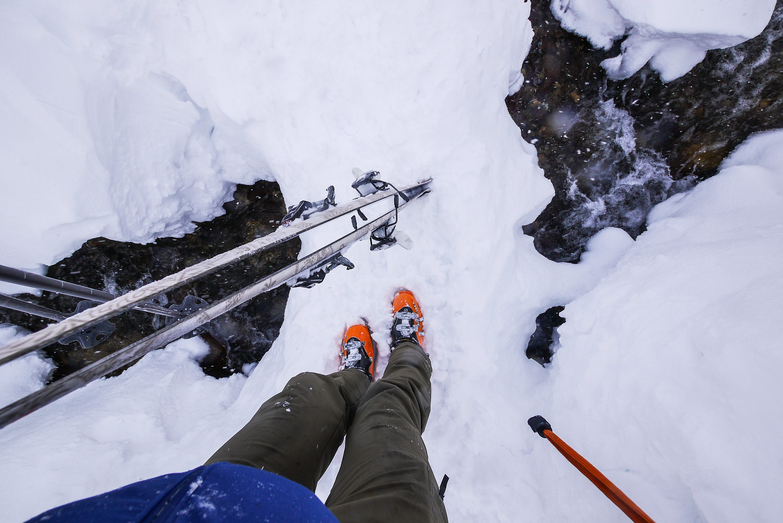
There appears to be a couple of locations to drop down off the road to the riverbed at the trailhead. We ended up scrambling down the steeper access point right at the t-intersection. The other option is to walk a little bit downhill and drop down at a more civilized angle to the riverbed, although that would likely require two stream crossings, rather than just the one.

All in all, it is quite the inglorious start to the route, particularly when the wind is as strong as it was for us.

Mt. Furano backcountry ski touring (Hokkaido, Japan)

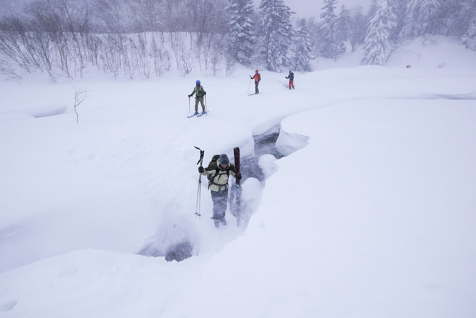
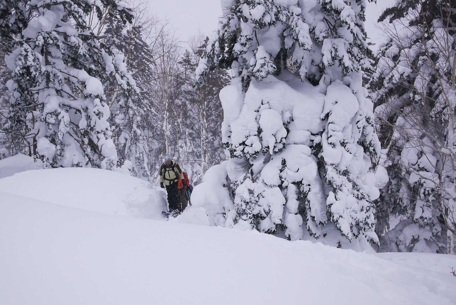
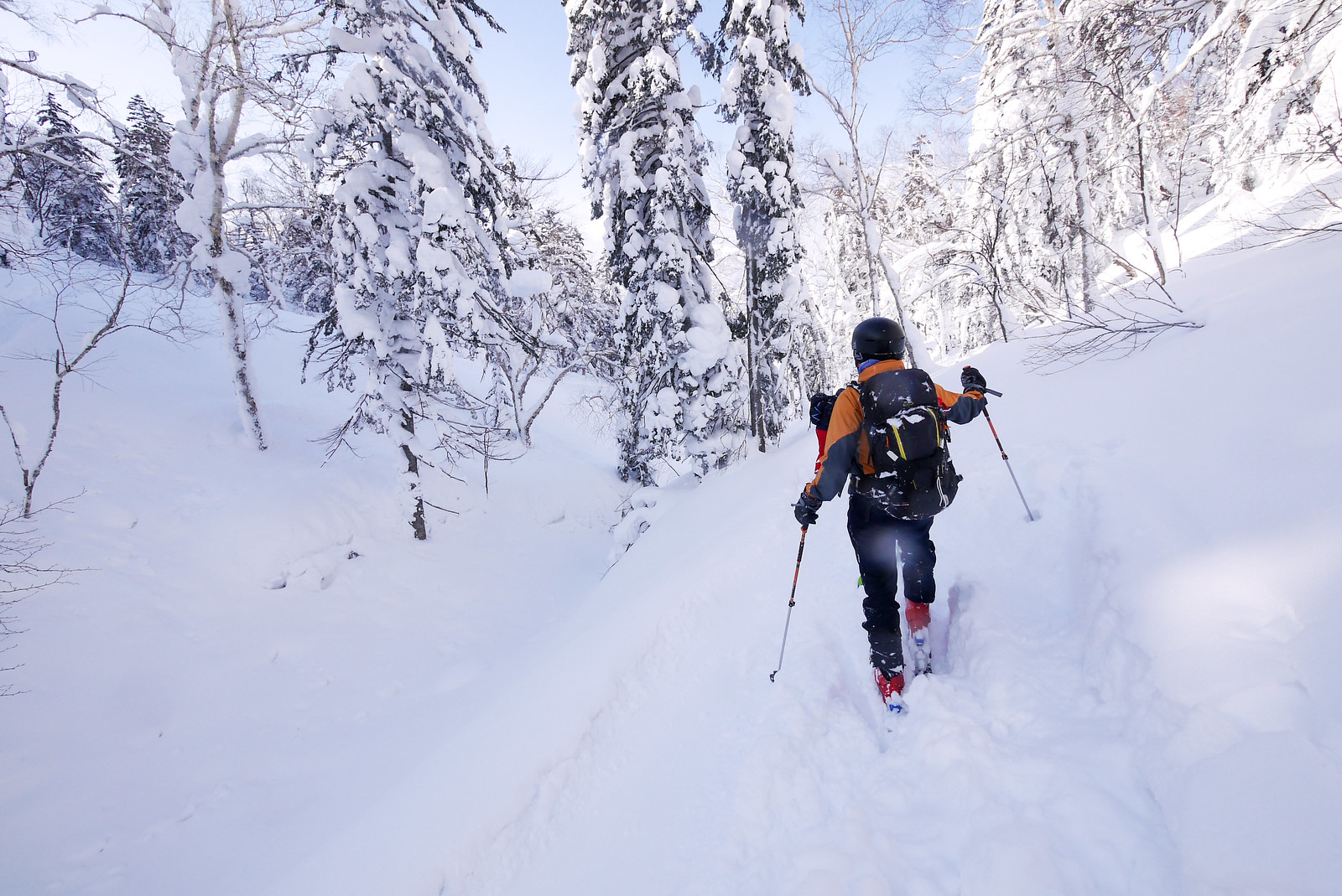
Once we were all safely across the precarious narrow bridge across the Nukkakushi-Furano River, we quickly headed into the shelter of the forest. And indeed it was much more sheltered – a calm oasis in the storm.

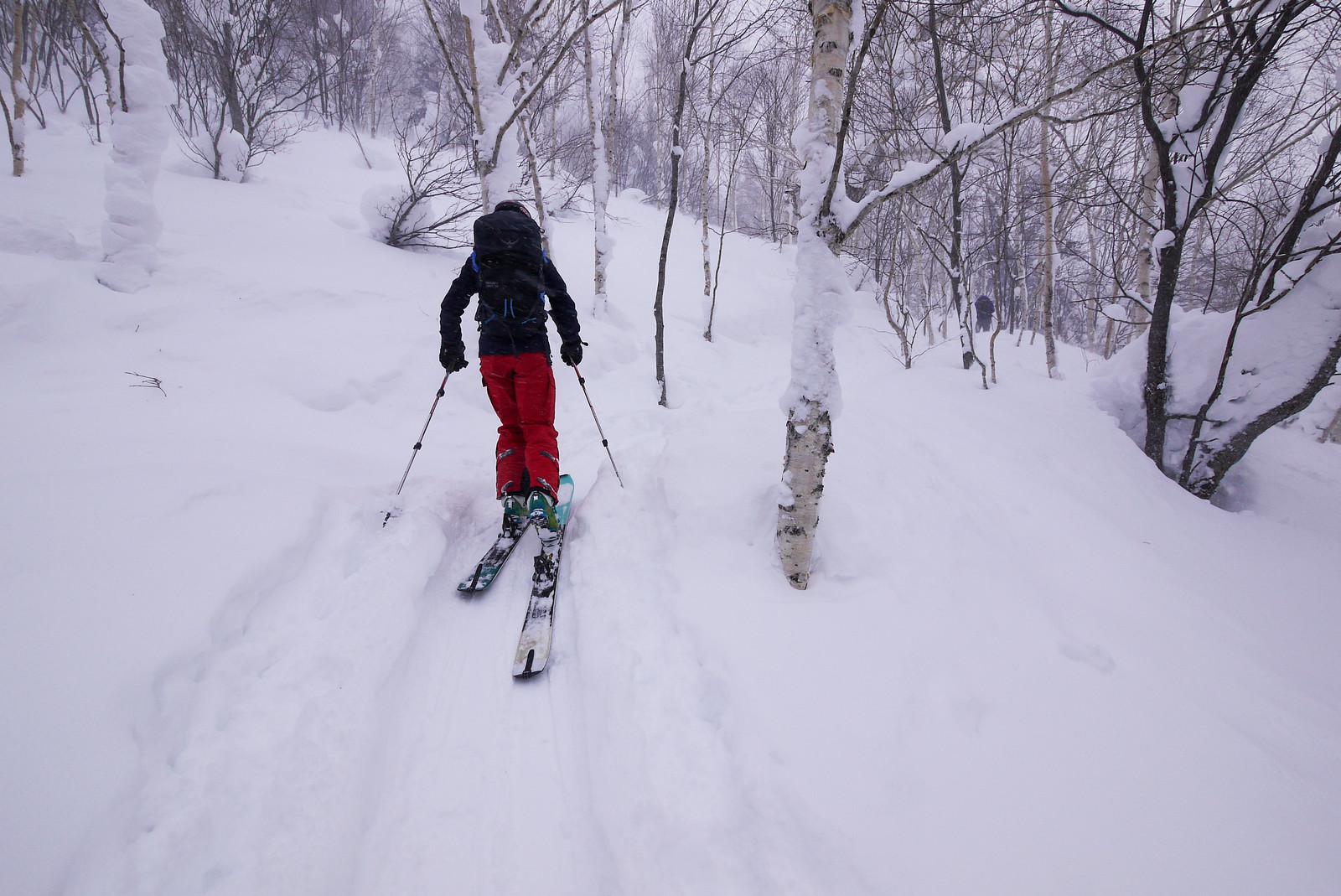
From here we started up the eastern side of the Beberui Creek gully, crossing at around 1,100m onto the Giant Ridge.

Mt. Furano backcountry ski touring (Hokkaido, Japan)

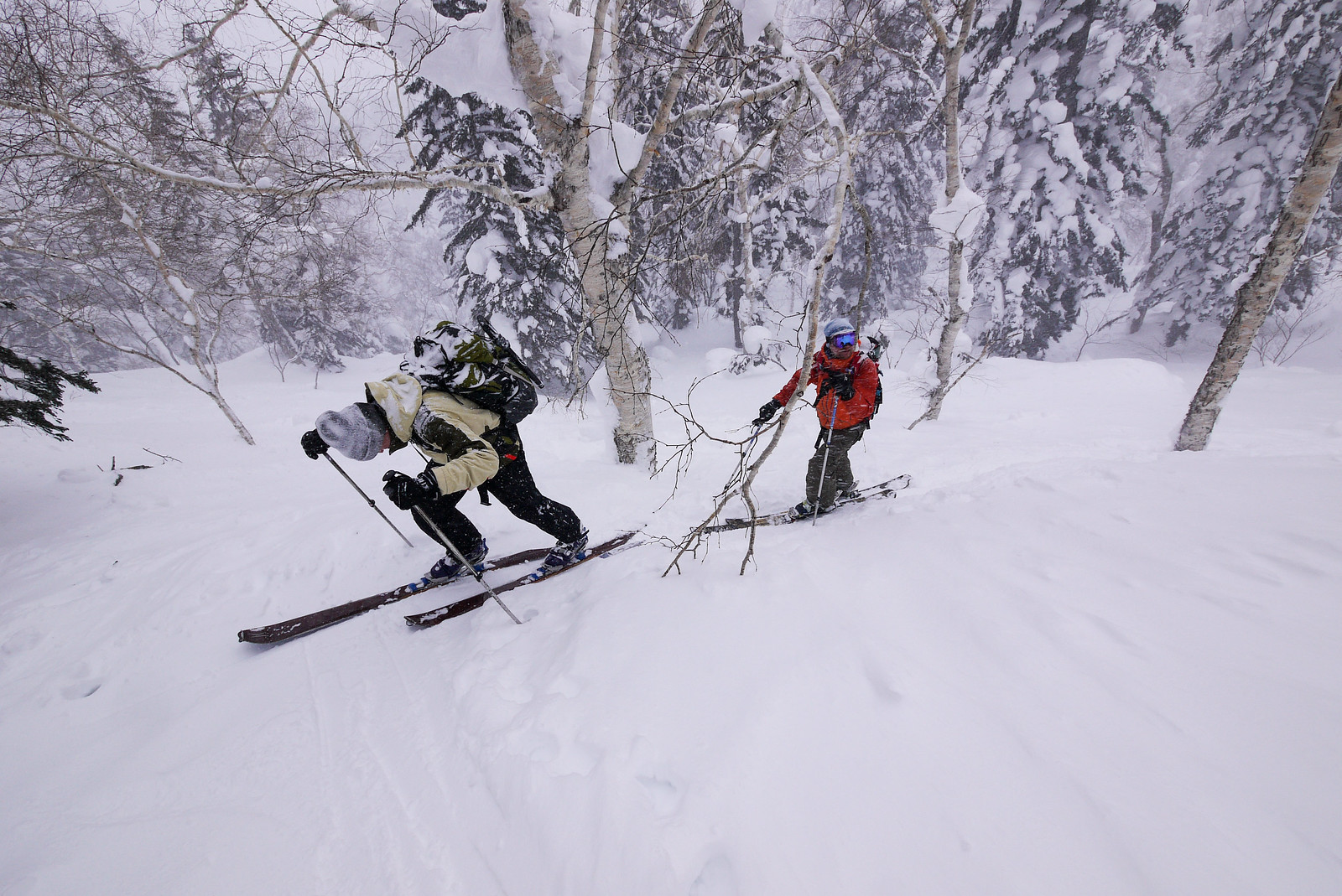
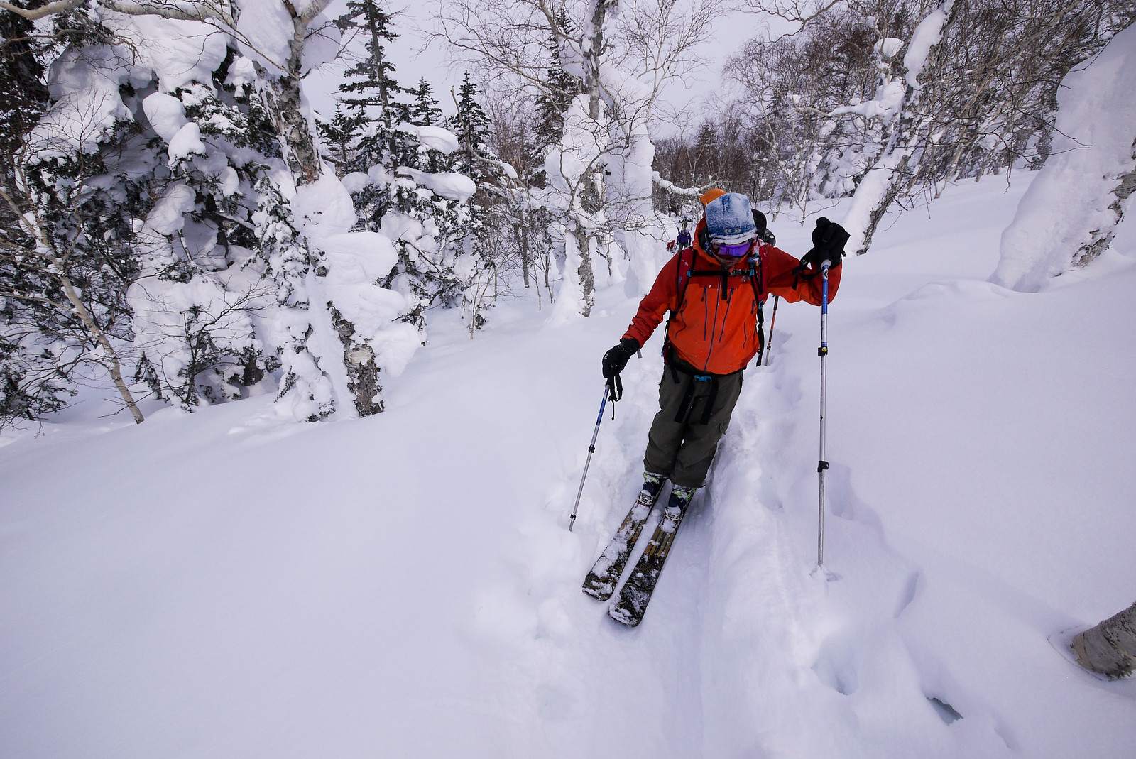
Along the way, we met two groups of skiers, returning the way they had come. They had not gotten very far up the ridge before turning back due to high winds and heavy snow that was not great for skiing.

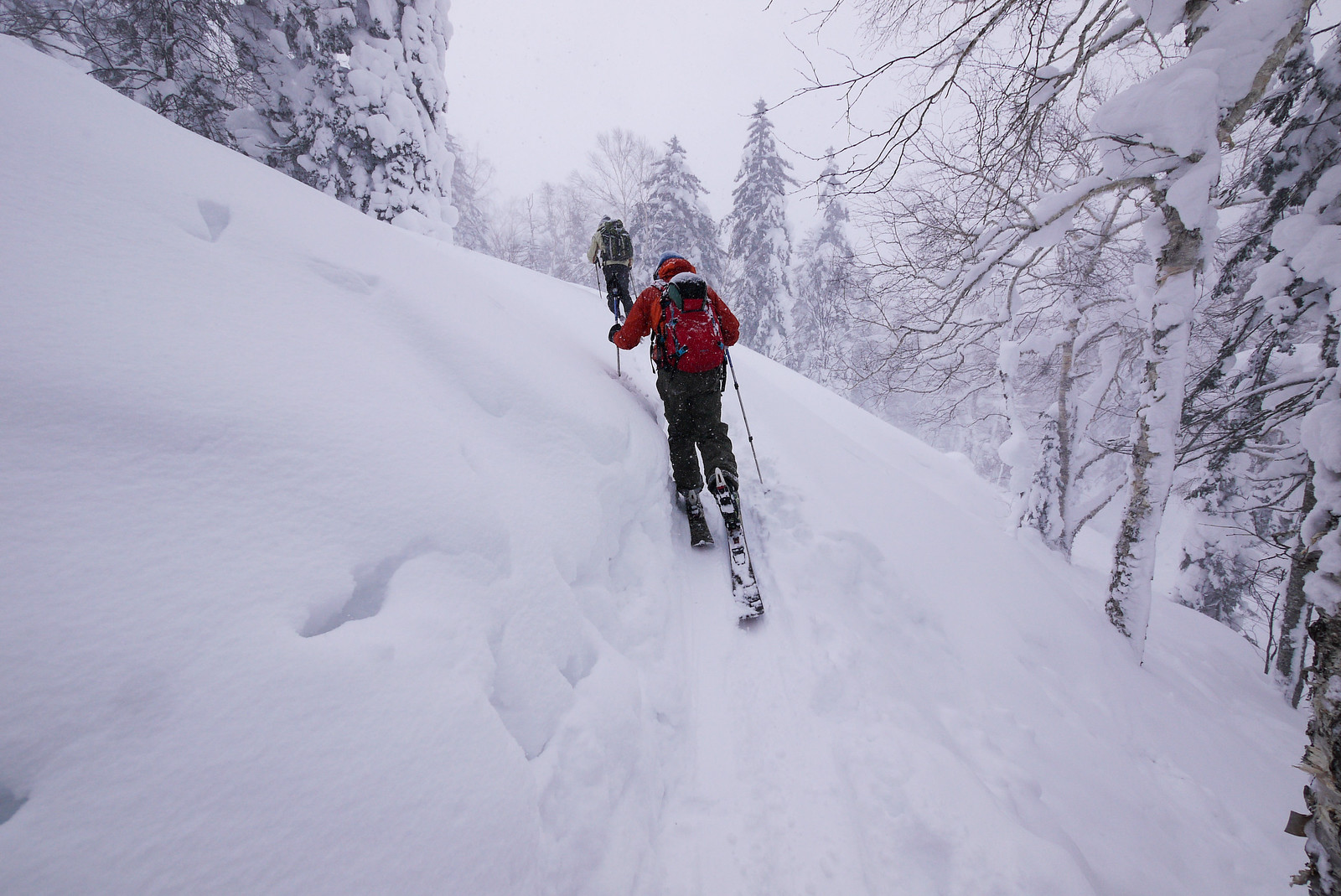
I was in two minds about continuing up, not only because of the bleak outlook further up the ridge, but also because the two snowboarders in our party who were on snowshoes were struggling in a couple of places with bottomless snow even on the relatively hard-packed skin track.

We decided to push on, however, and see what things were like further up nearer the treeline. We’d turn back if it wasn’t looking too promising.

To our delight, however, the weather only got better as time went by. At times we had views across the Furano Plains through gaps in the trees. Amazing how better weather can lift the spirits.

Mt. Furano backcountry ski touring (Hokkaido, Japan)

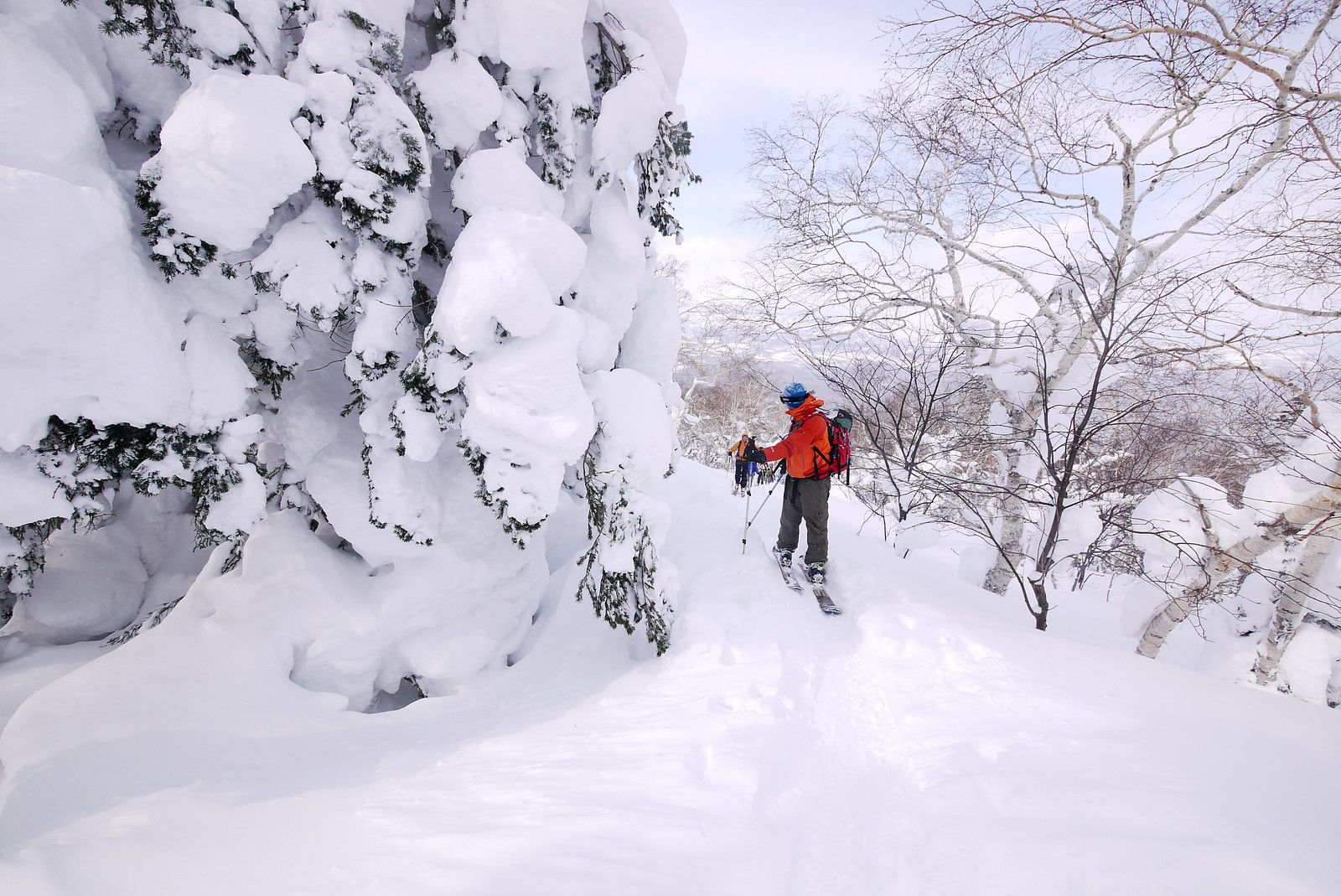
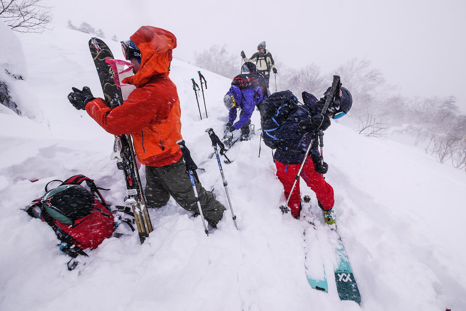
The weather was indecisive though, so as another snowy squall rolled in, we decided to call it a day, just at the treeline at around 1,400m. The snow on the Giant Ridge was quite wind affected also, so that added to our satisfaction that we’d fought the good fight for today.

We all set about getting ready for the downhill.

Mt. Furano backcountry ski touring (Hokkaido, Japan)

Unfortunately for us, the snow was less than inspiring on the way down. While I had heard reports of the lightest, most glorious powder just one day previously, the wind had clearly transformed that into a slightly more compacted, heavy version. We consoled ourselves with the fact that given the roaring wind at the trailhead, we were just lucky enough to have made it this high up on the ridge in the first place.

And really, there isn’t a day in the snow in Hokkaido that hasn’t made me grin from ear to ear.

Mt. Furano backcountry ski touring (Hokkaido, Japan)
Backcountry ski touring on Mt. Furano's Giant Ridge (Hokkaido, Japan)
Image by Rick Siddle
Snowboarding fown Mt. Furano (Hokkaido, Japan)
Image by Rick Siddle
Backcountry ski touring on Mt. Furano's Giant Ridge (Hokkaido, Japan)
Image by Rick Siddle

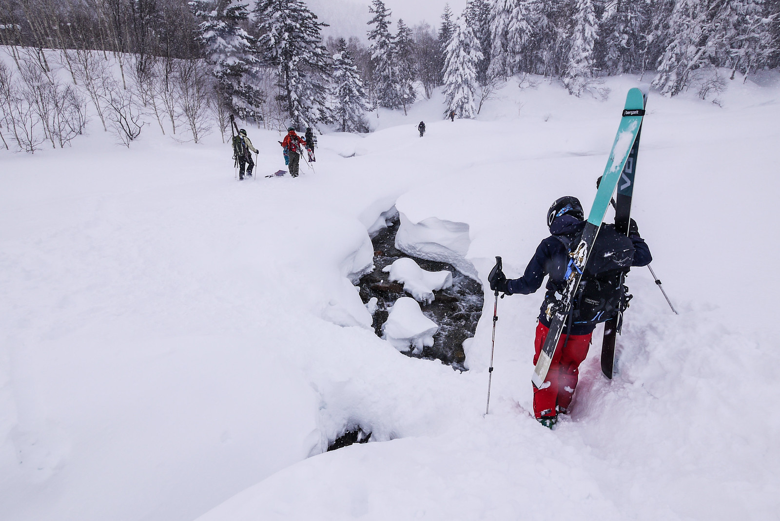
The way down for this route is essentially back the way you came. From the point that the route crosses the Beberui Creek, we just hurtled along the skin track back to the Nukkakushi-Furano River bed. From there it was a short book-pack back up to the t-junction and the cars.

Mt. Furano backcountry ski touring (Hokkaido, Japan)

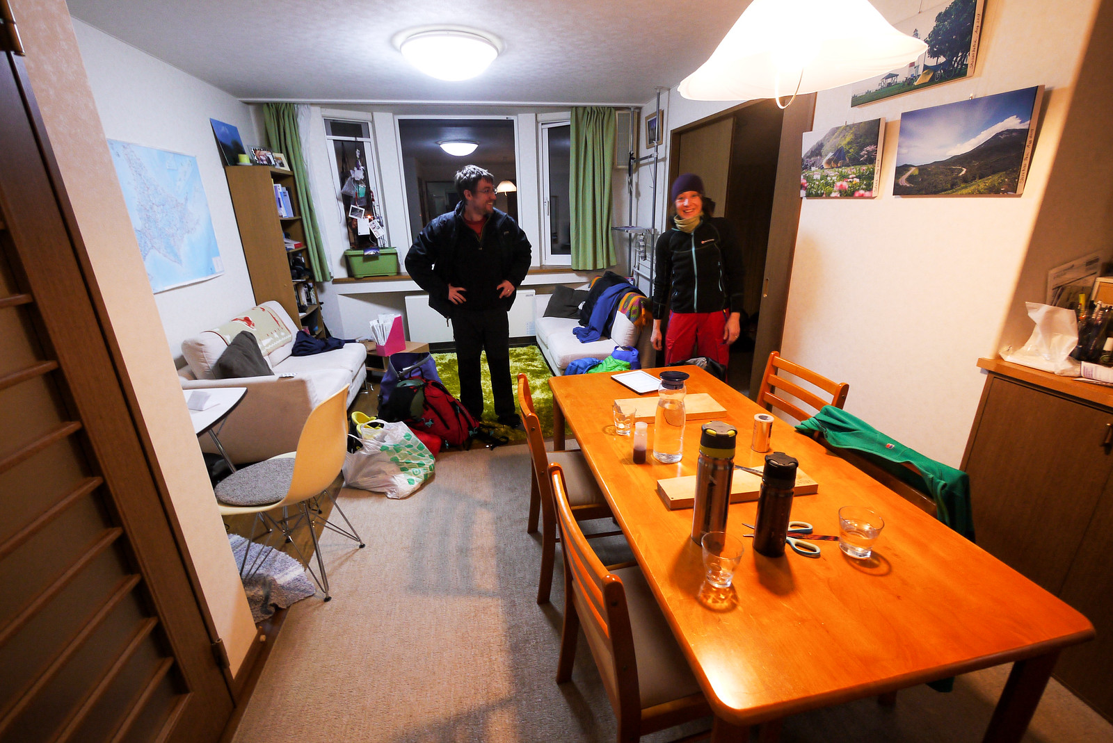
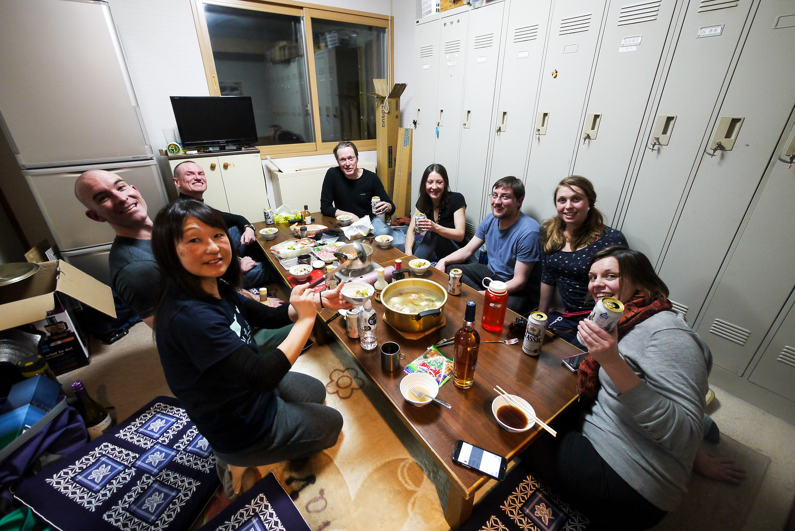
We were booked in to the Hakuginso Lodge that night (details here), and I am glad we booked ahead. The entire lodge was full that night, bustling with keen backcountry explorers.

Most larger groups (more than ten or fifteen) are put in one of the large tatami rooms, and this is convenient because this allows for both sleeping and cooking. The well-appointed kitchen downstairs is great, but the dining area isn’t really suited to large groups. Our group was nine people, and the staff were concerned that we’d struggle to fit everyone in at the tables in the kitchen.

To alleviate the space pressure, they very kindly allowed us to use a small staff room, adding an extra low table for us to use. The room is used primarily for the overnight staff at the lodge for meals and sleeping. “So long as you’re out by 8pm, you’re welcome to use this room,” the staff member said, apologizing profusely for how cramped and pokey the room was.

Our dinner that night was a shared Japanese hotpot nabe, so the arrangement was perfect. Despite the exploding popularity of the lodge over the last few years, the staff are still down to earth and helpful.

After dinner, some of us walked 10 minutes down the road to the wild Fukiage Onsen hotspring (see the bottom of this post and near the bottom of this post for photos). It was close to a perfect temperature, with a ceiling of clear starry skies.

The final shout-out goes to Alan and Emma from Scotland for bringing some delicious Scapa scotch whiskey. A great accent to the night!

Mt. Furano backcountry ski touring (Hokkaido, Japan)

Comments | Queries | Reports

Done this route to Furano-dake, or others nearby? Thinking of doing it? Please post any feedback, reports, or queries here. Thanks!

2 thoughts on “Furano-dake’s Giant Ridge Ski Touring”

  1. Not sure if you’ve come across this page: https://www.sandan.net/avalanche/avalanchehazardmap.html

    It’s a bit dated now (covers 1935 – 2014) and includes avalanches with no involvement as well as avalanche accidents. But it is a good overview what areas have historically avalanched in the Furanodake/Tokachidake area.
    There’s quite a cluster at the top of Giant Ridge, although few of those are recorded to have caught anyone. The next ridge north (what you see from the road) has seen a number of accidents and fatalities.

    Figured the information might help. Cheers for putting together such a good site!

Leave a Reply to Rob Thomson Cancel reply

Your email address will not be published. Required fields are marked *

This site uses Akismet to reduce spam. Learn how your comment data is processed.

See More Like this

Printable Furano-dake Topomap

TOPO DOWNLOAD (PDF, 15.4MB)

Download may take some time

Hokkaido Wilds Foundation

We’ve got affiliate links on HokkaidoWilds.org to help fund the Hokkaido Wilds foundation.

The Foundation gets a small commission on sales from affiliate links, but we only link to stuff we think is worth checking out for people keen on the outdoors in Hokkaido and Japan.

The Hokkaido Wilds Foundation is a fund where 100% of funds are donated to Hokkaido volunteer groups involved in sustainable, safe, and responsible access to the Hokkaido outdoors.

Learn more here

ADVANCED FILTERS

Filter by location

About Filters

REGION: The general mountain/geographical region the route is in.

BEST MONTH(S): Time of year a route is suited to visiting. Some pop all season, some are more limited.

DIFFICULTY: How strenuous a route is, and how technical it is. Full details here.

FREERIDE/SKITOUR: Very subjective, but is a route more-of-a-walk-than-a-ski or the other way around? Some routes are all about the screaming downhill (freeride), some are more about the hunt for a peak or nice forest (ski-tour). Some are in between. 

MAIN ASPECT: Which cardinal direction the primary consequential slope is facing, that you might encounter on the route. More details here.

ROUTE TAGS: An eclectic picking of other categories that routes might belong to.

SEARCH BY LOCATION: You can find routes near your current location – just click on the crosshairs (). You may need to give permission to HokkaidoWilds.org to know your GPS location (don’t worry, we won’t track you). Or, type in a destination, such as Niseko or Sapporo or Asahikawa etc.

Please let us know how we can make it easier to narrow down your search. Contact Rob at rob@hokkaidowilds.org with your suggestions.

Furano-dake’s Giant Ridge Ski Touring Difficulty Rating

Category

Grade

Points

Strenuousness

Vertical Gain

C

30

Time ascending

D

0

Technicality

Altitude

A

10

Hazards

B

12

Navigation

B

12

Totals

64/100

GRADES range from A (very difficult) to D (easy). Hazards include exposure to avalanche and fall risk. More details here. Rating rubric adapted from Hokkaido Yukiyama Guidebook 北海道雪山ガイド.