Asahidake Volcanic Steam-vents Ski Touring

旭岳地獄谷

Posted on Dec 31, 2017
60 4
WN
Posted on Dec 31, 2017
60 4
WN
6.6km

Distance

1.5 hours

Time

165m

Ascent

1780m

Highest point

4.5/10
Difficulty
Snow Icon | Hokkaido Wilds
Dec-May

Best season

Asahidake (旭岳 - 2,291m), Hokkaido's highest mountain, is an active volcano. In winter when the weather isn't blowing a gale, it is possible to wander relatively freely around the fumaroles, at around 1,700m. The route outlined here starts at the top of the Asahidake Ropeway, but if you'd rather skin up, just follow the Asahidake downhill ski course B, marked on the descent of the route on this page - it will take about 1.5 hours or so. Don't take the mountain lightly, as the weather can change very quickly. If you're lucky, however, the grand old Mt. Asahi can turn on some incredible weather.

Last updated Apr 2, 2021

Route Map

Need to know details

Location

This route starts at the Sugatami Station at the top of the Asahidake Ropeway (here), in central Hokkaido, about 40km east of Asahikawa City.

General notes

This route is a very leisurely wander around the fumarole areas near the top of the Asahidake Ropeway. If the weather is good, consider boot-packing up to the top of Asahidake as well, although this will add a solid 5 hours to the trip time. It is also a very hard-packed, icy route, so consider carrying crampons and hiring a guide. Overall, avalanche and exposure risk can increase exponentially in this area if the weather turns. Do not take this ‘easy’ route lightly – people have and do regularly die here.

  • Equipment: As noted below, temperatures with windchill can drop well below -20°C here – dress appropriately. Snow can be deep and soft – snowshoes or skis are essential. Travel with a navigation device of some sort – a smartphone pre-loaded with maps, for example (and make sure to know how to use it).
Hut
Asahidake Refuge (full details here)

The Asahidake Refuge (旭岳石室, 1,660m) is a basic but well-built stone hut on the western flanks of Asahidake, Hokkaido’s highest mountain, located in the Daisetsu mountain range in central Hokkaido. The hut is designated as an emergency-use only hut – non-emergency overnight stays are not allowed. The hut is only 20 minutes walk from the Sugatami ropeway station.

Route details

This route is not marked. In winter, skiers and snowshoers need to assume they’ll be navigating on their own. Head due east from the Sugatami Station at the top of the ropeway, and in about 20 minutes you’ll arrive at the Asahidake Ishimuro Stone Hut. This hut is not open in winter (although there is a second story window entry for emergencies only). From here, you’ll see the closest fumerole steam vent. Beyond that steam vent, follow your nose up a few hundred meters into the Jigoku-dani (地獄谷), to peruse the other fumeroles. Be aware of sudden changes in weather and/or wind direction.

  • NOTE: People can get completely and hopelessly lost even a few hundred meters from the ropeway top station if the weather turns, so only venture out in good visibility conditions with a good forecast. We’ve attempted this route in the past and only got a few hundred meters from the ropeway station before turning back due to high wind and snow – when it is snowing hard and the wind is up, your tracks in the snow can disappear in minutes.
Route Timing
Up | 1hrs
Down | .5hrs

Set aside about an hour for wandering around the fumaroles, and then about 30 minutes for skiing down the Asahidake ski area.

Transport

Public transport:

The Asahidake Ropeway is accessible by the public Ideyu-go bus (いでゆ号) from Asahikawa Station, via Asahikawa Airport and Higashikawa Township. See the timetable at the very bottom of the Asahidake Ropeway website here: https://asahidake.hokkaido.jp/en/#ACCESS

By car:

There is ample parking at the base of the Asahidake Ropeway (here).

Physical maps
Official Topo Map: Asahidake (旭岳) – map no. NK-54-7-3-3

NOTE: The official 1/25000 topo map(s) above can be purchased for 350yen from Kinokuniya bookstore next to Sapporo Station or online (in Japanese).

Aspect
The main aspect skiers are exposed to on the descent and/or ascent is West. Other aspects that may also be encountered while following the route outlined on this page include: North. Therefore, keep an eye on the weather forecast a few days ahead of your trip to monitor wind, snow, and temperature. Also, since this route is in the general vicinity of the Furano area, consider looking at the Furano Avalanche Center (on Facebook). They issue sporadic observations throughout the season which may give extra insight into avalanche conditions.

Snow and
route safety

When the weather is nice, or even only slightly nice, it can be very easy to be complacent on this route. This is probably because of the sheer accessibility of the area via the ropeway. You’ll likely see tourists in sneakers and jeans bracing against the cold for a quick selfie near the ropeway station. The reality is that the top of the ropeway is at 1,600m, which is well within serious mountaineering territory. In winter, with windchill, it can easily get down to below -20degC. Even with no snow forecast, high winds will cause whiteout conditions very quickly. Make conservative decisions in the high mountains of Hokkaido. If you’re lucky enough to get lost and then rescued (and not die), personnel and rescue costs are steep, and will be charged directly to you; think in the tens of thousands of dollars if it takes more than a few hours to find you.

  • Notify the police of your backcountry plans online using Compass – instructions here.

Asahidake Volcanic Steam-vents Ski Touring Difficulty Rating

Category

Grade

Points

Strenuousness

Vertical Gain

D

25

Time ascending

D

0

Technicality

Altitude

A

10

Hazards

D

0

Navigation

B

12

Totals

47/100

GRADES range from A (very difficult) to D (easy).  More details here. Rating rubric adapted from Hokkaido Yukiyama Guidebook 北海道雪山ガイド.

Weather forecast

Windy.com weather forecast for Asahidake Steam Vents
Onsen nearby

The bottom of the ropeway is in Asahidake Onsen village. Yukoman Onsen (location) was nice (800yen per person).

Extra Resources
No extra English resources that we know of. If you know of any, please let us know in the comments.

Guide Options

If you’d like to ski this route and/or explore other peaks in central Hokkaido together with a local certified guide, get in touch with Yasuko Kikuchi. Born and raised in Hokkaido, she’s a JMGA-certified guide now based in Sapporo. Her outdoor experience is broad and worldwide, having worked as a Canadian Ski Patrol member, and has sumitted a number of 6,000m+ peaks around the world. She speaks good English, and can arrange transport to and from central Hokkaido. In addition to Yasuko, also see a full list of English-speaking Hokkaido Mountain Guides Association (HMGA) guides on the HMGA website here

Support us

Like this content? Buy the HokkaidoWilds.org team a coffee. 50% of tips go to the Hokkaido Wilds Foundation.

Show Full Route Notes Close Route Notes

Route Trip Notes

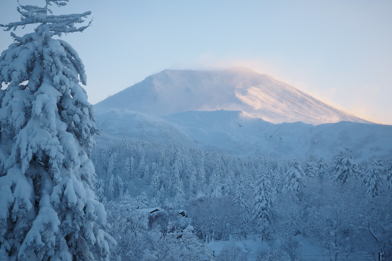
We were on a week-long holiday on the eastern side of Hokkaido, and naturally had to drive all the way back to Sapporo, so why not go via Asahidake Onsen? The days before Mt. Asahi included an overnight hut trip ski tour on Mt. Mokoto near Lake Kussharo. We had amazing weather on the second day there (trip report and route guide here), so we were hoping for more of the same on Hokkaido’s rather unpredictable highest mountain.

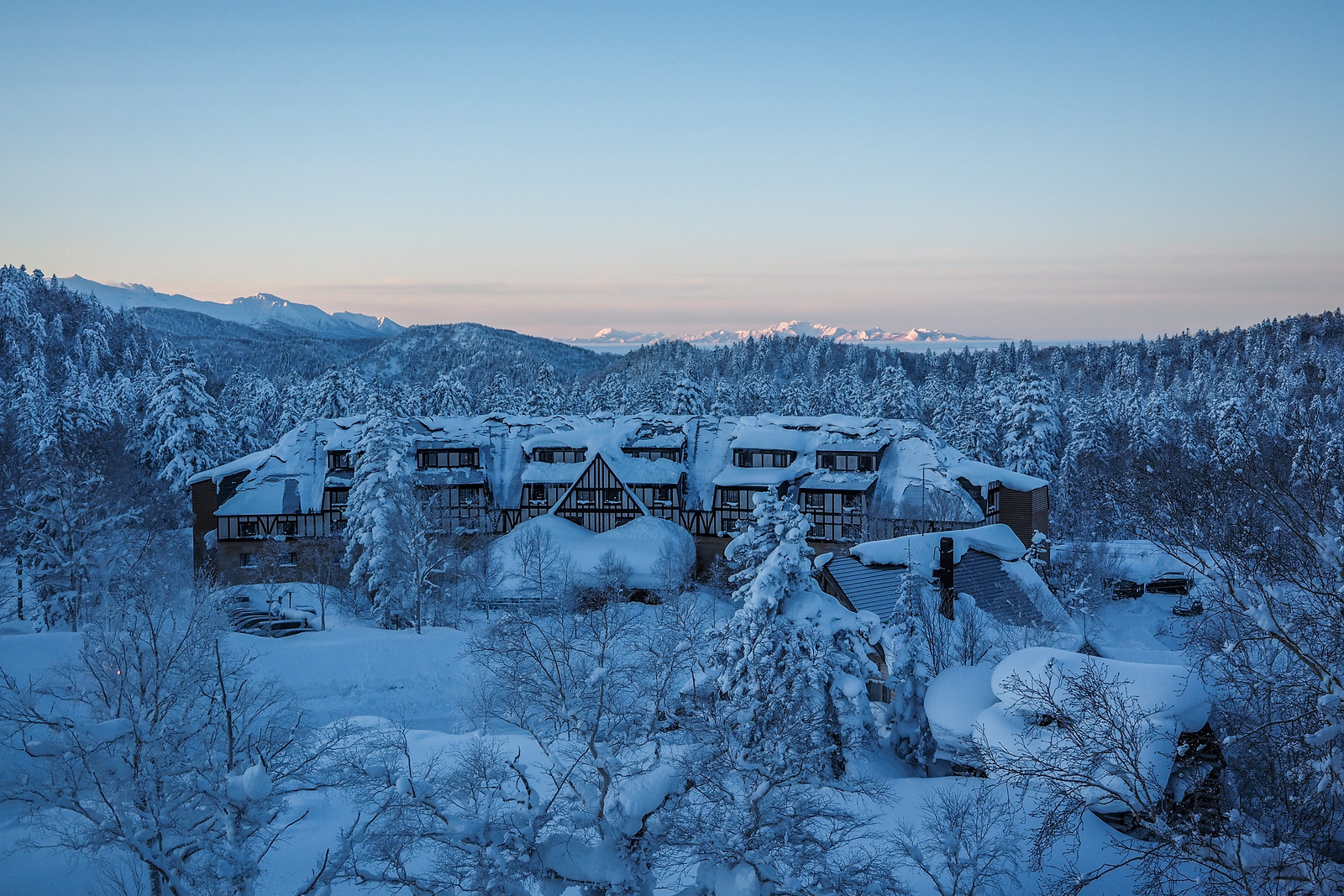
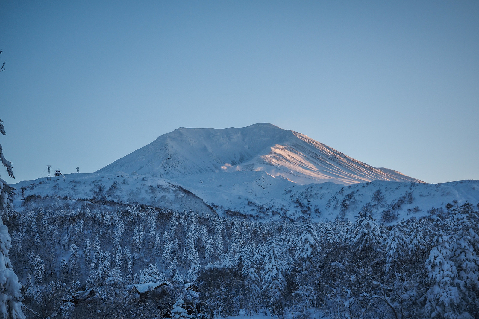
We stayed in Asahidake Onsen village (resort?) at the Shirakabaso Youth Hostel (the cheapest but slightly overpriced accommodation in town), and woke to clear skies. A quick look at Mt. Asahi from the youth hostel viewing platform, however, suggested that conditions at the top of the Asahidake Ropeway were not going to be great. It looked to be blowing a gale.

Mt. Asahi fumerole ski tour (Hokkaido, Japan)

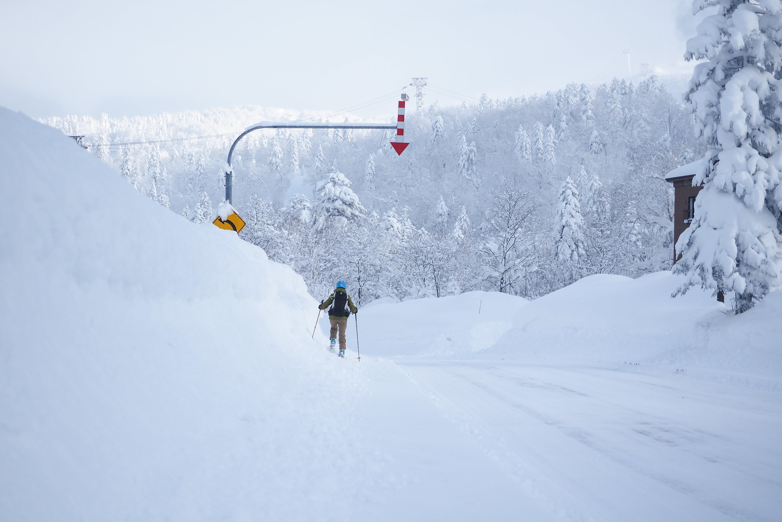
We decided to head up the ropeway anyway, if it was running; it closes if the wind is too strong. It was only a 10 minute walk from the hostel to the ropeway, so we skinned most of the way up the side of the road. We were taken aback at how much snow there was in comparison to on the other side of the ranges out further east.

Mt. Asahi fumerole ski tour (Hokkaido, Japan)

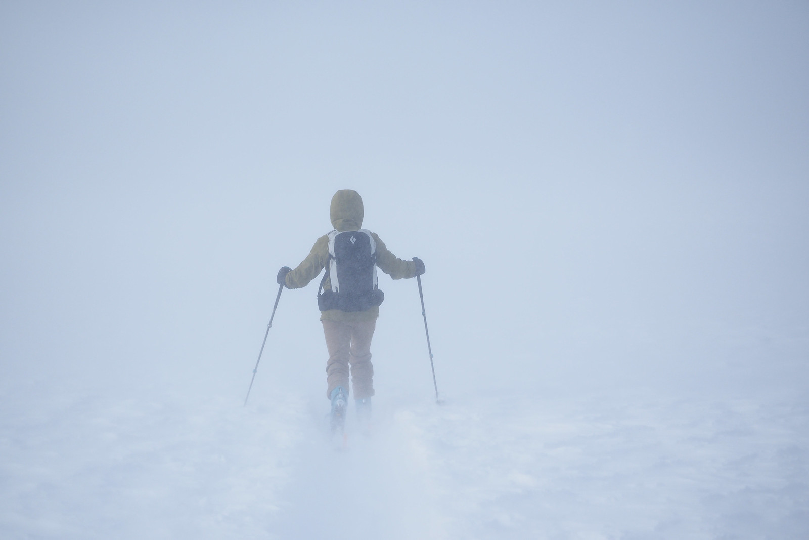
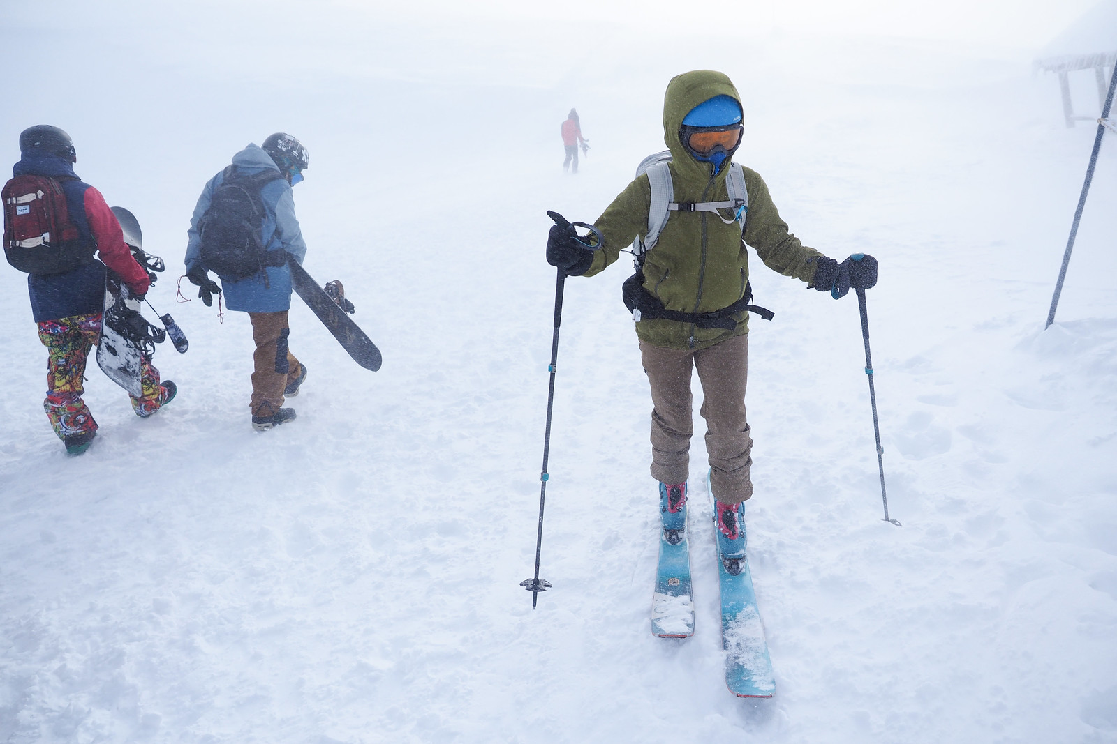
At the top of the ropeway, it was quite clear that it was not going to be a leisurely meander. It was a near-whiteout with scathingly cold and strong wind. We made it about a quarter of the way towards the stone hut with about 100m visibility, before turning back when this dropped to about 20m.

We were booked in for another night in Asahidake Onsen, so we returned down the ski slopes to the village, hoping for better weather the next day.

Mt. Asahi fumerole ski tour (Hokkaido, Japan)

Mt. Asahi fumerole ski tour (Hokkaido, Japan)

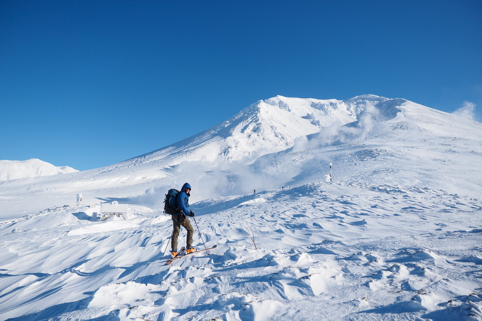
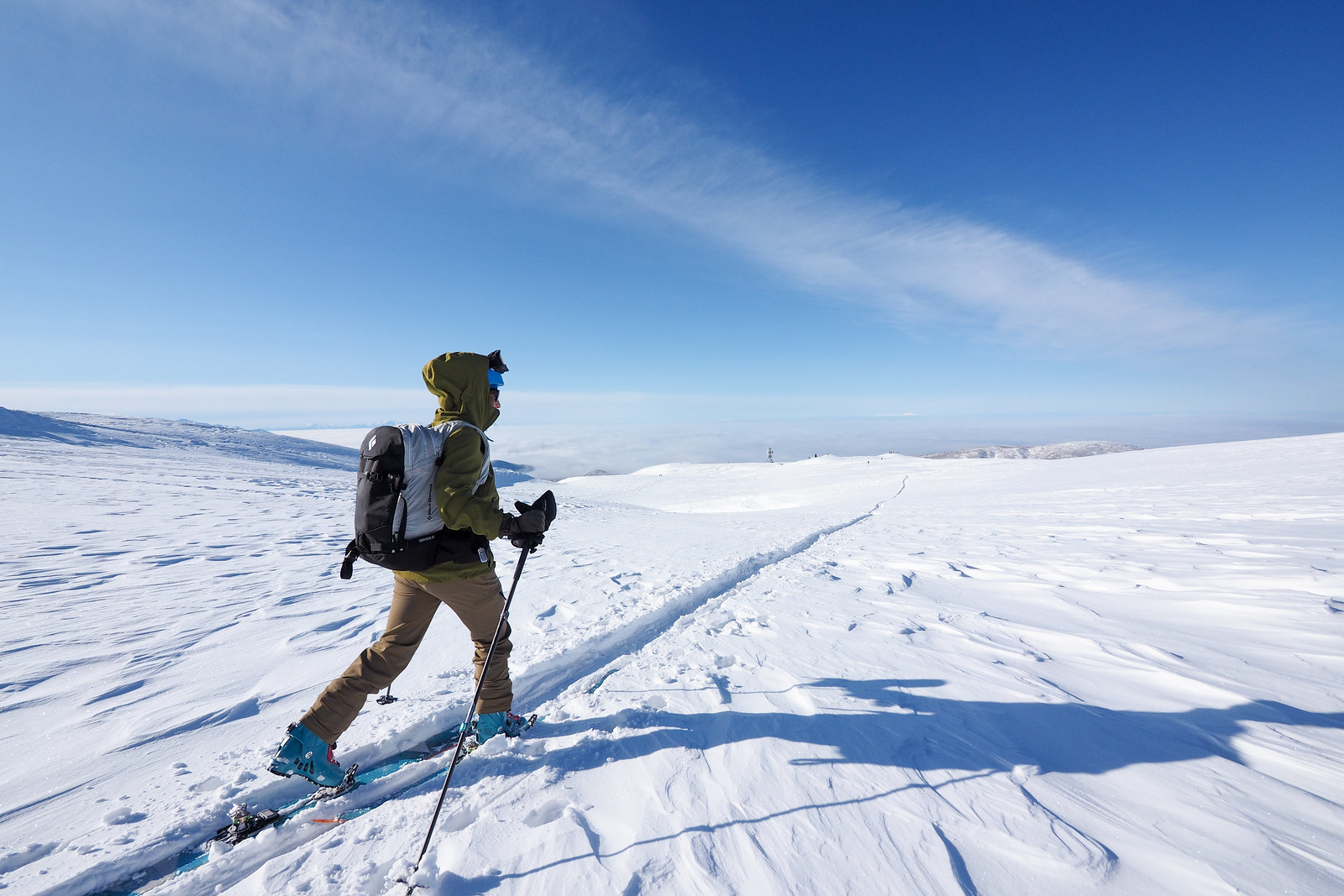
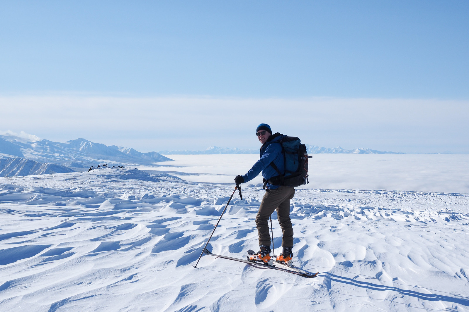
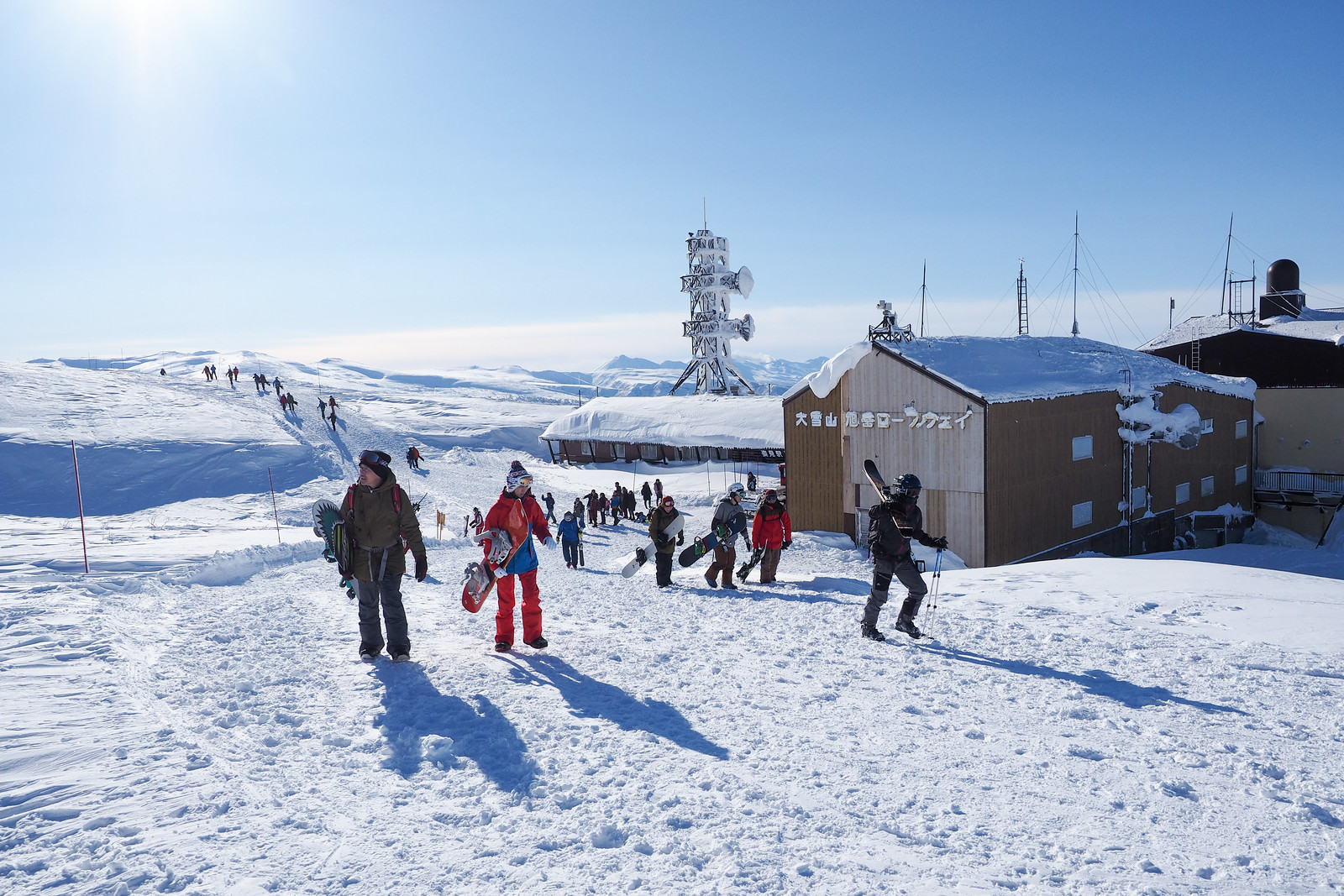
The next day broke to near-perfect conditions. We wasted no time getting going and were on the first gondola up the mountain.

Mt. Asahi fumerole ski tour (Hokkaido, Japan)

Mt. Asahi fumerole ski tour (Hokkaido, Japan)

Mt. Asahi fumerole ski tour (Hokkaido, Japan)

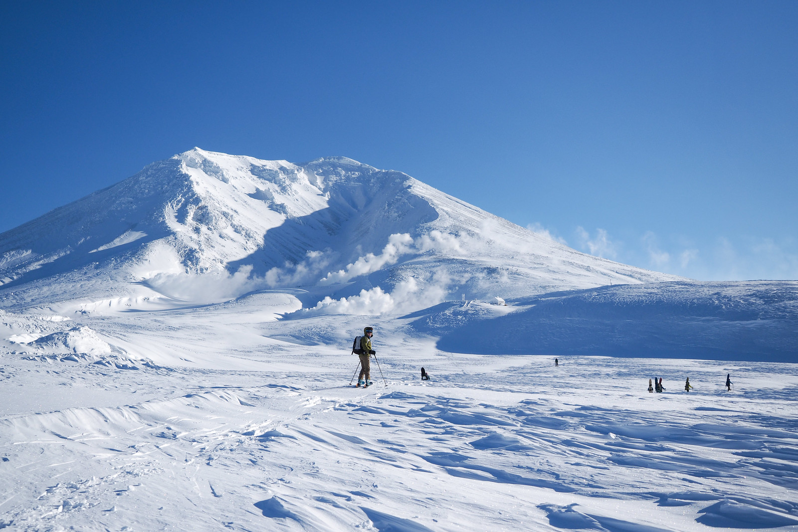
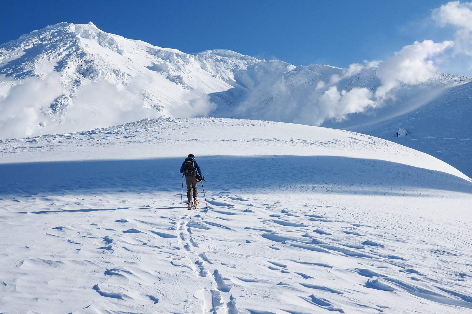
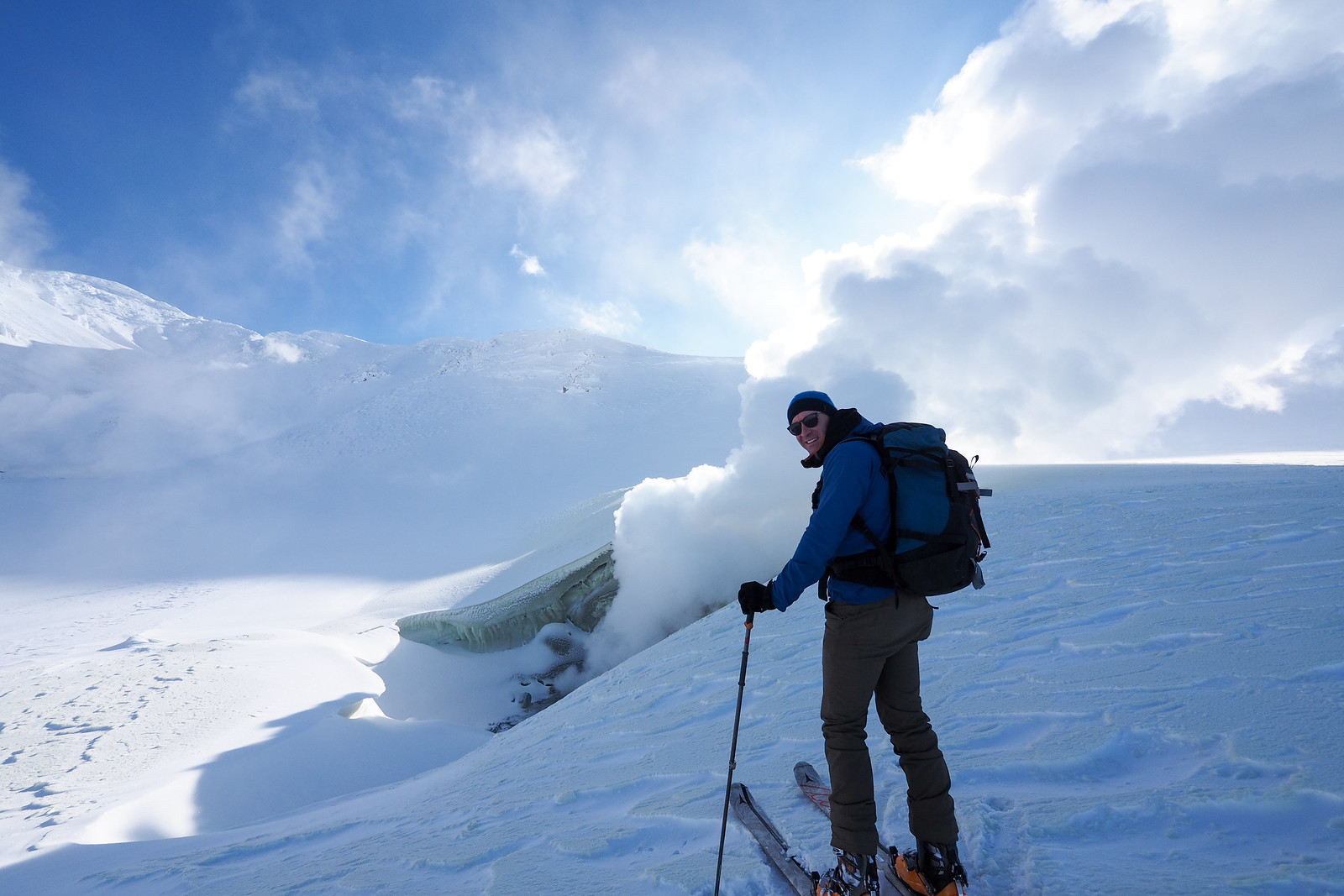
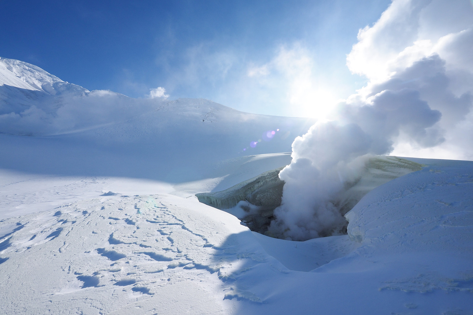
When you can stop, hold your breath, and hear nothing but loud silence, you know you’ve hit the weather jackpot. Other climbers with more time on their hands were marching up the southern ridge of Mt. Asahi, heading for the summit. We left this for another time, and concentrated on the much more leisurely circuit around some of the steam vents in the ‘Hell valley’.

I was infinitely jealous of whoever had spent the night out in a tent near the stone emergency hut. It would have been a blustery start to the night, but I can imagine the morning calm would have been worth it.

Mt. Asahi fumerole ski tour (Hokkaido, Japan)

Mt. Asahi fumerole ski tour (Hokkaido, Japan)

Mt. Asahi fumerole ski tour (Hokkaido, Japan)

Mt. Asahi fumerole ski tour (Hokkaido, Japan)

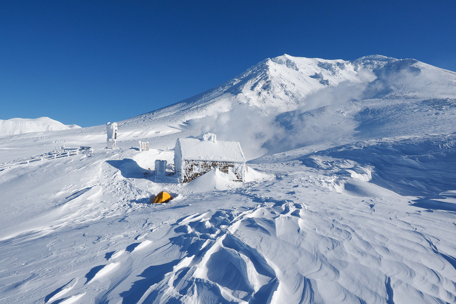
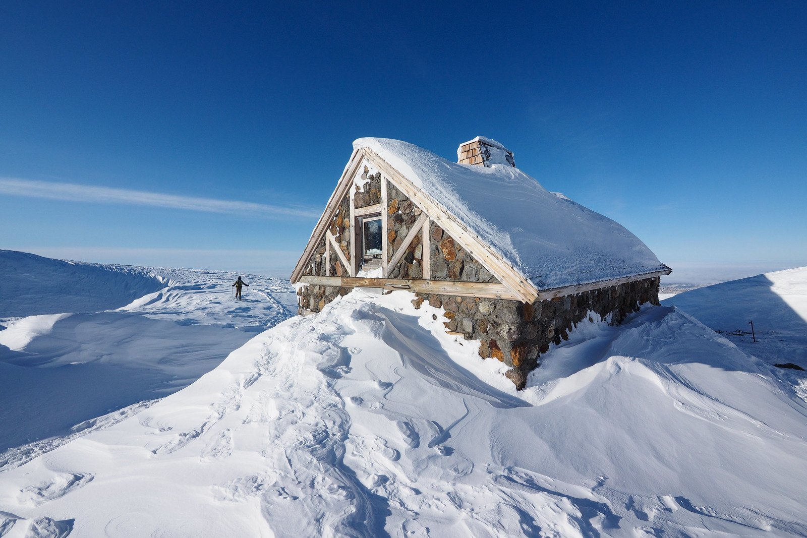
The stone hut (asahidake ishimuro) is well-and-truly an emergency hut, with no non-emergency overnight stays allowed. Even if you wanted to stay overnight in winter, it would be nearly breaking and entering, as the second-story window is well iced shut. A screw-driver on a multi-tool would probably shimmy it open, but not without damaging the wooden framing.

We carried on up the valley to a truly majestic landscape.

Mt. Asahi fumerole ski tour (Hokkaido, Japan)

Mt. Asahi fumerole ski tour (Hokkaido, Japan)

Mt. Asahi fumerole ski tour (Hokkaido, Japan)

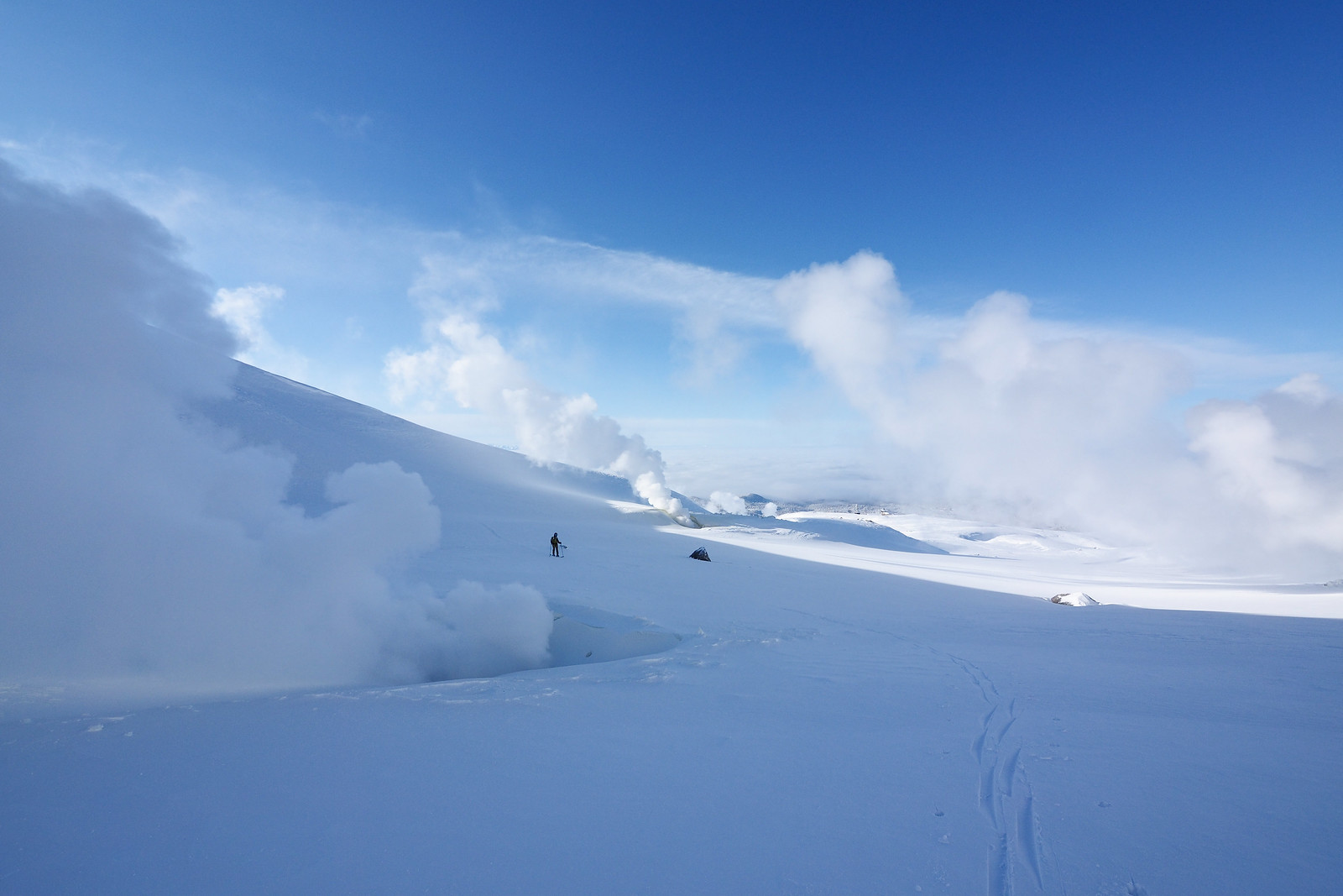
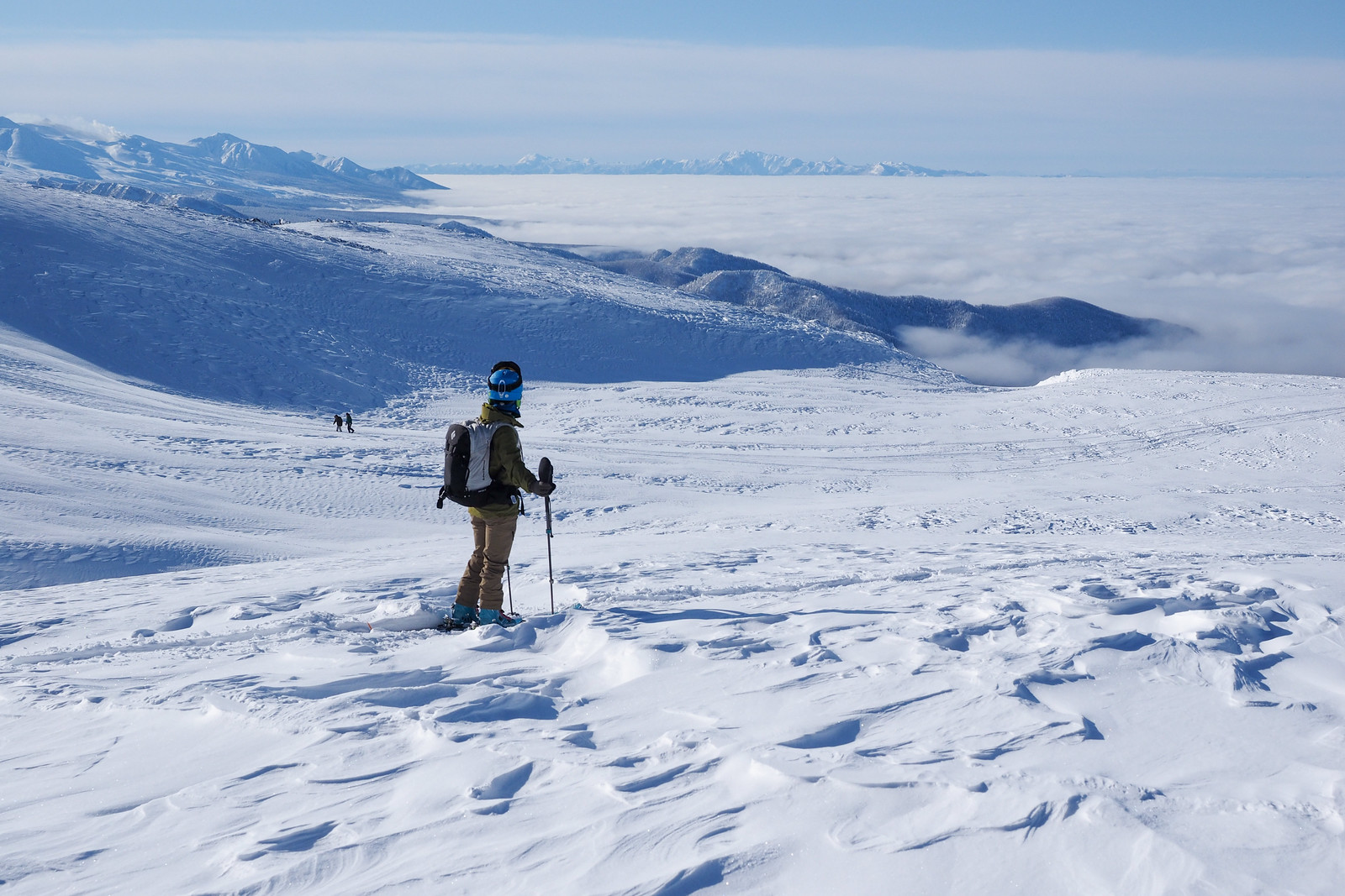
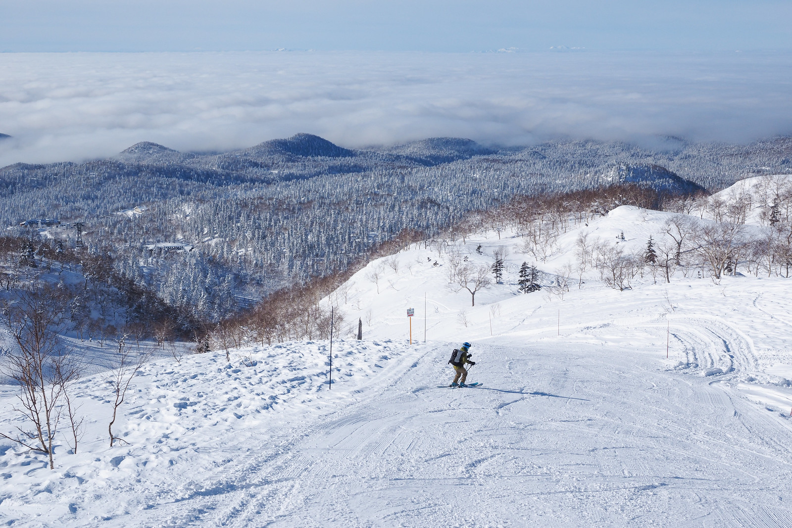
After pottering around at the upper-most fumaroles, we made our way back down to where the summer walking trail does a loop back to the ropeway station. Heading back down the valley gave us a great view of the sea of clouds further down the Asahikawa plains, and on to the Yubari mountain range in the far distance.

Mt. Asahi fumerole ski tour (Hokkaido, Japan)

Mt. Asahi fumerole ski tour (Hokkaido, Japan)

Mt. Asahi fumerole ski tour (Hokkaido, Japan)

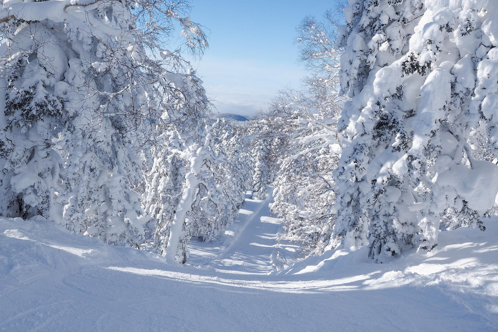
Once we were back at the ropeway top station, we joined the throngs of new arrivals for a fast blast down the unique groomed slopes of the Asahidake Ropeway ski area. This ski area is unique in that 1) the scenery is amazing (great massive pines covered in marshmallow snow) and 2) it is not really much of a ski area – the groomers are only just wide enough for some short turns and are more like access-road shortcuts down the mountain. An absolute blast!

All in all a great first-visit to the beautiful but cantankerous Mt. Asahi, Hokkaido’s highest.

Mt. Asahi fumerole ski tour (Hokkaido, Japan)

Mt. Asahi fumerole ski tour (Hokkaido, Japan)

Mt. Asahi fumerole ski tour (Hokkaido, Japan)

Comments | Queries | Reports

Done this route to Asahidake Steam Vents, or others nearby? Thinking of doing it? Please post any feedback, reports, or queries here. Thanks!

4 thoughts on “Asahidake Volcanic Steam-vents Ski Touring”

    1. Hey Jake, apologies for the late reply! You’d be catching a lot of sharks in October and November! A decent base isn’t there until mid-December. If you’re up for an adventure though, it’s always worth a hike up to see how the season is progressing. Also note that the ropeway doesn’t allow carrying ski gear onto the gondola until December 30th, so you’d be hiking from the base before then.

  1. Any chance there is a geo-referenced map for this area? I primarily use Avenza and the geo-referenced maps you have are super awesome. My wife and I skied in Hokkaido (mainly Niseko, Tokachidake, and Asahidake) a few years ago with a guiding company, but this year we’re heading to the same areas on our own. We lapped the area to skier’s right of the Asahidake tramway (kind of out toward that Mitanohara area on the map) after setting a skin track and it was epic. Fresh lines for days!

    A geo-referenced map of the Asahidake area I think is the last one on our list! Thank you so much for providing these references!

Leave a Reply to Dave Cancel reply

Your email address will not be published. Required fields are marked *

This site uses Akismet to reduce spam. Learn how your comment data is processed.

See More Like this

Printable Asahidake Steam Vents Topomap

TOPO DOWNLOAD (PDF, 7MB)

Download may take some time

Hokkaido Wilds Foundation

We’ve got affiliate links on HokkaidoWilds.org to help fund the Hokkaido Wilds foundation.

The Foundation gets a small commission on sales from affiliate links, but we only link to stuff we think is worth checking out for people keen on the outdoors in Hokkaido and Japan.

The Hokkaido Wilds Foundation is a fund where 100% of funds are donated to Hokkaido volunteer groups involved in sustainable, safe, and responsible access to the Hokkaido outdoors.

Learn more here

ADVANCED FILTERS

Filter by location

About Filters

REGION: The general mountain/geographical region the route is in.

BEST MONTH(S): Time of year a route is suited to visiting. Some pop all season, some are more limited.

DIFFICULTY: How strenuous a route is, and how technical it is. Full details here.

FREERIDE/SKITOUR: Very subjective, but is a route more-of-a-walk-than-a-ski or the other way around? Some routes are all about the screaming downhill (freeride), some are more about the hunt for a peak or nice forest (ski-tour). Some are in between. 

MAIN ASPECT: Which cardinal direction the primary consequential slope is facing, that you might encounter on the route. More details here.

ROUTE TAGS: An eclectic picking of other categories that routes might belong to.

SEARCH BY LOCATION: You can find routes near your current location – just click on the crosshairs (). You may need to give permission to HokkaidoWilds.org to know your GPS location (don’t worry, we won’t track you). Or, type in a destination, such as Niseko or Sapporo or Asahikawa etc.

Please let us know how we can make it easier to narrow down your search. Contact Rob at rob@hokkaidowilds.org with your suggestions.

Asahidake Volcanic Steam-vents Ski Touring Difficulty Rating

Category

Grade

Points

Strenuousness

Vertical Gain

D

25

Time ascending

D

0

Technicality

Altitude

A

10

Hazards

D

0

Navigation

B

12

Totals

47/100

GRADES range from A (very difficult) to D (easy). Hazards include exposure to avalanche and fall risk. More details here. Rating rubric adapted from Hokkaido Yukiyama Guidebook 北海道雪山ガイド.