Posted on Mar 11, 2018
108 2
S
Posted on Mar 11, 2018
108 2
S
15.5km

Distance

6 hours

Time

1165m

Ascent

1090m

Highest point

5.5/10
Difficulty
Snow Icon | Hokkaido Wilds
Jan-Mar

Best season

Mt. Sahoro (佐幌岳, 1,060m) is a prominent peak just north of the Karikachi Pass (狩勝峠, 644m) in central Hokkaido. Generally, the winter approach follows the summer trail along the ridge from the Karikachi Pass to the peak. Near the peak is the bunker-like Sahoro-sanso Hut (佐幌山荘. This will set you up for an early-morning run down the Sahoro Ski Area before climbing back up and back the way you came (or hitching a ride back) to the Karikachi Pass. Sahoro Resort is also home to one of the best brown-bear parks in Hokkaido.

Last updated Dec 26, 2022

Route Map

Need to know details

Location

This route skirts around the Mt. Sahoro ridgeline from Karikachi Pass to Mt. Sahoro, above the Sahoro Resort area to the east, in central Hokkaido, just north of Obihiro City.

General notes

Sahoro Resort, about 30km north of Obihiro City in central Hokkaido, is home to the Sahoro Bear Mountain, Sahoro Resort, and Clubmed Hokkaido. It is a relatively lesser-known winter destination in Hokkaido, although the ski area there boasts seven lifts and a multitude of ski runs. There’s a basic bunker-like hut (with wood-burner stove) at the Mt. Sahoro summit above the resort though (full details about the hut here), which makes it a viable option for an overnight ski touring trip. If visiting later in the season you’ll need to be prepared to dig your way into the entrance of the hut, as it becomes mostly-buried (or completely buried) under snow.

Hut
Sahoro-sanso Hut (full details here)

Sahoro-sanso Hut at the summit of Mt. Sahoro is a bunker-like shed, built to withstand the brutal winter conditions that the Hidaka Ranges gets. In summer I have heard it described as a dark, humid, musty shack, so I’m not super confident about its prospects in the non-snow season (please let us know in the comments below if you have any intel on the hut in summer!). In winter, however, it is essentially a glorified snowcave, and very much worth the effort to dig the entrance out for a cosy (albeit dark) night over in the hills.

Route details

The route from Karikachi Pass along the main ridge to the summit follows the summer trail.

Route Timing
Up | 3.5hrs
Down | 3hrs

About 3.5 hours from Karikachi Pass to Mt. Sahoro summit along the ridge.

Transport

Public transport:

Karikachi Pass is not accessible by public transport, but the Sahoro Resort Ski Area is, either by direct bus from Chitose Airport, or by shuttle bus from Shintoku Village. See details here: https://www.sahoro.co.jp/language/cn/transportation/transportation.html. At the Sahoro Resort Hotel (location), ask the front desk staff to call you a taxi. From Sahoro Resort Hotel to the top of Karikachi Pass, Shintoku Taxi quoted me approximately 3,000yen. Expect a 20 minute wait for the taxi. Note that the Shintoku Taxis don’t have ski carriers, so you’d be putting the skis inside the taxi – this means you’d likely only get three people in one taxi at a push.

By car:

There is ample parking at the rest area at the top of Karikachi Pass here. To get back to your car at Karikachi Pass from Sahoro Resort, you can either try hitching (as we did, below) or ask the Sahoro Resort Hotel front staff to call you a taxi (see ‘public transport’ above, expect a 20 minute wait).

Physical maps
Official Topo Map: Karikachi-toge (狩勝峠) – map no. NK-54-8-2-3
Official Topo Map 2: Sahoro-dake (佐幌岳) – map no. NK-54-8-1-4

NOTE: The official 1/25000 topo map(s) above can be purchased for 350yen from Kinokuniya bookstore next to Sapporo Station or online (in Japanese).

Aspect
The main aspect skiers are exposed to on the descent and/or ascent is South. Therefore, keep an eye on the weather forecast a few days ahead of your trip to monitor wind, snow, and temperature. Also, since this route is in the general vicinity of the Furano area, consider looking at the Furano Avalanche Center (on Facebook). They issue sporadic observations throughout the season which may give extra insight into avalanche conditions.

Snow and
route safety

The ridge from Karikachi Pass to Mt. Sahoro can develop prominent cornices and cracks in the snow on the eastern aspects (to the climbers right). Keep well to the shrubs on the western side of the ridge.

  • Bad-weather route: The ridge route is very exposed, and will not be suitable when the wind is high. An alternative route approaches the summit from the 6th Station on the Karikachi Pass, along a more sheltered, wooded bowl (route here | GPX file download).
  • Notify the police of your backcountry plans online using Compass – instructions here.

Sahoro-dake and Sahoro-Sanso Hut Difficulty Rating

Category

Grade

Points

Strenuousness

Vertical Gain

A

40

Time ascending

C

3

Technicality

Altitude

B

6

Hazards

D

0

Navigation

C

6

Totals

55/100

GRADES range from A (very difficult) to D (easy).  More details here. Rating rubric adapted from Hokkaido Yukiyama Guidebook 北海道雪山ガイド.

Weather forecast

Windy.com weather forecast for Sahoro-dake
Onsen nearby

Sahoro Resort (here) has a very nice onsen.

Extra Resources

Guide Options

If you’d like to ski this route and/or explore other peaks in central Hokkaido together with a local certified guide, get in touch with Yasuko Kikuchi. Born and raised in Hokkaido, she’s a JMGA-certified guide now based in Sapporo. Her outdoor experience is broad and worldwide, having worked as a Canadian Ski Patrol member, and has sumitted a number of 6,000m+ peaks around the world. She speaks good English, and can arrange transport to and from central Hokkaido. In addition to Yasuko, also see a full list of English-speaking Hokkaido Mountain Guides Association (HMGA) guides on the HMGA website here

Support us

Like this content? Buy the HokkaidoWilds.org team a coffee. 50% of tips go to the Hokkaido Wilds Foundation.

Show Full Route Notes Close Route Notes

Route Trip Notes

I had also been in Niskeo all week, attending a Whiteroom Tours Backcountry Avalance Avoidance Course (similar to AST2), so I was keen to get out into the hills for some more touring.

So we made the 2.5 hour drive from Sapporo on Saturday to Karikachi Pass. We took the expressway all the way from central Sapporo, via Eniwa, to Tomamu, and from there drove up to Karikachi Pass. The highway toll was about 3,500yen.

At Karikachi Pass there was a cool breeze blowing, but the sun was out. We split up the ingredients for the shared nabe dinner, and set off.

Ski touring Mt. Sahoro in Hokkaido, Japan
Photo by Rick Siddle
Mt. Sahoro and Sahoro Sanso Hut ski touring (Hokkaido, Japan)

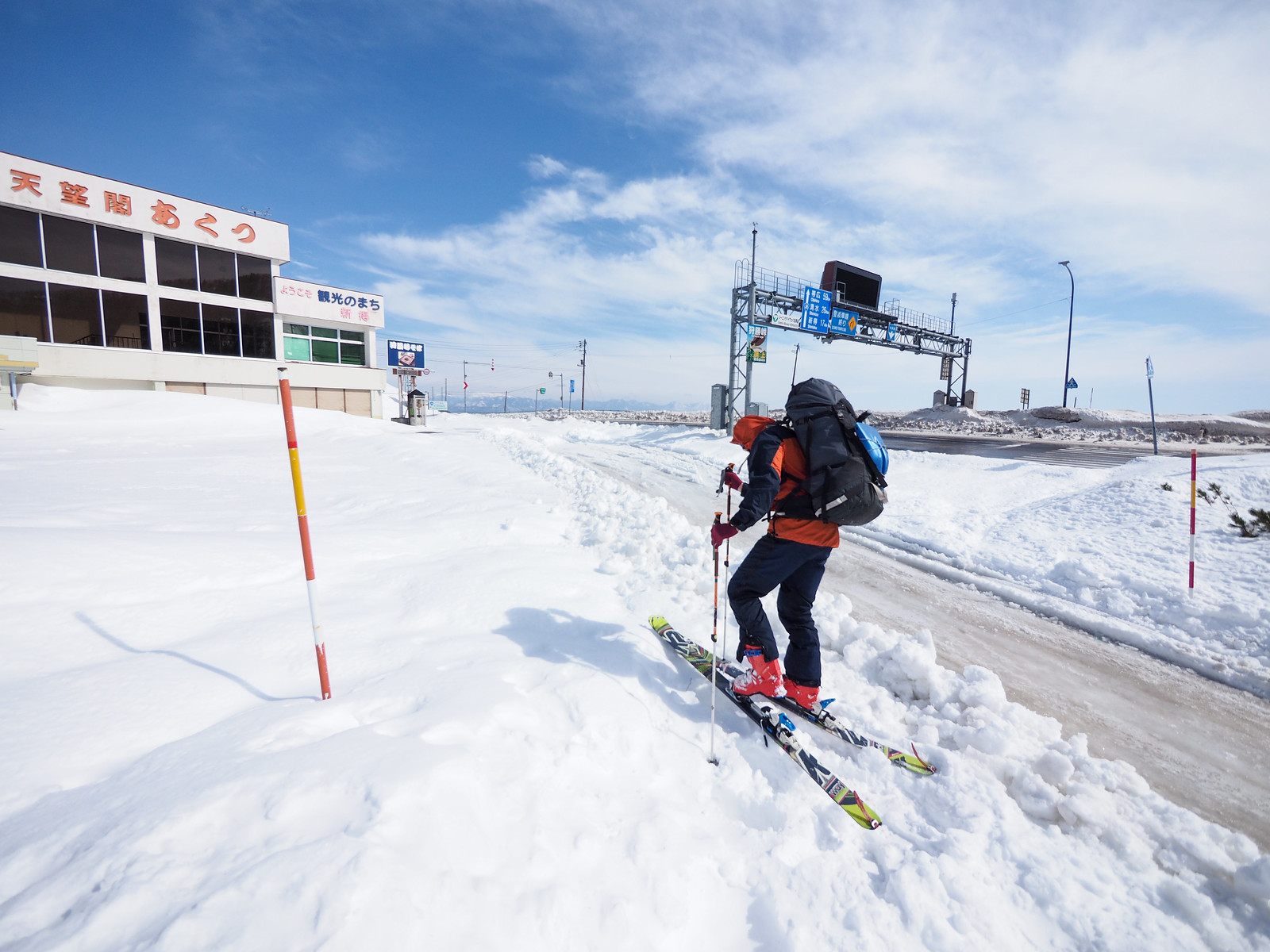
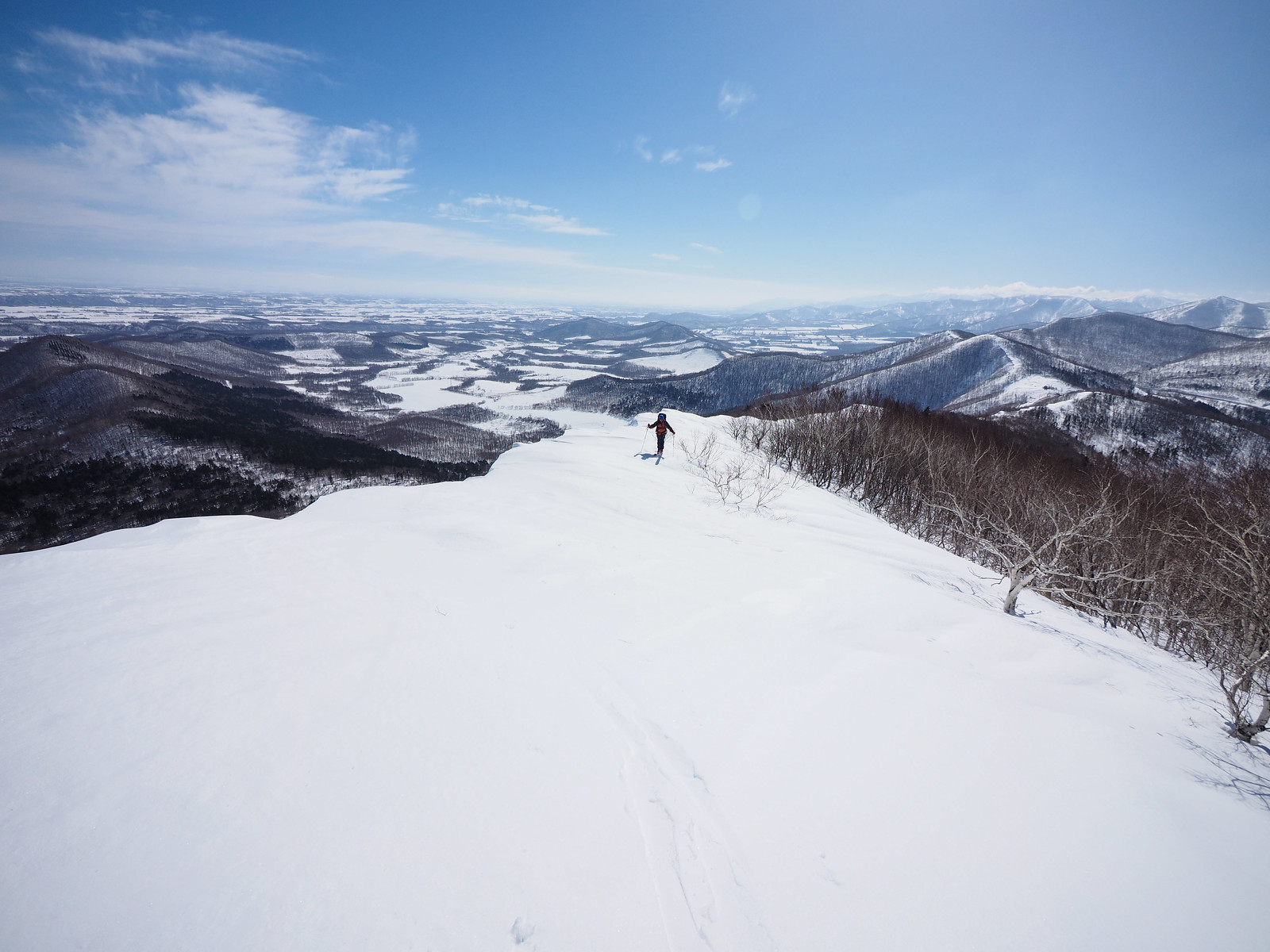
The ridge-line route from Karikachi Pass to Mt. Sahoro follows a prominent ridge for 5km via Mt. Sakura (桜山, 950m). We accessed the ridge from behind the pass’s roadstop buildings.

Already it was clear that we’d be skinning across a very hard and rain-runneled/wind-drifted surface. The effects of the previous few days of rain, and now colder temperatures, were painfully clear on the surface of the snow.

Mt. Sahoro and Sahoro Sanso Hut ski touring (Hokkaido, Japan)

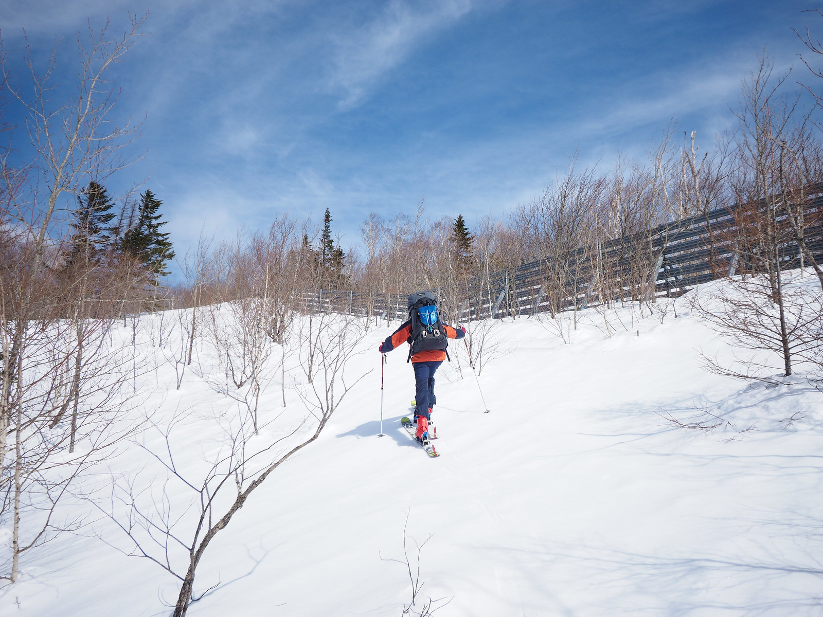
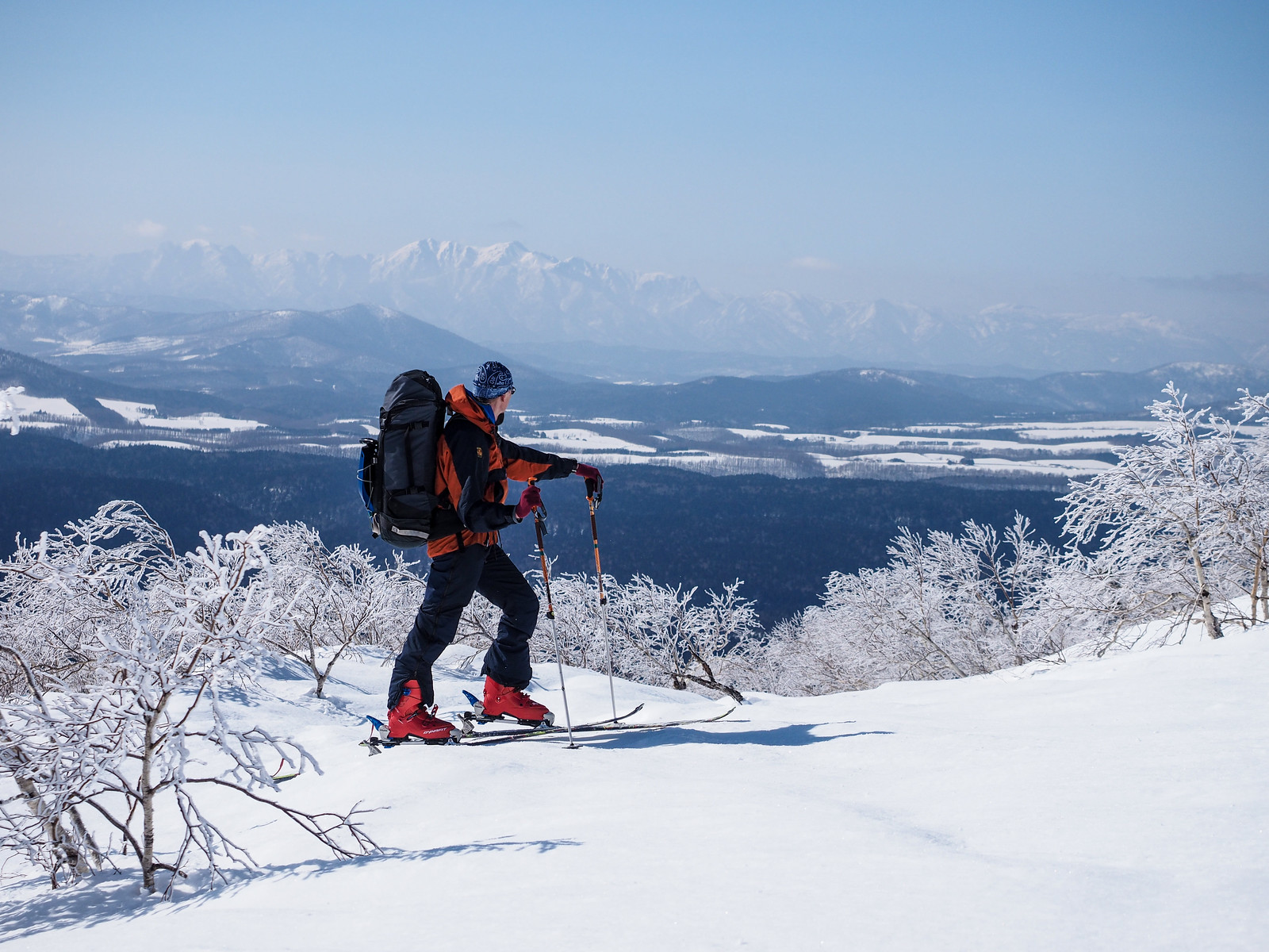
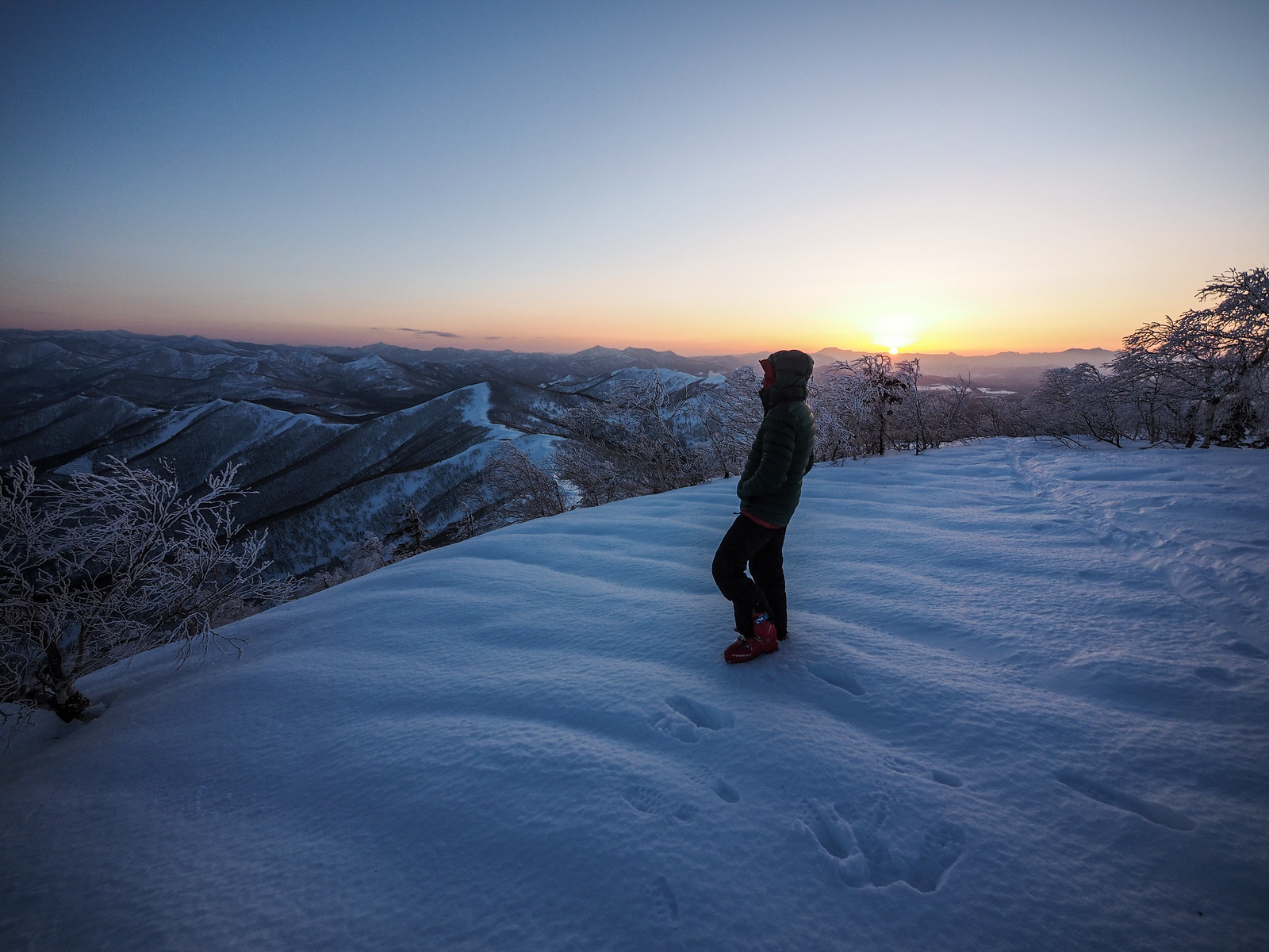
As soon as we emerged onto the ridge, however, we were greeted with expansive views over the Tokachi Plains to the northeast. The stark contrast between the weather we’d had for the last week or so and today was laughably huge. It was an absolute joy to be up there on the ridge is such great weather.

Mt. Sahoro and Sahoro Sanso Hut ski touring (Hokkaido, Japan)

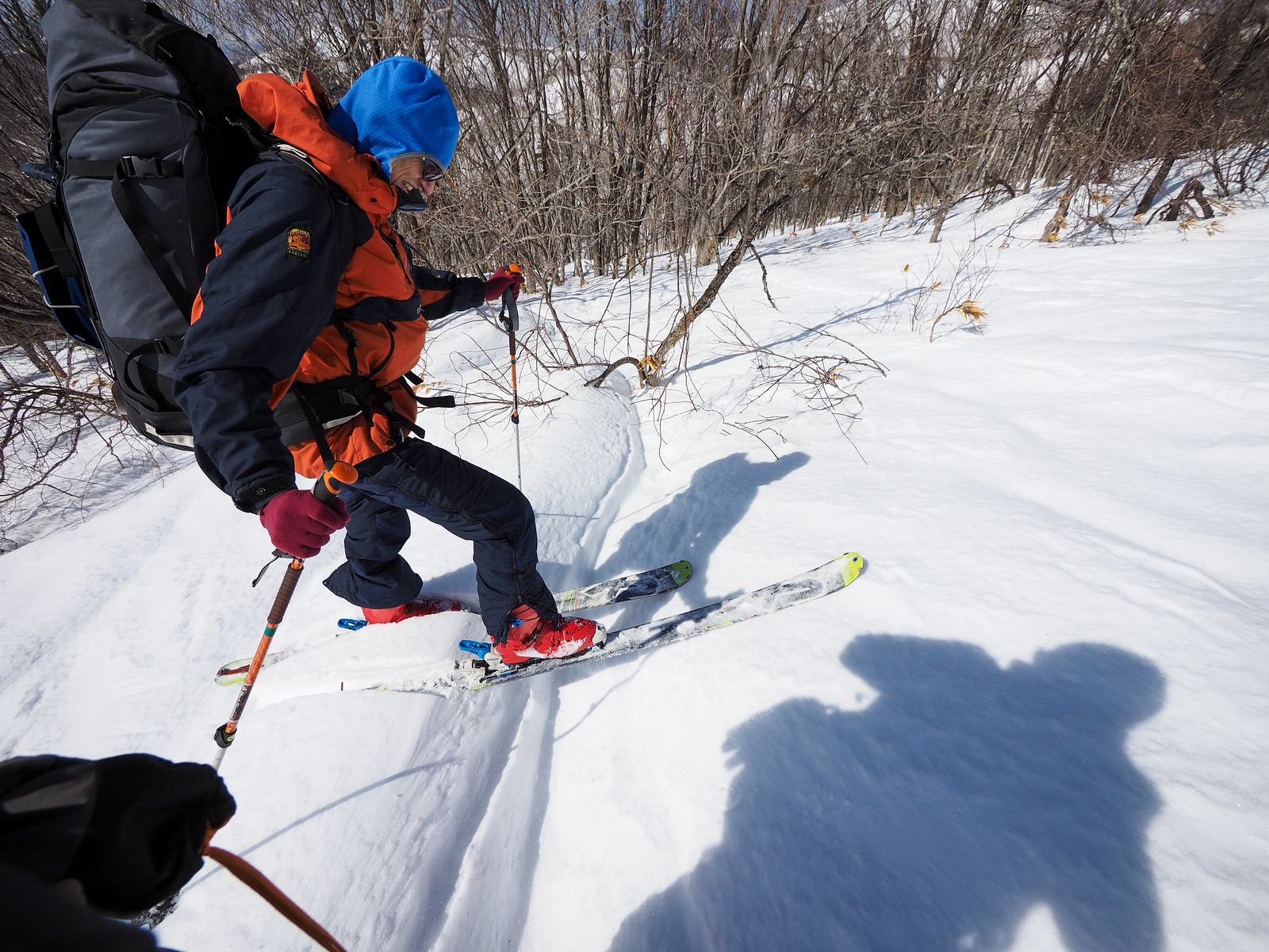
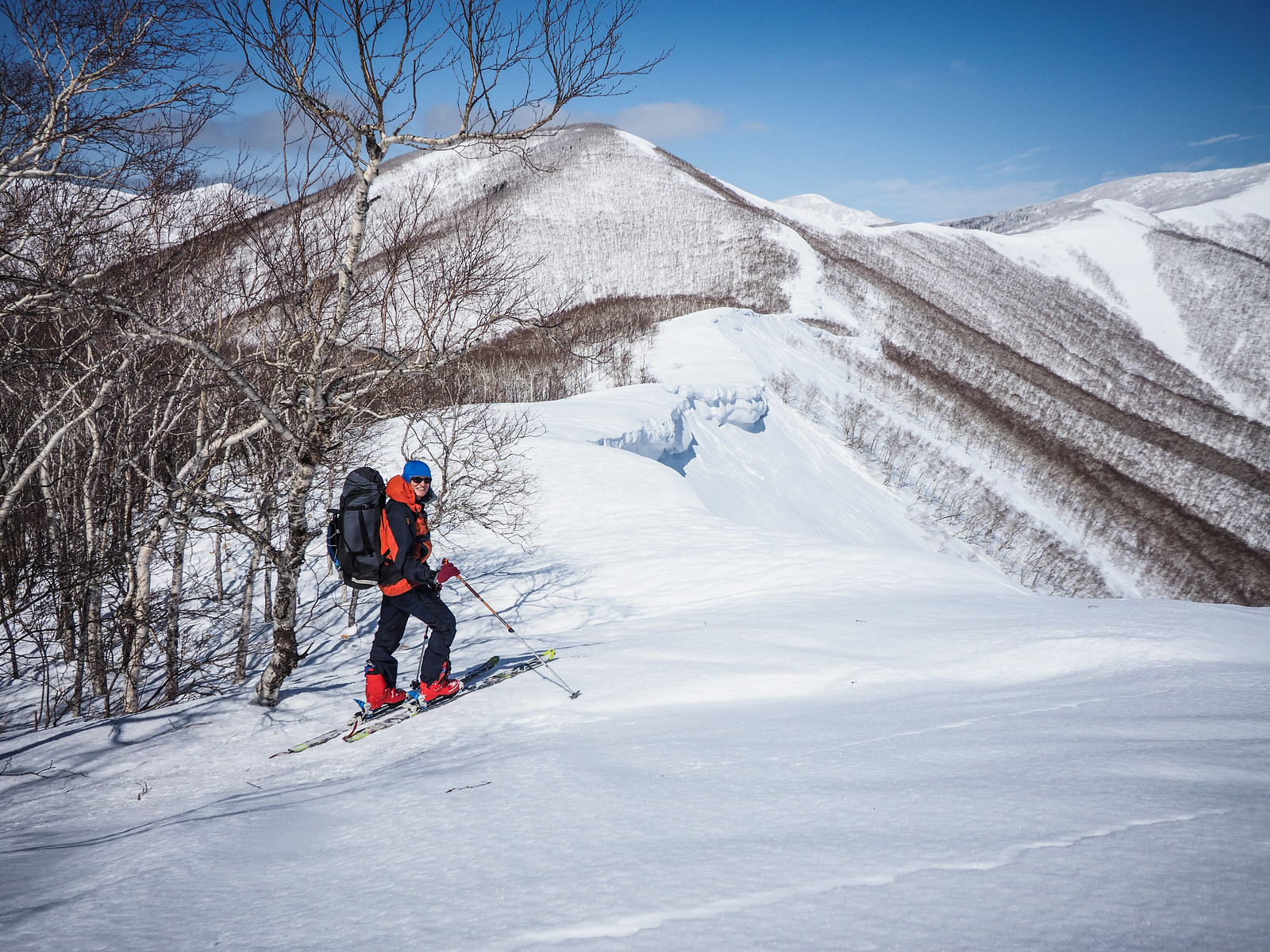
The weather certainly made up for the hard, icy surfaces we were travelling over. Our skins had plenty of grip, but the route consisted of plenty of ups and downs – the downs were more challenging than the ups!

Until we could see how pronounced the cornices were on the ridge, we spent a fair amount of time in the trees on the windward side of the ridge.

The cornices appeared to be well supported, however. Massive frozen waves, built up high above the actual ridge, but only just frothing at the top.

Mt. Sahoro and Sahoro Sanso Hut ski touring (Hokkaido, Japan)
Ski touring Mt. Sahoro in Hokkaido, Japan
Photo by Rick Siddle

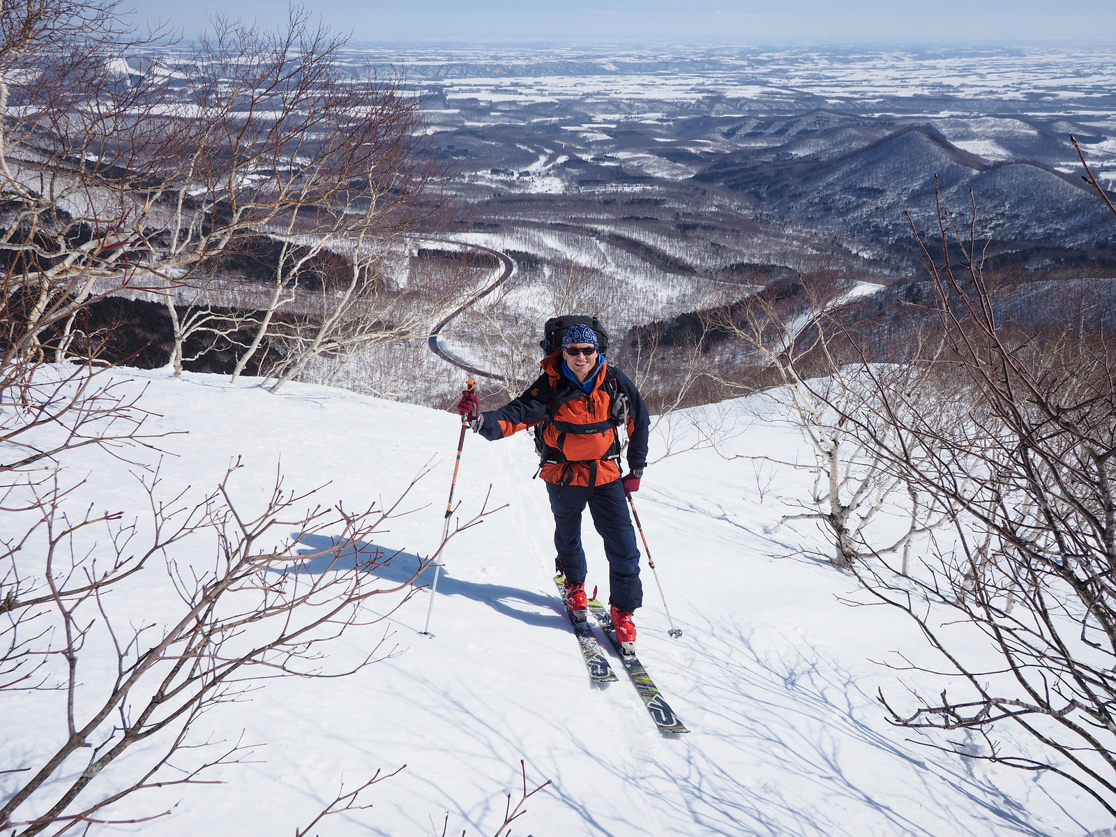
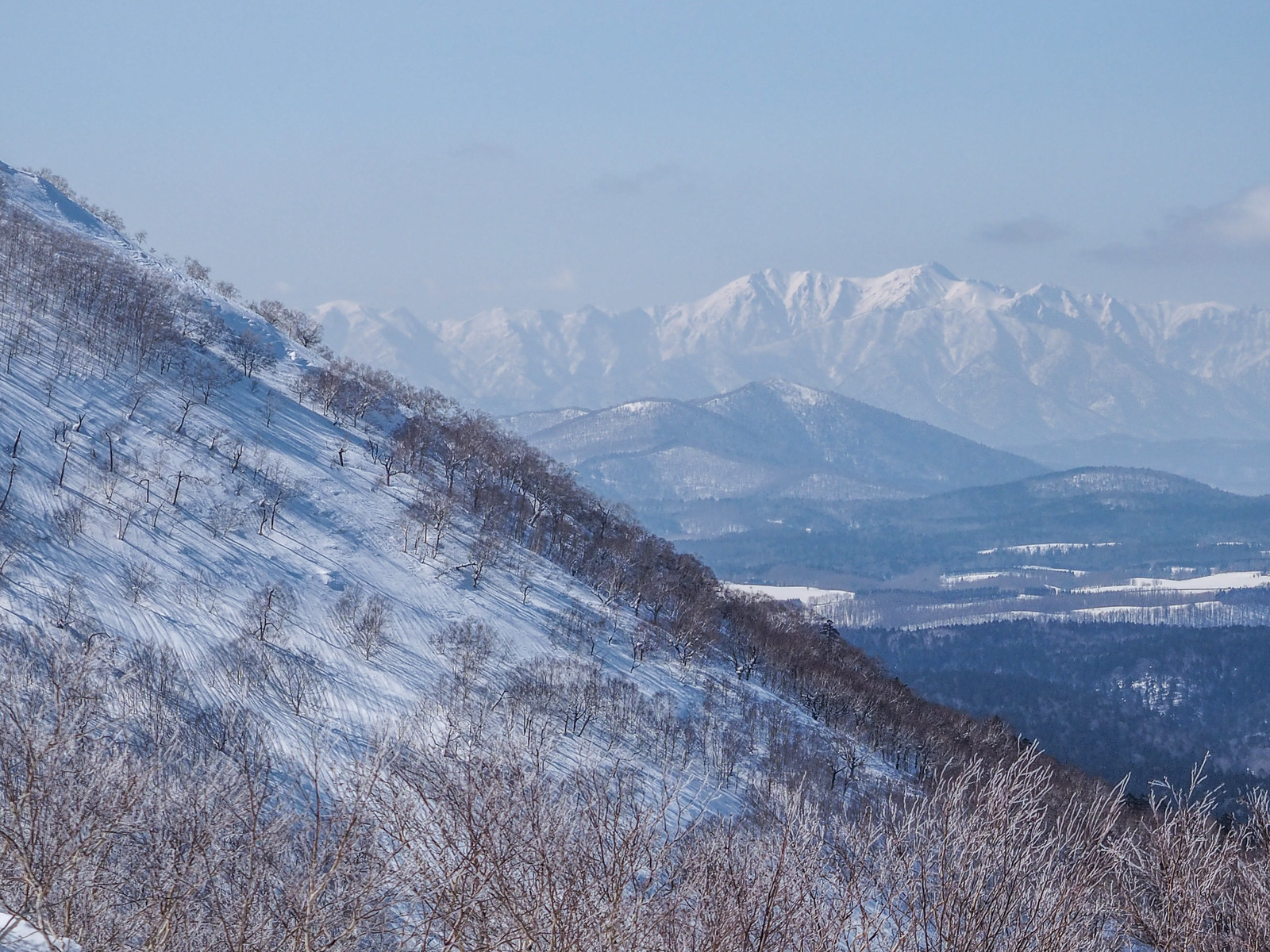
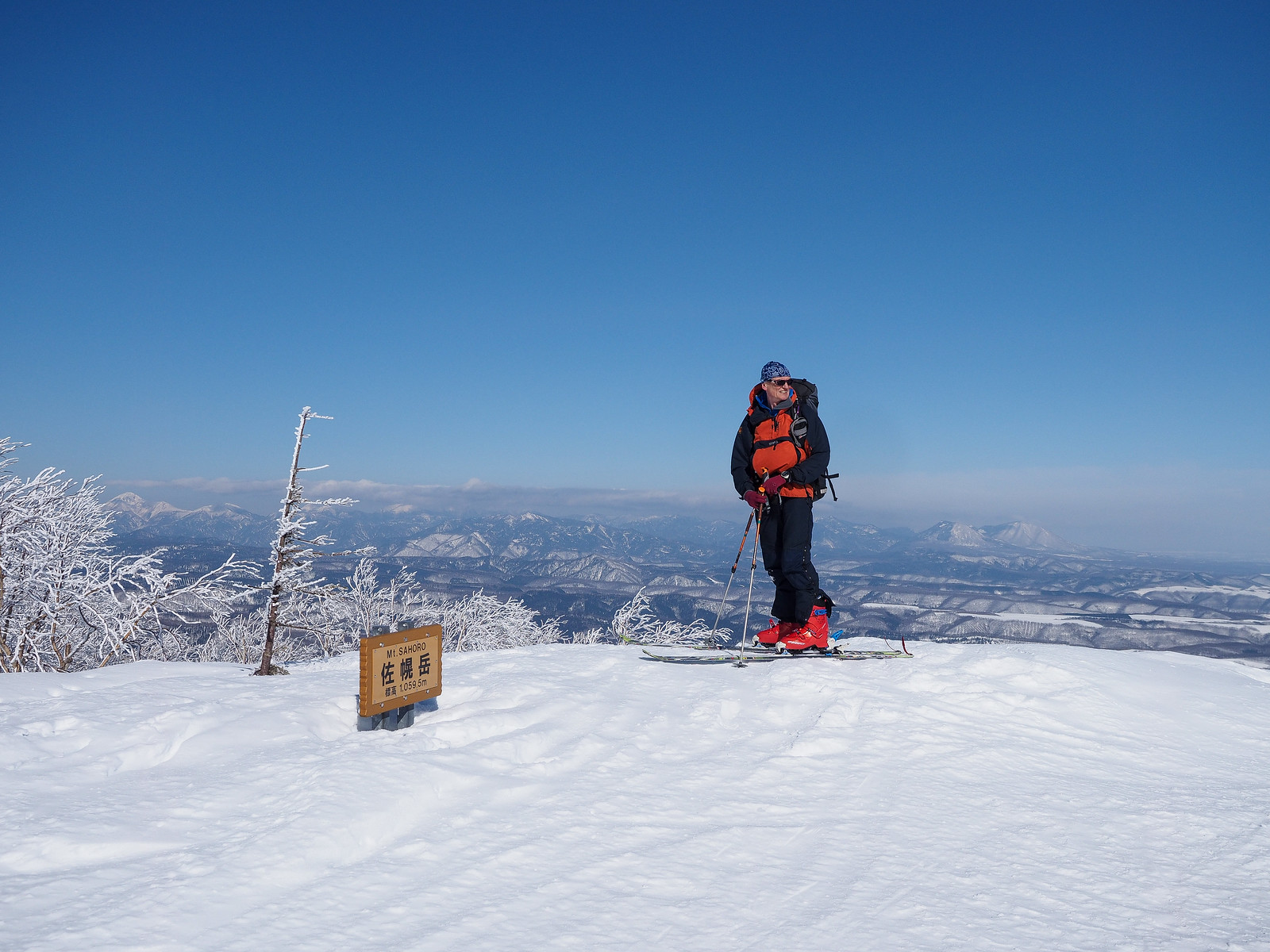
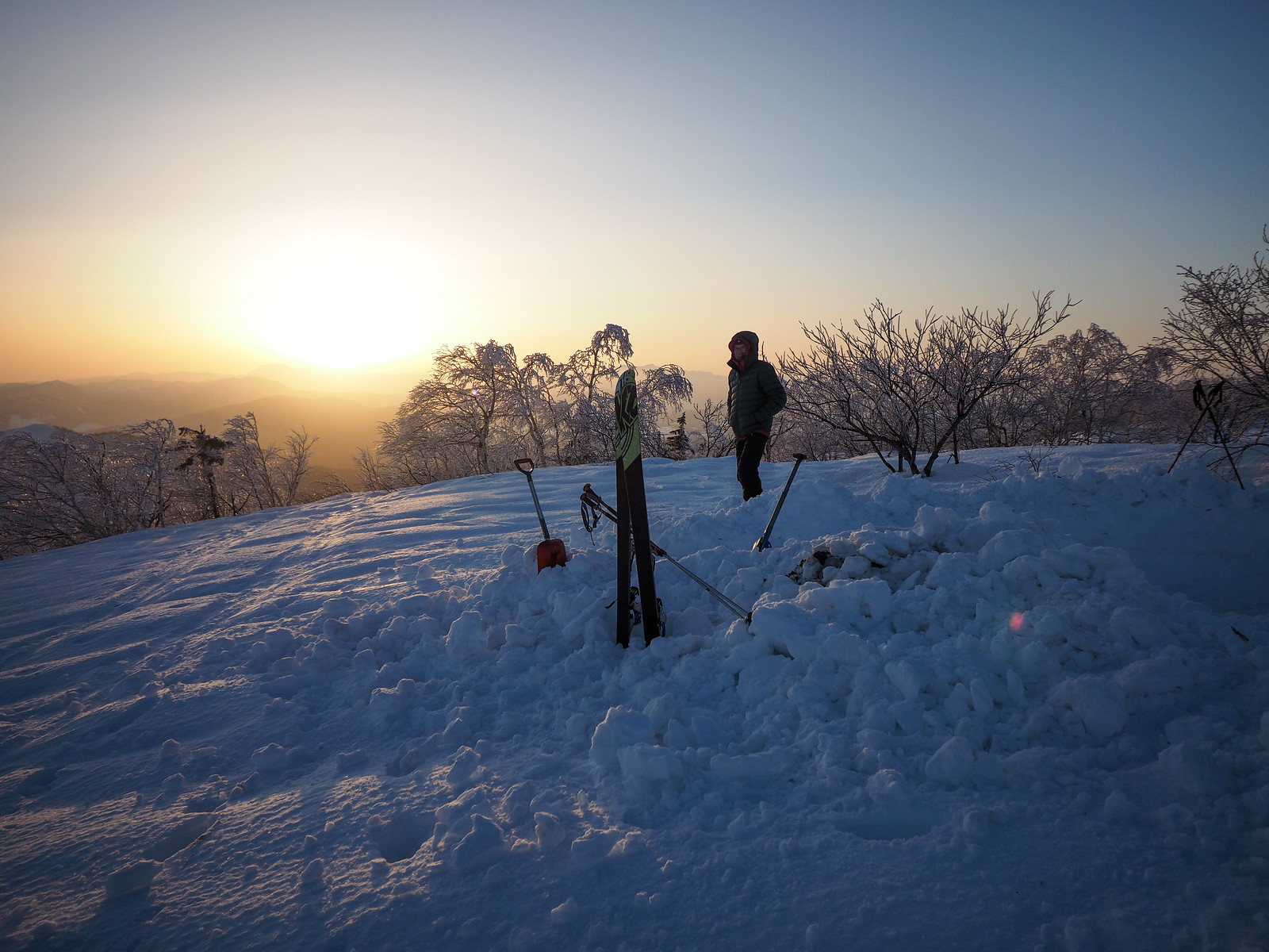
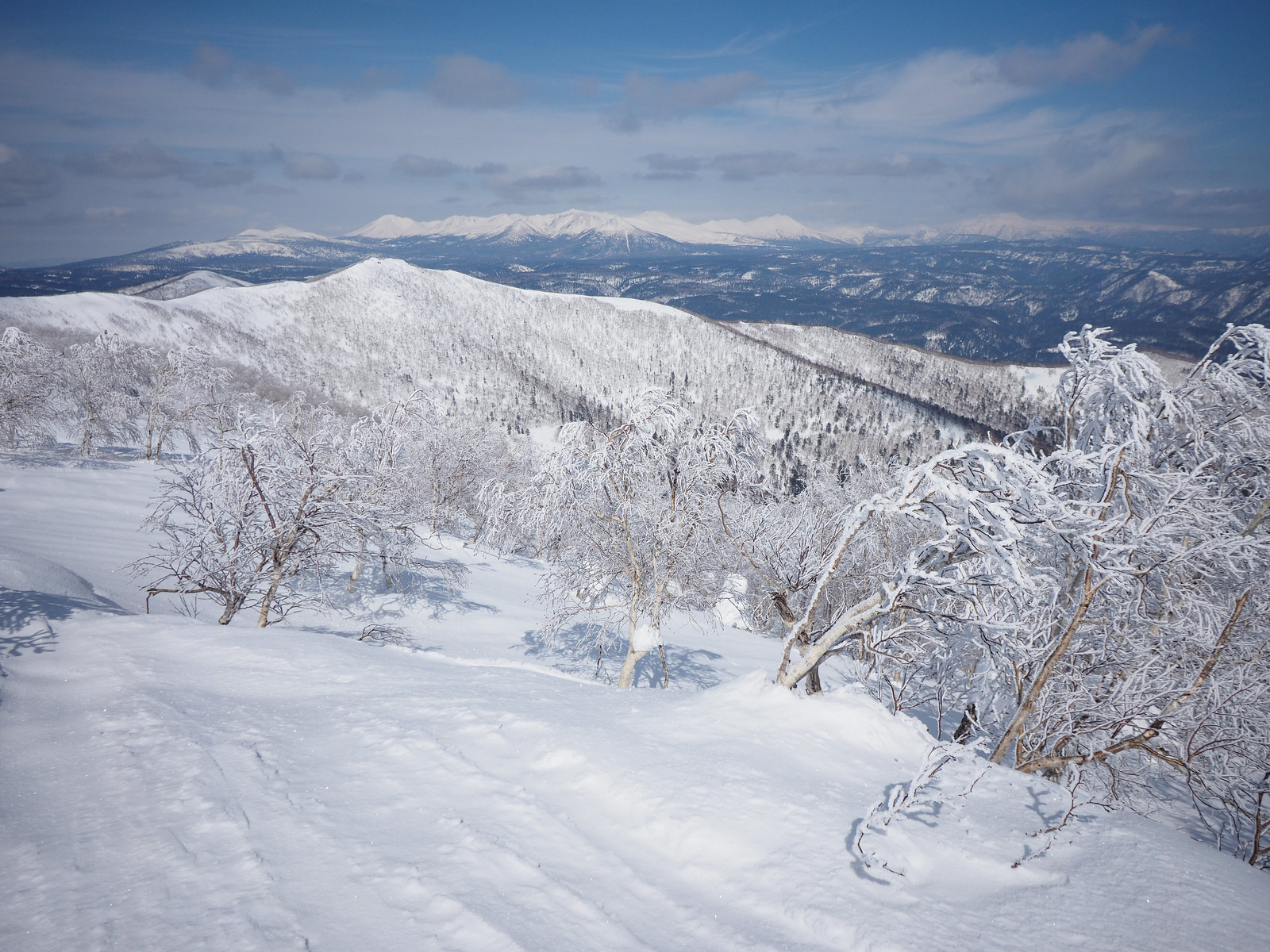
At around 3km on the route, and after a short, stiff climb, we passed over Mt. Sakura (950m – marked as Mt. Sahoro in English). From here, we were given views over the mighty Daisetsuzan Range to the north, and as far as Mt. Yubari in the east. The Karikachi Pass road snaked its way up to the ridge to the south.

Mt. Sahoro and Sahoro Sanso Hut ski touring (Hokkaido, Japan)

From Mt. Sakura, the ridge drops down to a saddle towards the final approach to Mt. Sahoro. With better snow conditions, this would be a good spot to temporarily take off the skins and get a few turns in. With the icy conditions we had, Rick opted to keep the skins on. I took them off half way down and clattered and bumbled down to the saddle.

Ski touring Mt. Sahoro in Hokkaido, Japan
Photo by Rick Siddle

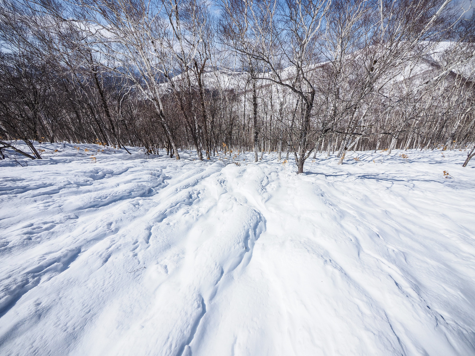
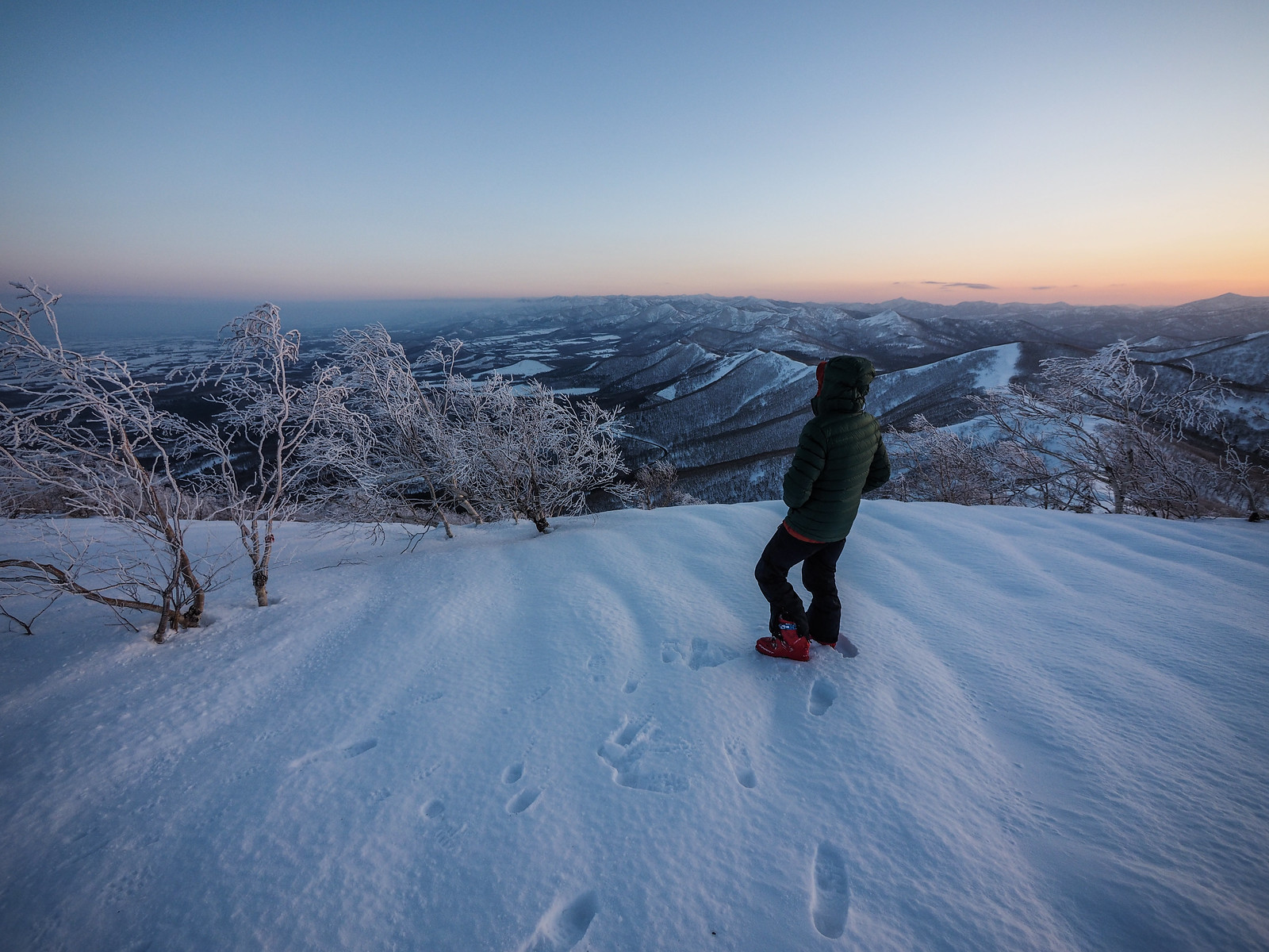
From around 1,000m, the air was cool enough for the trees to hold on to the frost. We were now making the final approach. At times I could hear the announcements from the Sahoro Resort ski area on the northeastern side of Mt. Sahoro.

Mt. Sahoro and Sahoro Sanso Hut ski touring (Hokkaido, Japan)

We were surprised to arrive at the summit of Mt. Sahoro without seeing the summit hut. According to the map, our route should have taken us directly past the front of it.

We did a visual search for the hut, walking north along the the summit ridge all the way to a small spur. I was beginning to think that I knew better, and that the Japan national Geospacial Information Authority (GSI – an official governmental department) had mis-marked the location of the hut. We had passed the spot where the hut was supposed to be, after all, and hadn’t seen any sign of it.

On my smartphone, I switched from Geographica (one of the great apps to display GSI topographical maps) to Google Maps satellite view. Right at that point, according to the eyes in the sky, we were standing exactly where the hut should be.

After staring blankly at the snow around us, it dawned on us. “Surely not,” I said to Rick. “Surely the hut isn’t completely buried!”

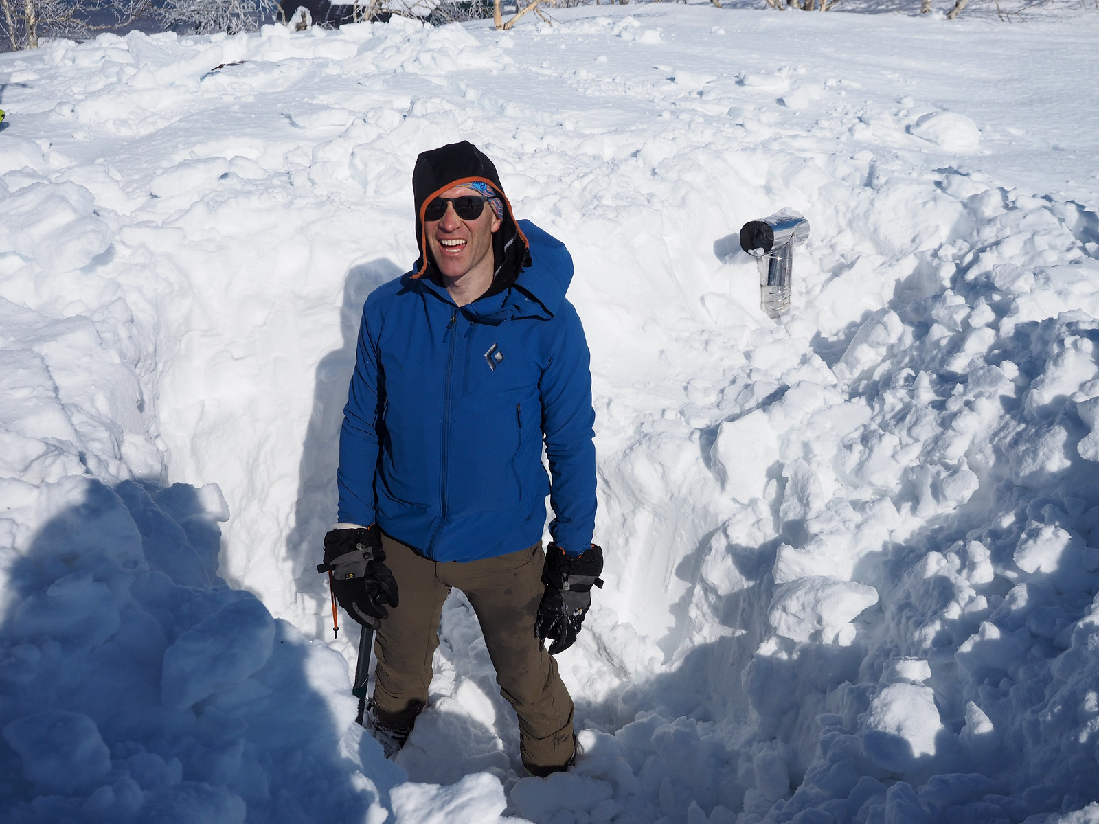
I’d seen pictures on the Internet showing the hut partially buried (such as in this blog post). But where we were standing, not even the chimney was visible.

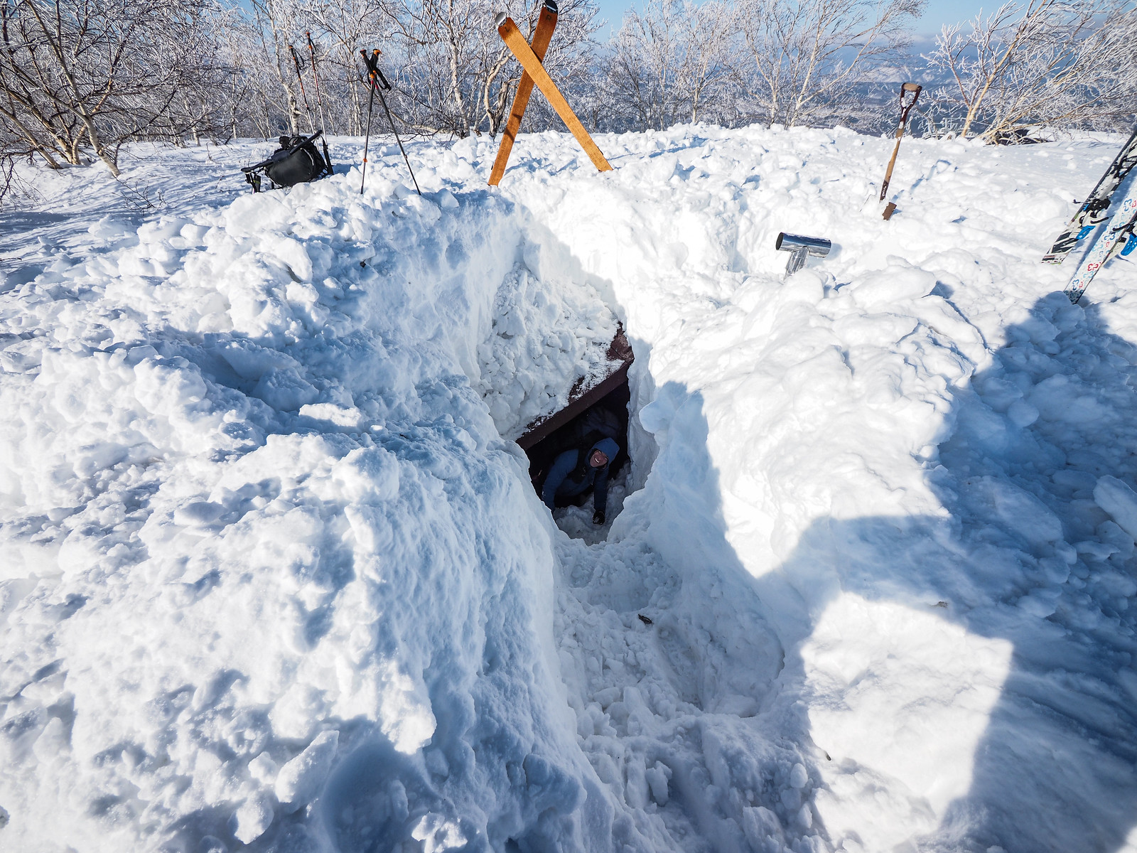
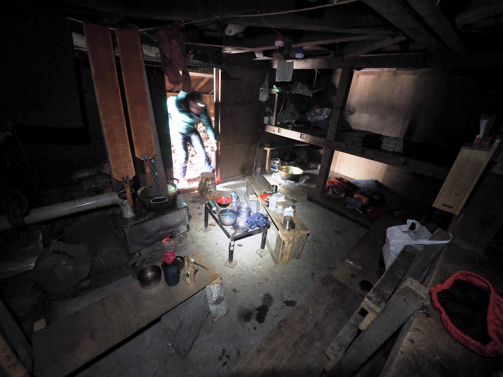
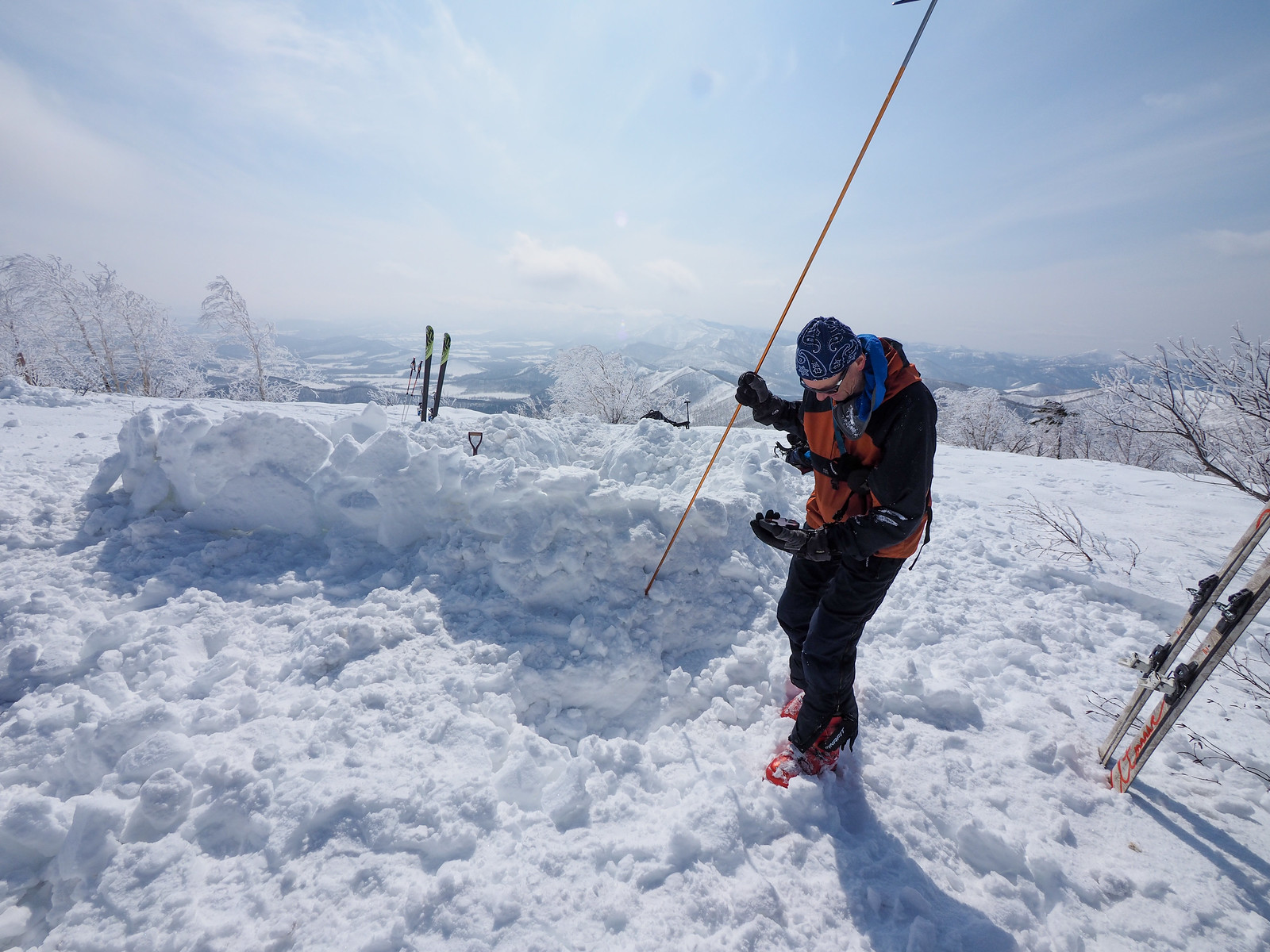
The one-story hut we intended to sleep overnight in was completely and utterly buried.

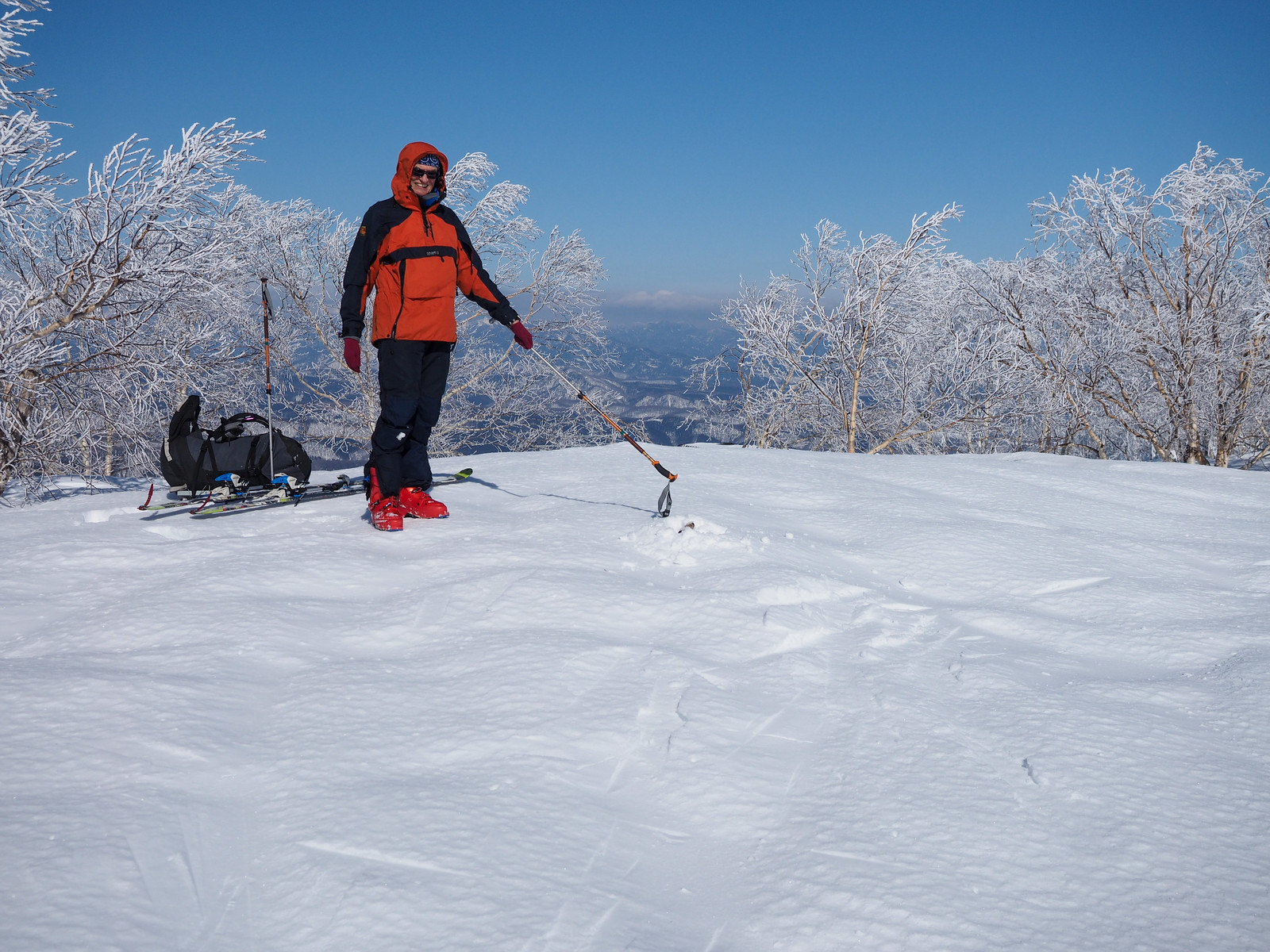
I scanned the snow surface for clues. We could use our probes to confirm the presence of the hut under the snow, but that wouldn’t tell us where the door to the hut is. I didn’t fancy digging multiple 3m deep holes just to locate the door.

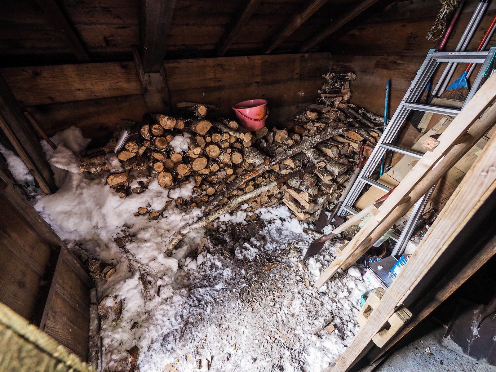
I scraped at a bump in the snow surface, and out popped a shovel handle. Some kind soul had, at some stage, stood the hut’s shovel in the snow. This was an important find. Most huts in Hokkaido have a shovel at the entrance of the hut. Could it be that this shovel was the “x” that marked the spot for the entrance?

Mt. Sahoro and Sahoro Sanso Hut ski touring (Hokkaido, Japan)

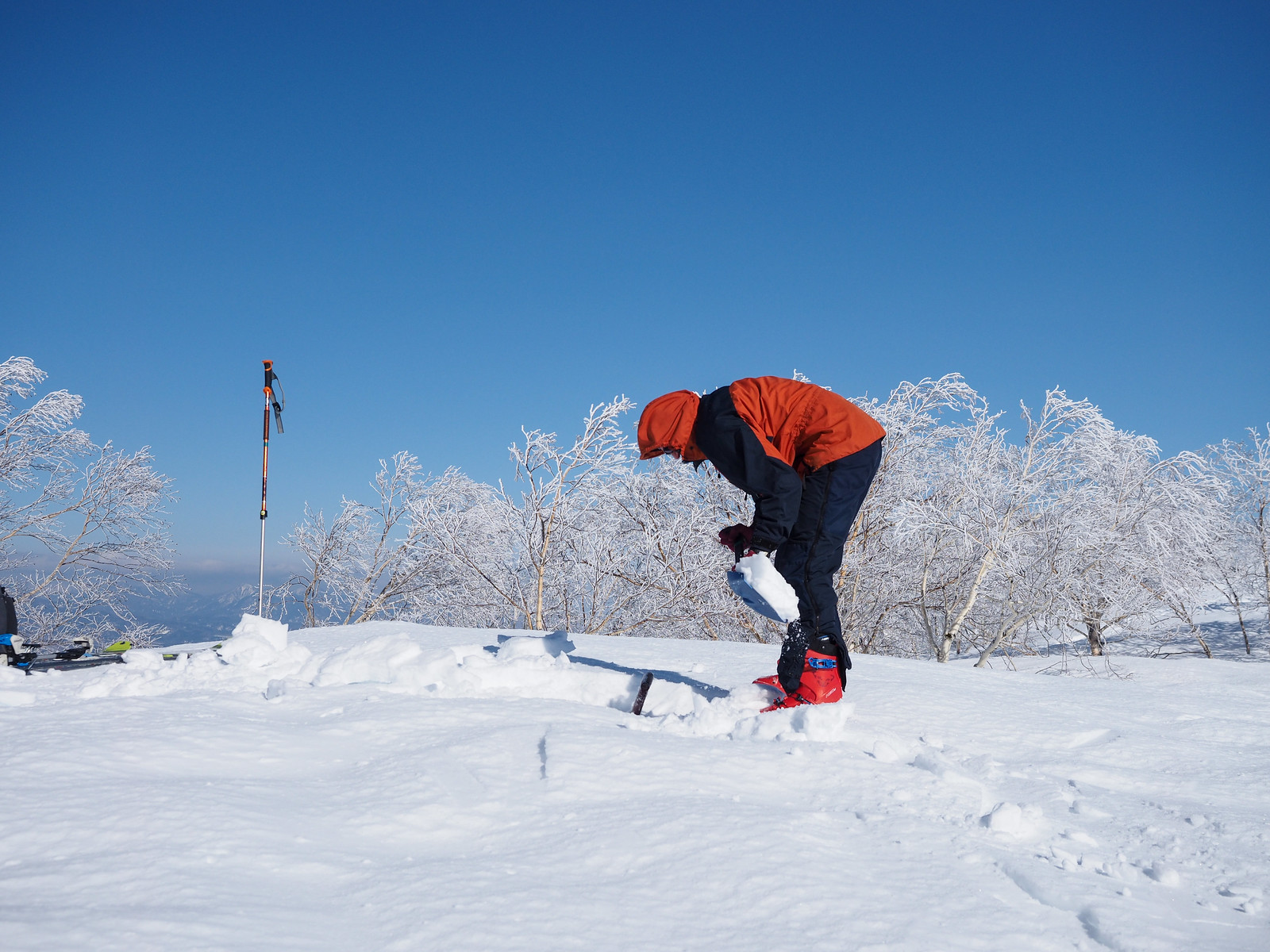
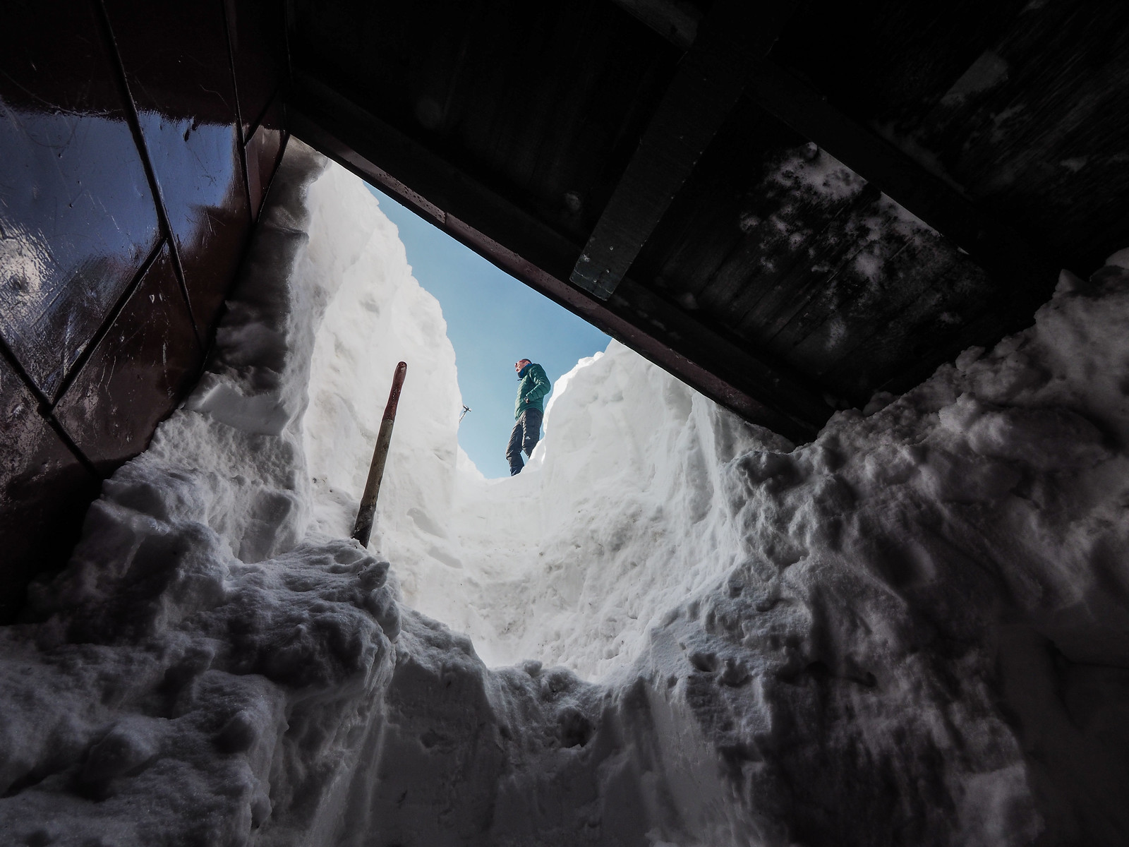
As an incredulous Rick began to dig around the shovel handle, I scraped at another hump in the snow. This revealed the apex of the hut’s roof. It was now beyond doubt. The 3 meter-high hut was buried. Not just covered with snow. From the 3m-high apex of the roof, the snow stretched out flat on all four sides.

There still remained some doubt as to whether the shovel was indeed marking the entrance to the hut. It would take a lot of effort to dig, so we wanted to make as sure as possible we hit the entrance in one go.

Just to the right of the shovel was another faint hump in the snow. I dug at it, and about 20cm down the top of the chimney appeared.

This was all I needed to mentally orient the buried hut in my mind. I knew from pictures that the chimney was on the south southwest facing side of the hut. I was still perplexed though. I thought the entrance to the hut was on the wall to the right of the chimney. I knew there was a shelter/veranda of sorts to the left of the chimney, but I had somehow got the impression that the actual door to the hut was on the other side.

The shovel was strong evidence that the entrance was in the veranda, so we got stuck in and started digging under the shovel.

Mt. Sahoro and Sahoro Sanso Hut ski touring (Hokkaido, Japan)

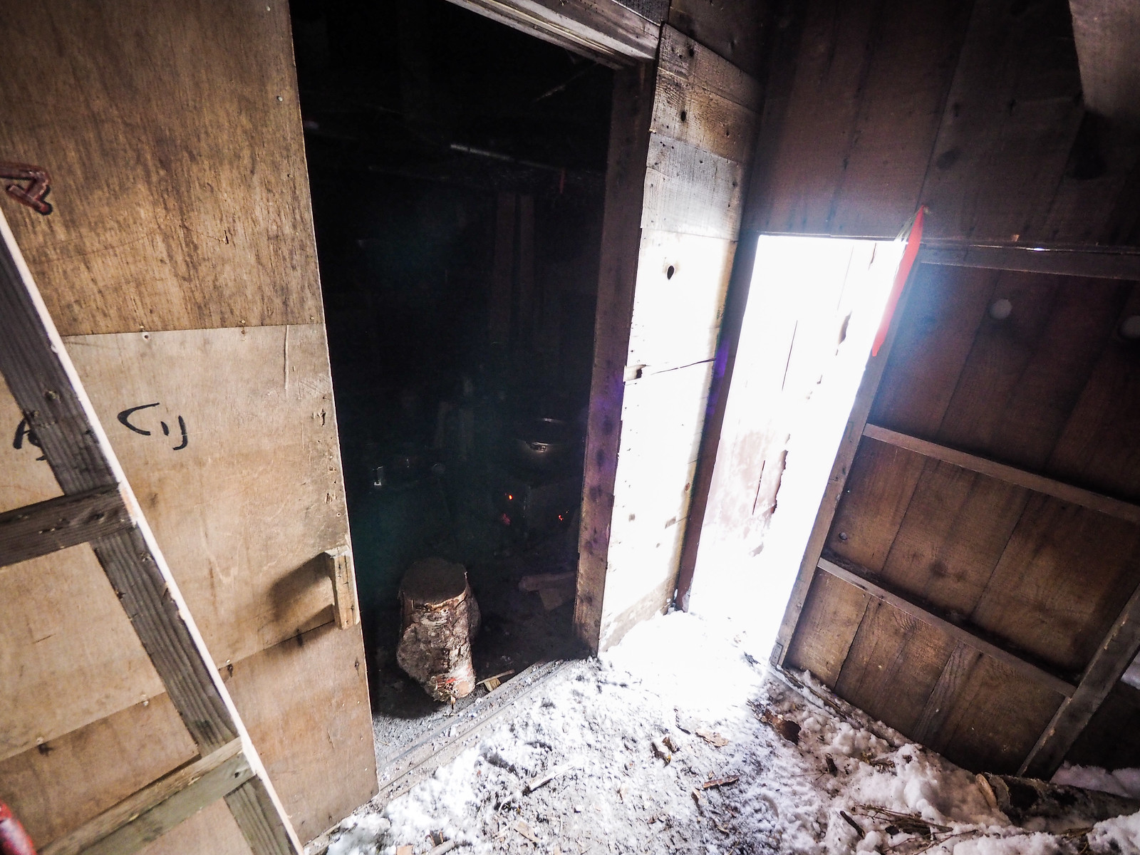
It wasn’t long before we hit gold. We found what appeared to be the southwest corner of the hut, and then my shovel dropped through to the hollow veranda space underneath.

We still had a long way to go to clear enough space to get into the veranda, and I was still not 100% sure that we’d actually find an entrance on this side of the hut.

Mt. Sahoro and Sahoro Sanso Hut ski touring (Hokkaido, Japan)

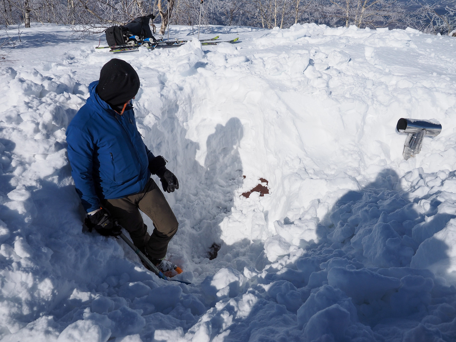
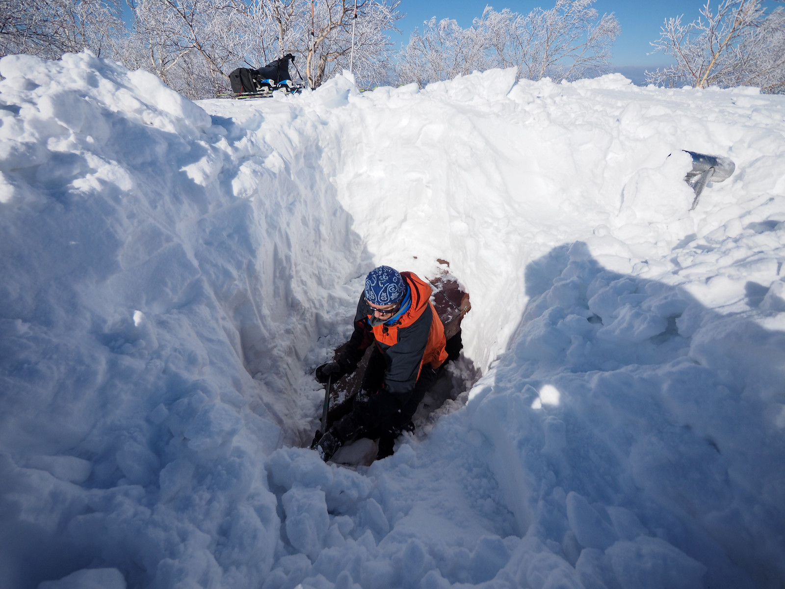
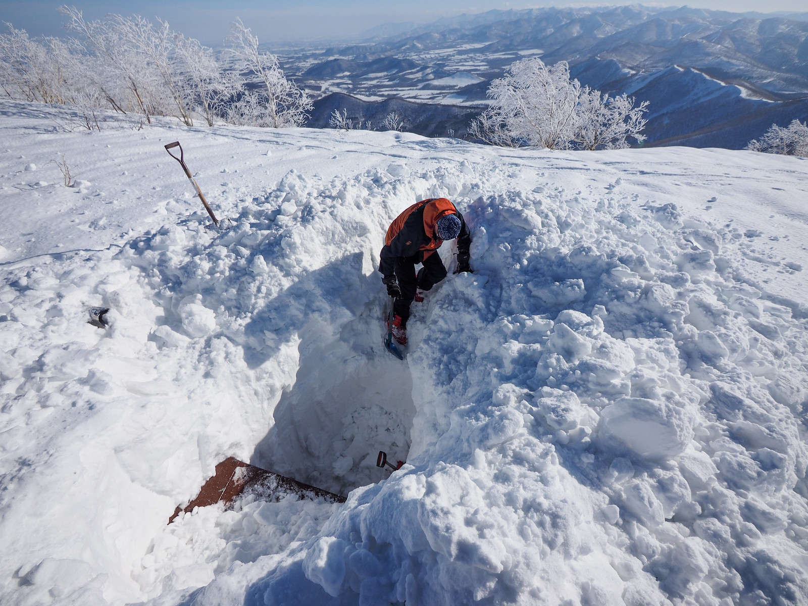
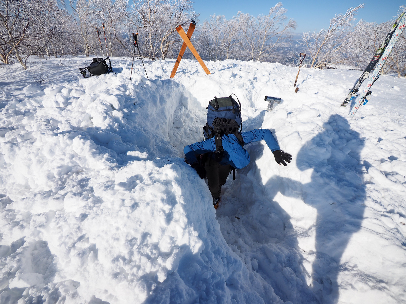
We took turns hauling snow out of the hole. After a solid 2 hours of digging and transporting snow, we finally had a gap large enough to open the hut door and confirm that indeed, this was our entrance.

We set up our skis to try to prevent anyone accidentally falling into the hole…it was a long way down.

Mt. Sahoro and Sahoro Sanso Hut ski touring (Hokkaido, Japan)

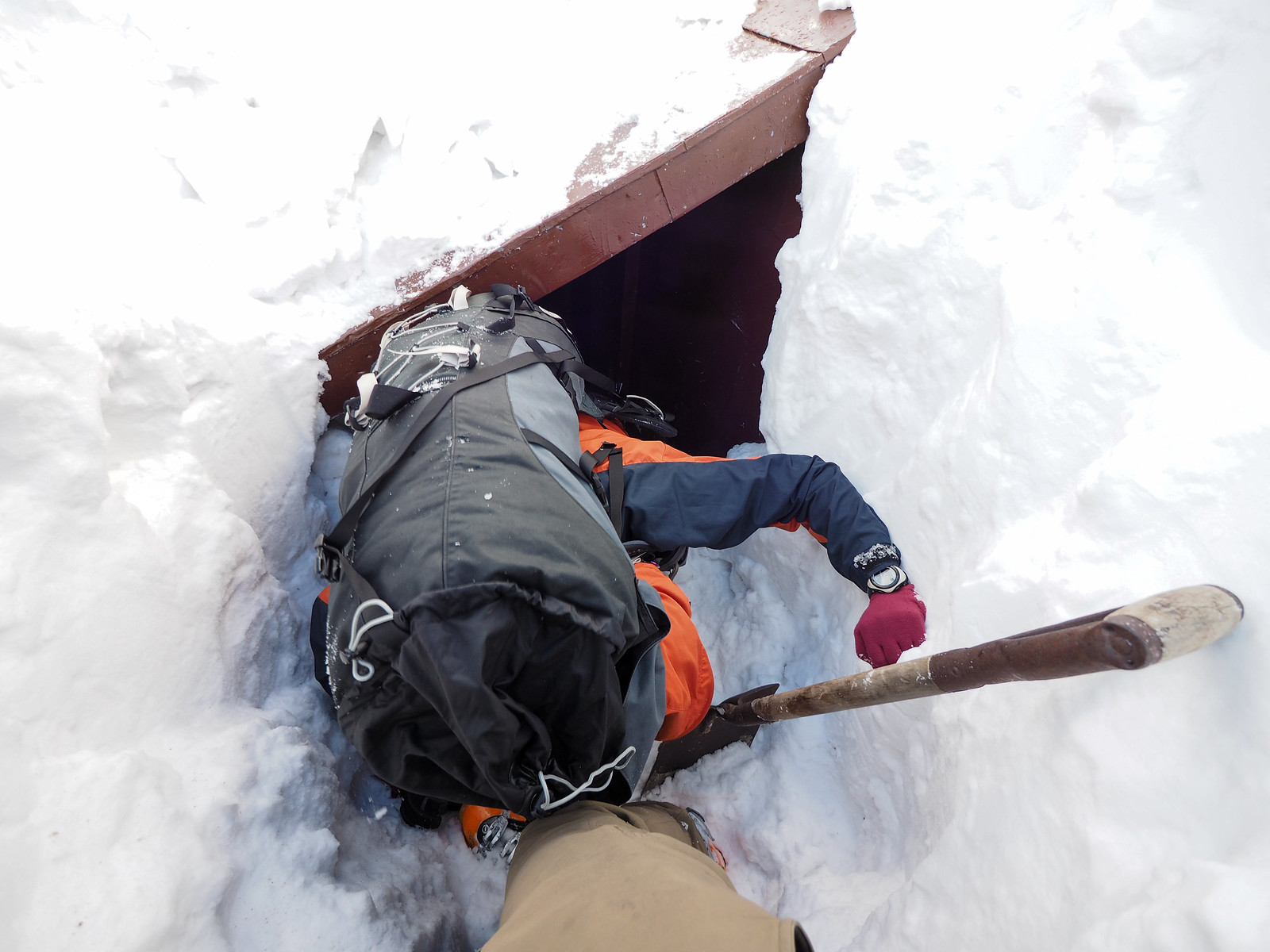
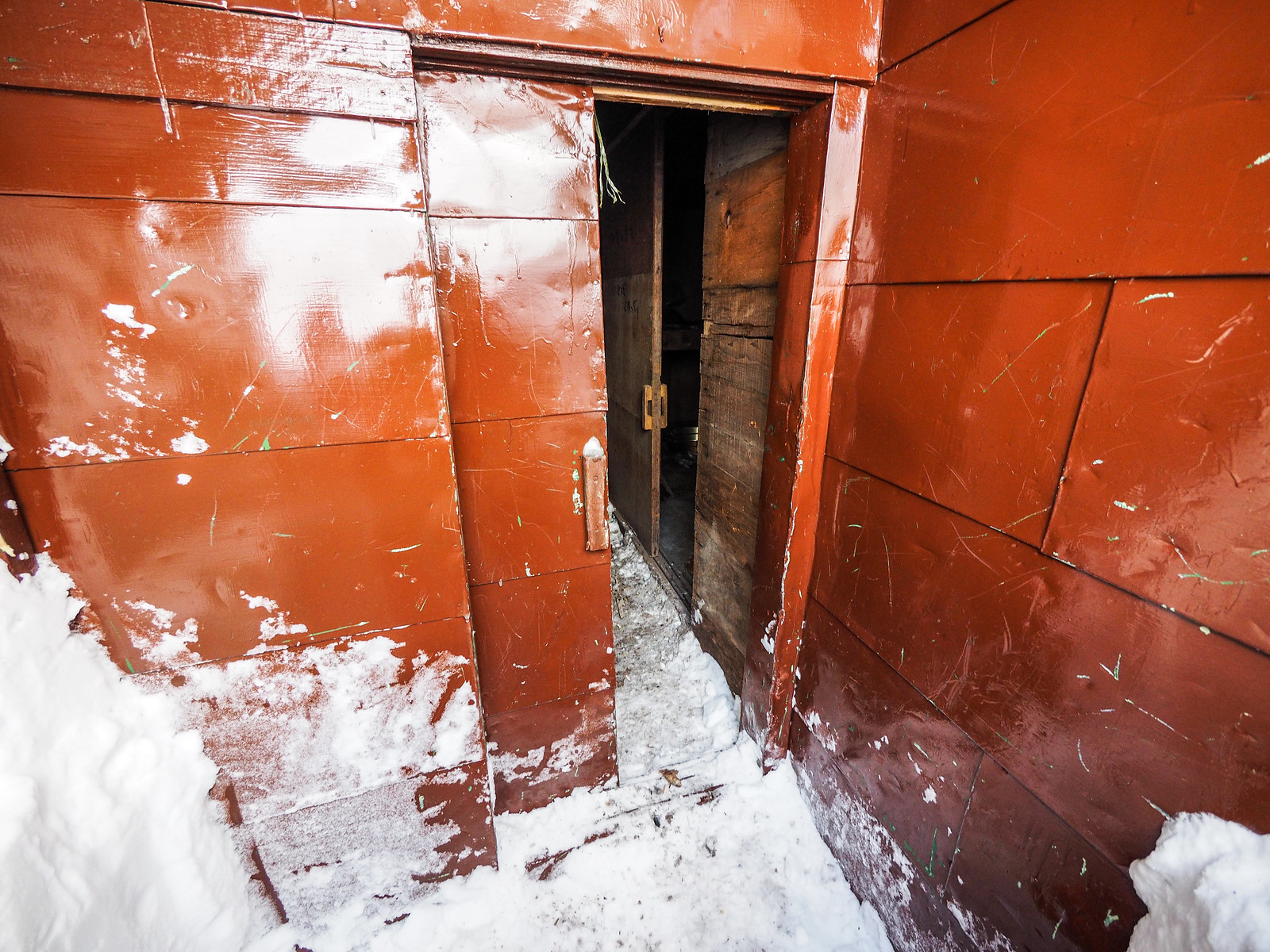
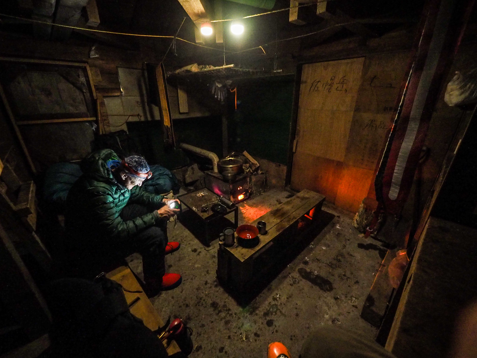
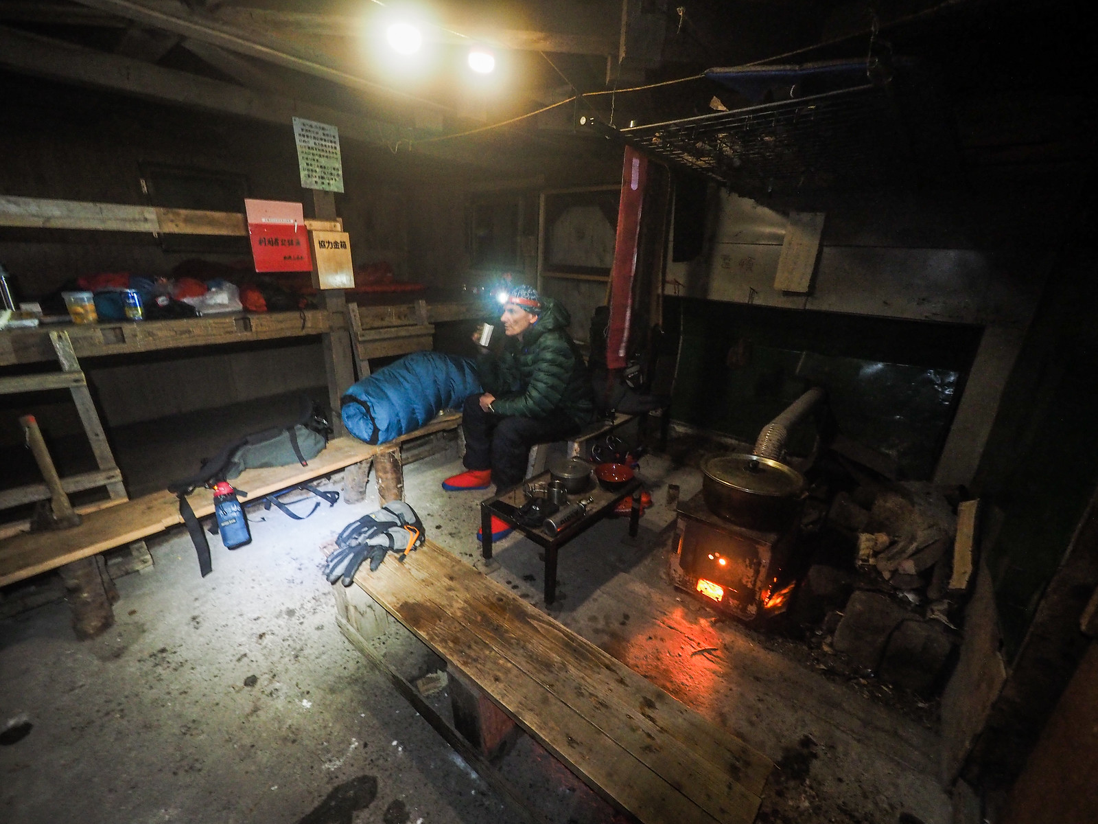
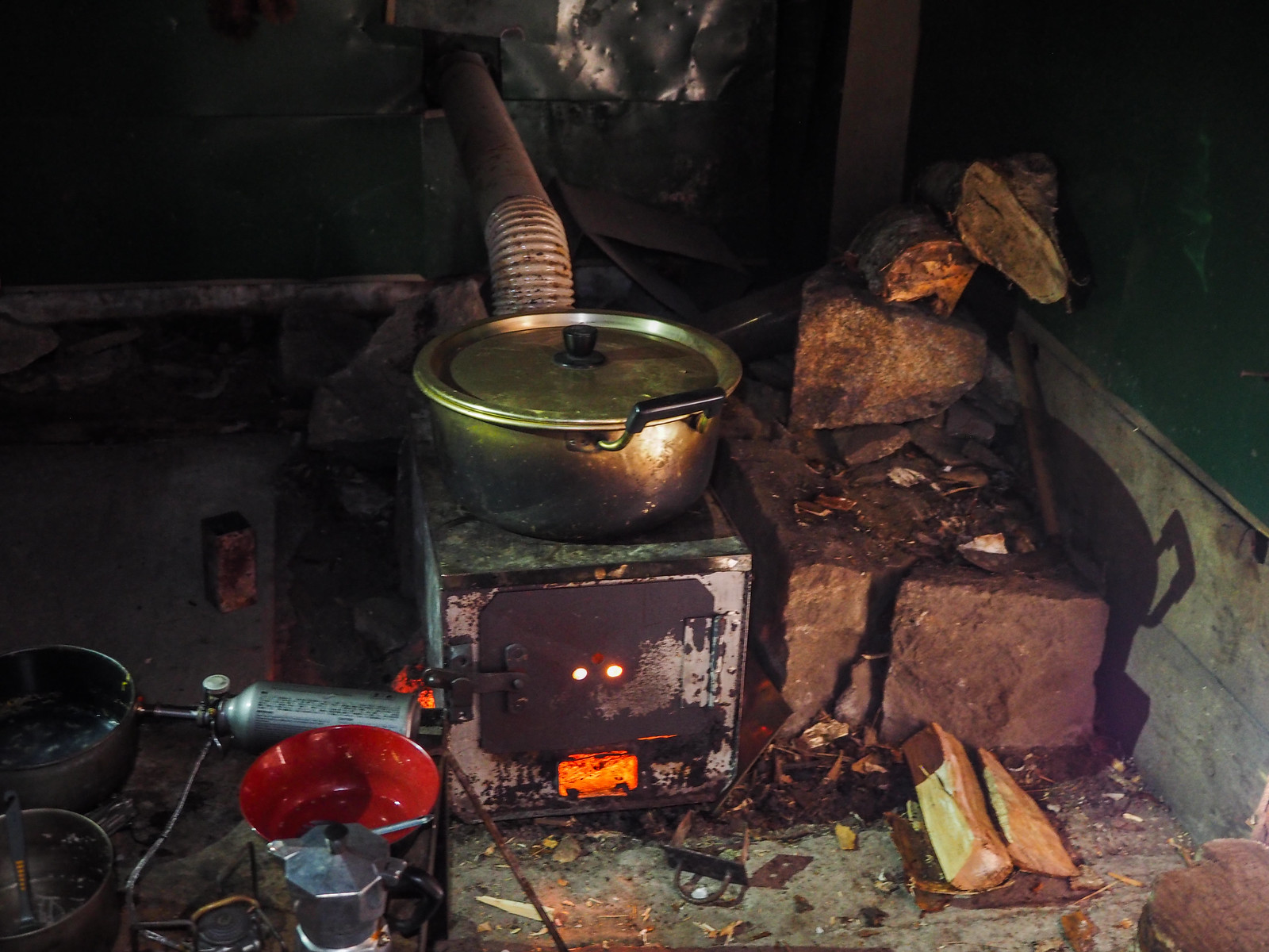
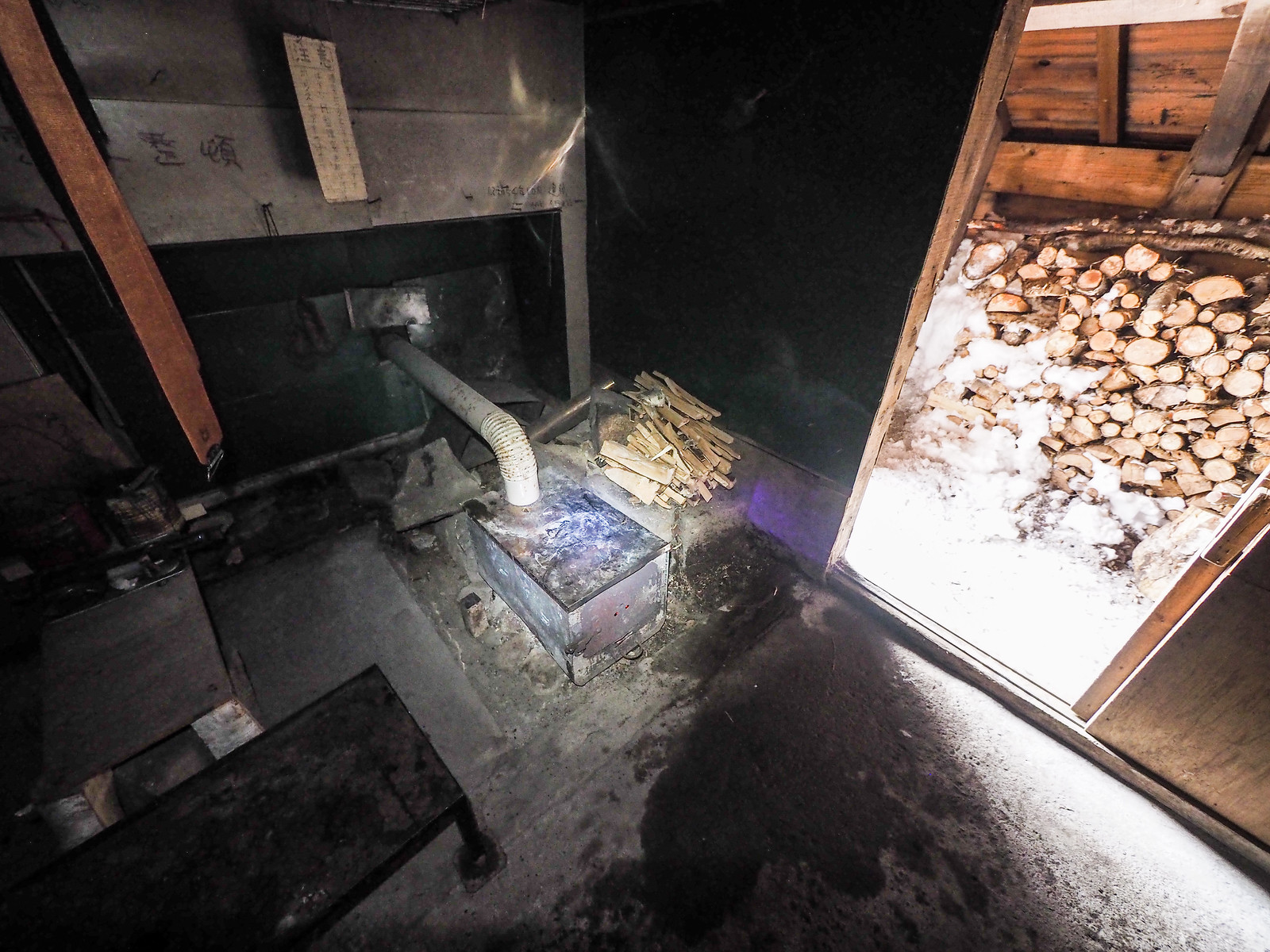
We took stock of the situation. Wood, check. Hut interior, check. We had made it into our glorified snow cave, and it was perfect.

Mt. Sahoro and Sahoro Sanso Hut ski touring (Hokkaido, Japan)

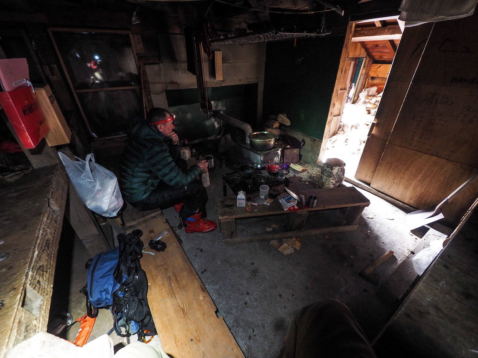
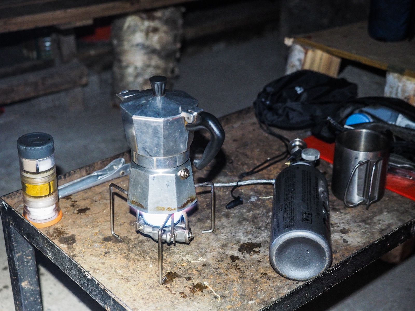
By the time we had got the stove running, with a large pot of snow on top melting, it was late afternoon and the sky was showing some fantastic colors. The day’s fun efforts faded into the past. What a way to finish the day.

Mt. Sahoro and Sahoro Sanso Hut ski touring (Hokkaido, Japan)

With the wood stove running smoothly – it was a smoky start – the hut was cosy, well insulated against the cold by meters of snow. The only unexpected thing was a significant amount of water dripping from the ceiling as the hut warmed up. Frost that had built up on the northern side of the hut’s ceiling was melting. Rick’s sleeping bag and sleeping mat got a little wet, but it all soon dried up as the hut warmed, and after an hour or so there were no more drips.

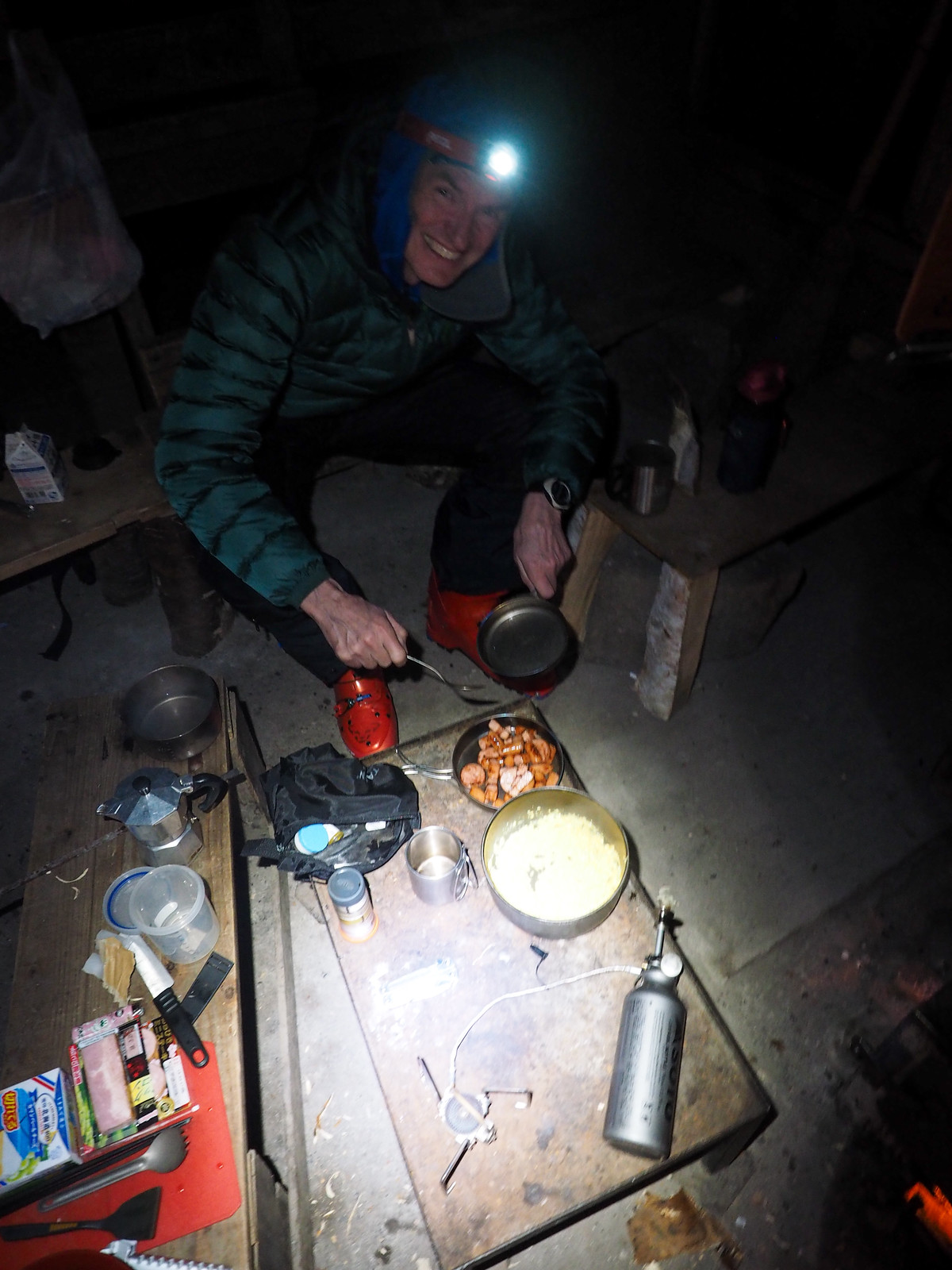
Dinner for us was the usual pork nabe. One member of our party of two managed to leave the all-important dipping sauce in the car, so it was more like a hearty soup, but it was warming all the same.

The night was hopelessly clear and beautiful. Hokkaido, you beauty.

Mt. Sahoro and Sahoro Sanso Hut ski touring (Hokkaido, Japan)

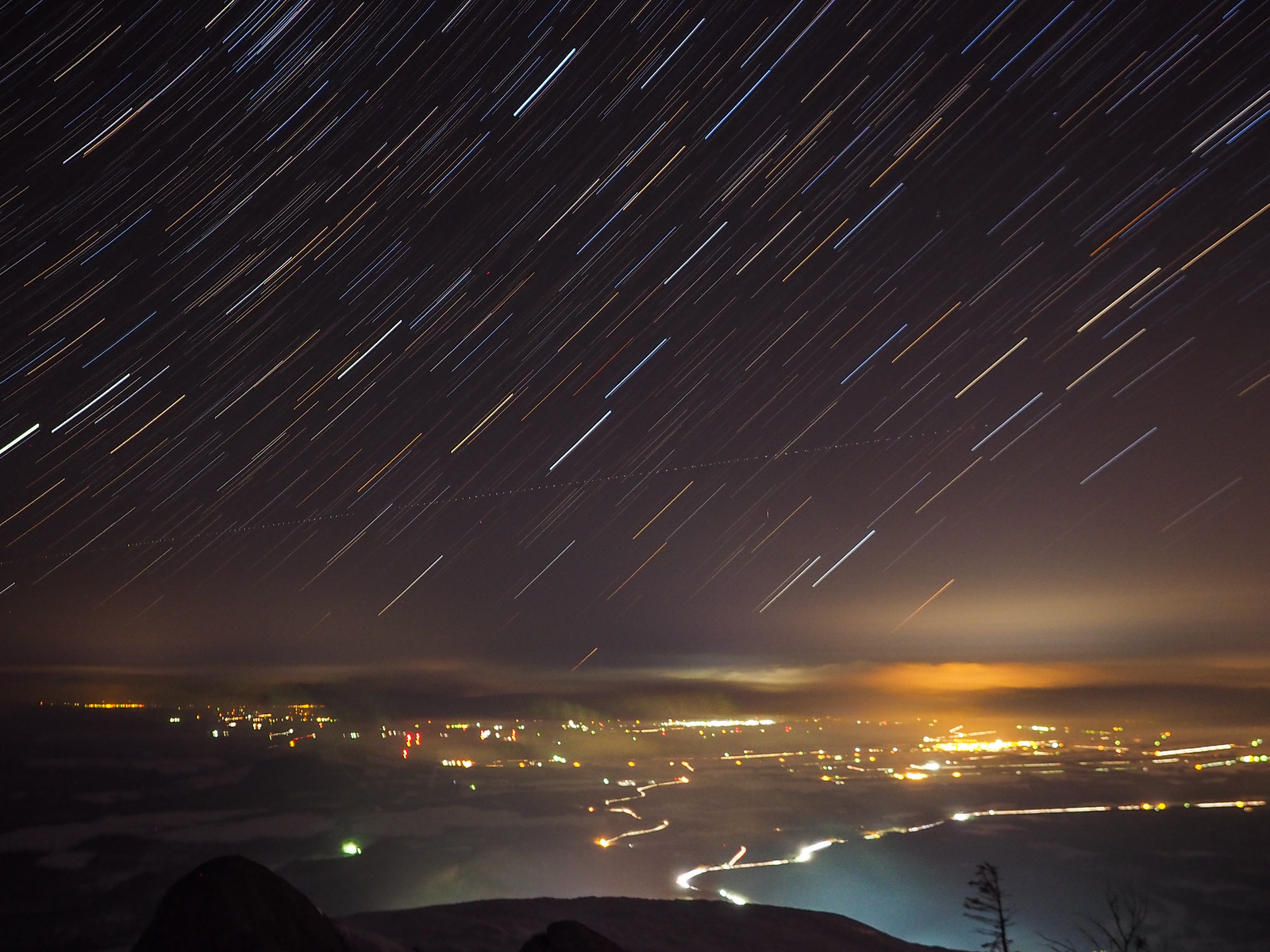
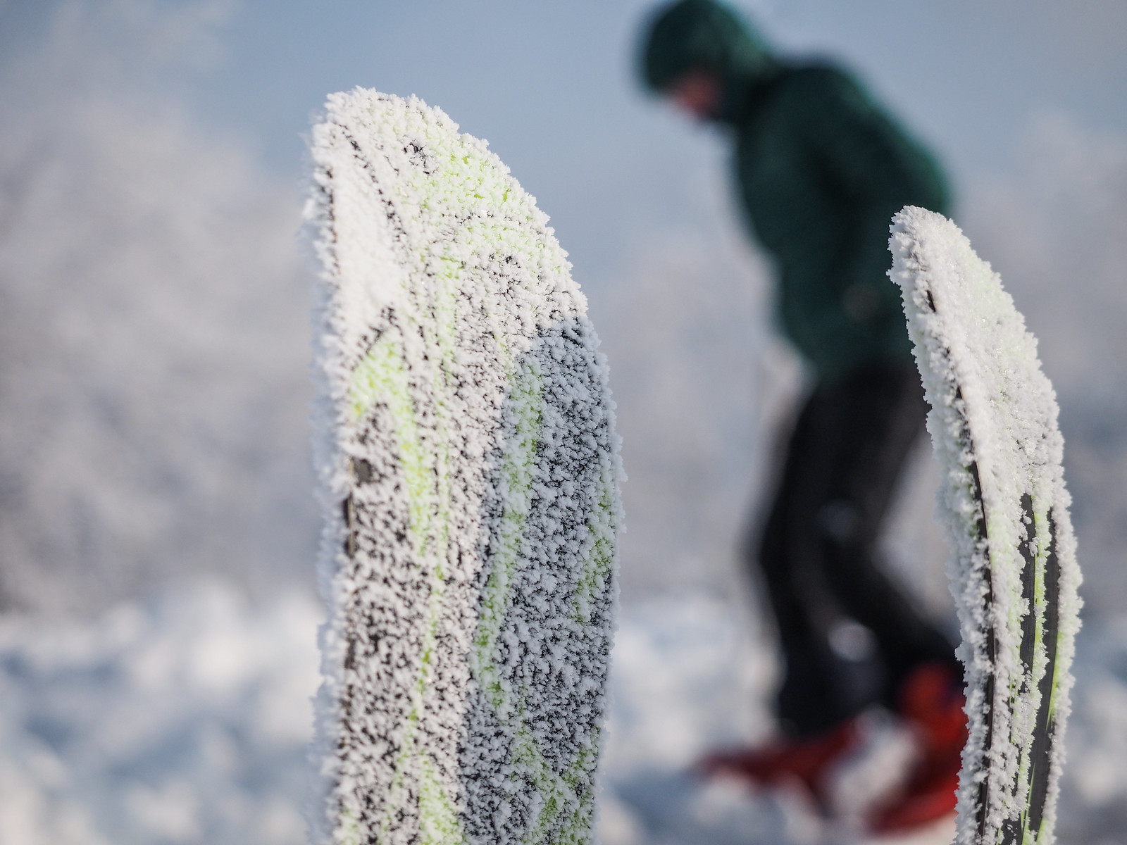
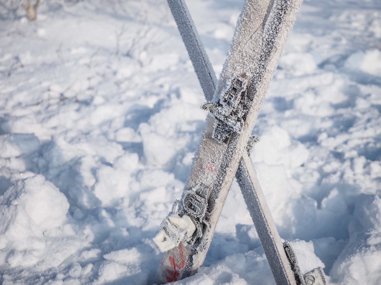
With no natural light in the hut, it wasn’t until 7am that I roused myself from my sleeping bag to get the fire going again. Outside was an amazing rimed winterland. Rick had been outside around midnight, and he mentioned that it was clouded over down to snow-level. This mist had attached itself to the trees and our skis.

Mt. Sahoro and Sahoro Sanso Hut ski touring (Hokkaido, Japan)
Back inside the hut, we had a breakfast of bacon, sausages and scrambled eggs. Coffee of course. The mighty wood stove happily kept a large pot of snow-melted water warm.
Mt. Sahoro and Sahoro Sanso Hut ski touring (Hokkaido, Japan)

Unfortunately all good things must come to an end, so we started the task of moving out of the hut. The interior of the hut was quite messy when we arrived, with wood splinters on the floor, some empty cans on the benches and table etc. We cleared all this up and swept the floor. I chopped some kindling for the next poor sods who dig their way into the hut.

We also put our hut-fee donation into the box on the wall – 500yen each we thought was about right for the night.

Mt. Sahoro Sahoro-sanso Hut in Hokkaido, Japan
Photo by Rick Siddle
Mt. Sahoro and Sahoro Sanso Hut ski touring (Hokkaido, Japan)

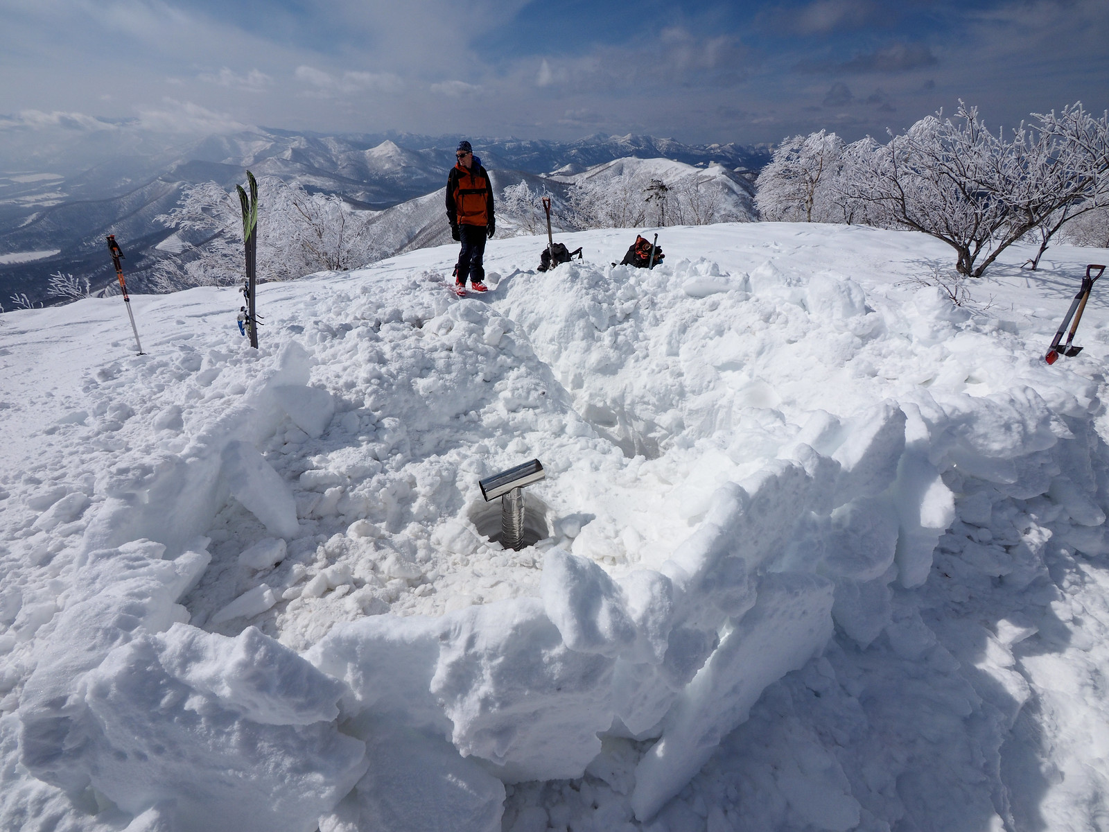
It didn’t feel quite right to fill in the gaping hole and stairs we’d dug down to the hut, so we built a wall around the hazard, and hoped that the hut would be used again before the next drift of snow filled the whole lot in.

Mt. Sahoro and Sahoro Sanso Hut ski touring (Hokkaido, Japan)

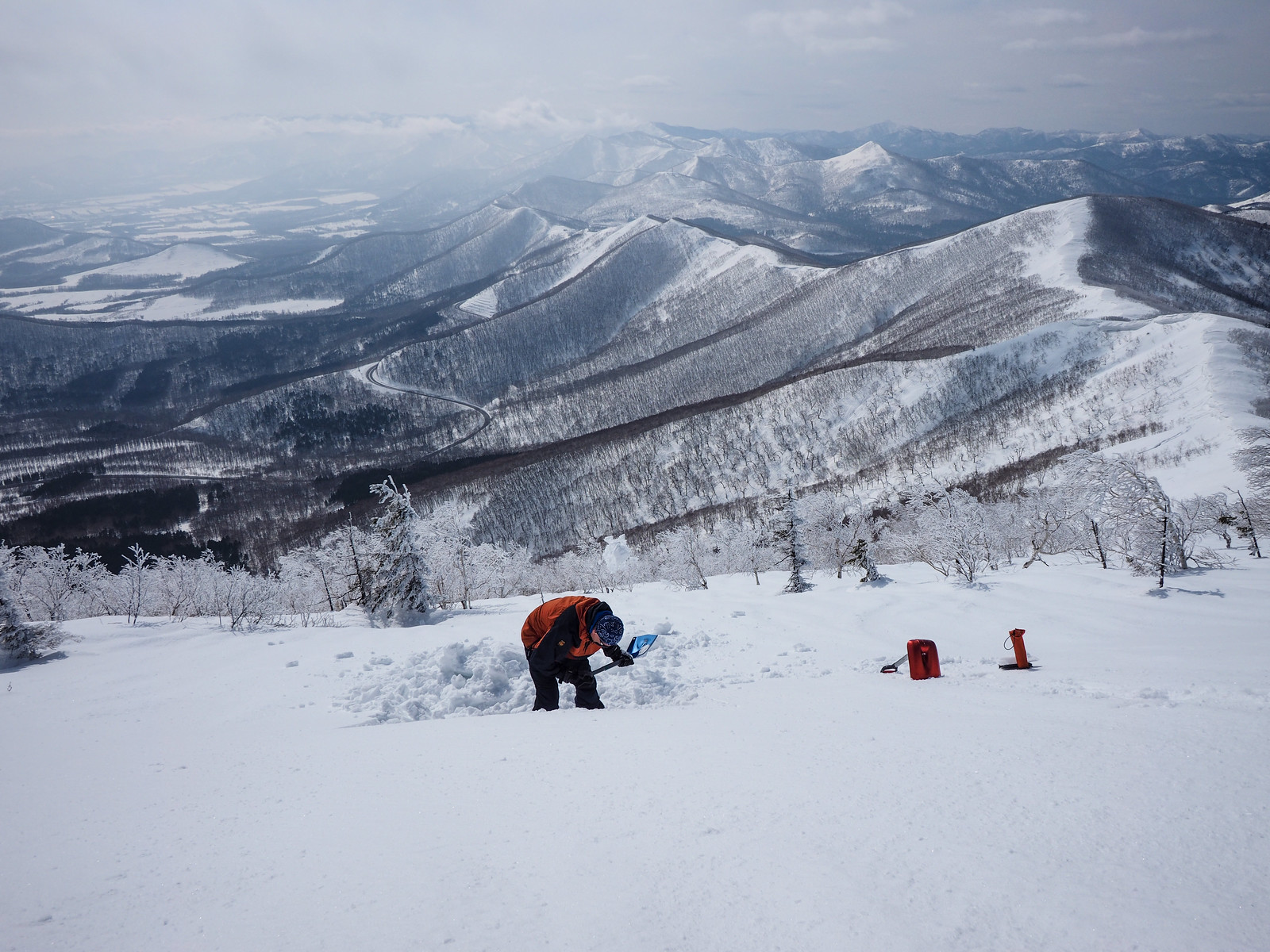
Before we left the summit, I did some review with Rick of the previous week’s avalanche training I’d done in Niseko. I’d been intending to do this for a while. Rick had done avalanche training quite a few years ago, but we’d been meaning to review the basics again.

I had Ronan Maguire’s Irish voice in my head saying “there’s no point in you knowing how to find and dig someone out in an avalanche if you’re buried and your mate has no idea how to dig you out.”

We did a column test first. The hard, crusty snow made this quite the challenge. No issues to report about the snowpack besides that we gave up any hope of skiing the more interesting bowl to the south of the summit (this route) – the whole face was a rain-runneled icy nightmare. Plenty stable enough, but too crusty to enjoy.

Next was a beacon search, including putting a probe togethe. Rick passed with flying colors.

Mt. Sahoro and Sahoro Sanso Hut ski touring (Hokkaido, Japan)

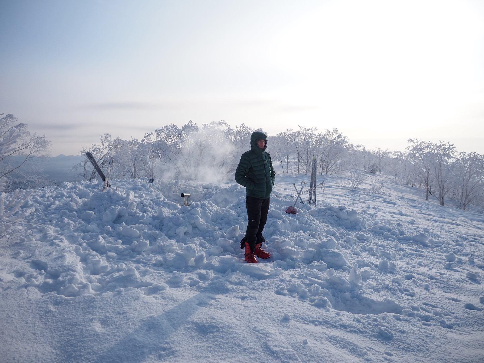
We lingered a little longer at the hut, taking a wander through the trees to take one last look at the mighty Daisetsu Mountain Range basking in the sun.

Mt. Sahoro and Sahoro Sanso Hut ski touring (Hokkaido, Japan)

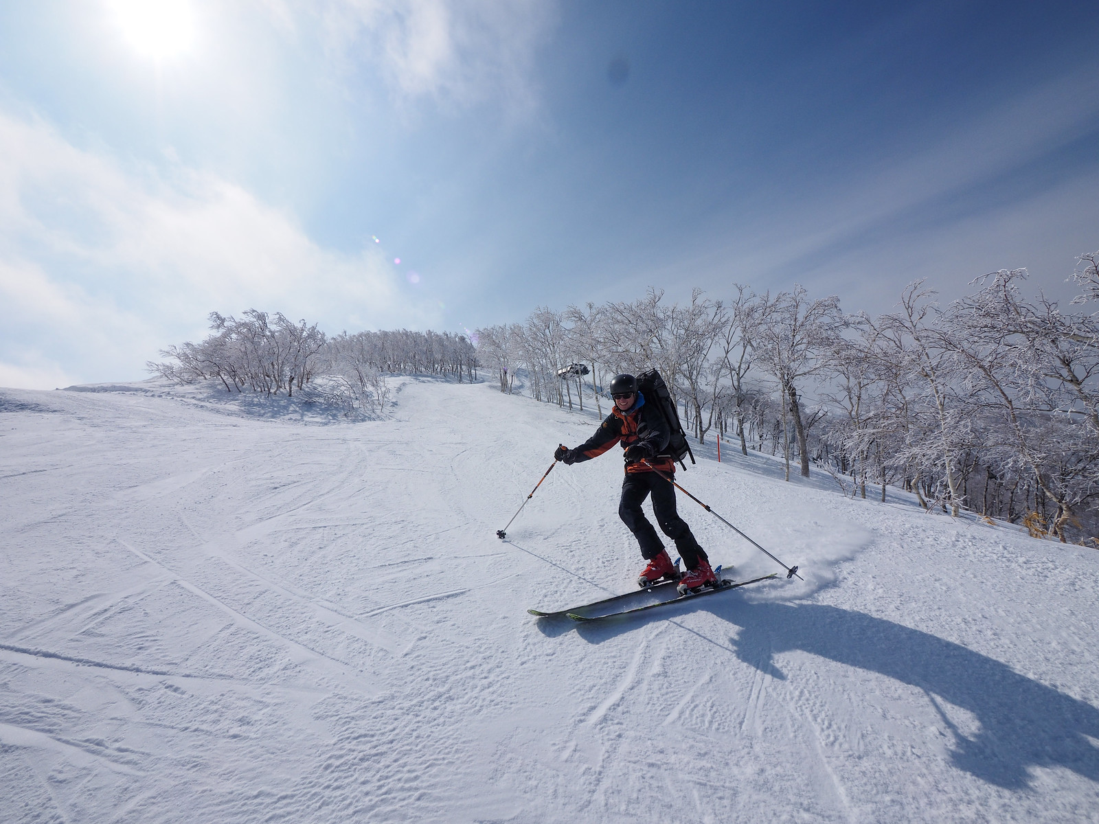
In the photo above, you can see one of the Sahoro Resort chairlift stations nearby in the background. The temptation to just hurtle down the ski slopes was too great – we chose this option rather than the icy backcountry downhill. We got more than a few stares from lightly-clad resort skiers as we skied past with large packs on.

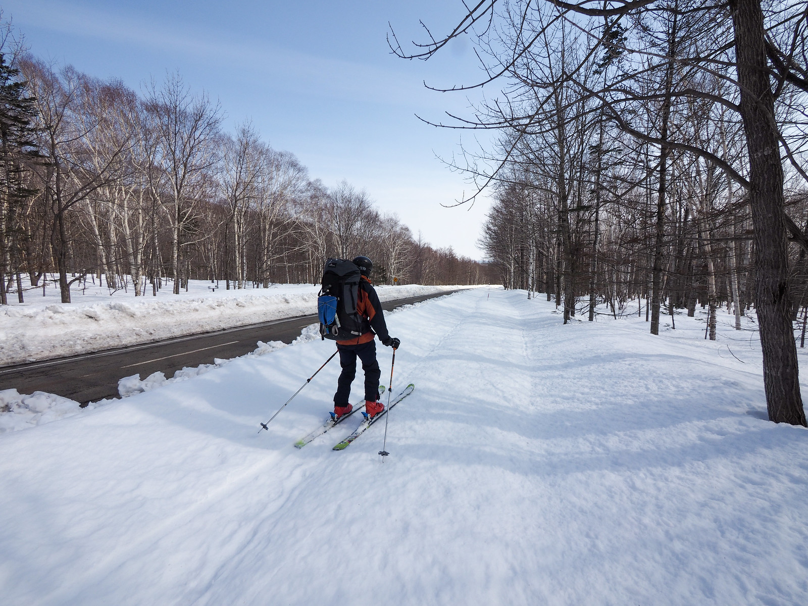
From the Sahoro Resort Hotel we skied down beside the main access road to the main road junction. I stood by the side of the road for about 30 minutes before a kind lady picked me up and took me back to the car at the top of the pass. She works in the Tomamu ski resort and hardly hesitated to stop to pick me up.

Just a few minutes before being picked up I had called Shintoku Taxi and asked for a taxi to take me to the pass. It was a Sunday, and there were only a few cars every 10 minutes or so. I cancelled the taxi in my hitched ride, and Rick and I were back on the way back to Sapporo in no time.

If the weather had been bad, the plan was to go straight to the Sahoro Resort Hotel (location), ask the front staff to order a taxi for 1.5 hours time, and use the time waiting for a hotspring soak there at the Hotel.

Mt. Sahoro and Sahoro Sanso Hut ski touring (Hokkaido, Japan)
Hitch-hiking up Karikachi Pass after ski touring across Mt. Sahoro (Hokkaido, Japan)
Photo by Rick Siddle

Comments | Queries | Reports

Done this route to Sahoro-dake, or others nearby? Thinking of doing it? Please post any feedback, reports, or queries here. Thanks!

2 thoughts on “Sahoro-dake and Sahoro-Sanso Hut”

  1. To you who love climbing.
    That was a very nice article.
    I was very surprised.
    I am looking forward to the next article.

Leave a Reply to Rob Thomson Cancel reply

Your email address will not be published. Required fields are marked *

This site uses Akismet to reduce spam. Learn how your comment data is processed.

See More Like this

Printable Sahoro-dake Topomap

TOPO DOWNLOAD (PDF, 2.7MB)

Download may take some time

Hokkaido Wilds Foundation

We’ve got affiliate links on HokkaidoWilds.org to help fund the Hokkaido Wilds foundation.

The Foundation gets a small commission on sales from affiliate links, but we only link to stuff we think is worth checking out for people keen on the outdoors in Hokkaido and Japan.

The Hokkaido Wilds Foundation is a fund where 100% of funds are donated to Hokkaido volunteer groups involved in sustainable, safe, and responsible access to the Hokkaido outdoors.

Learn more here

ADVANCED FILTERS

Filter by location

About Filters

REGION: The general mountain/geographical region the route is in.

BEST MONTH(S): Time of year a route is suited to visiting. Some pop all season, some are more limited.

DIFFICULTY: How strenuous a route is, and how technical it is. Full details here.

FREERIDE/SKITOUR: Very subjective, but is a route more-of-a-walk-than-a-ski or the other way around? Some routes are all about the screaming downhill (freeride), some are more about the hunt for a peak or nice forest (ski-tour). Some are in between. 

MAIN ASPECT: Which cardinal direction the primary consequential slope is facing, that you might encounter on the route. More details here.

ROUTE TAGS: An eclectic picking of other categories that routes might belong to.

SEARCH BY LOCATION: You can find routes near your current location – just click on the crosshairs (). You may need to give permission to HokkaidoWilds.org to know your GPS location (don’t worry, we won’t track you). Or, type in a destination, such as Niseko or Sapporo or Asahikawa etc.

Please let us know how we can make it easier to narrow down your search. Contact Rob at rob@hokkaidowilds.org with your suggestions.

Sahoro-dake and Sahoro-Sanso Hut Difficulty Rating

Category

Grade

Points

Strenuousness

Vertical Gain

A

40

Time ascending

C

3

Technicality

Altitude

B

6

Hazards

D

0

Navigation

C

6

Totals

55/100

GRADES range from A (very difficult) to D (easy). Hazards include exposure to avalanche and fall risk. More details here. Rating rubric adapted from Hokkaido Yukiyama Guidebook 北海道雪山ガイド.