Trip Report

Japan Far North: Days 12 & 13 (Mashita to Hamanasu to Sapporo)

Posted on Aug 22, 2013
2

Posted on Aug 22, 2013

Our last two days on the road on this 2013 summer vacation cycling trip were a bit of a blur. The highway connecting Sapporo to Rumoi along the coast is a whirlwind of tunnels interspersed with little nuggets of coast.

Last updated Oct 14, 2018


Lots of tunnels along the coast towards Hamamasu, Hokkaido, JapanWaterfall near Hamamasu, Hokkaido, Japan
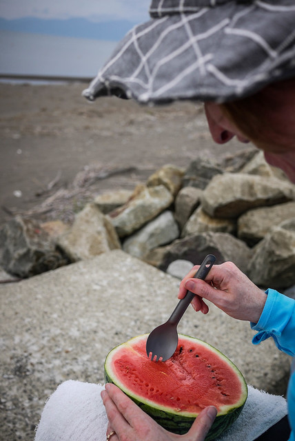
Roadside stalls lured us in with their delicious wares such as freshly steamed sweetcorn and watermelon.

More watermelon snacks (Ishikari City, Japan)We made the dash from Hamanasu to Sapporo in one day, despite planning on splitting it up into two days. A tiring 80km into a headwind later, we finally arrived back home after a fantastic two weeks and 600km cycle-exploring the far north of Japan – Rishiri and Rebun Islands, Wakkanai and surrounds.

Lots of tunnels along the coast towards Hamamasu, Hokkaido, Japan

Comments | Queries | Discussion

2 thoughts on “Japan Far North: Days 12 & 13 (Mashita to Hamanasu to Sapporo)”

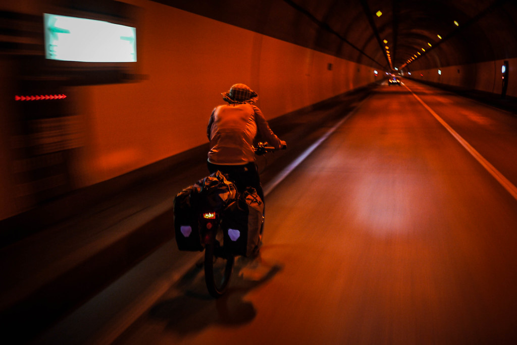
  1. Yeah, lots of tunnels between Sapporo and Hamanasu. Some have a raised path (just) wide enough to ride on, but on most we rode on the main traffic lane, pulling over when necessary for following traffic. It was a hot day, so the cool tunnel air was a relief. The longest tunnel was close to 5km.
    Following the river path out of Sapporo was awesome.
    The campground at Hamanasu is basic but has everything you need – toilets, water, an outdoor shower, and access to power. Seicomart is across the road. But the highlight is the delicious onsen 4km from the campground. One of the best we visited.

Leave a Comment

Your email address will not be published. Required fields are marked *

This site uses Akismet to reduce spam. Learn how your comment data is processed.

See More Like this

Download may take some time

Hokkaido Wilds Foundation

We’ve got affiliate links on HokkaidoWilds.org to help fund the Hokkaido Wilds foundation.

The Foundation gets a small commission on sales from affiliate links, but we only link to stuff we think is worth checking out for people keen on the outdoors in Hokkaido and Japan.

The Hokkaido Wilds Foundation is a fund where 100% of funds are donated to Hokkaido volunteer groups involved in sustainable, safe, and responsible access to the Hokkaido outdoors.

Learn more here

ADVANCED FILTERS

Filter by location

About Filters

REGION: The general mountain/geographical region the route is in.

BEST MONTH(S): Time of year a route is suited to visiting. Some pop all season, some are more limited.

DIFFICULTY: How strenuous a route is, and how technical it is. Full details here.

FREERIDE/SKITOUR: Very subjective, but is a route more-of-a-walk-than-a-ski or the other way around? Some routes are all about the screaming downhill (freeride), some are more about the hunt for a peak or nice forest (ski-tour). Some are in between. 

MAIN ASPECT: Which cardinal direction the primary consequential slope is facing, that you might encounter on the route. More details here.

ROUTE TAGS: An eclectic picking of other categories that routes might belong to.

SEARCH BY LOCATION: You can find routes near your current location – just click on the crosshairs (). You may need to give permission to HokkaidoWilds.org to know your GPS location (don’t worry, we won’t track you). Or, type in a destination, such as Niseko or Sapporo or Asahikawa etc.

Please let us know how we can make it easier to narrow down your search. Contact Rob at rob@hokkaidowilds.org with your suggestions.

Japan Far North: Days 12 & 13 (Mashita to Hamanasu to Sapporo) Difficulty Rating

Category

Grade

Points

Strenuousness

Vertical Gain

D

25

Time ascending

D

0

Technicality

Altitude

D

0

Hazards

D

Navigation

D

Totals

25/100

GRADES range from A (very difficult) to D (easy). Hazards include exposure to avalanche and fall risk. More details here. Rating rubric adapted from Hokkaido Yukiyama Guidebook 北海道雪山ガイド.