Posted on Sep 30, 2017
0

Posted on Sep 30, 2017

0 0
32km

Distance

2 day(s)

Time

1200m

Ascent

934m

Highest point

7.5/10

Difficulty

10%

Paved

Bankei Sanso mountain hut (万計山荘, 960m) is the largest backcountry hut in the Sapporo area. It is accessible either on foot on the Mt. Soranuma hiking trail, or a rough and steep forestry road. The latter makes for a perfect overnight bikepacking trip, easily accessed from central Sapporo City. From the hut, it is a short 1.5hr hike to the top of Mt. Soranuma. From the summit on a good day, Lake Shikotsu, Mt. Yotei, and Sapporo City are all well within view.

Last updated Jun 3, 2019

Route Map

Need to know details

Location

This route makes the most of the extensive network of forestry roads in the Sapporo hills southwest of Makomanai to visit one of Hokkaido’s most iconic but underrated mountain huts, the Bankei Sanso Hut.

General notes

I’ve written this route up as an overnight trip, purely due to the absolute charm of the Bankei Sanso Hut. The route could, of course, be easily done as a day trip.

Caretakers for the Bankei Sanso Hut can drive to the hut in their 4×4 cars on the forestry roads to the hut during the non-snow season, so the roads are perfect for mountain bikes. Mt. Soranuma has a popular hiking trail to its summit, and on the weekends you’ll likely see a steady stream of hikers heading up the well-trodden trail. It can be a muddy trail, so boots are recommended. From hut to summit, it takes between 1.5 and 2 hours. The summit offers amazing views over Sapporo City, Mt. Yotei, and Lake Shikotsu. Even if you don’t hike all the way to the summit, consider heading about 30 minutes up the trail from the hut to the Mamisu Lake. This lake is pristine and on a good day is great for a quick dip in its frigid waters.

Hut

Bankei Sanso Hut (full details here)

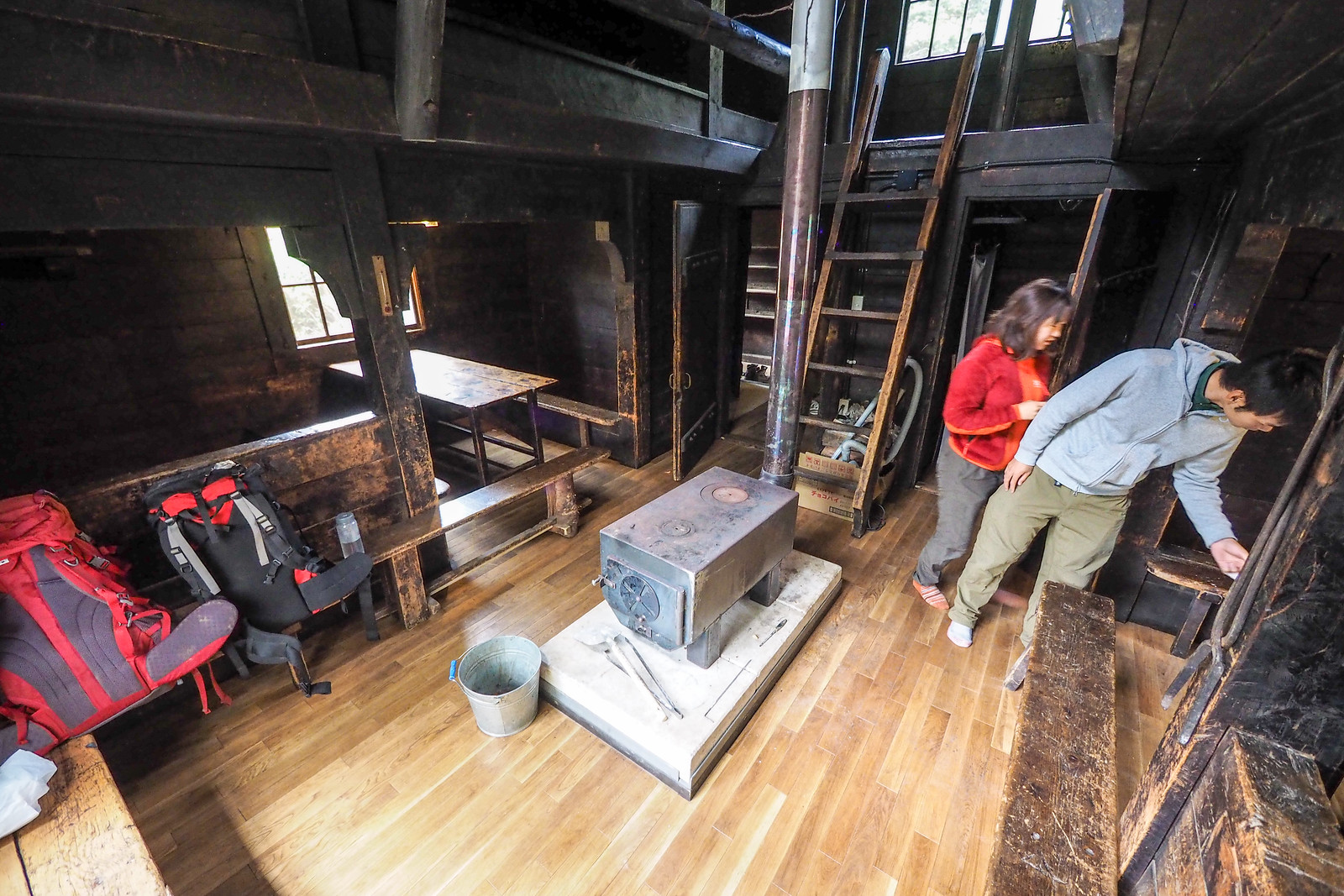
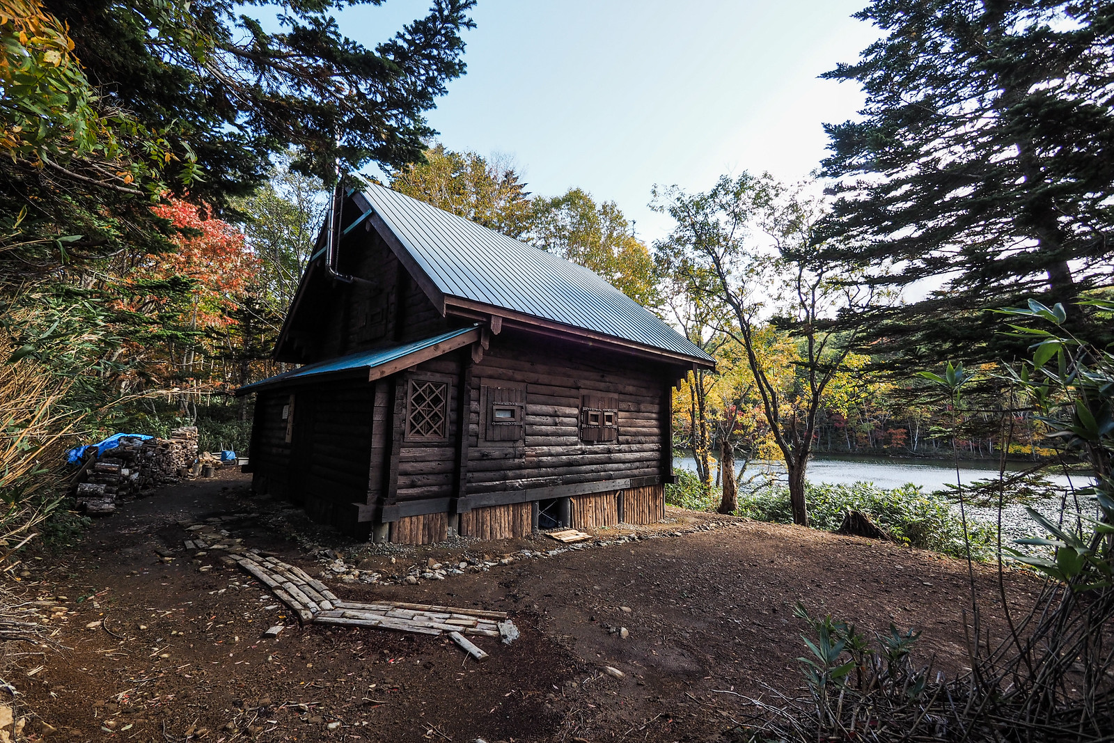
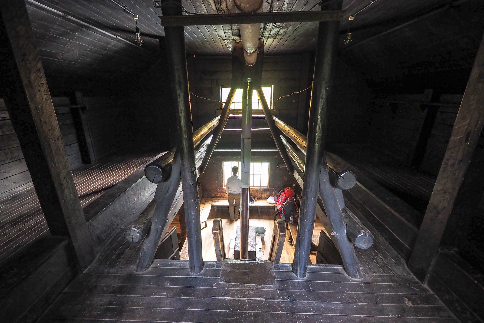
The Bankei Sanso Hut was built in 1965 as a forest workers’ hut, and is currently managed and maintained by the Bankei-sanso Hut Volunteer Society. The spacious two-story hut sleeps approximately 100 people. It is located about 3 hours up the Mt. Soranuma summer trail.

Route markers

The route to the hut is not signposted. In particular, it is easy to miss the turnoff from the main forestry road to the more minor gravel road that heads up to the hut. As with most gravel road riding in Hokkaido, there are always multiple junctions, and the intended route is not always the most-travelled option. Make sure to double check your route at each junction.

Route Timing

It will take most riders around 3 hours from the turnoff on the main Route 230 road to the hut. On the return from the hut down to Tokiwa it is a 1.5 hour blast down mostly well-kept forestry roads.

Physical maps

Explore the official Japan topomaps online for the area around Bankei Sanso Hut here. Follow these instructions to print out the area you would like as a hardcopy.

Route safety

The forestry roads are part of an active forestry area, so be aware that you’re not the only one likely to be using the roads. Keep watch for trucks and other heavy machinery.

Weather forecast

Windy.com weather forecast for Bankei Sanso Hut
Other resources
Onsen nearby

On your way back into Sapporo from Tokiwa, the only option resembling a place for a hot soak is the Makomanai-yu (真駒内湯), here. If you’re doing the route in reverse, then you might be tempted to cycle 5km up Route 230 to Matsu-no-yu (here), a beautiful little onsen hotsprings on the Toyohira River – replete with outdoor baths that overlook the river.

Support us

Like this content? Buy the HokkaidoWilds.org team a coffee. 50% of tips go to the Hokkaido Wilds Foundation.

Show Full Route Notes Close Route Notes

Route Trip Notes

Every now and then I get a hankering for an overnight trip into the hills. This weekend was one such occasion, so I set my sights on the Bankei Sanso mountain hut, near Mt. Soranuma on the outskirts of Sapporo City.

I’ve stayed in this hut before. Once on a spring-season snowshoe trip, and once on a ski tour (story here). The accessibility of the hut from Sapporo City, and the interesting terrain, makes it once of those places you can return to again and again.

This time I would be on a mountain bike, with the intention to cycle to the hut from Sapporo, stay the night, and hike to the summit the next day.

Because I live at the southern end of Sapporo, it was a two hour ride just to get to the Misumai area towards Jozankei. From the main road (Route 230), I would climb south along the forestry roads towards the hut.

There are two directions that the hut can be approached from on a bike. One is from the north, starting in Misumai. The other is starting closer to Makomanai in Sapporo City. I chose to climb up to the hut from the Misumai side, and descend down the other side (as marked on the route map above).

Just beyond the turn off on the Misumai side, there is a convenience store, so I stopped in there to replenish my water supplies and buy some snacks.

From there I started the rather slow process of climbing up to the hut. The route from the main road starts out paved, passing some interesting, quiet homes along the way.

Before long, it is the end of the road for the general public in vehicles. A locked gate bars the way for all but forestry vehicles (and bicyclists). From there, the route winds up active logging roads, so keep your eyes out for trucks, and always yield to vehicles.

I had anticipated the ride up to take about 2 hours, so I was hoping to be at the hut before lunch. The slow leak in my front tube, however, had other plans, and I had to stop to repair it. The steepness of the roads were also a surprise. For me it was a matter of cycling 30m, stopping to catch my breath, cycling another 30m, stopping, and repeating this process.

It was never so steep that it was impossible to cycle; a stronger, fitter cyclist (with less luggage) would do this much more quickly.

After a quick lunch on the road, I arrived at the hut at around 1:30pm, 3 hours after I left the main Route 230 road. It was a beautiful autumn day.

The hut is right next to Bankei Pond – very picturesque. 

Bankei Sanso Hut is not the only mountain hut next to the pond. Hokkaido University also manages a smaller hut about 50m from the larger Bankei Sanso hut.

It was recently renovated, and in September this year re-opened for non-winter overnight stays. Call Hokkaido University to book to stay there – you’ll also need to visit the university to pay before using the hut.

Soranuma-dake Overnight Bike 'n Hike (Hokkaido, Japan)

During the summer months, members from the volunteer association which manages the hut stay overnight on Saturdays. Besides them, however, it was just me, Mike and Birget. Mike and Birget had also made the trek up to the hut on bikes.

The next morning we hiked up the well-trodden trail to the summit of Mt. Soranuma, via the gorgeous Mamisu Lake.

From the summit, we had spectacular views in all directions towards Sapporo City, Mt. Yotei, and Lake Shikotsu. We also had a very cute – and amazingly tame – Hokkaido squirrel visit us at the top.

The bike ride back down to Sapporo from the hut lived up to what I expected from the day before, lugging myself up those steep inclines. It was rip-roaring fun. Even, I hope, for first-time gravel-road rider Birget 🙂

Comments | Queries | Reports

Done this route up to Bankei Sanso Hut? Thinking of doing it? Please post any feedback or queries here. Thanks!

Leave a Reply

Your email address will not be published. Required fields are marked *

This site uses Akismet to reduce spam. Learn how your comment data is processed.

See More Like this

Printable Bankei Sanso Hut Topomap

TOPO DOWNLOAD (PDF, 0MB)

Download may take some time

Hokkaido Wilds Foundation

We’ve got affiliate links on HokkaidoWilds.org to help fund the Hokkaido Wilds foundation.

The Foundation gets a small commission on sales from affiliate links, but we only link to stuff we think is worth checking out for people keen on the outdoors in Hokkaido and Japan.

The Hokkaido Wilds Foundation is a fund where 100% of funds are donated to Hokkaido volunteer groups involved in sustainable, safe, and responsible access to the Hokkaido outdoors.

Learn more here

ADVANCED FILTERS

Filter by location

About Filters

REGION: The general mountain/geographical region the route is in.

BEST MONTH(S): Time of year a route is suited to visiting. Some pop all season, some are more limited.

DIFFICULTY: How strenuous a route is, and how technical it is. Full details here.

FREERIDE/SKITOUR: Very subjective, but is a route more-of-a-walk-than-a-ski or the other way around? Some routes are all about the screaming downhill (freeride), some are more about the hunt for a peak or nice forest (ski-tour). Some are in between. 

MAIN ASPECT: Which cardinal direction the primary consequential slope is facing, that you might encounter on the route. More details here.

ROUTE TAGS: An eclectic picking of other categories that routes might belong to.

SEARCH BY LOCATION: You can find routes near your current location – just click on the crosshairs (). You may need to give permission to HokkaidoWilds.org to know your GPS location (don’t worry, we won’t track you). Or, type in a destination, such as Niseko or Sapporo or Asahikawa etc.

Please let us know how we can make it easier to narrow down your search. Contact Rob at rob@hokkaidowilds.org with your suggestions.

Bankei Hut Bikepacking Difficulty Rating

Category

Grade

Points

Strenuousness

Vertical Gain

D

25

Time ascending

D

0

Technicality

Altitude

D

0

Hazards

D

Navigation

D

Totals

25/100

GRADES range from A (very difficult) to D (easy). Hazards include exposure to avalanche and fall risk. More details here. Rating rubric adapted from Hokkaido Yukiyama Guidebook 北海道雪山ガイド.