
- A 110km down-to-the-coast-then-up-again route that would take us into the bustling city of Kushiro (https://goo.gl/maps/ejZrm).
- A more direct 80km route that would take us across two low ridges via forestry roads (marked on Google but not available for routing).
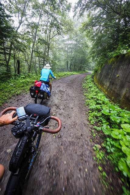
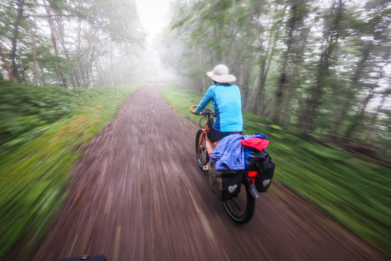
We chose the latter of the two options, and spent 20km on gorgeous misty gravel roads through quiet Hokkaido forest.
The two forest roads connect 1) Route 222 near Akan Town, and Route 242 near Kamishohoro and 2) Route 242 and Route 392 near Kamichahoro. On the excellent Touring Mapple (Hokkaido), they are at I3 and G3 on page 27.
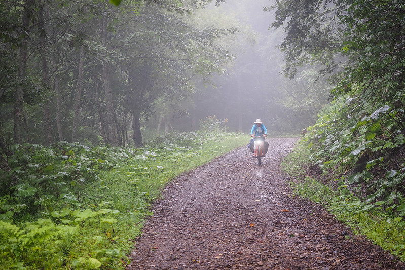
The climbs are fairly steep at times on this route, but nothing too out of the ordinary for a forestry road. The gravel is chunky, so we were happy to be on our 2.35 Schwalbe Big Apple tires (drop the pressure, and they’re like magic carpets).
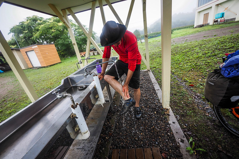
Conveniently, at the route 392 end of the route, there is an old school, still operated by the community as a community center (the Shizen-no-ie). An outside washing area made short work of muddy bikes and legs.
By the time lunchtime rolled around, the skies had cleared and it was a scorcher. Our tent and panniers had been damp-ish for a few days, so we took the chance to lay it all out to dry while we had lunch in a covered bus stop.
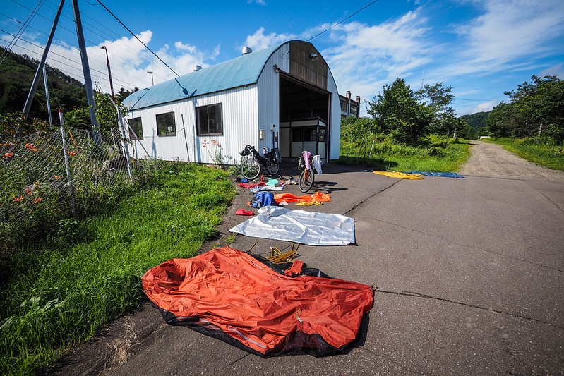
In this sense, rainy spells on a bike tour are sort of like uphills. They can be tough going, but the reward of fresh dry gear at the end of them is worth the grind.
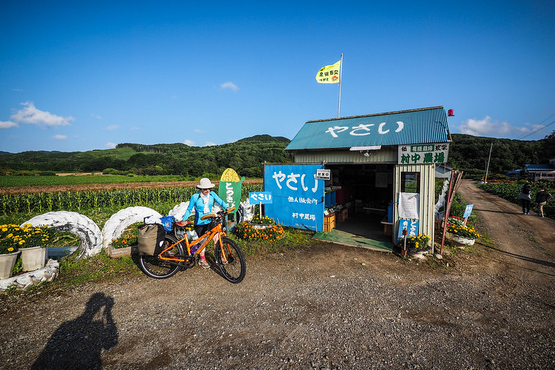
Our route for the rest of the day was more or less void of stores and people in general. Our road maps warns motorists that it is a 60km stretch of road with no facilities. The first sign of supplies came in the form of a very well stocked honesty-box style vegetable stall. We bought 200g of plum tomatoes (for 100 yen – US$1 equivalent) and ate the lot on the spot.
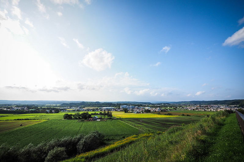
We were soon freewheeling it into the small, seemingly very prosperous town of Honbetsu. Our priorities were to buy supplies at a supermarket, visit the local hotspring spa, and set up camp at the Honbetsu campground.
Once we had rolled into town, we learned that the official Honbetsu natural hotsprings were a 5km bike ride away, in the opposite direction of the campground. We were hot and tired, so we opted instead for the more local sento (bath house). We had the place to ourselves, and it did the trick.


_8922260339_o-768x302.jpg?x18351)


8 thoughts on “Cycling Across Hokkaido, Japan (Day 9): From Akan to Honbetsu”
Hey, I was here today and the gravel road was closed, so I had to detour through the coast as suggested. By the way, I investigated after the gate and it had a lot of water so my guess is the locals stopped using it after the trees fell.
Any idea on the status of the gravel road anno September 2020?
We don’t have any more recent beta on the road, unfortunately. Probably best to assume it’s still strewn with trees. Do let us know if you discover anything on the ground!
I’m planning to do this route in June of this year. The comment above suggests the gravel road might be inaccessible. Do you know if this is still the case?
I’ll also be cycling this route this year, in July. Hopefully given 4 years it’s been cleared but if you hear any new info on it I’d really appreciate it if you could pop it here!
Thanks!
Hi Mark, did you ride this road? I’m heading across tomorrow and keen to know if it’s the right option!
Thanks
This looks like an idyllic ride – capped with fresh vegetables. Beautiful.
It is a beautiful area!