Trip Report

GW Cycle-Camping | Day 3: Tsukigata to Naganuma (Hokkaido, Japan)

Posted on May 5, 2013
0

Posted on May 5, 2013

Getting up before dawn is not always easy for those who do not usually get up before dawn. But is it even harder when ‘before dawn’ is 3:45am, as it is in Hokkaido even at this time of the year. But before dawn it was this morning, as we hoped to see thousands of wild migratory geese take off for the day’s feeding from Miyajima-numa lake, in Tsukigata Town.

Last updated Oct 14, 2018

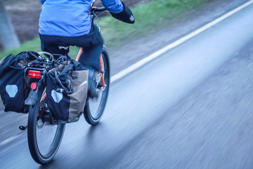
First up was a brisk 4km bike ride to the lake.

Early morning bike ride in Tsukigata Town, Hokkaido, Japan

Cycling over the old iron frame bridge in Tsukigata Town, Hokkaido, Japan

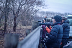
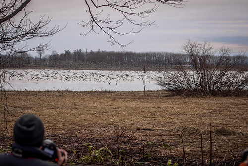
The more hardcore photographers were already there in force.

Photographers at Miyajima-numa (Tsukigata Town, Hokkaido, Japan)

Photographers and migrating geese at Miyajima-numa (Tsukigata Town, Hokkaido, Japan) Photographers at Miyajima-numa (Tsukigata Town, Hokkaido, Japan)

Migrating geese at Miyajima-numa (Tsukigata Town, Hokkaido, Japan)

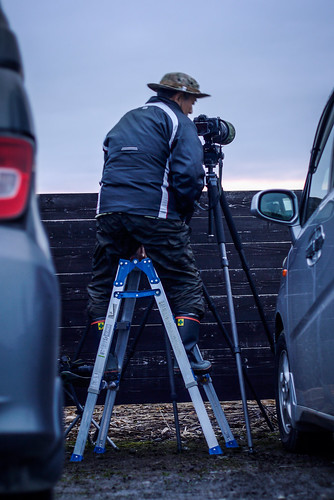
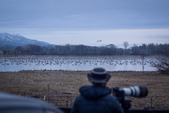
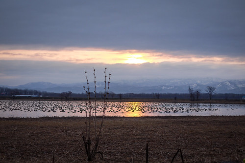
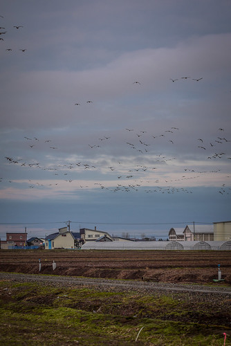
Right on 4:30am, the geese started moving. They took off from the water in flocks of hundreds.

Photographers and migrating geese at Miyajima-numa (Tsukigata Town, Hokkaido, Japan)

The geese are protected, but apparently the local farmers are not thrilled about having thousands of hungry geese descending on their crops every day.

Migrating geese flying over farmland near Miyajima-numa (Tsukigata Town, Hokkaido, Japan)

The early morning start did not dampen spirits on the cycling team.

Cycling with no hands (Tsukigata Town, Hokkaido, Japan)

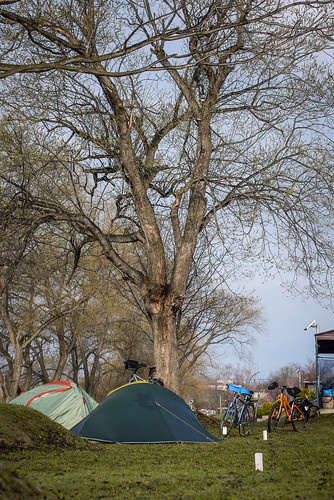
Spirits were further heightened by the appearance of sunlight at the campground, a welcome change after two days of rain.

Camping at Tsukigata Kairaku Campground (Tsukigata, Hokkaido, Japan)

Surly Karate Monkey in touring mode (Tsukigata Town, Hokkaido, Japan)

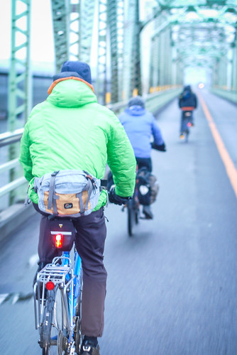
After another hearty breakfast, we departed camp and headed for the Ishikari River once again. The first 1km along the floodbank was paved, but this soon gave way to more dirt road.

Cycling along a paved road on the Ishikari River floodbank (near Iwamizawa, Hokkaido, Japan)

Dirt farm roads near the Ishikari River (Iwamizawa, Hokkaido, Japan)

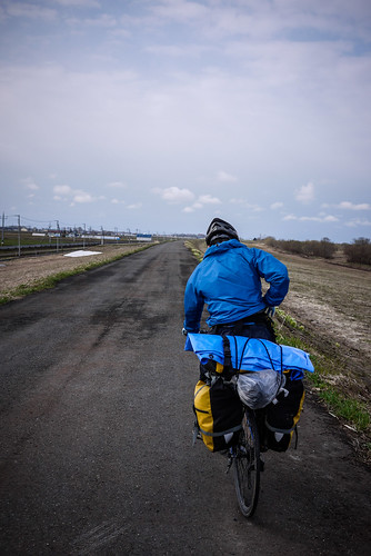
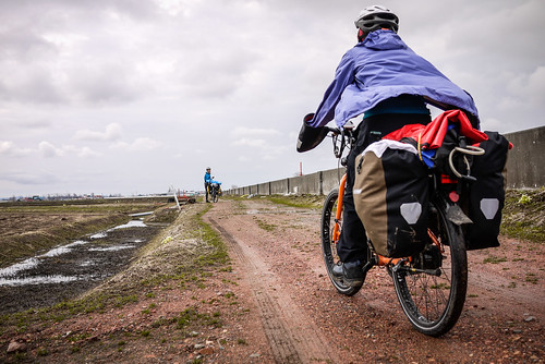
Once again, no problem for fatter tires, but hard going on skinnies. We headed for the nearest quiet paved road, and were rewarded by great views to the mountains across the plains.

Cycling group photo (near Iwamizawa, Hokkaido, Japan)

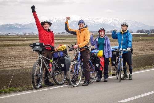
Rick, the Brit in the team, had managed to develop a sore knee during the three days’ riding, so opted out of the last night’s camp and headed straight back to Sapporo rather than carrying on with us. This meant that we were down to three.

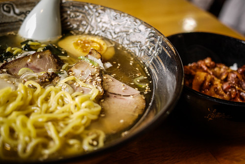
Today’s lunch was by Google’s recommendation. On the Android smartphone app for Google Maps, you are able to tell Google to find nearest ramen restaurants. Today’s recommendation was Kirara Ramen in Nanporo. It was delicious. I got the ‘salt’ ramen with a free side of pork-on-rice. I paid 850yen for the feast (US$8.50)

Shio ramen with buta-don at Nanporo Ramen Kirara (Nanporo, Hokkaido, Japan)

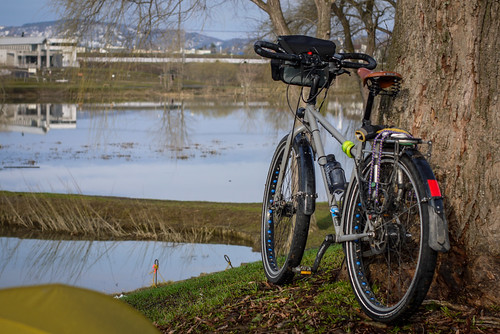
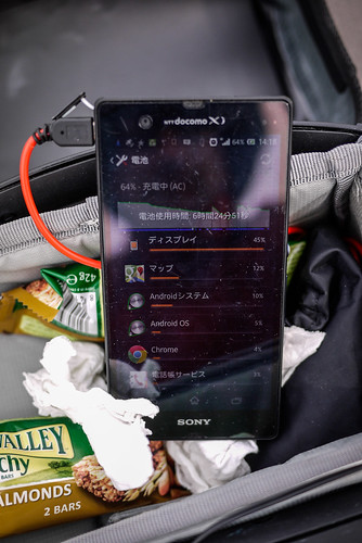
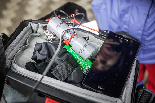
I ought to mention that on this trip, I have been using a home-made (DIY) USB charger that I attach to my dynamo hub. I’ll be writing a blog post later about making one of these, but it works really well. I get about 1% battery charge per 1km cycled, when my Sony Xperia Z smartphone is switched off. Over a 60km cycling day, this is enough to keep the device charged, and turn it on every now and then to check location via GPS. The charger does not seem to put out enough charge, however, to keep the phone charged while the screen is on. Full write-up to come soon.

DIY USB dynamo charger for a bicycle - charging a Sony Xperia Z (near Nanporo, Hokkaido, Japan)

DIY USB dynamo charger for a bicycle (Hokkaido, Japan)

We cycled on to Naganuma Town, and checked into the Maoi Autocamp Campground. This relatively upmarket place cost us 1,200yen each (US$12). As routine on this trip dictated, we put up the tents and headed for an onsen, 3 minutes walk away. Dinner was convenience-store bought rice and veges and meat, cooked on our camp stoves.

Route/trip details

Sun 5th May | Tsukigata Kairaku Park Campground to Naganuma Maoi Auto-land
Distance: 60km
Approximate route:  https://bit.ly/15oQGe5

After seeing the geese leaving at sunrise at Miyajima-numa, head back down the Ishikari River stopbank road, then onto the Yubari River cycling road at Ebetsu, end up at the Maoi Auto-land campground in Naganuma Town. Campground cost is 1000yen entry (includes Naganuma onsen pass), plus 500yen per tent site (up to two tents per site). The campground is near Higashi Teien (large Japanese garden).

Campground address: 夕張郡長沼町東7線北4(https://goo.gl/maps/3nSkw
Campground TEL: 0123-88-0700
Campground URL: https://bit.ly/14y24nv

Comments | Queries | Discussion

Leave a Comment

Your email address will not be published. Required fields are marked *

This site uses Akismet to reduce spam. Learn how your comment data is processed.

See More Like this

Download may take some time

Hokkaido Wilds Foundation

We’ve got affiliate links on HokkaidoWilds.org to help fund the Hokkaido Wilds foundation.

The Foundation gets a small commission on sales from affiliate links, but we only link to stuff we think is worth checking out for people keen on the outdoors in Hokkaido and Japan.

The Hokkaido Wilds Foundation is a fund where 100% of funds are donated to Hokkaido volunteer groups involved in sustainable, safe, and responsible access to the Hokkaido outdoors.

Learn more here

ADVANCED FILTERS

Filter by location

About Filters

REGION: The general mountain/geographical region the route is in.

BEST MONTH(S): Time of year a route is suited to visiting. Some pop all season, some are more limited.

DIFFICULTY: How strenuous a route is, and how technical it is. Full details here.

FREERIDE/SKITOUR: Very subjective, but is a route more-of-a-walk-than-a-ski or the other way around? Some routes are all about the screaming downhill (freeride), some are more about the hunt for a peak or nice forest (ski-tour). Some are in between. 

MAIN ASPECT: Which cardinal direction the primary consequential slope is facing, that you might encounter on the route. More details here.

ROUTE TAGS: An eclectic picking of other categories that routes might belong to.

SEARCH BY LOCATION: You can find routes near your current location – just click on the crosshairs (). You may need to give permission to HokkaidoWilds.org to know your GPS location (don’t worry, we won’t track you). Or, type in a destination, such as Niseko or Sapporo or Asahikawa etc.

Please let us know how we can make it easier to narrow down your search. Contact Rob at rob@hokkaidowilds.org with your suggestions.

GW Cycle-Camping | Day 3: Tsukigata to Naganuma (Hokkaido, Japan) Difficulty Rating

Category

Grade

Points

Strenuousness

Vertical Gain

D

25

Time ascending

D

0

Technicality

Altitude

D

0

Hazards

D

Navigation

D

Totals

25/100

GRADES range from A (very difficult) to D (easy). Hazards include exposure to avalanche and fall risk. More details here. Rating rubric adapted from Hokkaido Yukiyama Guidebook 北海道雪山ガイド.