Trip Report

GW Cycle-Camping | Day 4: Naganuma to Sapporo (Hokkaido, Japan)

Posted on May 6, 2013
0

Posted on May 6, 2013

We woke today to rain. Harder rain than the previous days. Just as well today’s destination was back home to Sapporo. Just as well, also, that we had a spacious pagoda all to ourselves to keep out of the rain.

Last updated Oct 14, 2018

Covered cooking area at the Maoi Autocamp Campground (Naganuma Town, Hokkaido, Japan)

Covered cooking area at the Maoi Autocamp Campground (Naganuma Town, Hokkaido, Japan)

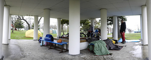
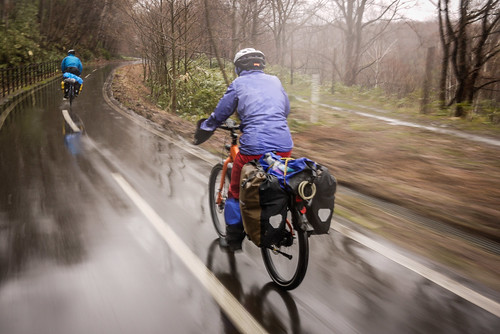
Of course the time came when we had to venture out. We were comforted by the fact that it was only 30km back to Sapporo.

About half of that distance was covered on the fantastic cycling road that cuts through forest and urban sprawl into Sapporo, running from Kitahiroshima. On a nice day, it looks like this: https://www.14degrees.org/en/?p=1579.

On a cold wet day, however, it looks more like this:

Cycling group photo on the Kitahiroshima Elfin Road (Kitahiroshima, Hokkaido, Japan)

Wet downhill bicycle ride on the Elfin cycling Road (Kitahiroshima, Hokkaido, Japan)

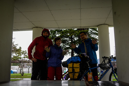
Safe and sound at home before 10am, after seeing our remaining companion off (Aki), we were happy to have the rest of the day at home to get laundry done and a wet tent aired and dried. Tomorrow it is back to work.

Despite the rain, it was great to get out and about for a well needed long weekend. The campsites we stayed at were great, considering the very close proximity of the hotsprings. Worth noting is that all the hotsprings had attached restaurants with very reasonable priced meals (between 600yen and 1200yen (US$6 to US$12)). We could have gotten away with not cooking any meals at all.

All up, we probably spent around 5,000yen (US$50) a day for the two of us (Haidee and Rob) for food, campground accommodation, and hotsprings. If it had been sunny, and hence had we been more motivated to cook more, it might have been slightly cheaper.

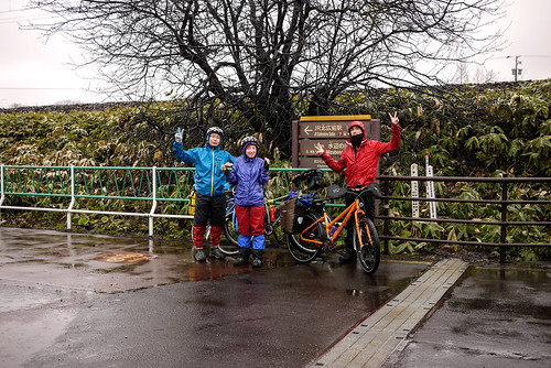
A big thanks for our fellow HIOC members Aki, Rick and Michal for the company!

Approximate route: https://goo.gl/maps/NzLUj

Comments | Queries | Discussion

Leave a Comment

Your email address will not be published. Required fields are marked *

This site uses Akismet to reduce spam. Learn how your comment data is processed.

See More Like this

Download may take some time

Hokkaido Wilds Foundation

We’ve got affiliate links on HokkaidoWilds.org to help fund the Hokkaido Wilds foundation.

The Foundation gets a small commission on sales from affiliate links, but we only link to stuff we think is worth checking out for people keen on the outdoors in Hokkaido and Japan.

The Hokkaido Wilds Foundation is a fund where 100% of funds are donated to Hokkaido volunteer groups involved in sustainable, safe, and responsible access to the Hokkaido outdoors.

Learn more here

ADVANCED FILTERS

Filter by location

About Filters

REGION: The general mountain/geographical region the route is in.

BEST MONTH(S): Time of year a route is suited to visiting. Some pop all season, some are more limited.

DIFFICULTY: How strenuous a route is, and how technical it is. Full details here.

FREERIDE/SKITOUR: Very subjective, but is a route more-of-a-walk-than-a-ski or the other way around? Some routes are all about the screaming downhill (freeride), some are more about the hunt for a peak or nice forest (ski-tour). Some are in between. 

MAIN ASPECT: Which cardinal direction the primary consequential slope is facing, that you might encounter on the route. More details here.

ROUTE TAGS: An eclectic picking of other categories that routes might belong to.

SEARCH BY LOCATION: You can find routes near your current location – just click on the crosshairs (). You may need to give permission to HokkaidoWilds.org to know your GPS location (don’t worry, we won’t track you). Or, type in a destination, such as Niseko or Sapporo or Asahikawa etc.

Please let us know how we can make it easier to narrow down your search. Contact Rob at rob@hokkaidowilds.org with your suggestions.

GW Cycle-Camping | Day 4: Naganuma to Sapporo (Hokkaido, Japan) Difficulty Rating

Category

Grade

Points

Strenuousness

Vertical Gain

D

25

Time ascending

D

0

Technicality

Altitude

D

0

Hazards

D

Navigation

D

Totals

25/100

GRADES range from A (very difficult) to D (easy). Hazards include exposure to avalanche and fall risk. More details here. Rating rubric adapted from Hokkaido Yukiyama Guidebook 北海道雪山ガイド.