Trip Report

HOKKAIDO (Shikotsu Trip Day 3): Eniwa to Sapporo

Posted on Aug 25, 2011
0

Posted on Aug 25, 2011

We awoke this morning to the pitter-patter of raindrops on our tent fly. It was early. About 4:15am, and it was just starting to get light. Time to move on, since we were free-camping in a park just next to the Eniwa Flower Road parking area.

Last updated Oct 14, 2018

A wet start to the day in Eniwa, Hokkaido, Japan (stealth camping at the Eniwa michi-no-eki)

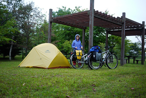
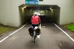
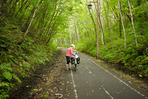
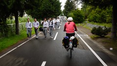
Stomachs grumbling from only a few snacks before we hit the road, we high-tailed it along the noisy main raods to Kitahiroshima JR Station, the beginning of the Shiroishi Cycling road. This magnificent cycling road is one we have cycled before. On the Kitahiroshima City side, the road is a full car-lane width, narrowing only slightly as it enters Sapporo City.

Once on the cycling road, it was pure bliss. A short 4km uphill was rewarded with almost 20km of gentle downhill into Sapporo.

Shiroishi Cycling Road, Sapporo, Hokkaido, Japan Shiroishi Cycling Road, Sapporo, Hokkaido, Japan

Shiroishi Cycling Road, Kitahiroshima, Hokkaido, Japan

Shiroishi Cycling Road, Sapporo, Hokkaido, Japan A bridge on the Shiroishi Cycling Road, Sapporo, Hokkaido, Japan

We made it home at around 8:45am, just as the rain was starting again in earnest. A quick packing up of equipment and a warm shower later, we were happy to drop onto a familiar bed and doze for a few hours. That kind of deep dozing that feels so good after wrenching oneself out of bed early for exercise. Haidee was especially deserving of the nap; she had work today from 4pm!

All in all it was a really great ride. The circuit could easily be done in just two days, and the large swathes of cycle paths along the route could make it some of the most pleasurable cycling possibly of anywhere in Japan. Lake Shikotsu is a gem, as is the short section of closed road to the west of it. I think this circuit could even be done on a longboard…

Distance: 31.7km | Time cycling: 1h 55m
Average Speed: 16.5km/h | Max speed: 35.2km/h


View Route Map on Google Maps

Comments | Queries | Discussion

Leave a Comment

Your email address will not be published. Required fields are marked *

This site uses Akismet to reduce spam. Learn how your comment data is processed.

See More Like this

Download may take some time

Hokkaido Wilds Foundation

We’ve got affiliate links on HokkaidoWilds.org to help fund the Hokkaido Wilds foundation.

The Foundation gets a small commission on sales from affiliate links, but we only link to stuff we think is worth checking out for people keen on the outdoors in Hokkaido and Japan.

The Hokkaido Wilds Foundation is a fund where 100% of funds are donated to Hokkaido volunteer groups involved in sustainable, safe, and responsible access to the Hokkaido outdoors.

Learn more here

ADVANCED FILTERS

Filter by location

About Filters

REGION: The general mountain/geographical region the route is in.

BEST MONTH(S): Time of year a route is suited to visiting. Some pop all season, some are more limited.

DIFFICULTY: How strenuous a route is, and how technical it is. Full details here.

FREERIDE/SKITOUR: Very subjective, but is a route more-of-a-walk-than-a-ski or the other way around? Some routes are all about the screaming downhill (freeride), some are more about the hunt for a peak or nice forest (ski-tour). Some are in between. 

MAIN ASPECT: Which cardinal direction the primary consequential slope is facing, that you might encounter on the route. More details here.

ROUTE TAGS: An eclectic picking of other categories that routes might belong to.

SEARCH BY LOCATION: You can find routes near your current location – just click on the crosshairs (). You may need to give permission to HokkaidoWilds.org to know your GPS location (don’t worry, we won’t track you). Or, type in a destination, such as Niseko or Sapporo or Asahikawa etc.

Please let us know how we can make it easier to narrow down your search. Contact Rob at rob@hokkaidowilds.org with your suggestions.

HOKKAIDO (Shikotsu Trip Day 3): Eniwa to Sapporo Difficulty Rating

Category

Grade

Points

Strenuousness

Vertical Gain

D

25

Time ascending

D

0

Technicality

Altitude

D

0

Hazards

D

Navigation

D

Totals

25/100

GRADES range from A (very difficult) to D (easy). Hazards include exposure to avalanche and fall risk. More details here. Rating rubric adapted from Hokkaido Yukiyama Guidebook 北海道雪山ガイド.