Trip Report

Shiretoko Loop Tour Day 1: Sapporo to Abashiri

Posted on Aug 1, 2012
0

Posted on Aug 1, 2012

Route Guide

The Shiretoko region in eastern Hokkaido is home to more grizzly bears per square kilometer than anywhere in Japan. It therefore seemed like the sensible thing to go there and cycle around for a couple of weeks, camping along the way. It was summer vacation here, after all.

Last updated Oct 14, 2018

Route Guide

So Haidee and I bundled up our bicycles onto the train in Sapporo, and got on an early train bound for Abashiri. About 400km east of Sapporo, on the northern sea coast. It was about 30 degrees Celsius when we left Sapporo. It was about 15 degrees in Abashiri when we arrived 5 hours later at noon. Our expectations of a hot and sweaty two week tour suddenly seemed extremely silly. Haidee was kicking herself for not bringing that extra merino wool longsleeve top.

A happy duo at Abashiri Station, Abashiri, Hokkaido, Japan

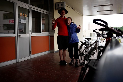
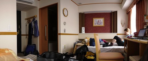
It was also raining. The idea for this trip was to relax. So we checked into a swanky hotel right in front of the train station (for a very reasonable 3,500yen each), and spent the first night in comfort.

Hotel room at the Toyoko Inn in Abashiri, Hokkaido, Japan

Abashiri Michi-no-eki (Abashiri, Hokkaido, Japan)

Route Map (by train)


View Larger Map

Comments | Queries | Discussion

Leave a Comment

Your email address will not be published. Required fields are marked *

This site uses Akismet to reduce spam. Learn how your comment data is processed.

See More Like this

Download may take some time

Hokkaido Wilds Foundation

We’ve got affiliate links on HokkaidoWilds.org to help fund the Hokkaido Wilds foundation.

The Foundation gets a small commission on sales from affiliate links, but we only link to stuff we think is worth checking out for people keen on the outdoors in Hokkaido and Japan.

The Hokkaido Wilds Foundation is a fund where 100% of funds are donated to Hokkaido volunteer groups involved in sustainable, safe, and responsible access to the Hokkaido outdoors.

Learn more here

ADVANCED FILTERS

Filter by location

About Filters

REGION: The general mountain/geographical region the route is in.

BEST MONTH(S): Time of year a route is suited to visiting. Some pop all season, some are more limited.

DIFFICULTY: How strenuous a route is, and how technical it is. Full details here.

FREERIDE/SKITOUR: Very subjective, but is a route more-of-a-walk-than-a-ski or the other way around? Some routes are all about the screaming downhill (freeride), some are more about the hunt for a peak or nice forest (ski-tour). Some are in between. 

MAIN ASPECT: Which cardinal direction the primary consequential slope is facing, that you might encounter on the route. More details here.

ROUTE TAGS: An eclectic picking of other categories that routes might belong to.

SEARCH BY LOCATION: You can find routes near your current location – just click on the crosshairs (). You may need to give permission to HokkaidoWilds.org to know your GPS location (don’t worry, we won’t track you). Or, type in a destination, such as Niseko or Sapporo or Asahikawa etc.

Please let us know how we can make it easier to narrow down your search. Contact Rob at rob@hokkaidowilds.org with your suggestions.

Shiretoko Loop Tour Day 1: Sapporo to Abashiri Difficulty Rating

Category

Grade

Points

Strenuousness

Vertical Gain

D

25

Time ascending

D

0

Technicality

Altitude

D

0

Hazards

D

Navigation

D

Totals

25/100

GRADES range from A (very difficult) to D (easy). Hazards include exposure to avalanche and fall risk. More details here. Rating rubric adapted from Hokkaido Yukiyama Guidebook 北海道雪山ガイド.