Posted on Mar 23, 2018
44 0
SE
Posted on Mar 23, 2018
44 0
SE
16.6km

Distance

6.5 hours

Time

640m

Ascent

741m

Highest point

5.5/10
Difficulty
Snow Icon | Hokkaido Wilds
Jan-Mar

Best season

Mt. Nishibetsu (西別岳, 741m) is a diminutive hill famous for its alpine vegetation despite its low altitude. Not much further north is the caldera rim of Lake Mashu (摩周湖), so Mt. Nishibetsu can be a good transit point for adventures further afield. In this route guide I introduce the hopelessly beautiful Nishibetsu Hut (西別小屋, 335m), only accessible in winter on skis or snowshoes via a 5km forestry road. This free hut, unlocked and open for use, is the perfect base to explore the area's winter offerings.

Last updated Apr 2, 2021

Route Map

Need to know details

Location

This route starts just south of Lake Mashu, at the end of the snow clearing (around here) at the northern reaches of Shibecha Town in far eastern Hokkaido. Depending on the time of year you’re there, you’ll have between 5km and 7.5km of mostly flat forestry road to cover to the hut.

General notes

The real attraction of this route is the Nishibetsu Hut, which makes for a perfect overnight trip to Mt. Nishibetsu. The hut has to be seen to be believed, particularly considering it doesn’t cost anything to stay over. See the hut details below. Mt. Nishibetsu’s low altitude coupled with eastern Hokkaido’s low snowfall means that the season to visit is limited if you want any decent skiing. The route also spends most of the time to the hut in plantation forest.

Hut
Nishibetsu Hut (full details here)

Nishibetsu Hut (西別小屋, 335m) is a hopelessly beautiful, immaculately upkept loghouse-cabin, situated at the trailhead for Mt. Nishibetsu in Eastern Hokkaido. In the non-snow season, the hut is accessible by car or bicycle via a couple of gravel roads. In winter, the hut is only accessible in winter on skis or snowshoes via a snowed in 5km forestry road. This free hut, unlocked and open for use, is the perfect base to explore the area’s winter or summer offerings.

Route details

The route to the hut, once on the northern-most road skirting the fields (here), follows the Kiraway long-distance walking route. Therefore, the route is relatively well marked. Just keep to the forestry roads and you’ll be fine.

Route Timing
Up | 4.5hrs
Down | 2.5hrs

About 2-3 hours from end of snow-clearing (around here) to hut, another 2 hours from hut to Mt. Nishibetsu summit. The return from summit back to your car will take about 2.5 hours.

Transport

Public transport:

There is no public transport, either in summer or winter.

By car:

In summer, it is possible to drive to the hut and park in the large Mt. Nishibetsu Trailhead carpark. In winter, you’ll be able to park you car to the side of the road at the end of the snow-clearing (around here), about 5km south of the hut.

Physical maps
Official Topo Map: Mashuko-nanbu (摩周湖南部) – map no. NK-55-31-7-4
Official Topo Map 2: Yourouushi (養老牛) – map no. NK-55-31-7-1

NOTE: The official 1/25000 topo map(s) above can be purchased for 350yen from Kinokuniya bookstore next to Sapporo Station or online (in Japanese).

Aspect
The main aspect skiers are exposed to on the descent and/or ascent is Southeast. Therefore, keep an eye on the weather forecast a few days ahead of your trip to monitor wind, snow, and temperature. Unfortunately there are no avalanche information services for recreational backcountry users in this immediate area (but see the JAN reports and Furano Avalanche Center for sporadic observations eslewhere in Hokkaido).

Snow and
route safety

Police notification: Fill your police notification out online using Compass – instructions here

Nishibetsu-dake and Nishibetsu Hut Difficulty Rating

Category

Grade

Points

Strenuousness

Vertical Gain

B

35

Time ascending

B

6

Technicality

Altitude

C

3

Hazards

C

6

Navigation

C

6

Totals

56/100

GRADES range from A (very difficult) to D (easy).  More details here. Rating rubric adapted from Hokkaido Yukiyama Guidebook 北海道雪山ガイド.

Weather forecast

Windy.com weather forecast for Nishibetsu-dake
Onsen nearby
  • Karamatsu-no-yu (養老牛温泉 からまつの湯 | location) is a beautiful free outdoor mixed gender hotspring next to a river.
  • Yoroushi Onsen (養老牛温泉 | location) is a more established onsen with jaw-droppingly nice outdoor pools, including one river-side outdoor mixed pool.
Extra Resources
No extra English resources that we know of. If you know of any, please let us know in the comments.

Guide Options

If you’d like to ski this route and/or explore other peaks in eastern Hokkaido together with a local certified guide, get in touch with Yasuko Kikuchi. Born and raised in Kitami City in eastern Hokkaido, she’s a JMGA-certified guide now based in Sapporo. Her outdoor experience is broad and worldwide, having worked as a Canadian Ski Patrol member, and has sumitted a number of 6,000m+ peaks around the world. She speaks good English, and can arrange transport to and from eastern Hokkaido. In addition to Yasuko, also see a full list of English-speaking Hokkaido Mountain Guides Association (HMGA) guides on the HMGA website here

Support us

Like this content? Buy the HokkaidoWilds.org team a coffee. 50% of tips go to the Hokkaido Wilds Foundation.

Show Full Route Notes Close Route Notes

Route Trip Notes

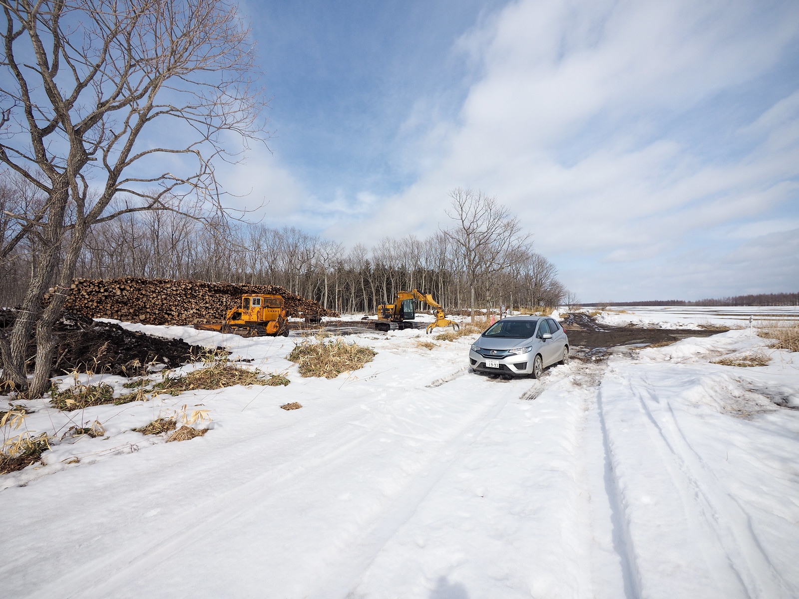
The previous night, Hiro and I had stayed at the rather dilapidated Mt. Musa Sokuseiso Hut. We were back at the car in the morning by 11am, and made the 45 minute drive to the end of the snow-cleared section of road to start skiing towards Nishibetsu Hut at around 1pm. Because it was late in the season, we were able to drive all the way to the start of the forestry road (here), which cut off about 1km of skiing.

We parked up and got on our way.

Mt. Nishibetsu Hut ski touring (Eastern Hokkaido, Japan)

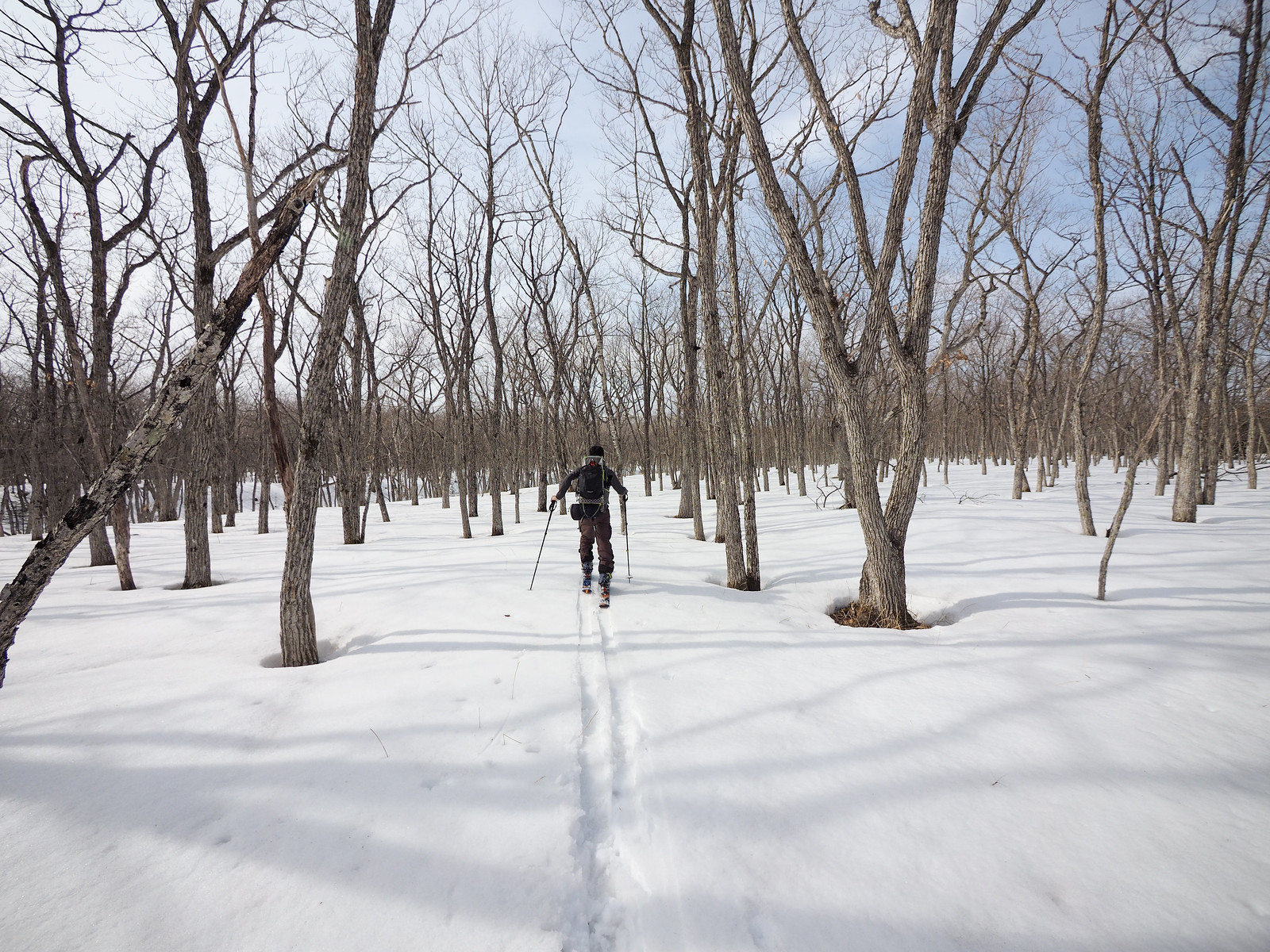
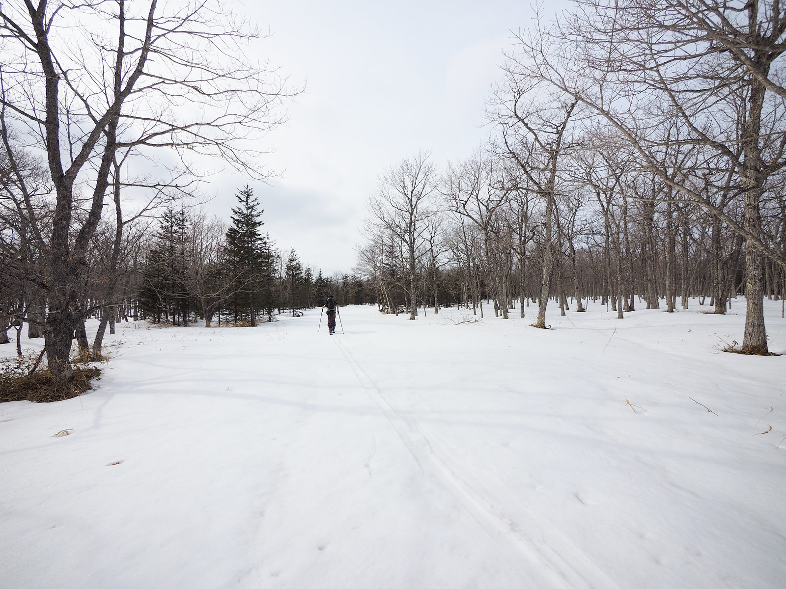
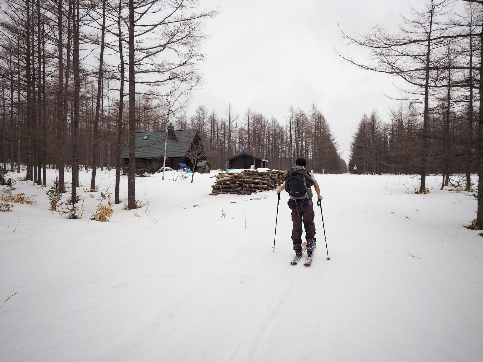
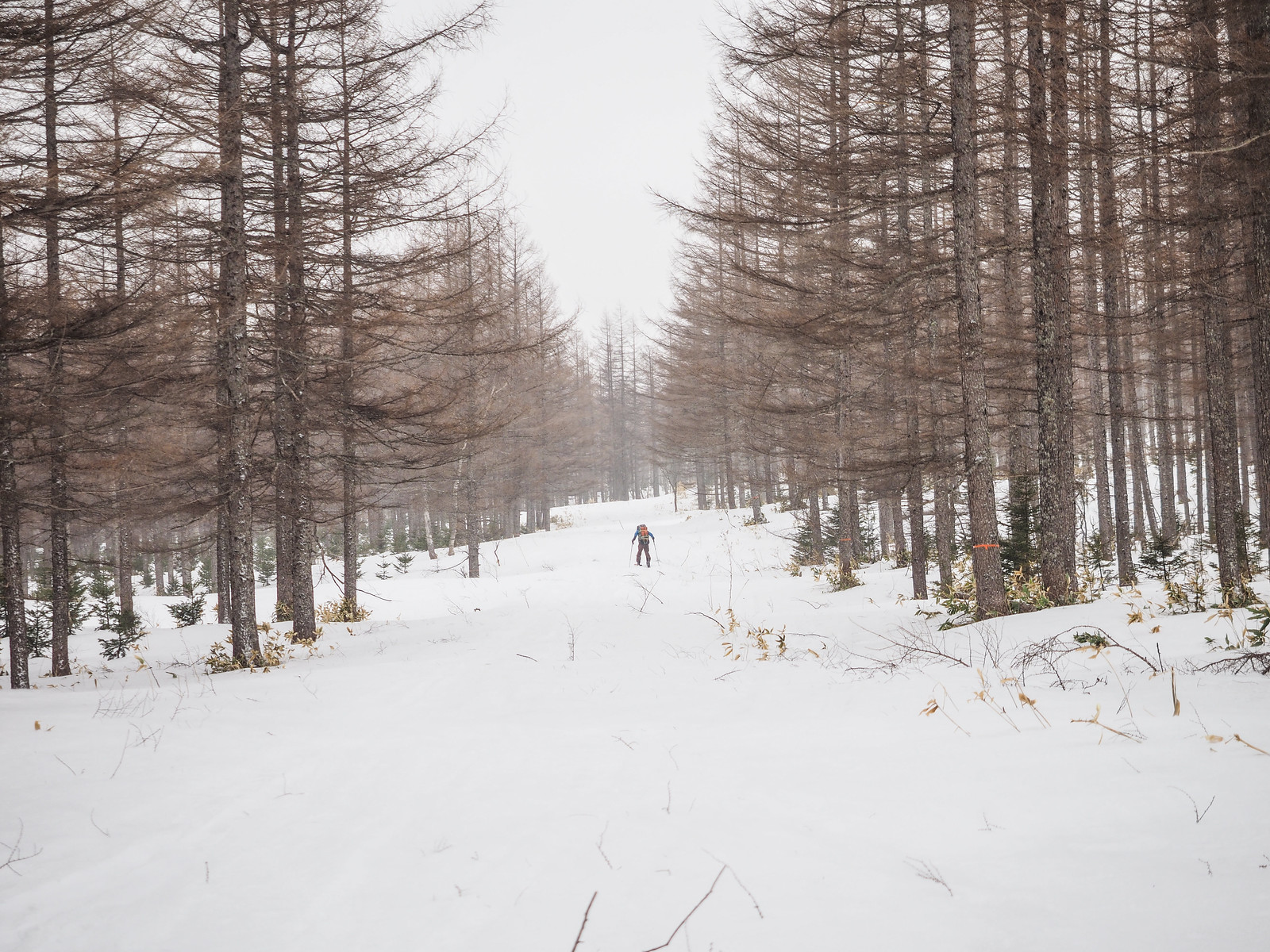
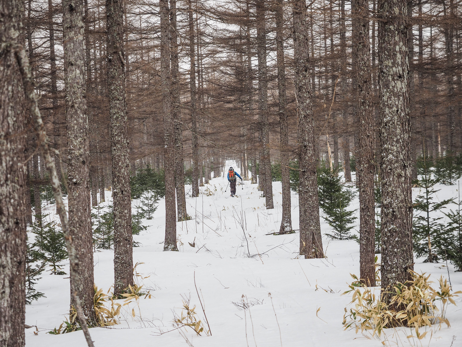
I’d seen mentions of the forestry road approaching the hut being hopelessly boring, but Hiro and I had a good pace, and the kilometers went past fast enough.

We did have it pretty easy though. The snow had a decently hard crust on it, and we were very rarely breaking trail.

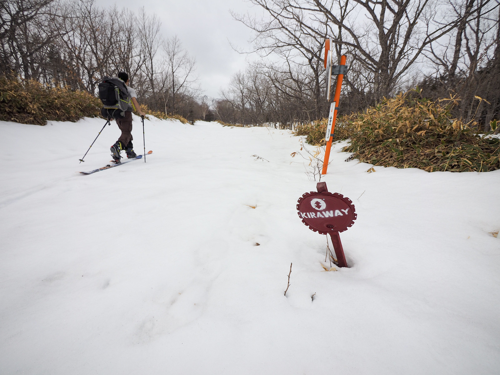
Most of the way was following the Kiraway – a 71km long walk trail from Nakashibetsu to Teshikaga Town. The trail is popular in summer with hikers.

Mt. Nishibetsu Hut ski touring (Eastern Hokkaido, Japan)

After just under two hours of skiing, the rumored Nishibetsu Hut appeared in a clearing in the trees. It was everything it was made out to be. Even though we knew it would be unlocked, it felt amazing that it actually was. It felt like we were stepping into something that should not just be open to the public.

Mt. Nishibetsu Hut ski touring (Eastern Hokkaido, Japan)

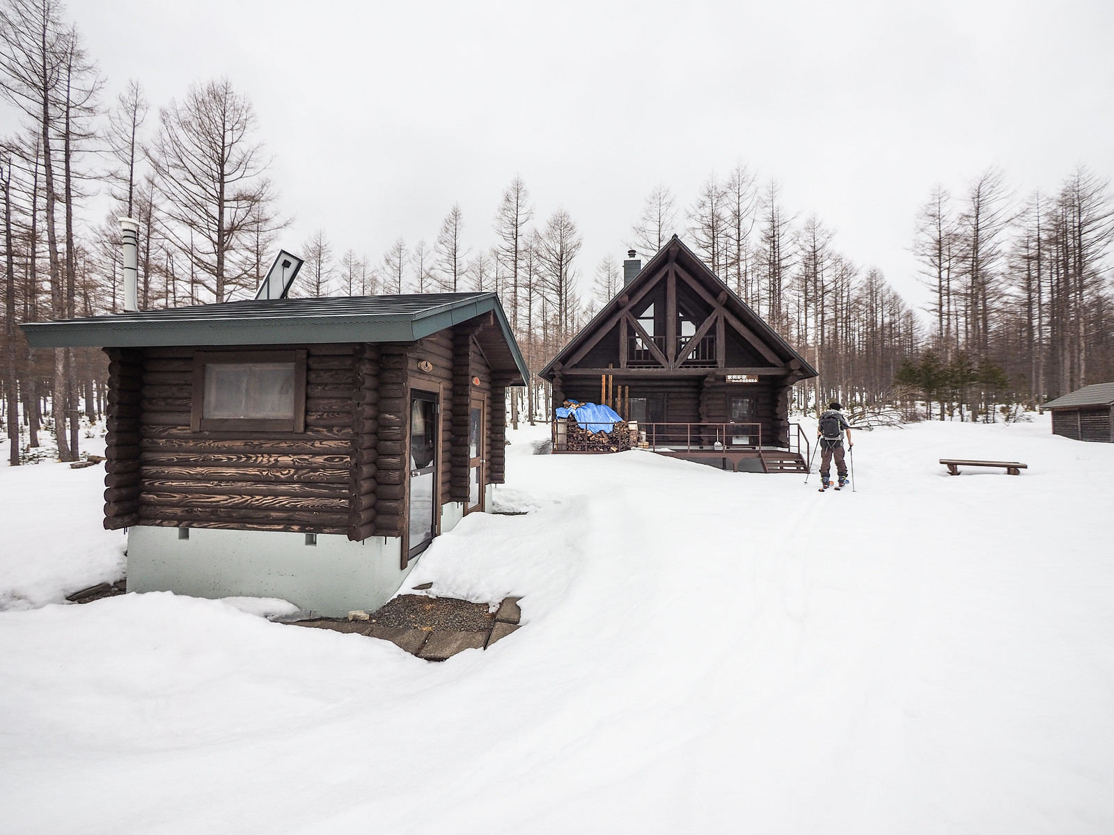
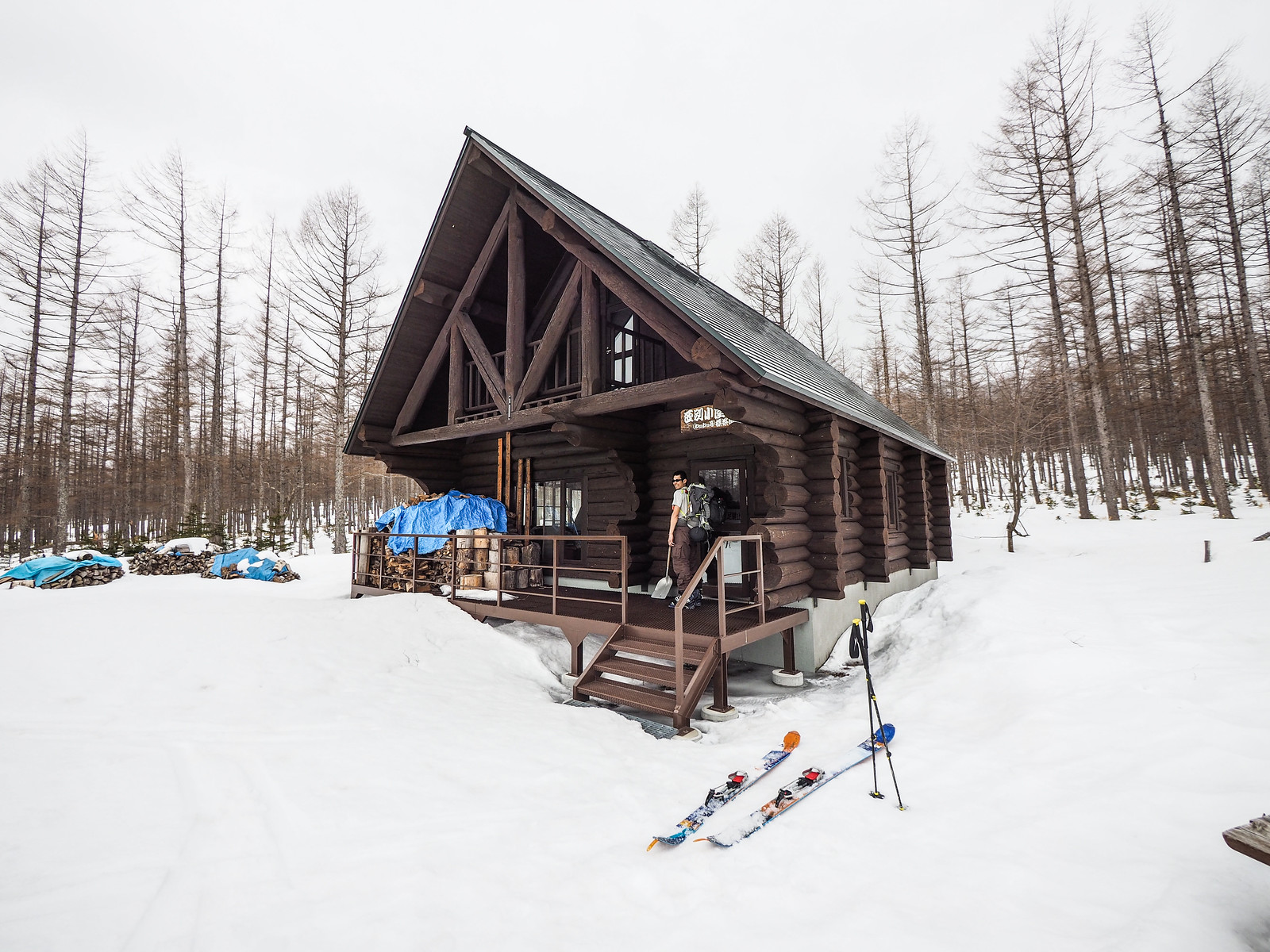
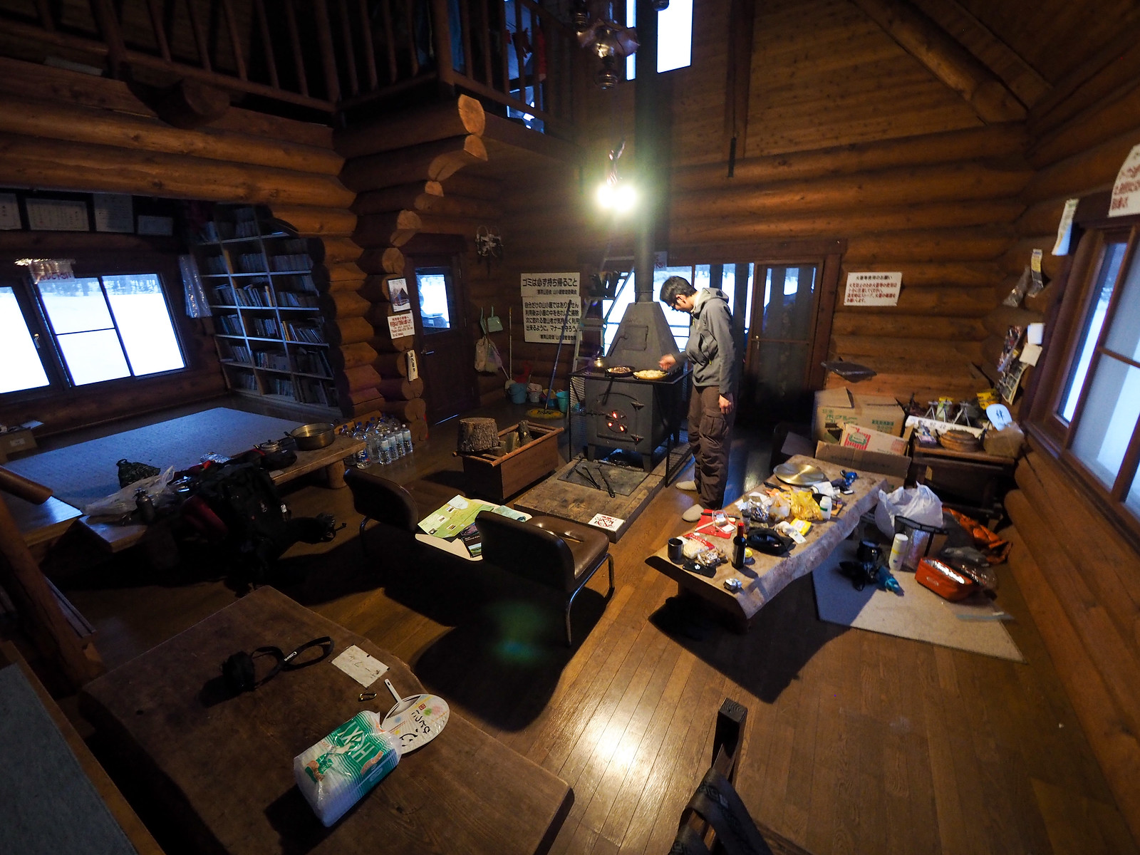
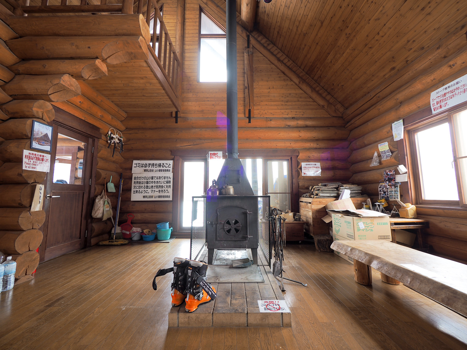
The hut has a library. It has a full suite of kitchen utensils and pots and pans. And bedding. A glorious stove. Double-glazed windows. A balcony on the second floor.

As far as Hokkaido mountain huts go, this was heaven.

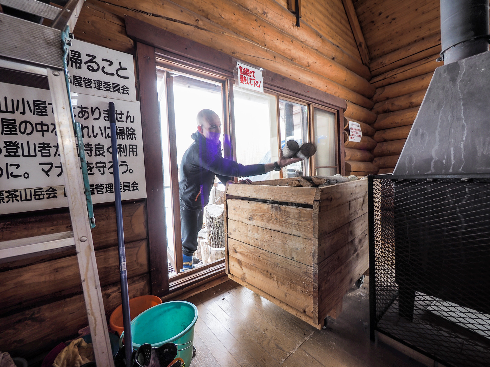
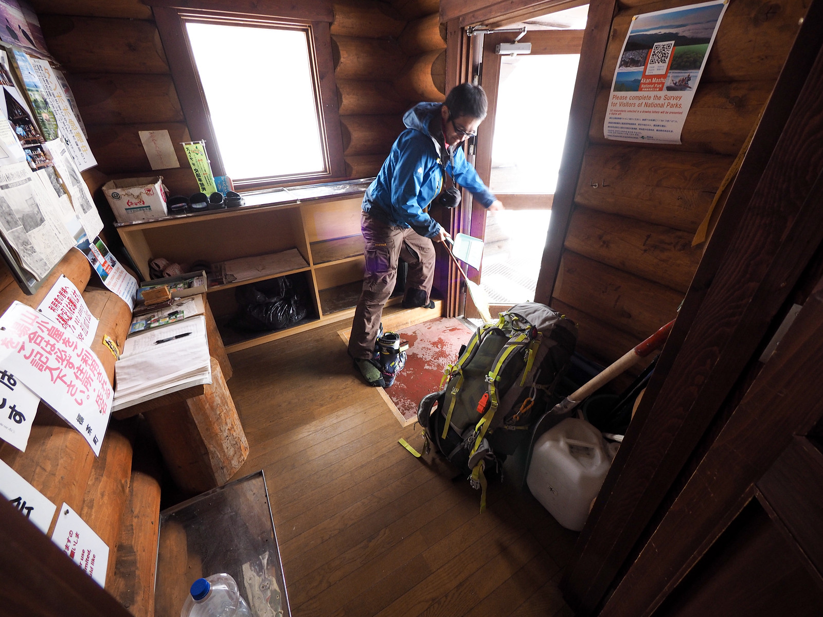
It seemed that the hut had not been used or cleaned since late autumn, and we spent an hour or so cleaning out the wood stove, and sweeping up the dead ladybugs on the floors.

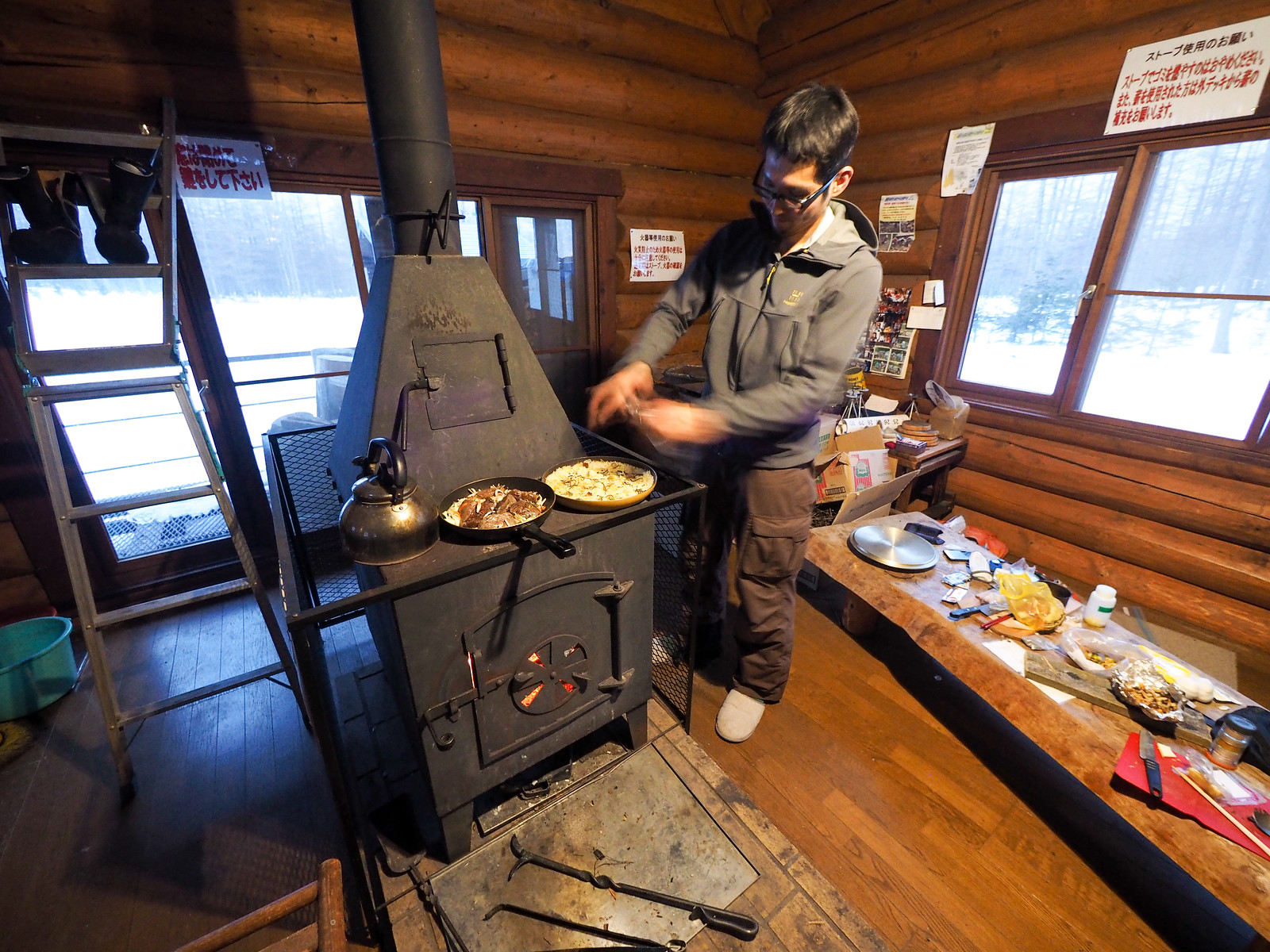
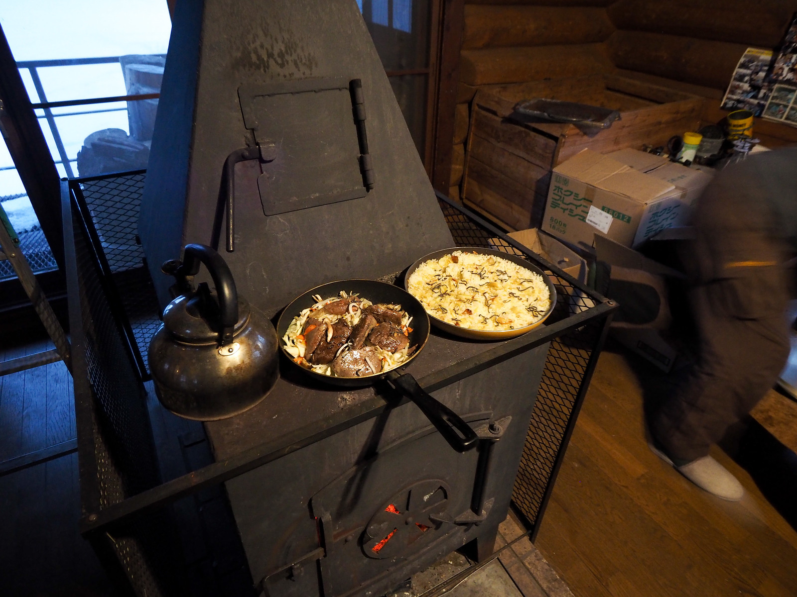
After that, it was slow-food time. On the menu was some more of Hiro’s wild Hokkaido venison he’d received from a friend, and Hiro’s current hut-food obsession – paella. The wood stove worked a treat for this kind of slow food.

Mt. Nishibetsu Hut ski touring (Eastern Hokkaido, Japan)

After a good night’s sleep, we woke to a howling wind outside. We weren’t too perturbed about the prospect of not being able to summit Mt. Nishibetsu though. Yesterday the clear weather gave us a good look at the ridge on Mt. Nishibetsu that we’d be climbing up, and there really didn’t seem to be much snow up there. It was late spring in eastern Hokkaido, after all – this area gets much less snow than the northern and western parts of Hokkaido. This plus the icy conditions yesterday made it an easy decision to just take it easy and have a restful morning at the hut.

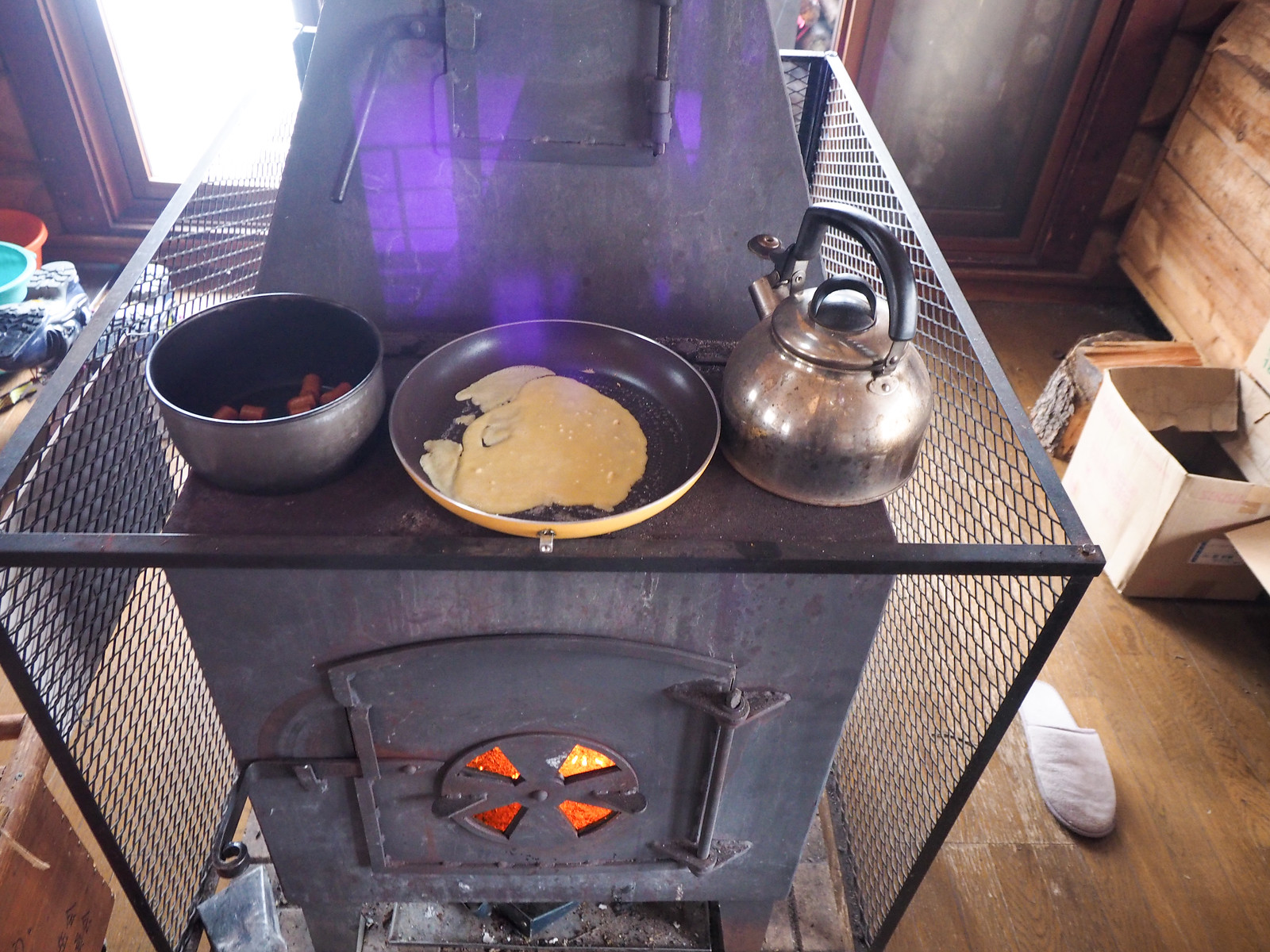
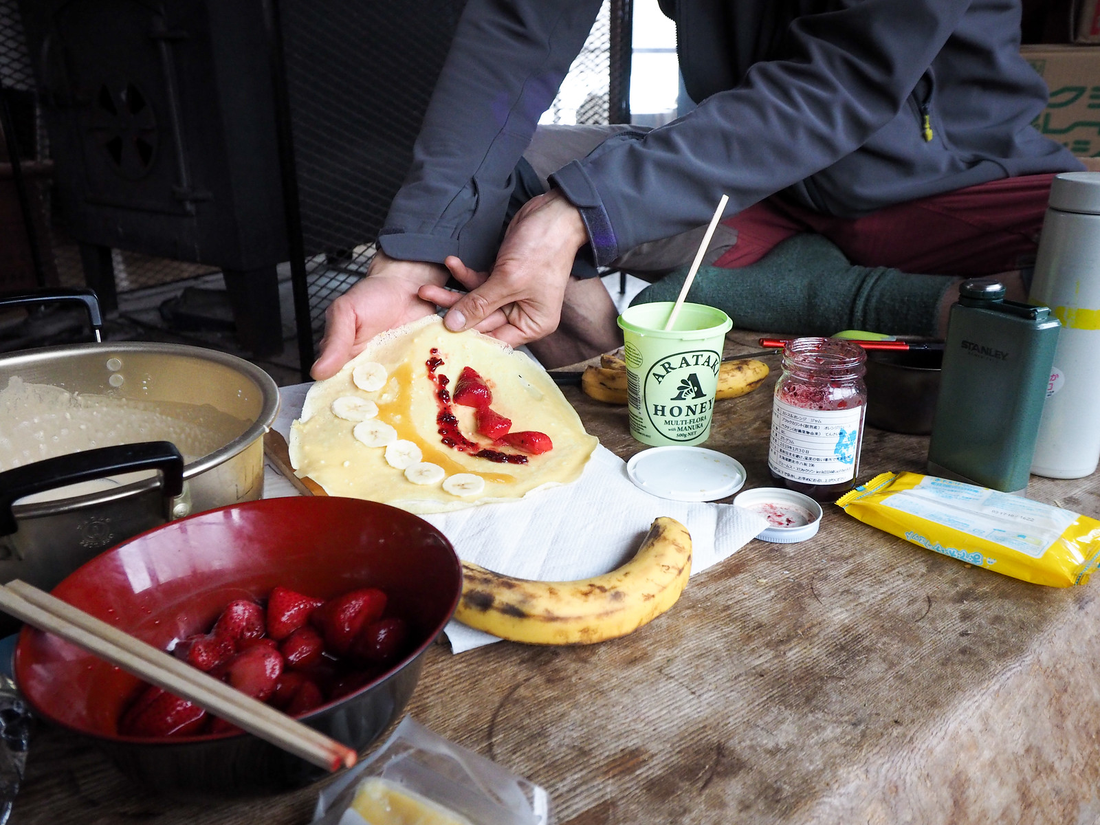
My contribution to the hut gourmet was crepes for breakfast, also cooked on the wood stove.

Mt. Nishibetsu Hut ski touring (Eastern Hokkaido, Japan)

After breakfast we did our leaving-the-hut chores: replenishing the inside wood-stash with wood from on the veranda, sweeping down surfaces, and giving the hut one more clean up.

Mt. Nishibetsu Hut ski touring (Eastern Hokkaido, Japan)

Rather reluctantly we bade our farewells to the hut, donned our skis, and started back to the car. We had a four-hour drive ahead of us to get to our next destination for this eastern-Hokkaido ski tour trip – the Shikaribetsu Gorge wild onsen area for some ski access wild onsen!

We took a bit of a shortcut on the way back to the car, hurtling down between rows of trees to cut off the corner of the two forestry roads to the hut.

When we were just about to the car, Hiro stopped ahead and pointed out some animal prints in the snow.

These were from a Hokkaido brown bear – probably only a few days earlier. It was a sobering thought that the bears around here were now awake, and we’d been sharing the woods with them on the ski to the hut and back!

Mt. Nishibetsu Hut ski touring (Eastern Hokkaido, Japan)
Bear prints tracks in the snow near Nishibetsu Hut in Eastern Hokkaido, Japan
Image by Hiro Miura

We made our quick getaway, and started the journey west.

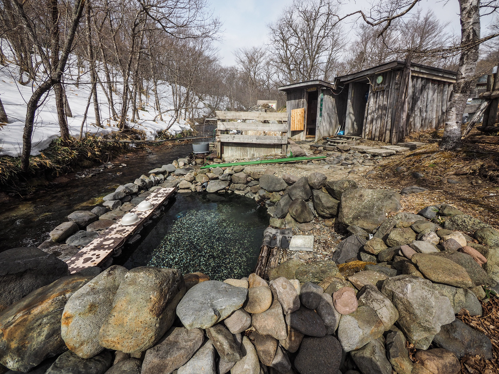
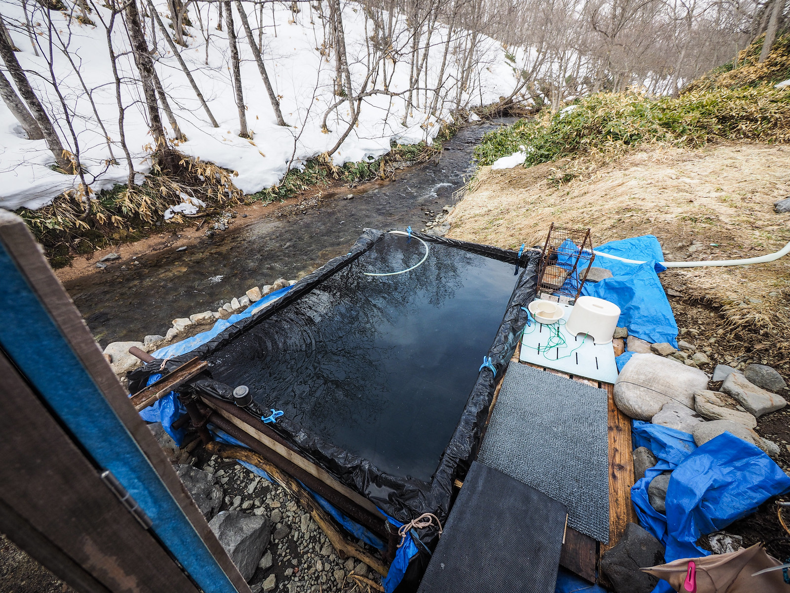
We did have a quick hot spring break beforehand though, at the free outdoor onsen Karamatsu-no-yu (location) near Yourouushi Onsen. Eastern Hokkaido is pure magic.

Mt. Nishibetsu Hut ski touring (Eastern Hokkaido, Japan)

Comments | Queries | Reports

Done this route to Nishibetsu-dake, or others nearby? Thinking of doing it? Please post any feedback, reports, or queries here. Thanks!

Leave a Reply

Your email address will not be published. Required fields are marked *

This site uses Akismet to reduce spam. Learn how your comment data is processed.

See More Like this

Printable Nishibetsu-dake Topomap

Download may take some time

Hokkaido Wilds Foundation

We’ve got affiliate links on HokkaidoWilds.org to help fund the Hokkaido Wilds foundation.

The Foundation gets a small commission on sales from affiliate links, but we only link to stuff we think is worth checking out for people keen on the outdoors in Hokkaido and Japan.

The Hokkaido Wilds Foundation is a fund where 100% of funds are donated to Hokkaido volunteer groups involved in sustainable, safe, and responsible access to the Hokkaido outdoors.

Learn more here

ADVANCED FILTERS

Filter by location

About Filters

REGION: The general mountain/geographical region the route is in.

BEST MONTH(S): Time of year a route is suited to visiting. Some pop all season, some are more limited.

DIFFICULTY: How strenuous a route is, and how technical it is. Full details here.

FREERIDE/SKITOUR: Very subjective, but is a route more-of-a-walk-than-a-ski or the other way around? Some routes are all about the screaming downhill (freeride), some are more about the hunt for a peak or nice forest (ski-tour). Some are in between. 

MAIN ASPECT: Which cardinal direction the primary consequential slope is facing, that you might encounter on the route. More details here.

ROUTE TAGS: An eclectic picking of other categories that routes might belong to.

SEARCH BY LOCATION: You can find routes near your current location – just click on the crosshairs (). You may need to give permission to HokkaidoWilds.org to know your GPS location (don’t worry, we won’t track you). Or, type in a destination, such as Niseko or Sapporo or Asahikawa etc.

Please let us know how we can make it easier to narrow down your search. Contact Rob at rob@hokkaidowilds.org with your suggestions.

Nishibetsu-dake and Nishibetsu Hut Difficulty Rating

Category

Grade

Points

Strenuousness

Vertical Gain

B

35

Time ascending

B

6

Technicality

Altitude

C

3

Hazards

C

6

Navigation

C

6

Totals

56/100

GRADES range from A (very difficult) to D (easy). Hazards include exposure to avalanche and fall risk. More details here. Rating rubric adapted from Hokkaido Yukiyama Guidebook 北海道雪山ガイド.