Yururi Island

ユルリ島 | Uriri-moshiri

Posted on Jun 11, 2025
0

Posted on Jun 11, 2025

0 0

21km

Distance

1 day(s)

Time

4/5

Remoteness

3/5

Water clarity

7/10

Difficulty

Jun-Aug

Best season

CAUTION: Yururi and Moyururi Islands are Hokkaido-designated Natural Monuments, and are National Wildlife Sanctuaries. It is prohibited for the general public to land on the islands, even if arriving by sea kayak. As such, this is a very committing circumnavigation, with no landing permitted throughout the duration.

Yururi Island ユルリ島 is an uninhabited island in the far east of Hokkaido, near Nemuro 根室. Only permitted professional guides or researchers are allowed on the island. As such, it's a wild place, inhabited only by wild horses, spotted seals, sea otters, and sea birds. For the committed sea kayaker, this island, as well as the nearby Moyururi Island モユルリ島 can be an inspiring day out on the water, replete with the heaving swells of the north Pacific Ocean. The island protrudes abruptly from the ocean, rimmed by cliffs. The dead-flat plateau above the cliffs adds to Yururi Island's mystery. There's a beautiful reverence captured in a website dedicated to the place.

We visited this route on Aug 20, 2024

Paddlers: Rob, Haidee, Timbah, Ben

Route Map

Need to know details

Location

Yururi Island sits 4km off the Pacific Ocean coast about 20km south of Nemuro Peninsula in far eastern Hokkaido.

Put-in Location: Google Maps

The put-in is at the long sandy beach at Konbumori 昆布盛. The beach is protected somewhat by lines of concrete tetra block wave-breaks. As noted in the transport notes below, you can drive onto the beach, but it’s best to park off the beach just down the road.

Take-out Location: Google Maps

The take-out is the same as the put-in.

General notes

The degree to which Yururi Island has become Atsushi Okada‘s muse is quite inspiring. On his website dedicated to the island, the artist paints the island in such mysterious colors that it has become somewhat of an underground larger-than-life presence in Hokkaido. I say underground because I’m confident most of the Hokkaido population doesn’t even know the island exists. It is revered by one artist in particular but appears to be entirely forgotten about by everyone else.

On the water in gloriously clear summer weather, however, the island presents itself as a pragmatic landform. It has its curiosities, least of all that it juts out of the ocean as if cut from a cookie-cutter. High cliffs rim the island, but the island itself is completely flat.

The stand-out curiosity is the horses. The island was abandoned by the last human inhabitants in 1971, and they left their horses there. Since then, Yururi Island’s horses have had a troubled existence, but they still remain till this day. Read more about Yururi Island’s horses here. If you’re lucky, you’ll see the horses watching you from high above the cliffs as you paddle by.

The island itself is designated as a Natural Monument of Hokkaido 北海道指定の天然記念物, so only approved personnel are allowed to land on the island (namely, government officials, researchers, and other permitted people). This means that sea kayakers who want to circumnavigate the island need to commit to a long day on the water without the possibility of landing, except in a genuine emergency. Even then, you’d likely get a grilling.

Sea states vary around the island. The island itself provides shelter from the punishing Pacific Ocean swells, so you can expect a relatively protected crossing, as well as leeward paddling on the island’s western shoreline. It seems that most of the wildlife also likes the sheltered leeward waters of the western shoreline – we saw spotted seals, sea otters, and sea birds. A full circumnavigation will require exposure to the open Pacific Ocean, so this should not be attempted lightly.

Route description

From the put-in at the protected beach in Konbumori, set a course due east for Yururi Island. The Yururi Strait ユルリ海峡 has a tidal current that changes direction and maxes out at 1.3kt, but it’s manageable. In about 45 minutes, you’ll be in the protected shelter of the western side of Yururi Island. We found the most wildlife on this side of the island. Expect curious seals, wary sea otters, and plenty of birdlife. If you’re looking for the endangered etopirika エトピリカ tufted puffin, we saw one on the much more exposed eastern side of the island.

If conditions allow it, it’s worth circumnavigating both islands. The eastern side will be much more lively than the west. Expect 2m heaving Pacific Ocean swells even on a calm forecast day. Best to keep your distance from the shoreline on the eastern side of the island, as isolated shoals with large breaking waves can creep up on you.

On our return to the mainland at around 4pm, we happened to coincide with what appeared to be the daily exodus of deep-sea fishing vessels from Hanasaki Port on the Nemuro Peninsula, heading south. We had to wait about 15 minutes to catch a space to paddle through the procession. In those 15 minutes, we were drifted by the Yururi Strait tidal current about 200m northwards.

The landing at the sandy Konbumori beach ought to be straight forward. There are lines of concrete tetra blocks forming wave breaks just off the beach.

Route Timing
Trip time: 6hrs 0min

For a full circumnavigation of both Moyururi and Yururi Islands, we recommend allowing a solid six hours.

Transport

Public transport:

If you’ve got a folding kayak, it would be possible to catch an express bus or JR train from Sapporo to Kushiro, and then a local train to Konbumori 昆布盛 JR train station on the Nemuro Line 根室線. It would be an all-day affair. Catching a 6:48am train from Sapporo station would get you to Konbumori station (one transfer in Kushiro) at 2pm. From Konbumori JR train station, it would be a 950m (15min) walk to the put-in on the beach at Konbumori. It’s a quiet, somewhat lonely, but very friendly community there at the put-in beach, so no one would bat an eyelid if you chose to camp on the beach overnight (local trains on the Nemuro line can be few and far between).

By car: 

The put-in at Konbumori 昆布盛 is a six-hour drive east of Sapporo City. It’s about a 25-minute drive south of Nemuro City 根室市. It’s possible to drive onto the beach at Konbumori, but make sure to park in such a way that you don’t block access to the beach by local konbu kelp harvesters. Ideally, drive onto the beach for unloading/loading boats and gear, and then park your vehicle about 150m south down the road. There’s a wide grassy verge where you can park your car without blocking traffic.

Physical maps

ELECTRONIC CHARTS
Japanese-language ENCs are available on the Japanese-language new pec smart smartphone app (Android | iPhone). 960yen per month for a subscription.

PRINTED CHARTS

The S-Guide for Akkeshi (DH810W-06) includes Yururi Island in 1:60,000 scale, and is available as PDF download (buy online here). The scale is spotty though, with only the main fishing ports included in small scale. The printed JHA/Japan Coast Guard 1:100,000 nautical chart for this area is Kiritappu Ko to Habomai Gyoko 霧多布港至歯舞漁港 (W25 – order online). A printed 1:50,000 scale bathymetric chart (Hanasaki 花咲; 6377-3) is available here.

Official Topo Map: Ochiishi (落石) – map no. NK-55-26-5-4

NOTE: The official 1/25000 topo map(s) above can be purchased for 350yen from Kinokuniya bookstore next to Sapporo Station or online (in Japanese).

route safety

It’s almost 4km from the mainland to Yururi Island. While the western side of the island will usually be in the lee of swells and wind, paddlers are in principle not allowed to land on the island. This is all to say that this is a very committing paddle, with no option for landing for the duration. Paddling on the eastern side of the islands will expose paddlers to the full brunt of the Pacific Ocean swells. Furthermore, landing on the eastern side of the islands is impossible, even if a paddler wanted to – think explosive boomers slamming into high, rocky cliffs. Parties should be proficient in high-stakes group- and self-rescue procedures.

Weather forecast

Windy.com weather forecast for Yururi Island

Tide
Tide information for Ochiishi

CampSites

None
Onsen nearby

The Nemuro area is a proper desert when it comes to onsen. There are none. If you’re headed back to Nemuro City, about a 25-minute drive north from the put-in, the Minato-yu sento (public bath) 港湯 (location, 500yen) is the pick of the bunch in that direction for a soak. If you search on Google Maps for sento 銭湯, you’ll find a few other hole-in-the-wall public baths in Nemuro. If you’re headed back towards Sapporo, then it’s more than worth it to hold out for the Kiritappu Onsen Yuyu 霧多布温泉ゆうゆ (location, 500yen). It’s about a 1 hour drive west from the put-in at Konbumori. The onsen has outdoor baths, and sauna with plunge pool. There’s an attached restaurant at the onsen with a large menu. Just down the road is the Cape Kiritappu Campground きりたっぷ岬キャンプ場 (location). The campground is free for tents and car-camping, and they have bungalows for 1,760yen a night. It’s a popular campground, so best to book ahead (TEL: 0153-62-3726) if you plan on using a bungalow.

Extra Resources

The Yururi Island website is a gorgeous treasure trove of artistic expression of the island’s history, story, and geography. We don’t know of any sea-kayaking specific resources for Yururi Island (English or Japanese).

Guide Options

We don’t know of anyone offering sea kayak tours to Yururi Island. Nemuro Nature Center may still offer boat tours – details here.

Support us

Like this content? Buy the HokkaidoWilds.org team a coffee. 50% of tips go to the Hokkaido Wilds Foundation.

Show Full Route Notes Close Route Notes

Route Trip Notes

We’d just finished a six-day circumnavigation of the Shiretoko Peninsula. But we still had four days left before we all needed to be back in Sapporo, and the sea kayaking momentum was still coursing through our veins. Eastern Hokkaido had a number of spots that were still well on my radar for sea kayaking day trips, least of all Yururi Island.

Yururi Island had held my attention for a few years, ever since I had seen videos of the place by the enigmatic artist Atsushi Okada. The paddle promised to be a tough one, with no landings allowed in principle during the 20km circumnavigation. We weren’t even sure we’d be able to do a full circumnavigation – the  thick Pacific swells were likely to be hefty on the exposed eastern side of the islands.

We discussed our options in the parking lot of the Rausu campground, and in the end decided we may as well just head west towards Nemuro, and see how the weather shaped up.

In the end, after a couple of days paddling in other locations on our way west towards Nemuro, we finally found our window. We’d slept in a parking lot in Nemuro City the night before, and were now ready to head to Konbumori, to the beach put-in for the paddle to Yuriri Island.

The put-in wasn’t a certainty, however. It was simply a best-guess based on Google Satellite imagery.  Indeed, we’d not heard of anyone sea kayaking around Yururi Island, and couldn’t find any information about it online. The put-in turned out to be just the ticket though. Good access to a sheltered beach, and off-street parking nearby. From the beach, the island looked far away, but at only just under 4km as the crow flies, we were feeling confident. The islands were large enough to shelter us from the Pacific swell, and there was hardly any wind.

As we transported our gear to the shoreline, curious locals rubber-necked as they drove past. No one stopped to say hello, but it was generally friendly vibes.

Pushing off from the beach at Konbumori, we were all quietly hopeful for a full circumnavigation, but at the same time expectations low. We’d know the feasibility of going the whole way round once we got a look at the exposed eastern coast section of the islands.

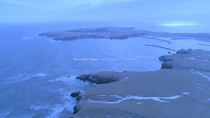
Yururi Island stuck a beautifully aesthetic look in the distance. Perfectly flat on top, rimmed by cliffs, topped with manicured-looking grass, and a lone lighthouse.

As we paddled, it slowly got larger.

Instead of going straight to Yururi Island, we opted to go first to the sheltered western side of Moyururi Island, the smaller of the two islands. If the sea state on the east of the islands was not suitable, we’d then just meander south along the eastern sides of the two islands before heading back to the mainland. If, however, things looked good for a circumnavigation, we could commit to the loop around the smaller island first, before considering attempting Yururi as well.

Along the way, we passed Kamoshima カモ島 (literally Duck Island). Through her binoculars, Haidee could spot an island completely dominated by shags.

When we arrived in the sheltered northeast-facing bay of Moyururi Island, we were realised we were not alone.

Like stealthy spies, a couple of seals tailed us, keeping watch on the intruders. Less interested was a lone sea otter, bobbing on the surface of the sea, nibbling on a morsel it had deftly balancing on its stomach.

Conditions were looking good for a loop around Moyururi Island, so we carried on.

As predicted, the eastern side of the island, exposed to the great expanse of the Pacific Ocean, was livelier. Big swells, hitherto uninterrupted, careened into the rugged cliffs and rocks, sending up plumes of sea spray. The water’s surface was foamy and agitated.

We kept our distance from the islands, padding about 300m off shore.

The conditions were perfectly manageable this far off the shoreline, so we decided to go for the full circumnavigation. 

Once we were on the east side of Yururi Island, we were once again paddling along the distinctive flat-top island feature, albeit with a much more dynamic, in accessible shoreline.

At about half way along the island, I heard an excited exclamation from Haidee.

“It’s an etopirika!” she yelled. 

Haidee and Timbah saw it – an endangered tufted puffin (details here). Haidee, a keen birder, had never seen an etopirika tufted puffin before, so this was a special moment.

Further on in the distance, we could now see the tall obelisks of Nanatsu-iwa 七つ岩 (literally Seven Rocks), marking the southeastern corner of Yururi Island.

The heaving swell was bunching up at this congested point on the seabed, pushing us up and down, at times completely visually separating us from each other. We took a very wide berth of the rocks to seek shelter on the southern side of the island.

It was when we rounded the corner of the island that we first saw them. The majestic, land-lubbing mammalian inhabitants of Yururi Island.

The world-famous in far-eastern Hokkaido, Yururi wild horses.

These horses has somewhat of a folklore-ish presence. The last human inhabitants of the island left for good in the 1970’s. But they left their horses there. Since then, the horses (with very sporadic intervention by humans) have maintained a colony on the island.

See some footage of the beautiful beasts below, by Atsushi Okada.

We could see two horses up there on the plateau-like tops. One was mostly disinterested in us. The other watched us with detachment as we paddled by.

As we paddled around the southwestern corner of Yururi Island, we were now on chill-out mode. The swells were gone, and the sun was warm.

We’d now been out for about four hours.

And then, otters.

We daredn’t get too close, but we hung around for a bit, watching from about 50m away.

For the most part, the otters ignored us. But we kept moving.

We carried on along the sheltered western coastline of Yururi Island. Among the attractions was an archway through a small point. Given the right timing, it was a thrilling shortcut.

And there were more birds.

By the time we got back to where we’d arrived at the islands, it was getting relatively late in the day. This was no problem at all, apart from the fact that we were now coinciding our return to the mainland with the great daily exodus of the fishing vessels out of Hanasaki Port just north of the put-in.

The procession of vessels was long enough that we waited about 15 minutes for a gap.

In this 15 minutes, the tidal current in the Yururi Strait had drifted us about 200m northeast.

Once on our way again, the sun was low in the sky, staining everything orange.

Our return to the beach at Kombumori was perfectly timed to coincide with feeding time for the local sand flies. They were ravenous. Swarms of the little devils homed in on exposed flesh. Their ferocity was only matched by our fervour to get the boats and gear packed into the van, and for us to leave.

This would be our final paddling trip for this summer vacation two-week paddling journey. So, we decided to make the 1 hour drive west to Hamanaka Onsen, and the free Kiritappu campground for the night.

It was a well-earned end to a long, rewarding day on the water.

As with each ski touring, cycle touring, hiking, and canoe touring route guide published on hokkaidowilds.org, should you choose to follow the information on this page, do so at your own risk. Paddle sports can be very dangerous and physically demanding – wear a personal flotation device, get paddlesports instruction, and do not exceed your paddling ability. Prior to setting out check current local water levels, weather, conditions, and land/road/track closures. While traveling, obey all public and private land use restrictions and rules, carry proper safety and navigational equipment, and of course, follow leave-no-trace procedures. The information found herein is simply a planning resource to be used as a point of inspiration in conjunction with your own due-diligence. In spite of the fact that this information, associated GPS track (GPX, KML and maps), and all information was prepared under diligent research by the specified contributor and/or contributors, the accuracy of such and judgement of the author is not guaranteed. hokkaidowilds.org, its partners, associates, and contributors are in no way liable for personal injury, damage to personal property, or any other such situation that might happen to individuals following the information contained in this post.

Comments | Queries | Reports

Done this route to Yururi Island, or other waterways nearby? Thinking of doing it? Please post any feedback, reports, or queries here. Thanks!

Leave a Reply

Your email address will not be published. Required fields are marked *

This site uses Akismet to reduce spam. Learn how your comment data is processed.

See More Like this