Trip Report

Shiretoko Loop Tour Day 2: Abashiri to Shari

Posted on Aug 2, 2012
2

Posted on Aug 2, 2012

With the rain of yesterday gone, we were now keen to get on the road. The bear hunt began. Abashiri is a nice enough town. It has that feel of being sort of outpost-ish. Like it is right on the outskirts of Hokkaido. It is a quiet town, but apparently is more popular in winter, where you can see sea-ice floes. Haidee and I made a note to come back in winter.

Last updated Oct 8, 2018

With the rain of yesterday gone, we were now keen to get on the road. The bear hunt began.

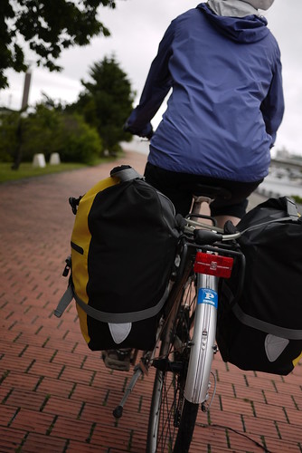
Cycling out of Abashiri along the Abashiri River (Abashiri, Hokkaido, Japan)

Abashiri is a nice enough town. It has that feel of being sort of outpost-ish. Like it is right on the outskirts of Hokkaido. It is a quiet town, but apparently is more popular in winter, where you can see sea-ice floes. Haidee and I made a note to come back in winter.

It is probably worth noting also that there is a fairly well stocked cycle store in Abashiri on Route 244 through the city (location here: goo.gl/maps/0qUJX). We had to pop in to get an extra headset spacer.

A well-stocked bike store (Koniji Cycle Shop) in Abashiri, Hokkaido, Japan

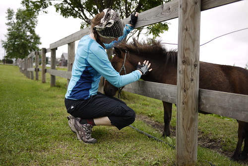
Not far out of Abashiri, along the coast, we stopped in at the White Swan Center on Lake Tofutsu. The distinct lack of white swans (there are more in winter) led us to the friendly miniature horses nearby.

Miniature horses at Lake Tofutsuko (Hokkaido, Japan)

Miniature horses (?) near the white swan reserve (Kitahama, Hokkaido, Japan) Miniature horses (?) near the white swan reserve (Kitahama, Hokkaido, Japan)

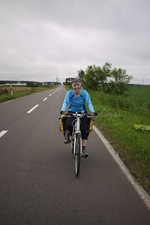
Where ever possible, we tried to get off the main roads, and onto adjacent farming roads. The area is criss-crossed with them, so a good map is really handy; it is amazing how much birdsong gets drowned out by automobile noise.

Cycling on quiet back roads near Shari (Hokkaido, Japan) Cycling on quiet back roads near Shari (Hokkaido, Japan)

Our destination for today was the town of Shari. The gateway to Shiretoko National Park. Or so they like to think. In any case, it was a nice enough town. It sort of reminded me of Taupo in New Zealand without the lake. Nice big houses and carefully manicured lawns and gardens.

The mouth of the Shari River in Shari (Hokkaido, Japan)

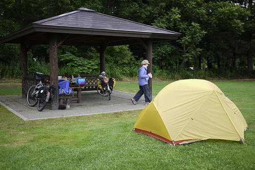
The Shari Campground was fantastic. It too was carefully manicured, with nice facilities. Even better, the caretaker let us stay for free; we were the only campers that night!

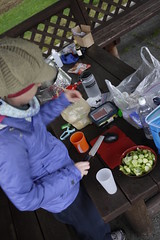
Making dinner at the Midori Kobo Shari Campground (みどり工房しゃりそよ風キャンプ場) in Shari (Hokkaido, Japan) Sapporo beer at the Midori Kobo Shari Campground (みどり工房しゃりそよ風キャンプ場) in Shari (Hokkaido, Japan)

Midori Kobo Shari Campground (みどり工房しゃりそよ風キャンプ場) in Shari (Hokkaido, Japan)

Route Map


View Larger Map – http://goo.gl/maps/Zt96h

Distance: 43.5km | Time on bikes: 3h 01m | Average speed: 14.4km/h | Bears: 0
Financials: Food: 5,209yen | Accommodation: 0yen | Onsen (hotspring): 0yen | Laundry: 0yen

Comments | Queries | Discussion

2 thoughts on “Shiretoko Loop Tour Day 2: Abashiri to Shari”

  1. We arrived in Abashiri late by train from Wakkanai, and stayed at a hotel. You can stock up on food and camping supplies at the supermarkets and hardware shops in Komabaminami, on the way out of town. There’s a Mont Bell outlet at Koshimizu, by the rest stop. Thanks for the route guide – we followed the quiet roads.

    As you say, Shari has a lovely grassy campsite, with shade, toilets, water and access to power. It was busy in August 2019, but there’s plenty of room.

  2. We’re re-tracing your trip with our two girls (1 and 4) and we’re in Shari now. Thank you for the incredibly helpful information.

Leave a Comment

Your email address will not be published. Required fields are marked *

This site uses Akismet to reduce spam. Learn how your comment data is processed.

See More Like this

Download may take some time

Hokkaido Wilds Foundation

We’ve got affiliate links on HokkaidoWilds.org to help fund the Hokkaido Wilds foundation.

The Foundation gets a small commission on sales from affiliate links, but we only link to stuff we think is worth checking out for people keen on the outdoors in Hokkaido and Japan.

The Hokkaido Wilds Foundation is a fund where 100% of funds are donated to Hokkaido volunteer groups involved in sustainable, safe, and responsible access to the Hokkaido outdoors.

Learn more here

ADVANCED FILTERS

Filter by location

About Filters

REGION: The general mountain/geographical region the route is in.

BEST MONTH(S): Time of year a route is suited to visiting. Some pop all season, some are more limited.

DIFFICULTY: How strenuous a route is, and how technical it is. Full details here.

FREERIDE/SKITOUR: Very subjective, but is a route more-of-a-walk-than-a-ski or the other way around? Some routes are all about the screaming downhill (freeride), some are more about the hunt for a peak or nice forest (ski-tour). Some are in between. 

MAIN ASPECT: Which cardinal direction the primary consequential slope is facing, that you might encounter on the route. More details here.

ROUTE TAGS: An eclectic picking of other categories that routes might belong to.

SEARCH BY LOCATION: You can find routes near your current location – just click on the crosshairs (). You may need to give permission to HokkaidoWilds.org to know your GPS location (don’t worry, we won’t track you). Or, type in a destination, such as Niseko or Sapporo or Asahikawa etc.

Please let us know how we can make it easier to narrow down your search. Contact Rob at rob@hokkaidowilds.org with your suggestions.

Shiretoko Loop Tour Day 2: Abashiri to Shari Difficulty Rating

Category

Grade

Points

Strenuousness

Vertical Gain

D

25

Time ascending

D

0

Technicality

Altitude

D

0

Hazards

D

Navigation

D

Totals

25/100

GRADES range from A (very difficult) to D (easy). Hazards include exposure to avalanche and fall risk. More details here. Rating rubric adapted from Hokkaido Yukiyama Guidebook 北海道雪山ガイド.