Trip Report

Shiretoko Loop Tour Day 3: Shari to Utoro

Posted on Aug 3, 2012
1

Posted on Aug 3, 2012

Route Guide

We managed to avoid the narrow bit of Route 334, but at the cost of some steep hills. Good for the soul. Like chicken soup, only less comforting. And despite the cold start in the morning, it was getting very hot later in the day. Perfect excuse to drop into a cafe (read: smokey old-style Japanese coffee bar) for some iced coffee and cake. The cake is ‘rare cheese cake’.

Last updated Oct 8, 2018

Route Guide

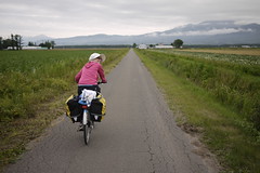
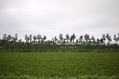
The day began today also on nice quiet farming roads. Fields of potatoes, mainly. With some daikon (large white Japanese radish).

Quiet farm roads near Shari (Hokkaido, Japan) Sparse wind-breaks near Shuen (Hokkaido, Japan)

Taking backroads to avoid the narrow Shiretoko Highway (Hokkaido, Japan)

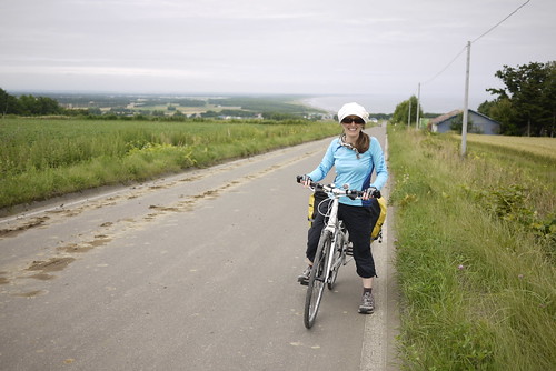
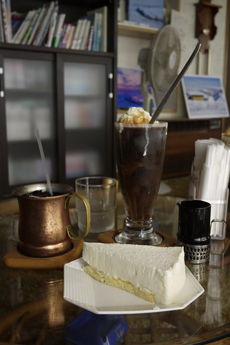
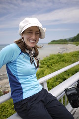
We did manage to avoid the narrow bit of Route 334, but at the cost of some steep hills. Good for the soul. Like chicken soup, only less comforting. And despite the cold start in the morning, it was getting very hot later in the day. Perfect excuse to drop into a cafe (read: smokey old-style Japanese coffee bar) for some iced coffee and cake. The cake is ‘rare cheese cake’.

Traditional Japanese 'kissaten' in Hinode (Hokkaido, Japan)

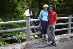
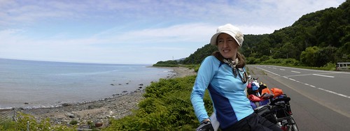
Quite unlike much of the Japanese coastline, the coast of Shiretoko Peninsula seems relatively untouched. Nice sweeping vistas and unrestrained waterfalls. It is worth noting that today was one of the few days on this trip we had blue skies.

Haidee on the Shiretoko Highway (Shiretoko, Hokkaido) One of many waterfalls to pose beside (Shiretoko, Hokkaido)

Haidee on the Shiretoko Highway (Shiretoko, Hokkaido)

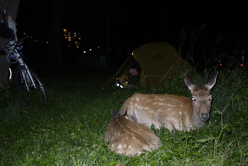
Our campsite for tonight was at the Shiretoko Campground in Utoro. It comes complete with wild deer who wander freely through the campground. We apparently set up our tent right next to where a family of deer bunk down for the night; even so, with all the warnings about storing food away from one’s tent during the night (to avoid encounters with bears), it was quite disconcerting to hear the dear pacing about outside at night.

Wild Hokkaido deer in the Shiretoko Noeijo (Shiretoko Campground) in Utoro (Hokkaido, Japan)

Route Map


View Larger Map

Distance: 40.1km | Time on bikes: 2h 56m | Average speed: 13.6km/h | Bears: 0
Financials: Food: 3,723yen | Accommodation: 800yen | Onsen (hotspring): 1500yen


Comments | Queries | Discussion

1 thought on “Shiretoko Loop Tour Day 3: Shari to Utoro”

  1. The cheesecake cafe was a welcome break from dodging traffic. There’s a few km of highway with no shoulder, unlike most of the Shiretoko Loop.
    At Utoro we styed at the hilltop camping ground. It was crowded and didn’t have enough toilets, but the sunset was fabulous.
    We set up the tent and biked to the Shiretoko Five Lakes. The walk around the lakes was delightful.

Leave a Comment

Your email address will not be published. Required fields are marked *

This site uses Akismet to reduce spam. Learn how your comment data is processed.

See More Like this

Download may take some time

Hokkaido Wilds Foundation

We’ve got affiliate links on HokkaidoWilds.org to help fund the Hokkaido Wilds foundation.

The Foundation gets a small commission on sales from affiliate links, but we only link to stuff we think is worth checking out for people keen on the outdoors in Hokkaido and Japan.

The Hokkaido Wilds Foundation is a fund where 100% of funds are donated to Hokkaido volunteer groups involved in sustainable, safe, and responsible access to the Hokkaido outdoors.

Learn more here

ADVANCED FILTERS

Filter by location

About Filters

REGION: The general mountain/geographical region the route is in.

BEST MONTH(S): Time of year a route is suited to visiting. Some pop all season, some are more limited.

DIFFICULTY: How strenuous a route is, and how technical it is. Full details here.

FREERIDE/SKITOUR: Very subjective, but is a route more-of-a-walk-than-a-ski or the other way around? Some routes are all about the screaming downhill (freeride), some are more about the hunt for a peak or nice forest (ski-tour). Some are in between. 

MAIN ASPECT: Which cardinal direction the primary consequential slope is facing, that you might encounter on the route. More details here.

ROUTE TAGS: An eclectic picking of other categories that routes might belong to.

SEARCH BY LOCATION: You can find routes near your current location – just click on the crosshairs (). You may need to give permission to HokkaidoWilds.org to know your GPS location (don’t worry, we won’t track you). Or, type in a destination, such as Niseko or Sapporo or Asahikawa etc.

Please let us know how we can make it easier to narrow down your search. Contact Rob at rob@hokkaidowilds.org with your suggestions.

Shiretoko Loop Tour Day 3: Shari to Utoro Difficulty Rating

Category

Grade

Points

Strenuousness

Vertical Gain

D

25

Time ascending

D

0

Technicality

Altitude

D

0

Hazards

D

Navigation

D

Totals

25/100

GRADES range from A (very difficult) to D (easy). Hazards include exposure to avalanche and fall risk. More details here. Rating rubric adapted from Hokkaido Yukiyama Guidebook 北海道雪山ガイド.