Posted on Jan 3, 2018
31 2
E
Posted on Jan 3, 2018
31 2
E
12km

Distance

5 hours

Time

800m

Ascent

910m

Highest point

5/10
Difficulty
Snow Icon | Hokkaido Wilds
Dec-Apr

Best season

Haruka-yama (春香山 - 910m) is somewhat of a popular hill with Sapporo locals. There is some great skiing on its upper slope behind the hut. That slope is the only decent skiing on the route, but it is good for a few laps. The hut, Ginreiso Hut (銀嶺荘), is owned by Tokai University and is officially designated as a staff and student retreat facility. However, the general public can stay with a prior booking (at least two days in advance), when the hutkeeper is present.

We visited this route on Jan 27, 2019

Last updated Apr 2, 2021

Route Map

Need to know details

Location

This route is about 1 hour’s drive from central Sapporo towards Otaru City. It is accessible from the JR Zenibako train station. The trailhead is here.

General notes

This route is suitable for either a day trip or overnight trip. While skinning up to the hut below the summit, you’ll probably encounter a couple of options for routes: either sticking to the forestry road most of the way up, or taking the summer trail route (see that route here). The GPS route on this page mainly sticks to the forestry road until the clearing at around 580m. Both routes have their pros and cons. The summer trail is more scenic/wooded, but the traverse sections can be tough going if you’re on snowshoes, and it is less traveled in winter. On the other hand, the forestry road can be quite hard-packed as it is also used by snow-mobiles, but navigation may be easier.

Hut
(CLOSED) Haruka-yama Ginreiso Hut (full details here)

CLOSED: As of April 2022, Ginreiso Hut is closed due to old age and disrepair, and cannot be used (see news article here). It is locked and not accessible by the public. This hut’s future is uncertain. We’ll keep this information here in hopes the hut might be reopened in the future. Ginreiso Hut is owned by Tokai University (Sapporo Campus). It can take up to 50 people, and can be used year round (booking is required two working days in advance). There is a hutkeeper at the hut year-round also (although there are times when he is not present). Call Tokai Univesity on 011-571-5111 (in Japanese) for details and to book.

Route details

There are a few route signs, all in Japanese. There are also some pieces of ribbon tied to trees, but these can be spaced far apart, and are not to be relied upon.

Route Timing
Up | 3hrs
Down | 2hrs

About 2.5 hours from trailhead to hut, then another 3o minutes to the summit of Haruka-yama. Bank on just under 2 hours from summit back to the trailhead.

Transport

Public transport:
  • By train an taxi: Arguably the most straight forward option for public transport is to get a local train to JR Zenibako Station (on the same JR line as Sapporo Station), and catch a taxi from there. It’s only about 2.8km from the station to the trailhead (route map here), so the taxi is cheap. Try telling the taxi driver that you want to go to the haruka-yama tozan-guchi(春香山登山口 – Mt. Haruka trailhead). It will be downhill on the return trip, so can be easily walked on the way down.
  • By train and bus: Catch a train to JR Zenibako train station, and catch the Zenibako/Katsuraoka-sen (銭函・桂岡線) bus from the JR Zenibako train station bus stop heading towards the Zenibako Jo-sui-jo bus stop (銭函浄水場). From the Zenibako Josui-jo bus stop it is a 1.3km walk to the trailhead. The timetable for this bus can be seen here: Timetable info. Return bus timetable here.
By car:

There is room for about 10 cars in two parking spots near the trailhead (here-ish). Don’t be tempted to park next to any snowmobile trailers or vans; the local snowmobile club rents their parking space from a local landowner, and this space is for club members only.

Physical maps
Official Topo Map: Zenibako (銭函) – map no. NK-54-14-14-1
Official Topo Map 2: Hariusu (張碓) – map no. NK-54-14-14-3

NOTE: The official 1/25000 topo map(s) above can be purchased for 350yen from Kinokuniya bookstore next to Sapporo Station or online (in Japanese).

Aspect
The main aspect skiers are exposed to on the descent and/or ascent is East. Therefore, keep an eye on the weather forecast a few days ahead of your trip to monitor wind, snow, and temperature. Also, since this route is in the general vicinity of the Shiribeshi area, consider looking at the Japan Avalanche Network avalanche bulletins (updated Tuesdays, Thursdays, Saturdays at 8am) or the daily Niseko Avalanche Information website. These may give extra insight into avalanche conditions in the greater area around the route.

Snow and
route safety

There are a few large, relatively steep, clear-cut sections of plantation forest above the forestry road at around the 250m mark on the route, so in heavy snow conditions, it may be wise to split groups up when crossing under these sections. Also, from the 700m point on the route, the main ridge is relatively wide and featureless. Take care in low visibility conditions here not to get lost.

  • Notify the police of your backcountry plans online using Compass – instructions here.

Haruka-yama Ski Touring Difficulty Rating

Category

Grade

Points

Strenuousness

Vertical Gain

B

35

Time ascending

C

3

Technicality

Altitude

B

6

Hazards

D

0

Navigation

C

6

Totals

50/100

GRADES range from A (very difficult) to D (easy).  More details here. Rating rubric adapted from Hokkaido Yukiyama Guidebook 北海道雪山ガイド.

Weather forecast

Windy.com weather forecast for Haruka-yama
Onsen nearby

Consider driving 20 minutes towards Otaru City, to the Asari Onsen area. Hotel Musashitei and Hotel Classe both have very nice onsen open to day visitors.

Extra Resources

Guide Options

If you’d like to ski this route and/or explore other hills around Sapporo together with a local certified guide, get in touch with either Wataru Nara or Yasuko Kikuchi. They’re both Hokkaido born-and-bred Sapporo-based JMGA-certified guides. They both cut their teeth on peaks including those around Sapporo City and have taken part in major international expeditions. In addition, see a full list of English-speaking Hokkaido Mountain Guides Association (HMGA) guides on the HMGA website here

Support us

Like this content? Buy the HokkaidoWilds.org team a coffee. 50% of tips go to the Hokkaido Wilds Foundation.

Show Full Route Notes Close Route Notes

Route Trip Notes

Route blurb from the Hokkaido Yukiyama Guide (2015), p. 90 (translated by Hokkaido Wilds)

In the old days, Mt. Haruka got its name because it was a great distance (haruka ni tooi – 遥に遠い) from the Zenibako settlement. In the early days of the Showa period, the kanji characters used for the mountain were changed from 遥山 (literally far mountain) to the beautiful 春香山 (haruka-yama – literally spring fragrance mountain). It is also possible to approach Mt. Haruka from near Sapporo Kokusai Ski area, but in the guide, we introduce the route from Katsuraoka in Otaru City, which has better transport access. In winter, the hutkeeper at Ginreiso Hut welcomes visitors with a warm wood stove. Staying in this hut, with its cosy kerosene lamps, is a good place to stay overnight.

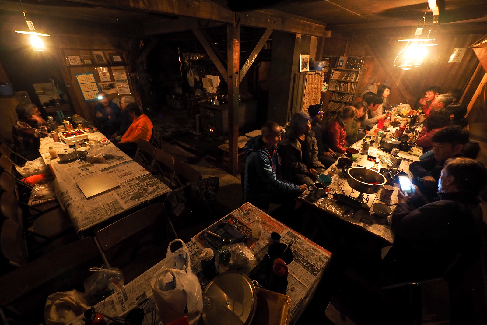
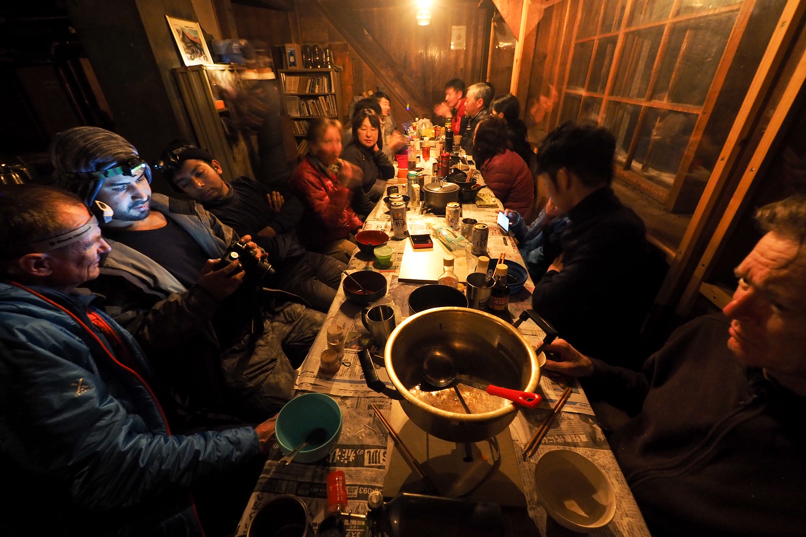
In my enthusiasm to get a few friends up to the gorgeous Ginreiso Hut on Mt. Haruka for an overnight new years trip, somehow we ended up with a group of 9 people. Half on skis, the other half on snowshoes. Two years back, when a group of four of us went up at almost the same time of year, we were the only ones in the hut. This year, the hut was bustling with over 25 people staying over.

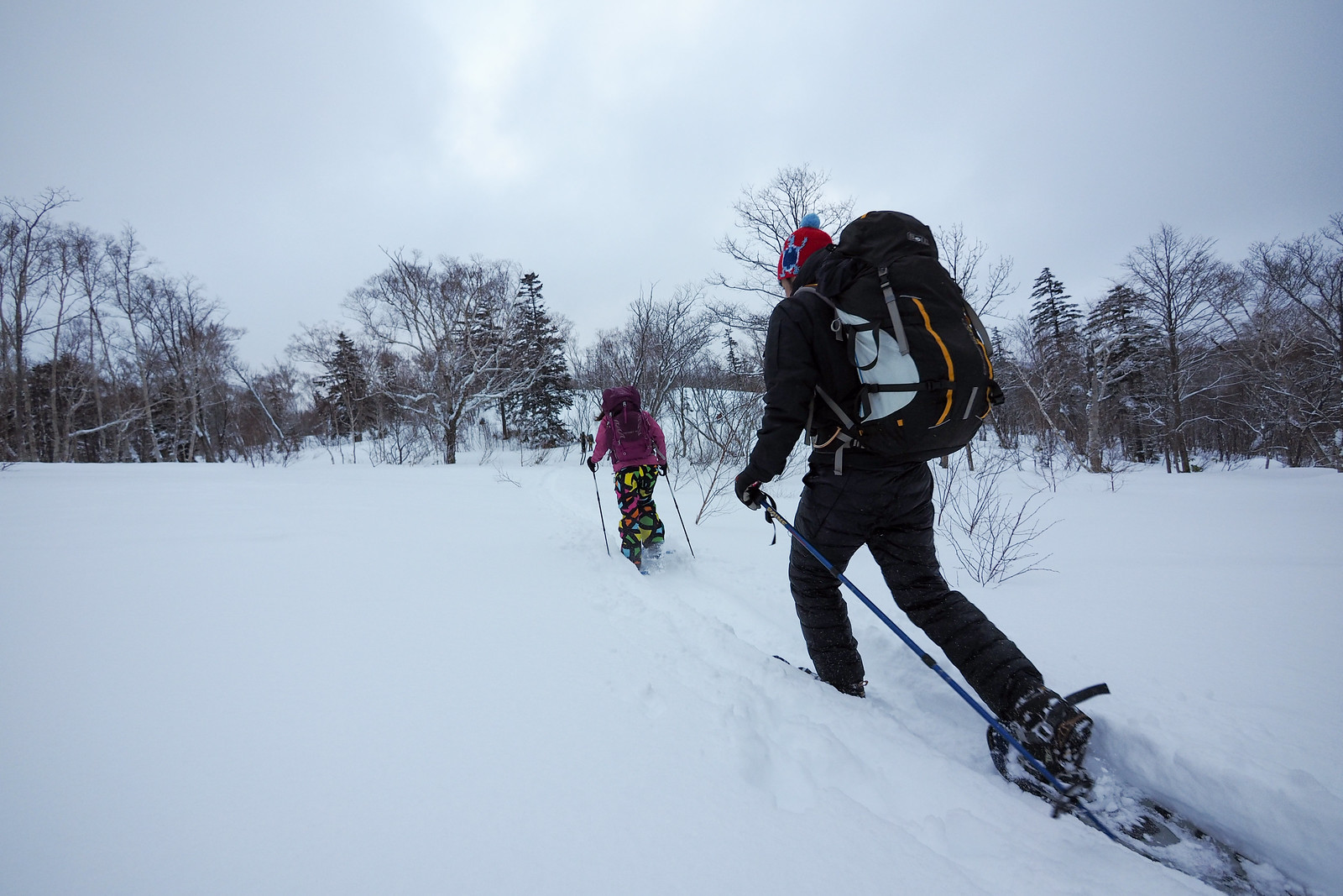
We started the ascent at the trailhead with heavy, wet snow falling, and temperatures well above freezing.

Mt. Haruka Ginreiso Hut Overnight Winter Trip Dec 2017 (Hokkaido, Japan)

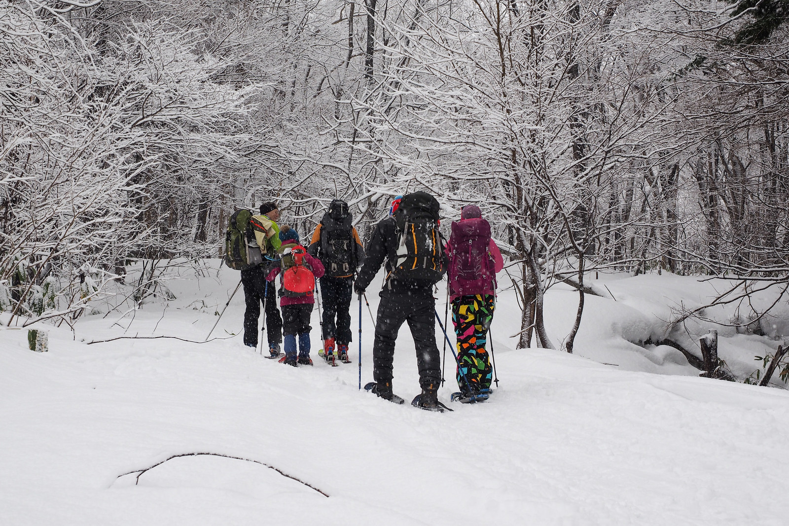
The snow eased off a little as we climbed, most of us shedding layers, trying not to overheat.

Mt. Haruka Ginreiso Hut Overnight Winter Trip Dec 2017 (Hokkaido, Japan)

Mt. Haruka Ginreiso Hut Overnight Winter Trip Dec 2017 (Hokkaido, Japan)

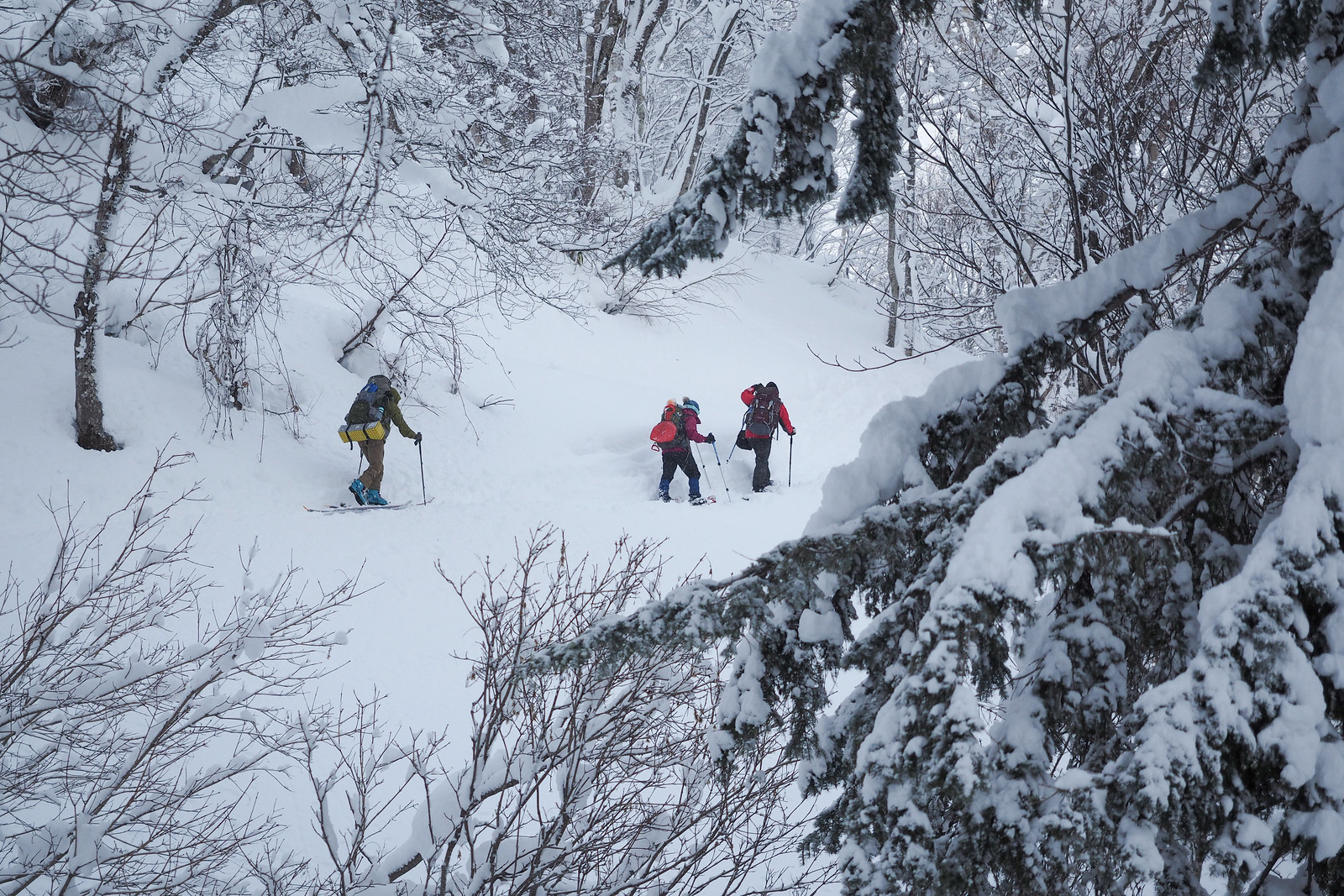
While it was mostly calm on the way up through the valley, once we got to the main Zenibako Pass ridge near the hut, we were exposed to a strong gale. Visibility was good, however, so we pushed on to the safety of the hut.

Mt. Haruka Ginreiso Hut Overnight Winter Trip Dec 2017 (Hokkaido, Japan)

Mt. Haruka Ginreiso Hut Overnight Winter Trip Dec 2017 (Hokkaido, Japan)

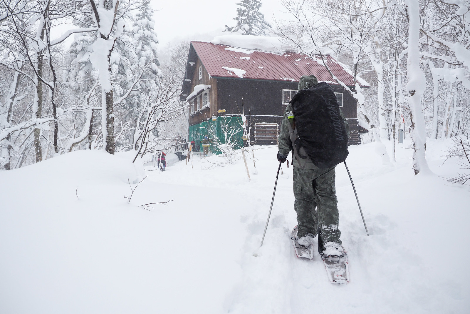
When we arrived at the hut the hutkeeper welcomed us with great fanfare, making sure we were suitably free of snow to enter the hut. We warmed up next to the fire and ate some lunch, and we set up our bunks. We also set up our table ready for dinner later that night. The hutkeeper came around and made sure that we had not yet hooked our stoves up to our fuel canisters. “Safety first!” he beamed. We then headed back out for a hike to the summit.

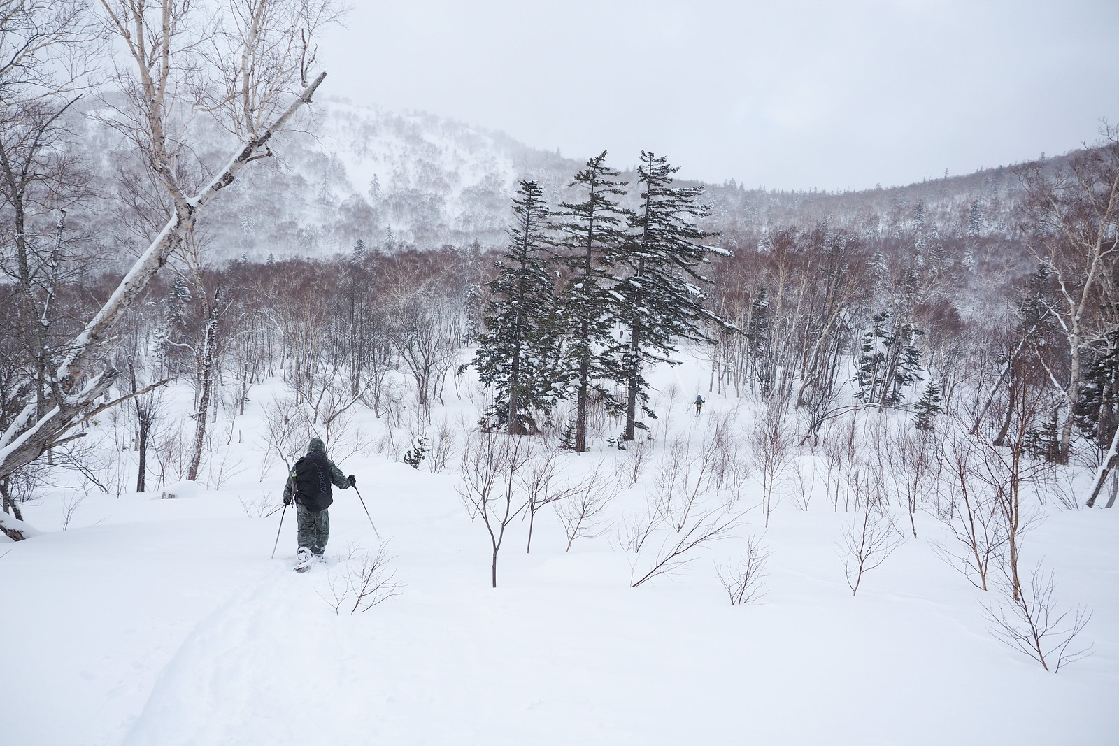
Views along the way were relatively good, before a snow shower snatched the view and visibility away from us as we neared the top. The snow was in great condition, and provided some great turns. The skiers in the group transitioned back to skins and climbed up for another run before returning to the hut.

Upon returning to the hut and entering, I noticed a commotion at one of the tables in the hut’s first-floor dining area. Someone’s gas camping stove, attached via a hose to a regular non-threaded propane gas canister, was flaring very high. I overheard someone say it was probably because the canister had been tipped up, causing some liquid to escape through the hose. Sure enough, as soon as the person placed the canister back on the table, the stove stopped flaring.

At this point, I turned away to take the liners out of my boots. Only moments later, I heard a number of people in the group at the table scream. I turned around and saw that not only was the stove flaring at least one meter up towards the kerosene lamps hanging from the ceiling, there were now large flames flaring from the interface between the gas canister and the hose running to the stove. I can only assume that the stove user had tried to unhook the canister from the hose while the stove was still running.

My instinct was to run over to the table to see if I could help. A few people were blowing on the flames, but of course this was just forcing the flames higher, and causing them to catch light to the newspaper sheets covering the tables.

It was becoming clear that the best way forward was to smother the flames in some way. I ran to the kitchen, and grabbed the first small towel I could find. I doused it in water, returned to the table, and threw it over the gas canister. The towel was too small, however, and had little effect. So I ran into the kitchen again to try to find something larger. The only thing I could see were three thin, 30cmx30cm seat cushions.

I grabbed the cushions and doused them as much as I could in water, and ran back to the table. By now embers from the burning newspaper sheets on the table were starting to drop onto the straw mat flooring under the table. While I began yelling for someone to call the hutkeeper to get a fire extinguisher (he was outside the hut helping other guests), I threw the wet cushions over the canister and stove, and with the help of a few others around the table, finally managed to block any oxygen sources to the flames.

The fire was finally out. Quite the adrenaline rush.

Luckily no one seemed to be burned. The only damage appeared to be a number of newspaper sheets burned, as well as a plastic table cover which had melted in a couple of placed. It was only later in the night when I noticed that there was a fire extinguisher just next to the table where the fire had occurred. Being a powder type fire extinguisher, this would have made short work of the fire (never mind the mess of powder it would have left). I can only imagine that the hutkeeper has seen plenty of these incidents over the years.

Back to our group, and later on in the night, on the menu for dinner was a large shared Japanese hot-pot. This is one of my favourite meals to cook for a group on an outdoor trip. Plenty of fresh veges, tofu, pork, chicken, and udon noodles to finish off with the resulting broth. The shabu-shabu sesame and ponzu sauces are key, though; well worth the extra weight of lugging the glass bottles up the mountain.

Mt. Haruka Ginreiso Hut Overnight Winter Trip Dec 2017 (Hokkaido, Japan)

Mt. Haruka Ginreiso Hut Overnight Winter Trip Dec 2017 (Hokkaido, Japan)

That night, the hutkeeper kept the stove relatively well stoked, so despite some of us feeling a little too warm overnight, the group mostly slept well.

Because our second day there was the day the hutkeeper had to head back down to Sapporo for his weekly check-in at the university, we had to be out of the hut by 8am. Wakeup call at 6am, breakfast at 7am, and we were out by 8am.

With a couple of members in our group feeling like they were starting catch a cold, the group decided to head straight back down the mountain to the cars. From there, we headed to Asari Onsen for a hot spring soak, and the requisite ramen for lunch at Yoshiyama Shouten ramen (one of the best in Sapporo, according to Rick).

Mt. Haruka Ginreiso Hut Overnight Winter Trip Dec 2017 (Hokkaido, Japan)

Comments | Queries | Reports

Done this route to Haruka-yama, or others nearby? Thinking of doing it? Please post any feedback, reports, or queries here. Thanks!

2 thoughts on “Haruka-yama Ski Touring”

  1. Hi!
    Unfortunately, it’s a long hike up to the hut and a long way down without proper skiing slopes – about 2h up.
    The only good slope is above the hut.

Leave a Reply

Your email address will not be published. Required fields are marked *

This site uses Akismet to reduce spam. Learn how your comment data is processed.

See More Like this

Printable Haruka-yama Topomap

TOPO DOWNLOAD (PDF, 3.8MB)

Download may take some time

Hokkaido Wilds Foundation

We’ve got affiliate links on HokkaidoWilds.org to help fund the Hokkaido Wilds foundation.

The Foundation gets a small commission on sales from affiliate links, but we only link to stuff we think is worth checking out for people keen on the outdoors in Hokkaido and Japan.

The Hokkaido Wilds Foundation is a fund where 100% of funds are donated to Hokkaido volunteer groups involved in sustainable, safe, and responsible access to the Hokkaido outdoors.

Learn more here

ADVANCED FILTERS

Filter by location

About Filters

REGION: The general mountain/geographical region the route is in.

BEST MONTH(S): Time of year a route is suited to visiting. Some pop all season, some are more limited.

DIFFICULTY: How strenuous a route is, and how technical it is. Full details here.

FREERIDE/SKITOUR: Very subjective, but is a route more-of-a-walk-than-a-ski or the other way around? Some routes are all about the screaming downhill (freeride), some are more about the hunt for a peak or nice forest (ski-tour). Some are in between. 

MAIN ASPECT: Which cardinal direction the primary consequential slope is facing, that you might encounter on the route. More details here.

ROUTE TAGS: An eclectic picking of other categories that routes might belong to.

SEARCH BY LOCATION: You can find routes near your current location – just click on the crosshairs (). You may need to give permission to HokkaidoWilds.org to know your GPS location (don’t worry, we won’t track you). Or, type in a destination, such as Niseko or Sapporo or Asahikawa etc.

Please let us know how we can make it easier to narrow down your search. Contact Rob at rob@hokkaidowilds.org with your suggestions.

Haruka-yama Ski Touring Difficulty Rating

Category

Grade

Points

Strenuousness

Vertical Gain

B

35

Time ascending

C

3

Technicality

Altitude

B

6

Hazards

D

0

Navigation

C

6

Totals

50/100

GRADES range from A (very difficult) to D (easy). Hazards include exposure to avalanche and fall risk. More details here. Rating rubric adapted from Hokkaido Yukiyama Guidebook 北海道雪山ガイド.