Okuteine Hut and Utopia Piste via the Okuteine Valley Route

ユートピアゲレンデ

Posted on Feb 24, 2018
65 0
N
Posted on Feb 24, 2018
65 0
N
12km

Distance

6 hours

Time

450m

Ascent

975m

Highest point

5/10
Difficulty
Snow Icon | Hokkaido Wilds
Jan-Apr

Best season

In 1928, Prince Chichibu (son of Japan Emperor Taisho) skied the hallowed slopes of Utopia Piste (ユートピアゲレンデ) in the hills just west of Sapporo City. Two yeas later the Okuteine Yama-no-Ie Hut (奥手稲山の家) was built at the foot of that ski run, and still stands today. We visited the hut on an overnight ski trip to the Utopia Piste via the Okuteine River (奥手稲山の沢川) route - the most direct route to the hut - for some untracked skiing. Along for the trip was Jasper, a keen mix-breed Hokkaido-dog.

Last updated Apr 2, 2021

Route Map

Need to know details

Location

The start of this route (location) is about 2.5km downhill from Sapporo Kokusai Ski Area, in the hills west of Sapporo city.

General notes

This route is the easiest and most direct approach to the Okuteine Yama-no-Ie Hut, a hut managed by the Wandervogel Student Club from Hokkaido University (see detailed hut information here). From the hut, there is hopelessly easy access to the Utopia Piste, right next to the hut.

Hut
Okuteine Yama-no-Ie Hut (full details here)

The amazing Yama-no-Ie Hut tucked below Mt. Okuteine (奥手稲山, 948m) on the outer reaches of Sapporo City, is everything you can expect from a mountain hut managed by largely ambivalent Japanese university students: dingy, messy, and a glowing red-hot potbelly stove kept that way by the intrepid first-year students who hauled the coal up the mountain on their backs. But it’s that charm that makes it worth the trip to this hut in winter via a handful of different routes. The hut is not officially open in summer.

Route details

There may be sporadic bits of tape tied to trees, but it is best to assume there are no trail markers – you’ll be navigating mostly on your own.

Route Timing
Up | 3.5hrs
Down | 2hrs

About three hours from trailhead to the hut. From the hut to the top of the Utopia Piste is about 20 minutes.

Transport

Public transport:

As of March 2017, there were around 6 buses in the morning going from Sapporo Station Bus Terminal No. 17 to Sapporo Kokusai Ski Field (see details in English here). The earliest bus was at 7:10am, arriving at the ski field at 8:50am. The start of the route is about 2.5km downhill from the ski area; just skin among the forest next to the main road (route here). Return buses from the ski area are about every 30 minutes from 4pm till 7pm.

By car:

There is a large carpark area at the start of the trail (location).

Physical maps
Official Topo Map: Teine-yama (手稲山) – map no. NK-54-14-14-2

NOTE: The official 1/25000 topo map(s) above can be purchased for 350yen from Kinokuniya bookstore next to Sapporo Station or online (in Japanese).

Aspect
The main aspect skiers are exposed to on the descent and/or ascent is North. Therefore, keep an eye on the weather forecast a few days ahead of your trip to monitor wind, snow, and temperature. Also, since this route is in the general vicinity of the Shiribeshi area, consider looking at the Japan Avalanche Network avalanche bulletins (updated Tuesdays, Thursdays, Saturdays at 8am) or the daily Niseko Avalanche Information website. These may give extra insight into avalanche conditions in the greater area around the route.

Snow and
route safety

From the point that the forestry road ends to the hut, you’ll have to cross the stream a number of times using snow bridges, so take care. Notify the police of your backcountry plans online using Compass – instructions here.

Okuteine Hut and Utopia Piste via the Okuteine Valley Route Difficulty Rating

Category

Grade

Points

Strenuousness

Vertical Gain

C

30

Time ascending

C

3

Technicality

Altitude

B

6

Hazards

C

6

Navigation

C

6

Totals

51/100

GRADES range from A (very difficult) to D (easy).  More details here. Rating rubric adapted from Hokkaido Yukiyama Guidebook 北海道雪山ガイド.

Weather forecast

Windy.com weather forecast for Utopia Piste
Onsen nearby

Jozankei Onsen area has a huge number of onsen to choose from. If traveling by car, consider either Hoheikyo Onsen (1,000yen per person, and they have Indian curry), Hotel Milione (500yen per person), or Matsu-no-yu closer to Sapporo City (about 650yen per person).

Extra Resources
  • Parts of this route are part of the 3-day Sapporo Kokusai Ski area to the sea ski-traverse (route information here).
  • If the weather is glorious and you’re feeling up to it, there is a slightly longer loop-route via Mt. Okuteine and Mt. Tsuge (details here).
  • See the write-up (in Japanese) in the Hokkaido Yuki-yama Guide (ISBN: 978-4894538047) on pages 94-97.

Guide Options

If you’d like to ski this route and/or explore other hills around Sapporo together with a local certified guide, get in touch with either Wataru Nara or Yasuko Kikuchi. They’re both Hokkaido born-and-bred Sapporo-based JMGA-certified guides. They both cut their teeth on peaks including those around Sapporo City and have taken part in major international expeditions. In addition, see a full list of English-speaking Hokkaido Mountain Guides Association (HMGA) guides on the HMGA website here

Support us

Like this content? Buy the HokkaidoWilds.org team a coffee. 50% of tips go to the Hokkaido Wilds Foundation.

Show Full Route Notes Close Route Notes

Route Trip Notes

We’d been meaning to go ski touring with Haidee’s colleague and friend Aiko for a few years now. In her undergraduate days at Hokkaido University, Aiko was a member of the Wandervogel Club, so she has climbed most of the major peaks in Hokkaido, as well as spent a great deal of time in one of the most iconic and historic backcountry huts in Hokkaido – Okuteine Yama-no-Ie (full hut details in this post).

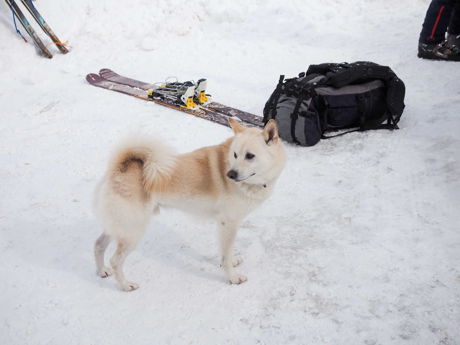
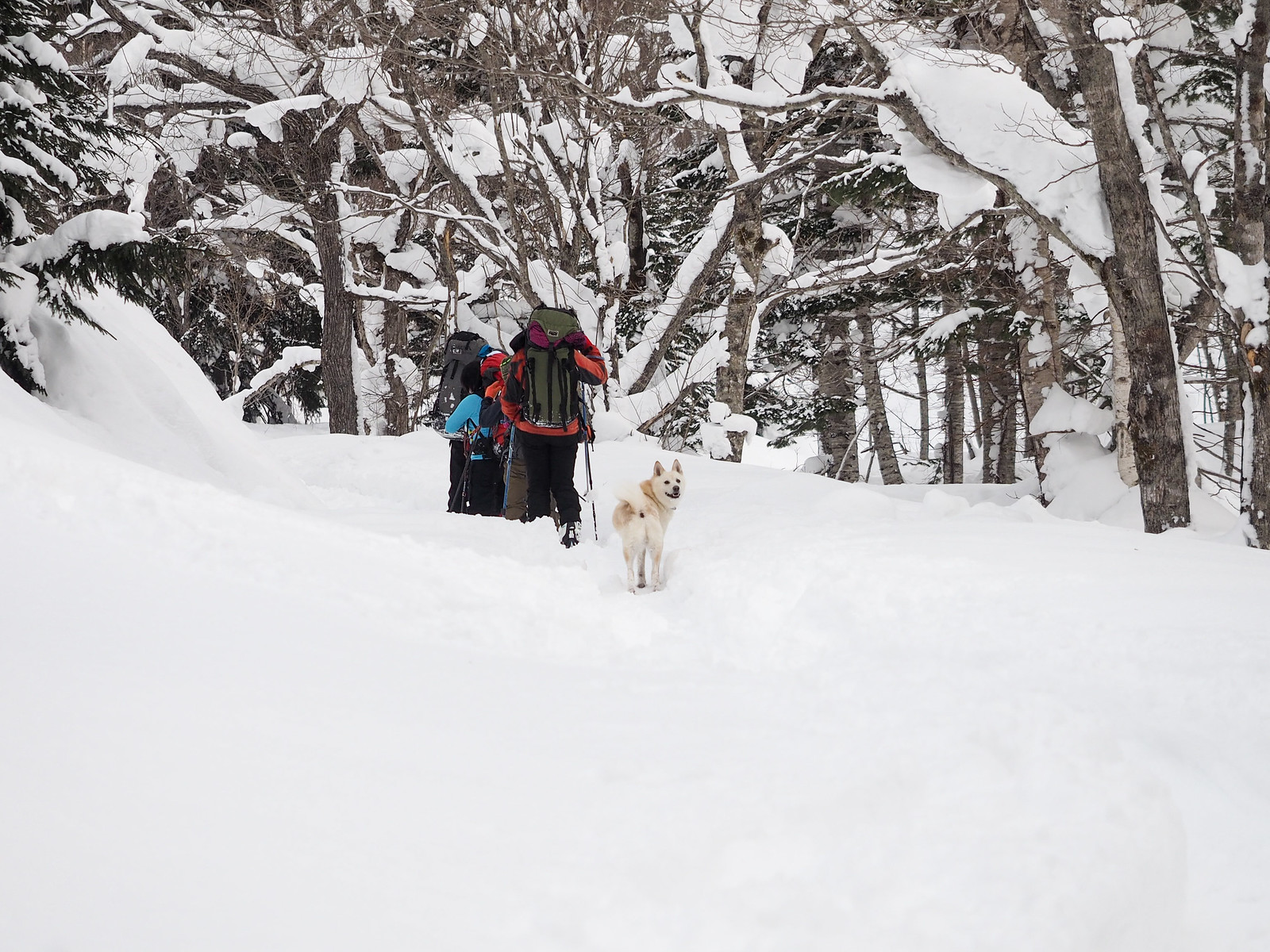
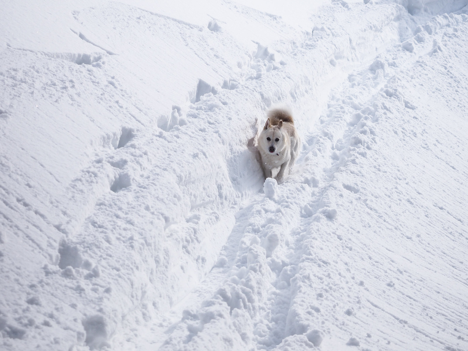
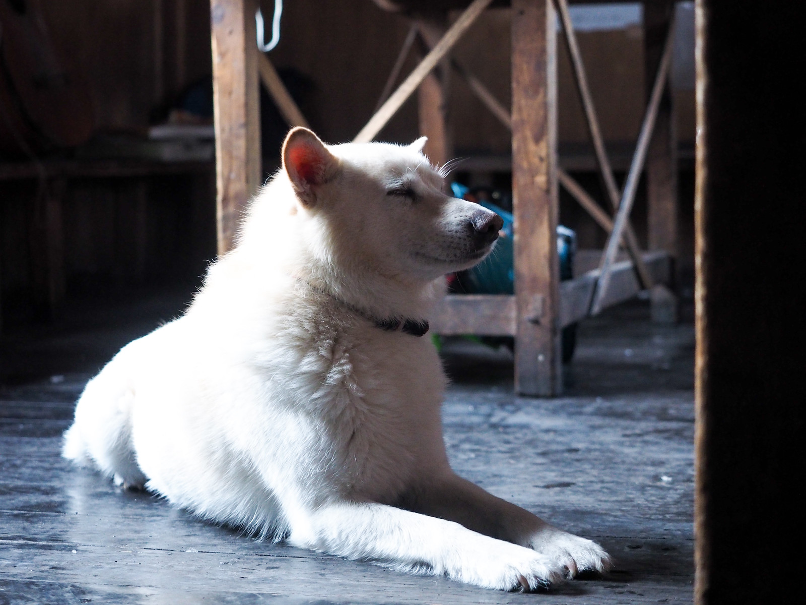
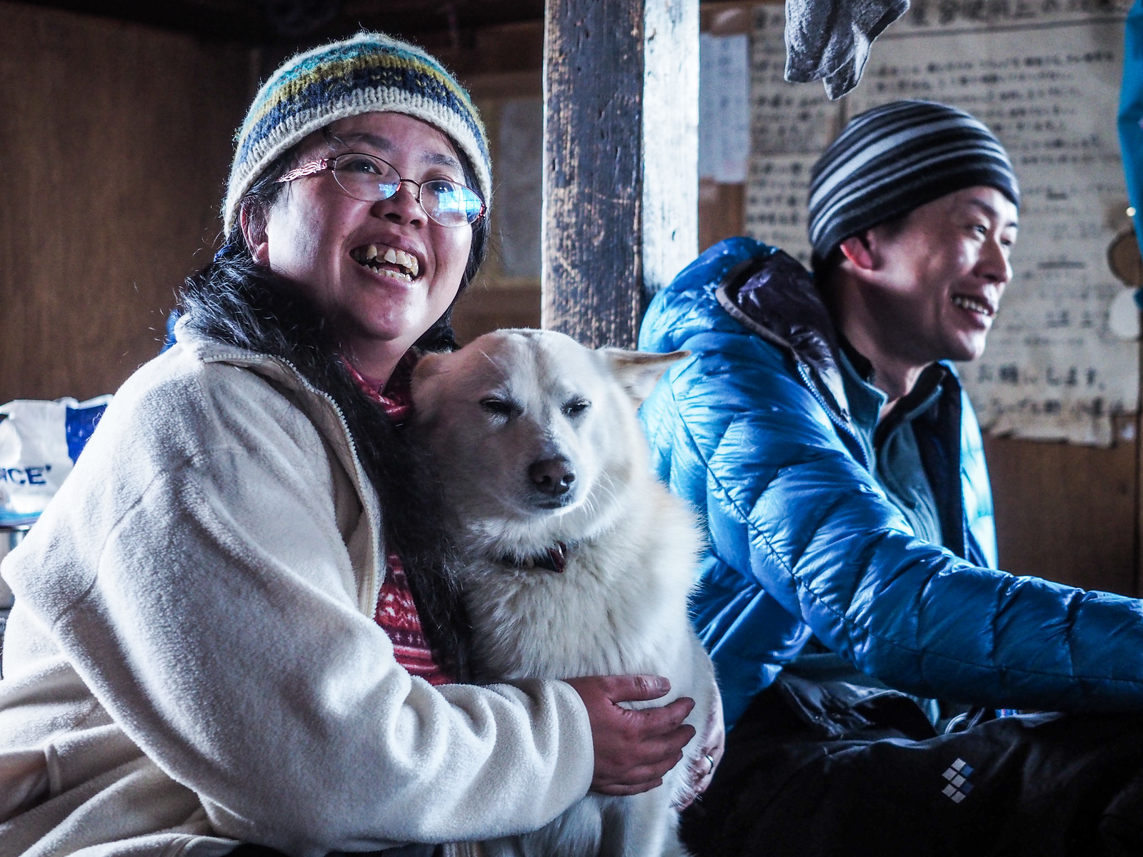
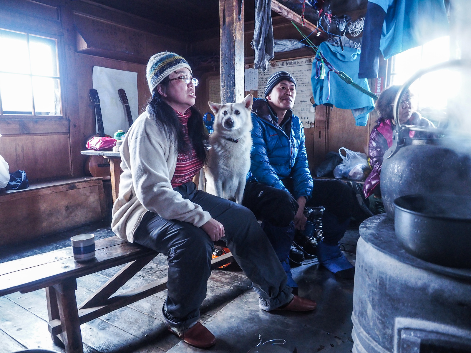
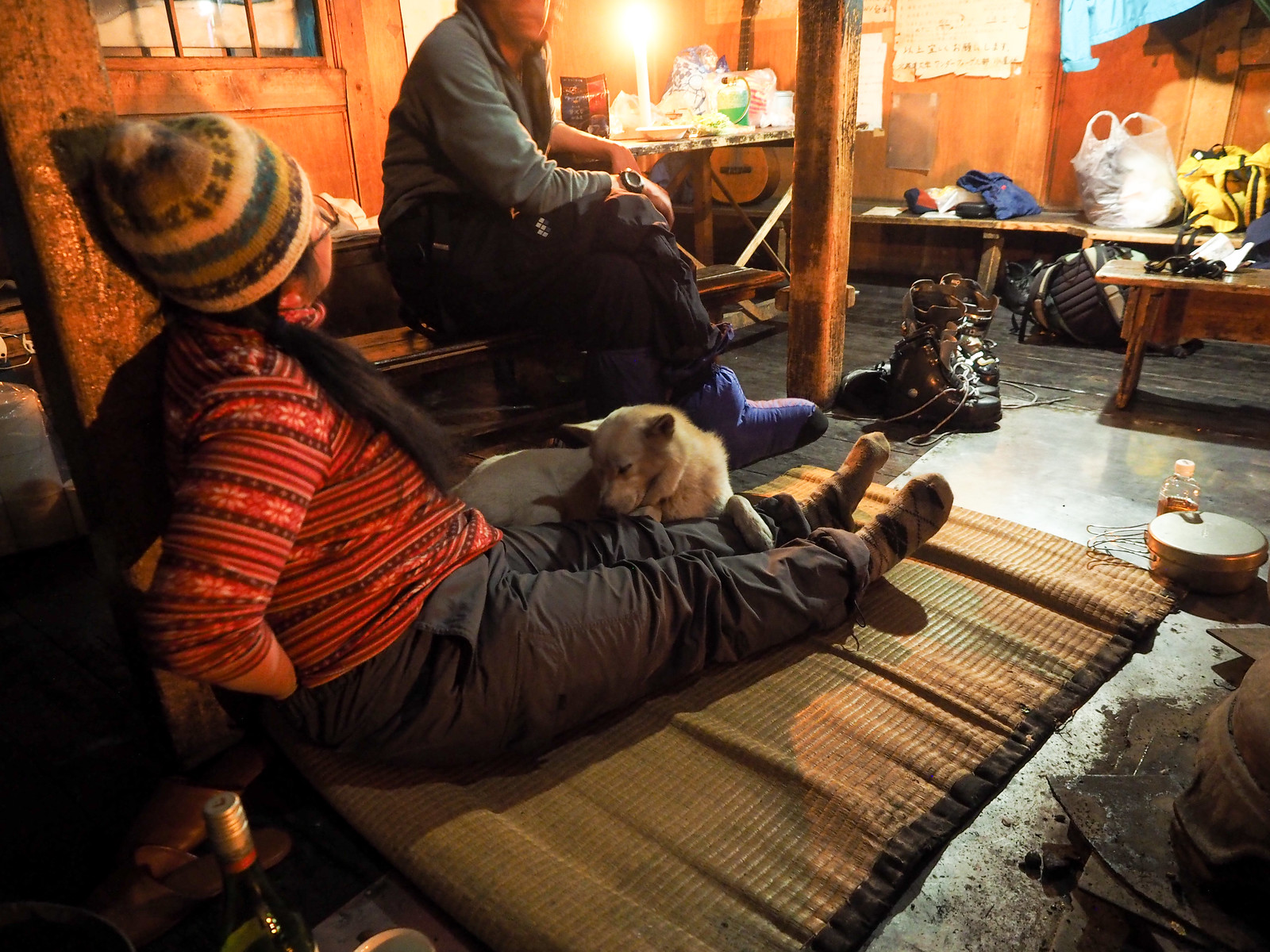
At last a trip came together. Aiko invited us to join in on a trip organized by the Laligurash Womens’ Outdoor Club (https://laligura.exblog.jp/) to the Yama-no-Ie Hut. In addition to the normal female crew, Aiko’s son, a husband of one of the women, me, and Aiko’s Hokkaido-dog Jasper (named after Canada’s largest national park) were also invited.

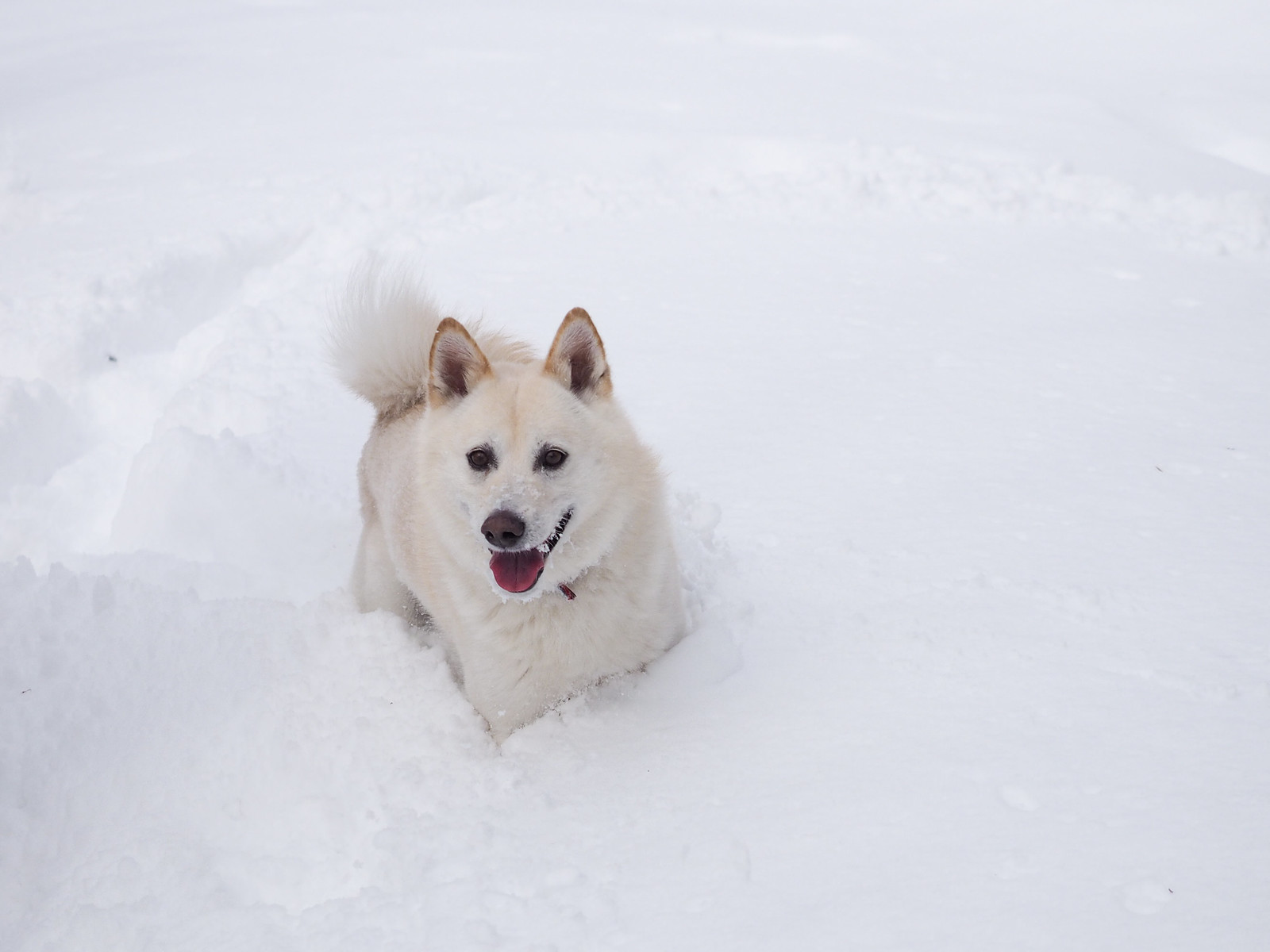
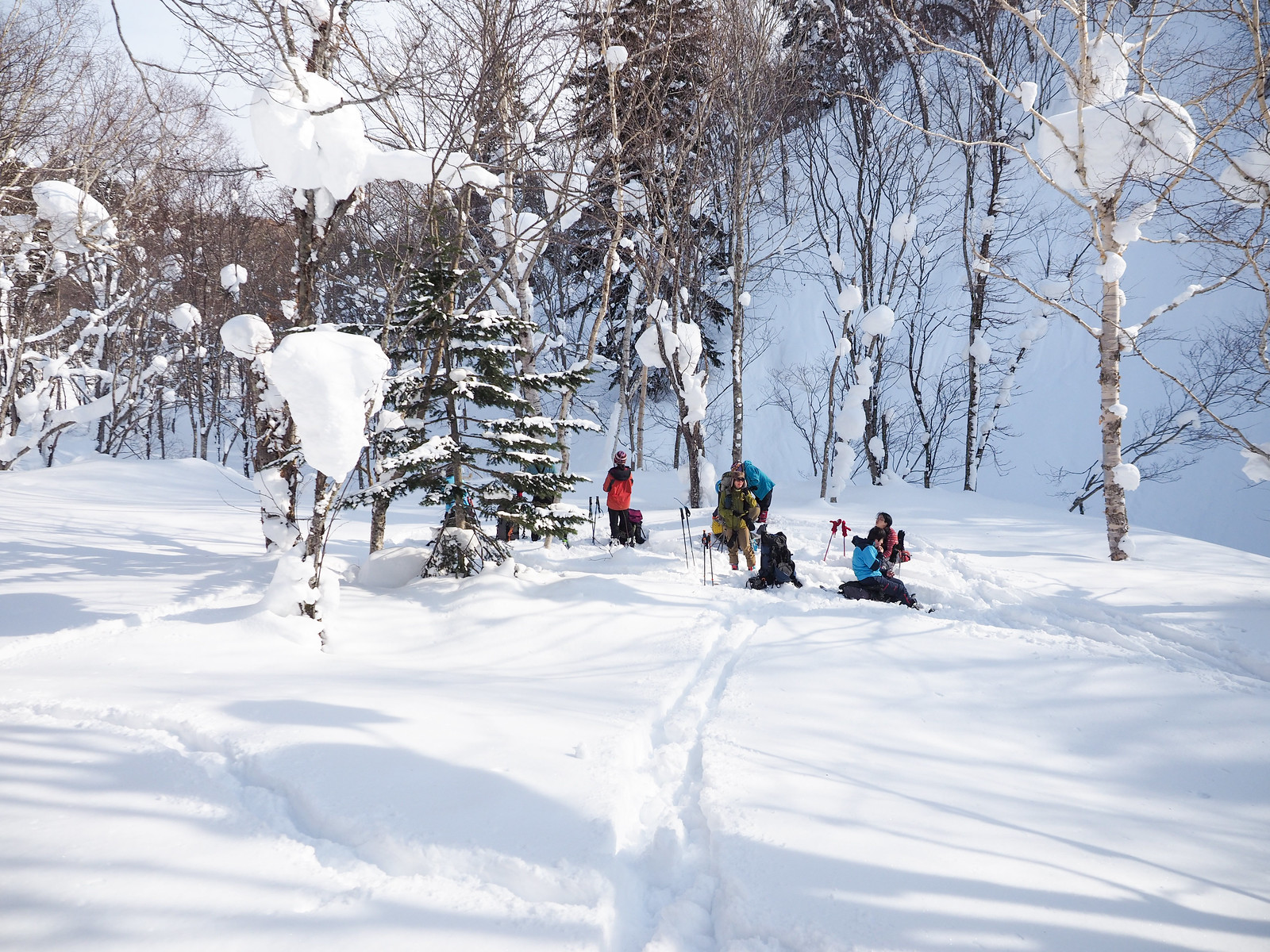
All up there were a jolly bunch of 9 humans and one very energetic snow-loving dog, all on skis. Except the dog. Despite Jasper’s fondness for snow, he hasn’t learned to ski yet.

Okuteine Hut and Yutopia Piste (Hokkaido, Japan)

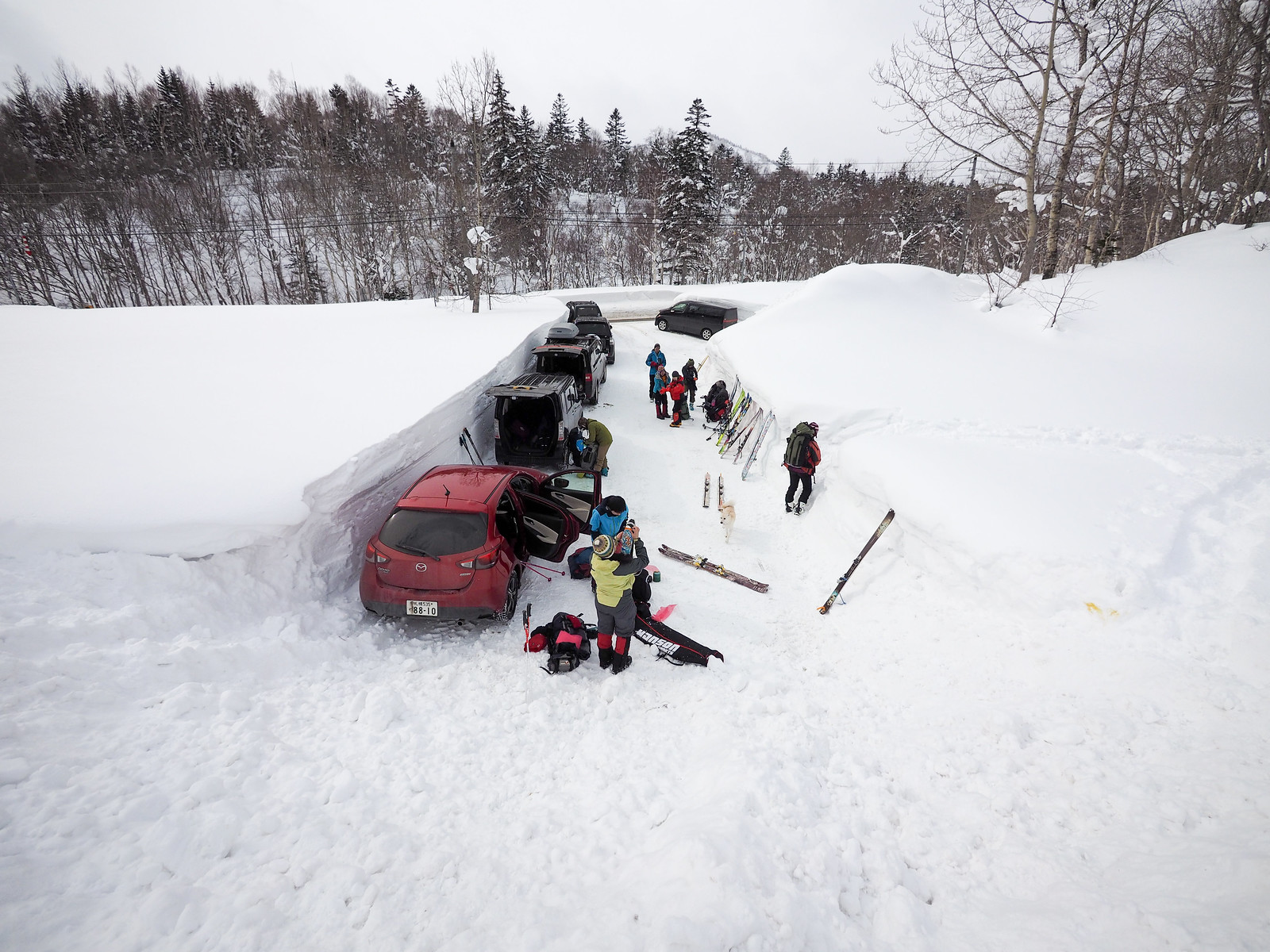
It was a relatively mild start to the trip, with about -5°C at the trailhead. After beacon checks and un-jamming Hayato’s Alpine-Trekkers, the group was moving at around 11:30am.

Okuteine Hut and Yutopia Piste (Hokkaido, Japan)

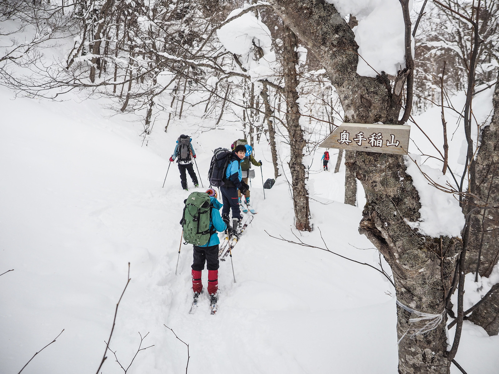
This would be my third time to visit the Yama-no-Ie hut. The first we approached via Mt. Okuteine (route guide), and the second time I was with Andy from Alaska for a three-day traverse, approaching the hut via Mt. Tsuge (route guide).

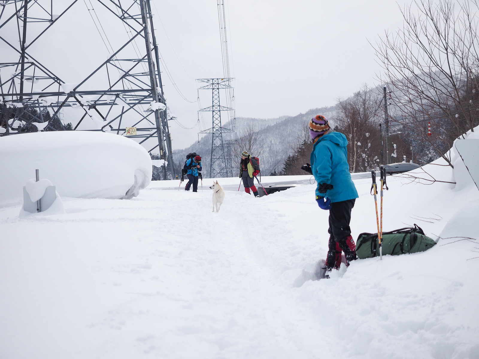
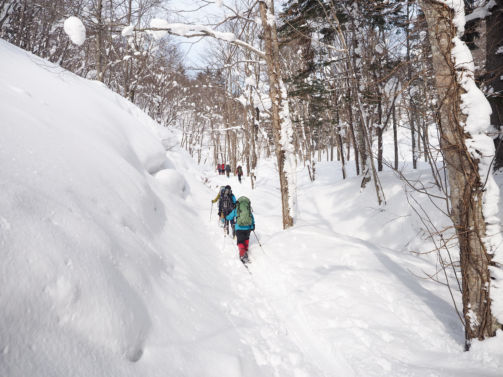
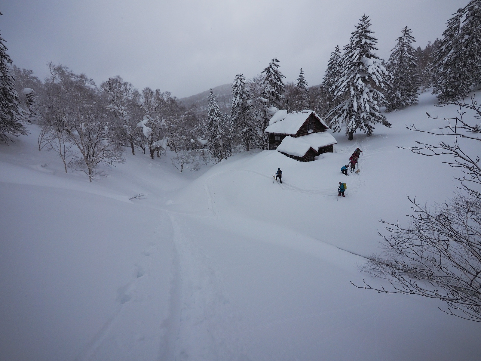
This time would be the first time I’ve approached the hut via the most direct route, along the Okuteine-sawa River. The route follows a forestry road until about half way to the hut.

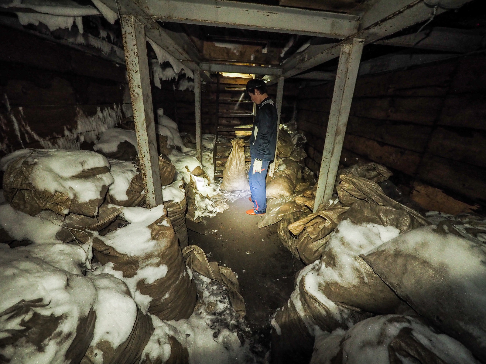
Incidentally, the end of the forestry road is the point from which the Hokkaido University Wandervogel Club members haul the coal to the hut for the hut’s stove. “Each member hauls coal at least twice during their time as members of the club,” explained Aiko. “If you were hauling coal, your pack would weigh about 40kg. The challenge was to complete the hike to the hut – about 3km uphill – without putting your pack down!”

Okuteine Hut and Yutopia Piste (Hokkaido, Japan)

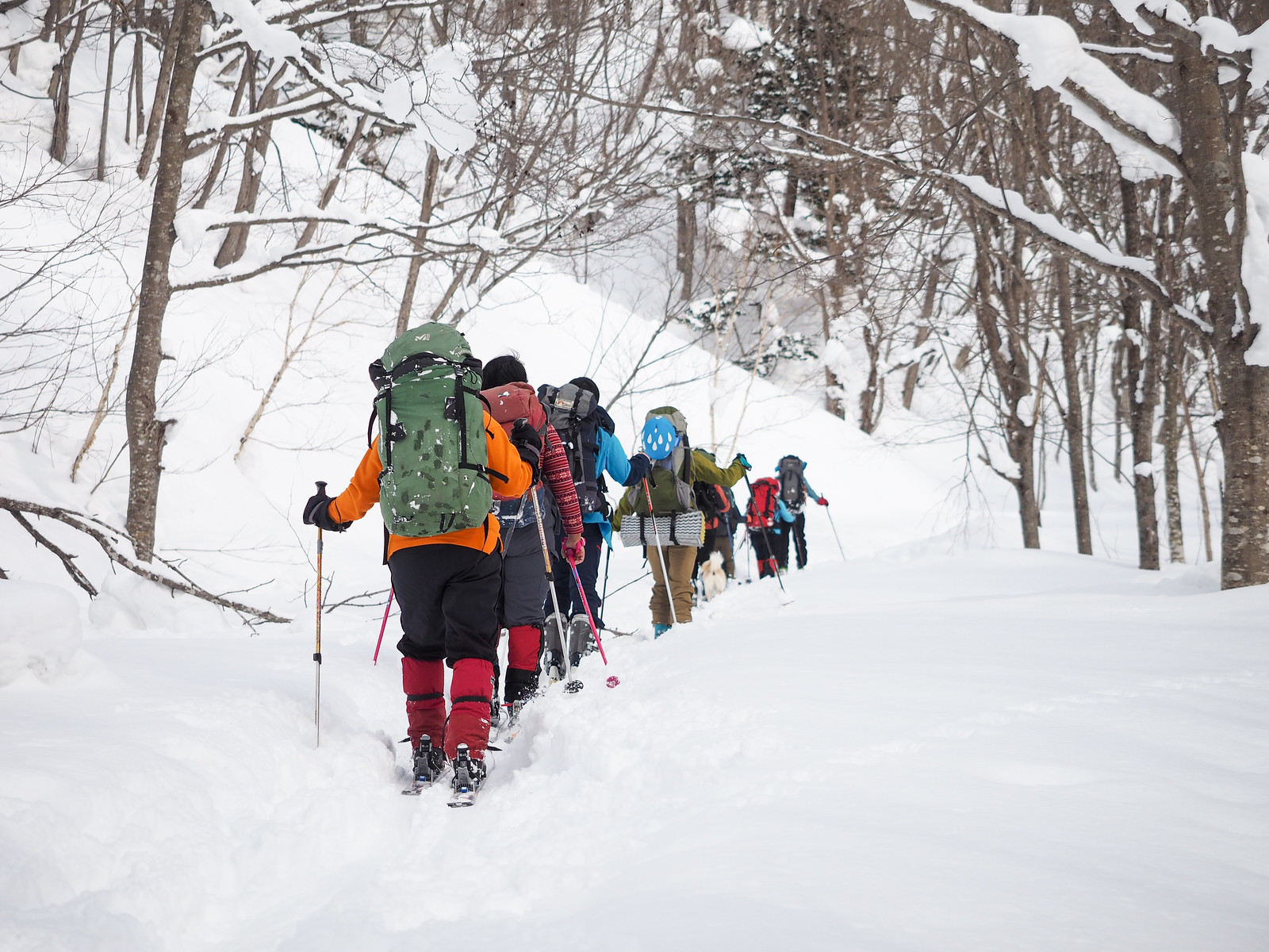
From the end of the forestry road, the route follows the valley floor most of the way to the hut. Even though the map shows a trail on the climber’s left of the river, this is not always the route taken in winter. There are frequent bluffs on both sides of the river, which require crossing the river on snowbridges every now and then.

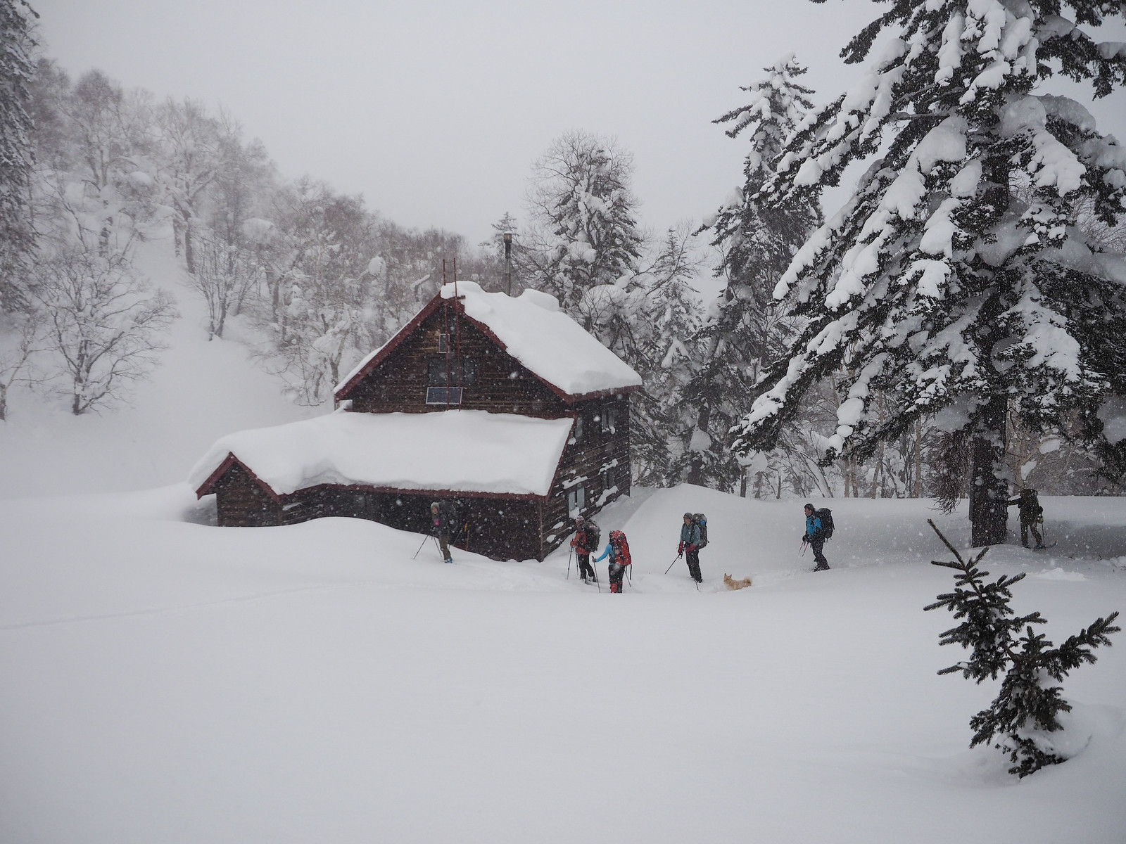
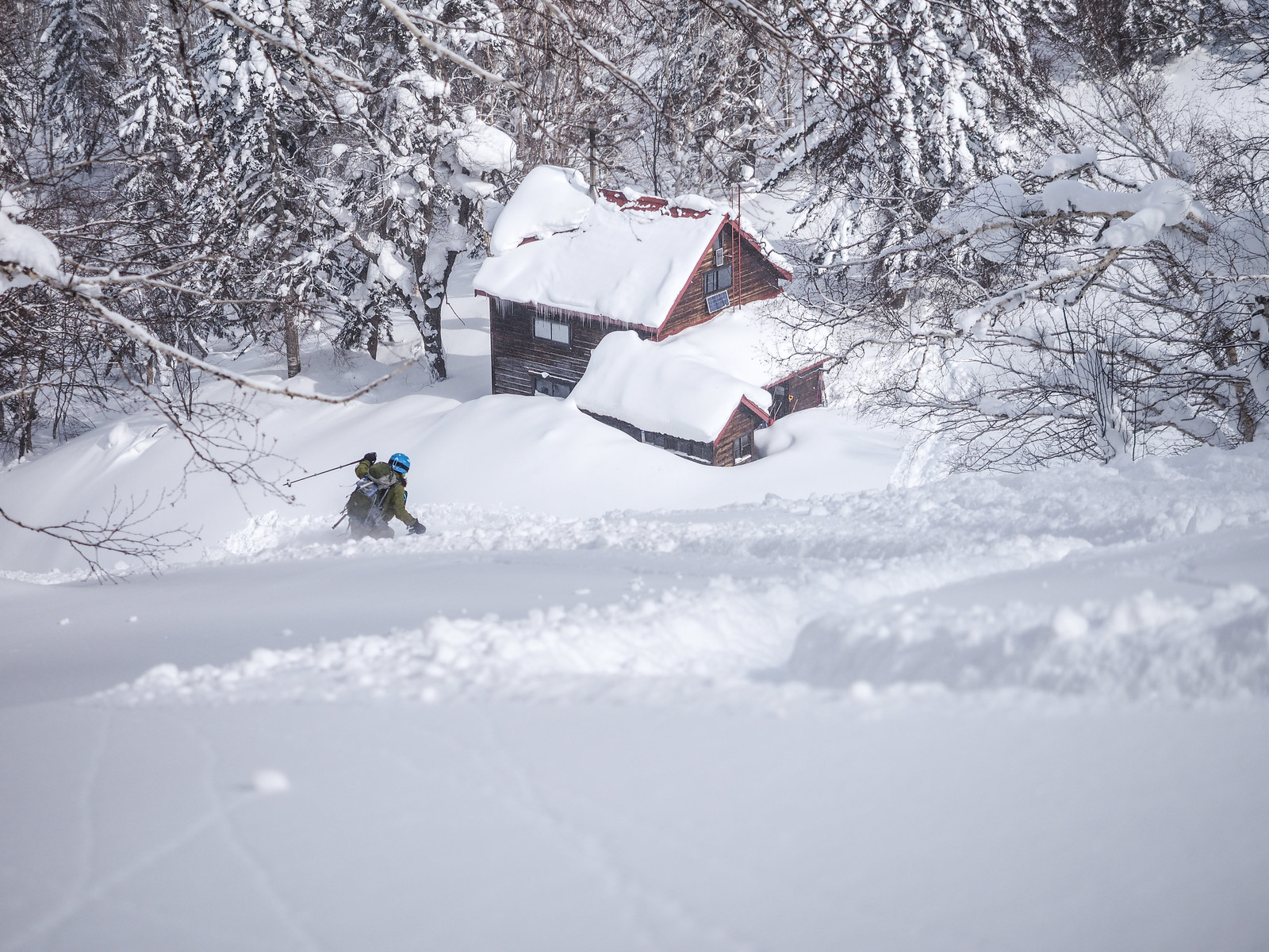
The hut is at the foot of the head of the main catchment basin, an area marked on early 1900’s maps as “Paradise”. I could not think of a more apt name.

As we arrived at the hut, a light snowfall had begun. This continued overnight, such that the next day it was sometimes a challenge to see out skin tracks from the day before.

Okuteine Hut and Yutopia Piste (Hokkaido, Japan)

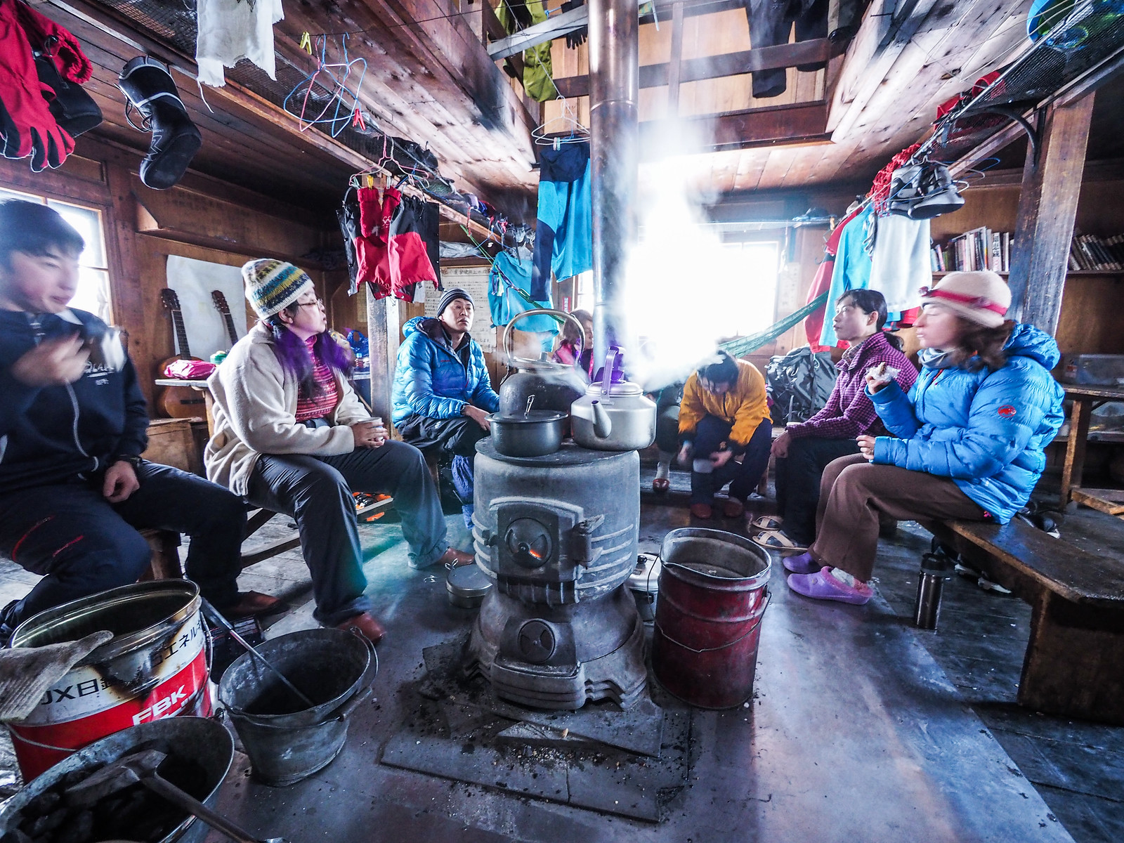
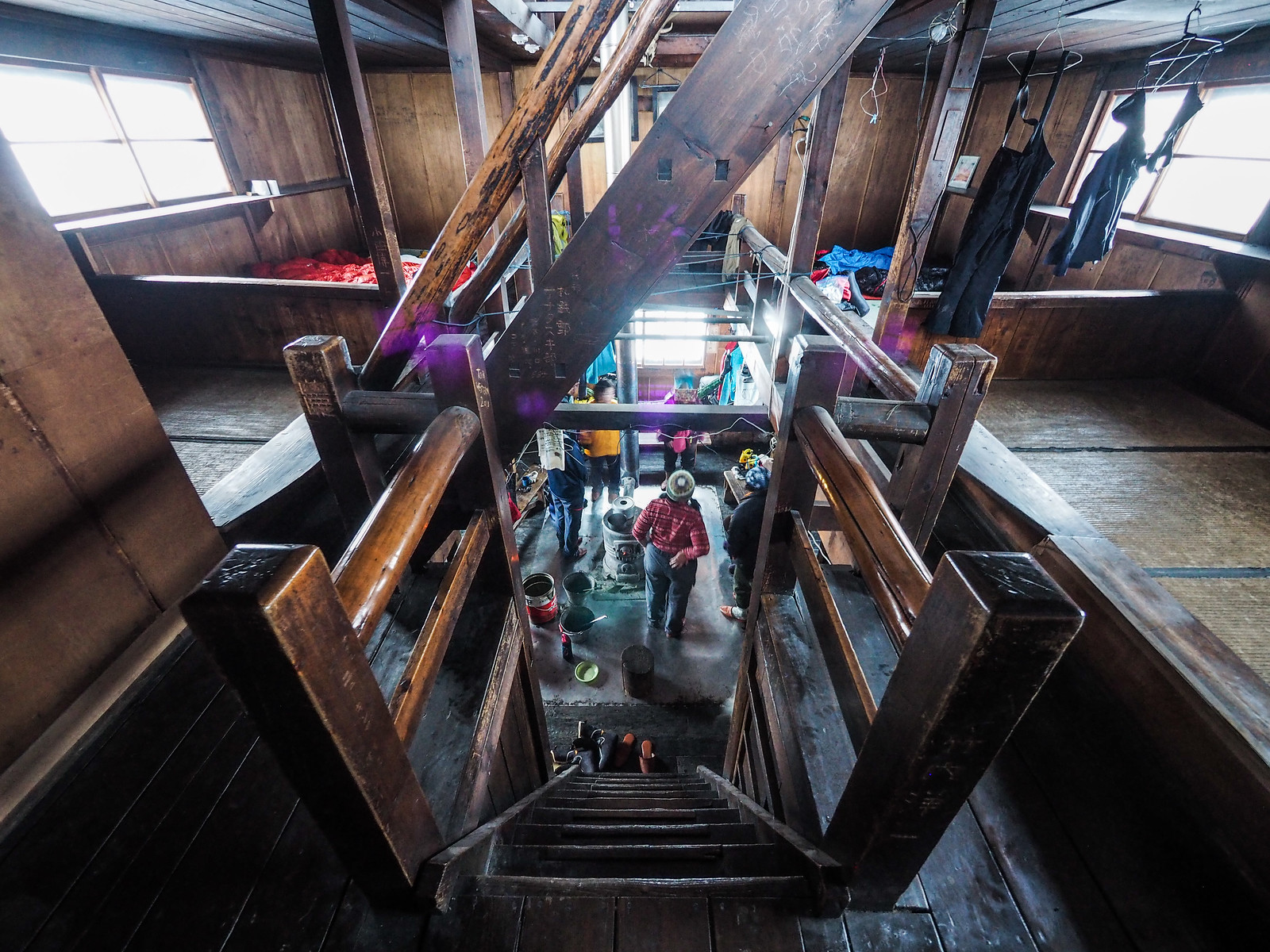
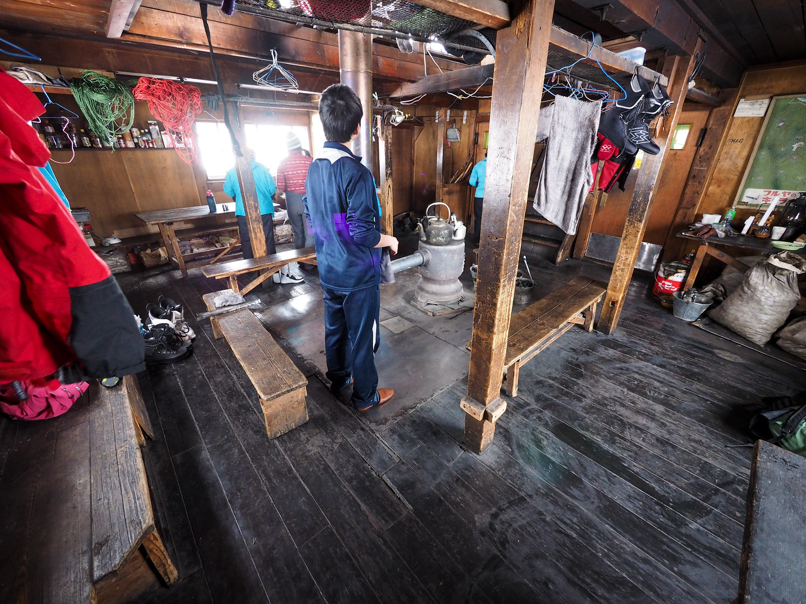
The first task at the hut was to get the coal stove cranking. This glorious iron stove, cast in Hakodate City, is extraordinarily powerful. It doesn’t take much to have the whole thing glowing red. Alas, however, a 100-year old hut does want for insulation, so beyond taking the bite out of the cold air in the hut, the hut will never be particularly warm, and any warmth lasts not much more than 10 minutes once the stove is off.

Bring a good sleeping bag!

Okuteine Yama-no-Ie Hut information (Hokkaido, Japan)
Image by Hayato Sano
Okuteine Yama-no-Ie Hut information (Hokkaido, Japan)
Image by Hayato Sano
Okuteine Hut and Yutopia Piste (Hokkaido, Japan)

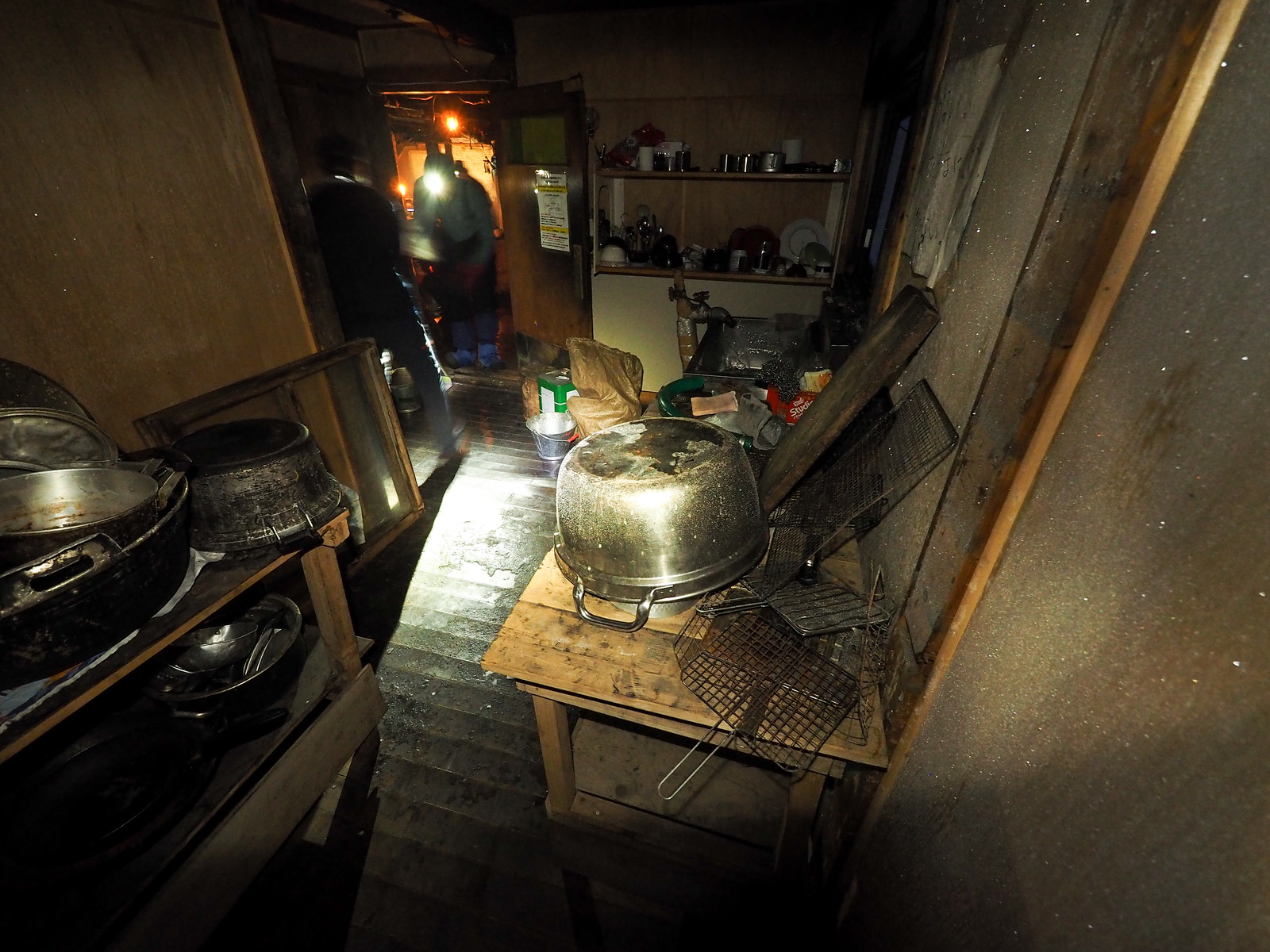
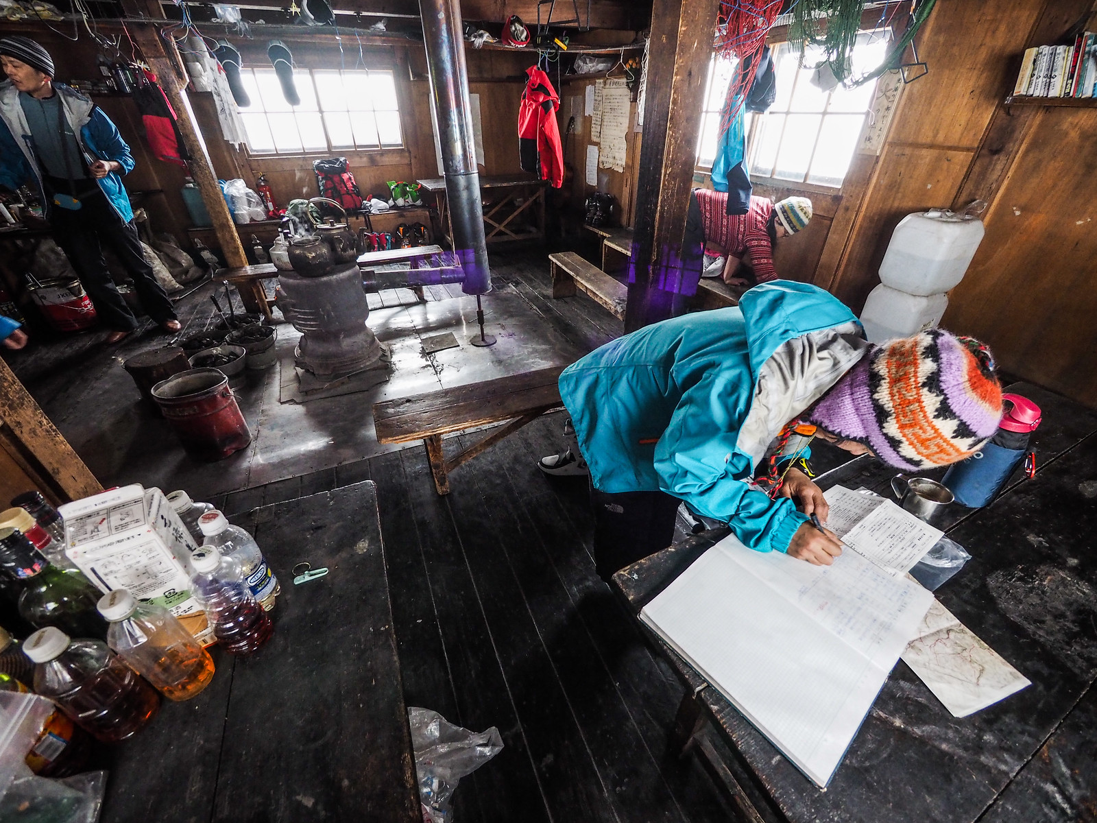
The hut itself is much larger and well-appointed than most people expect. Like I mention in the Okuteine Yama-no-ie Hut details, the hut has a kitchen area (frigidly cold) with running water, toilets accessed from within the hut, and a full two stories of sleeping quarters.

The coal that the students lug up to the hut each year in autumn is stored under the hut, accessed via a trapdoor behind a door in the kitchen area.

Okuteine Hut and Yutopia Piste (Hokkaido, Japan)
Jasper clearly approved of the facilities, and made himself thoroughly at home.
Okuteine Hut and Yutopia Piste (Hokkaido, Japan)

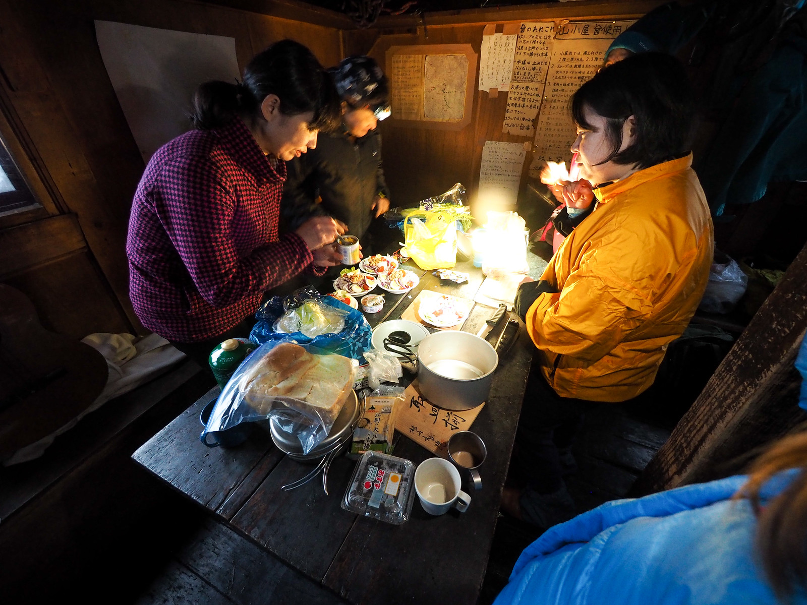
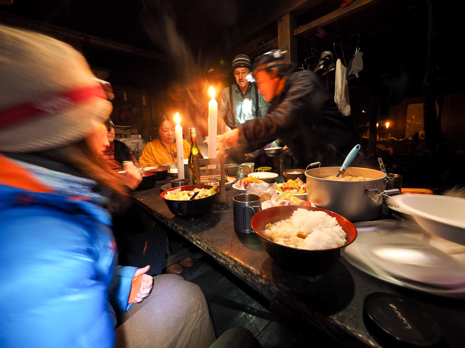
Dinner that night was prepared by the ladies, and consisted of salad, rice, and Japanese hot-pot – always a treat in a cold hut after a day of skinning.

Okuteine Hut and Yutopia Piste (Hokkaido, Japan)

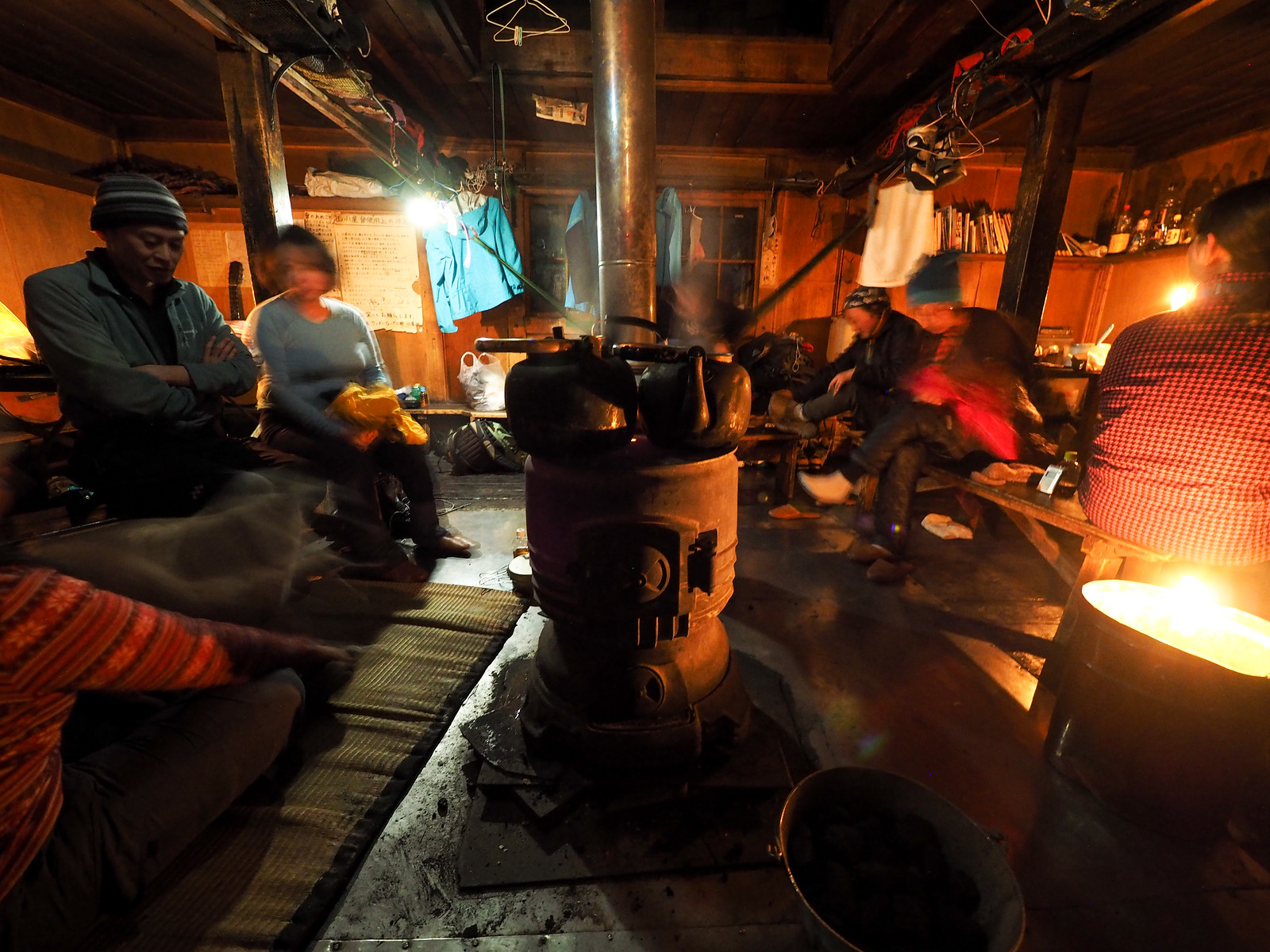
The next morning we woke to a typical Yama-no-ie morning: not a wisp of heat in the stove, and what felt well below freezing in the hut.

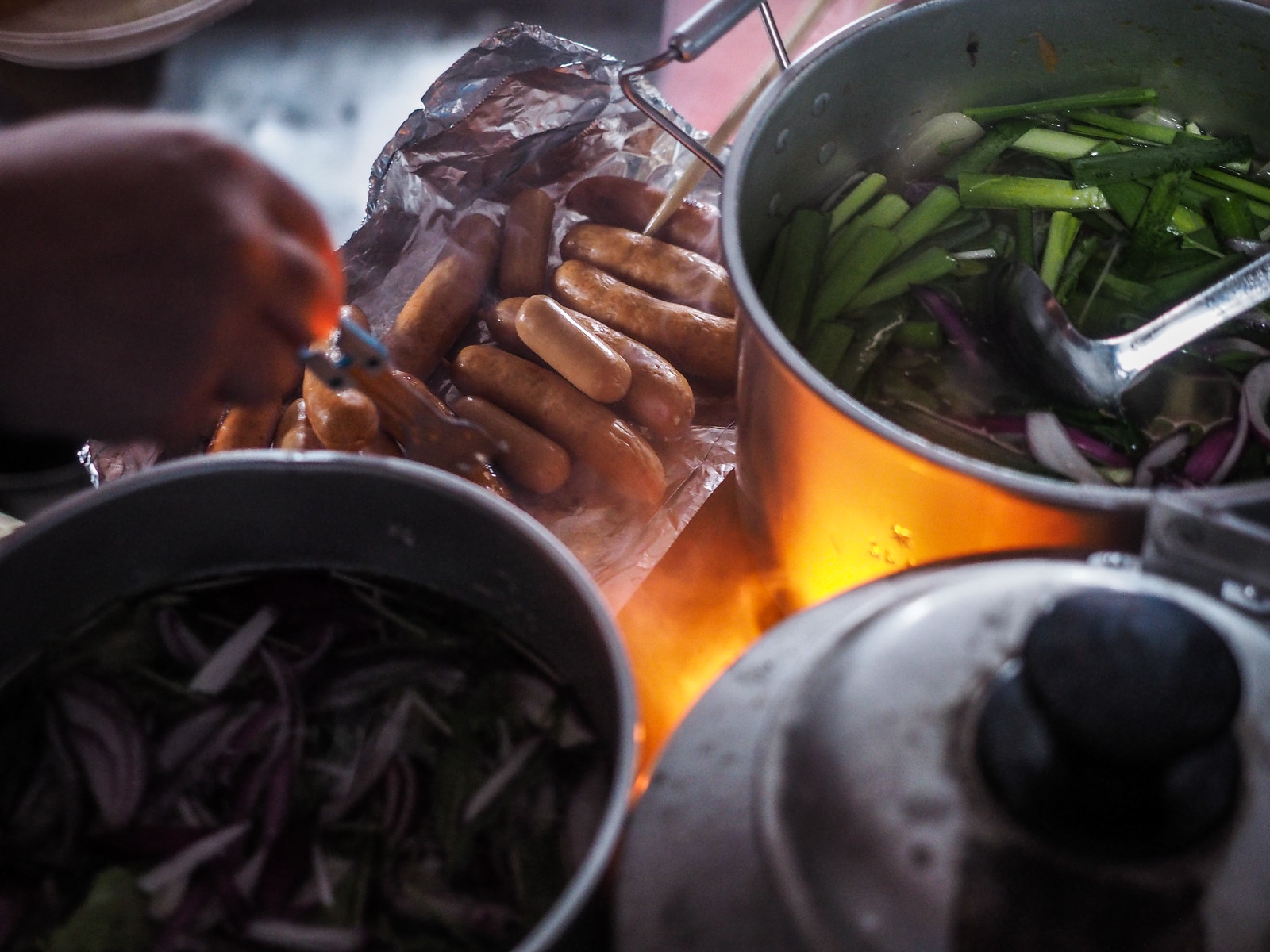
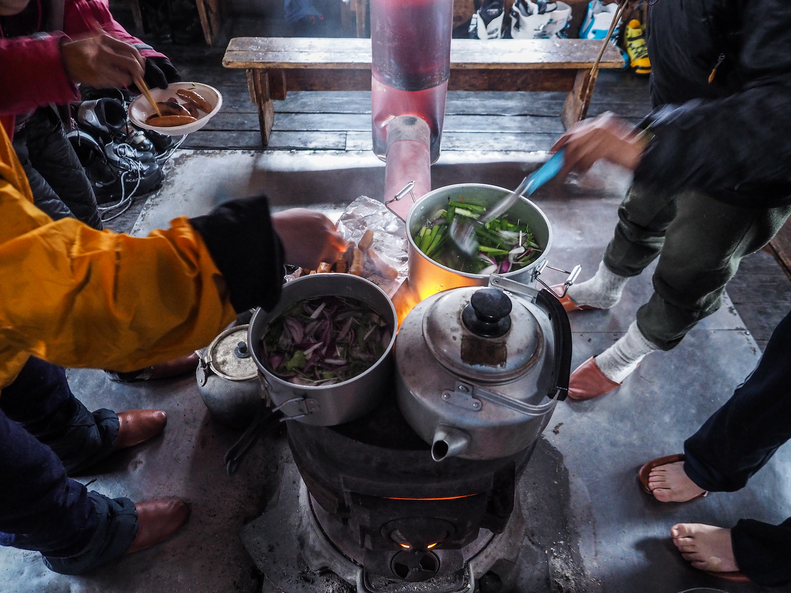
It took a while to get the stove going, but once it was stoked it at least warmed the vicinity of about 2m around the stove. It also facilitated the quick cooking of breakfast, once again organized and prepared by the ladies. This included sausages, toast, and hearty soup.

Yes, the flue in the second photo is glowing red hot.

Okuteine Hut and Yutopia Piste (Hokkaido, Japan)

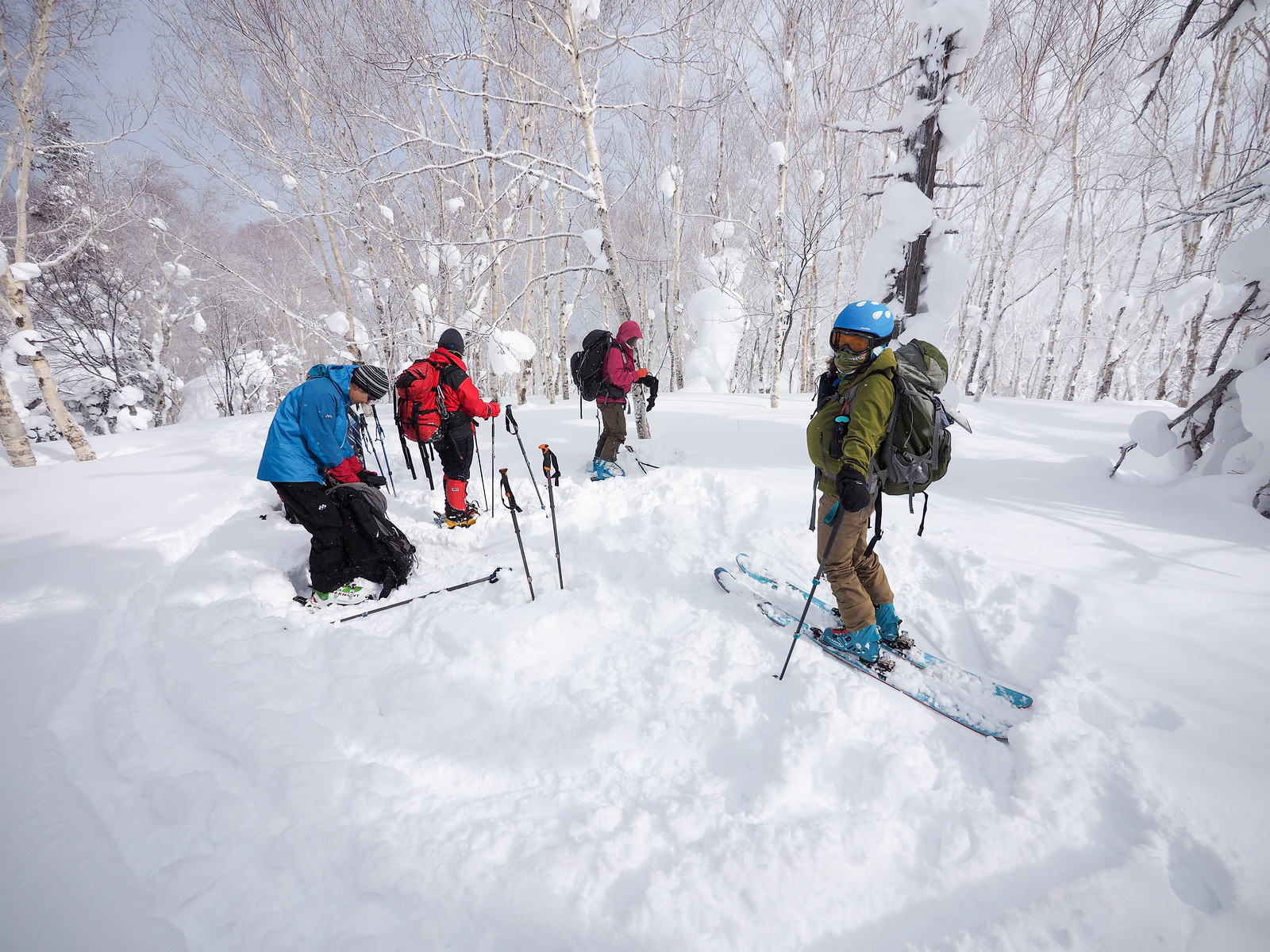
There had been some talk the previous day of the group splitting into two for the morning. One group would head for the Mt. Okuteine peak, and the other would do a few laps of the Utopia Piste next to the hut. In the end, the whole group decided to ski the piste – untracked snow was waiting.

I led the trail-breaking, and was at the top in about 20 minutes, via a zig-zagging route through the trees to the climber’s left of the cleared piste. From a relatively flat spot above the piste, we transitioned to ski mode and devoured some very nice turns on excellent quality snow.

Okuteine Hut and Yutopia Piste (Hokkaido, Japan)

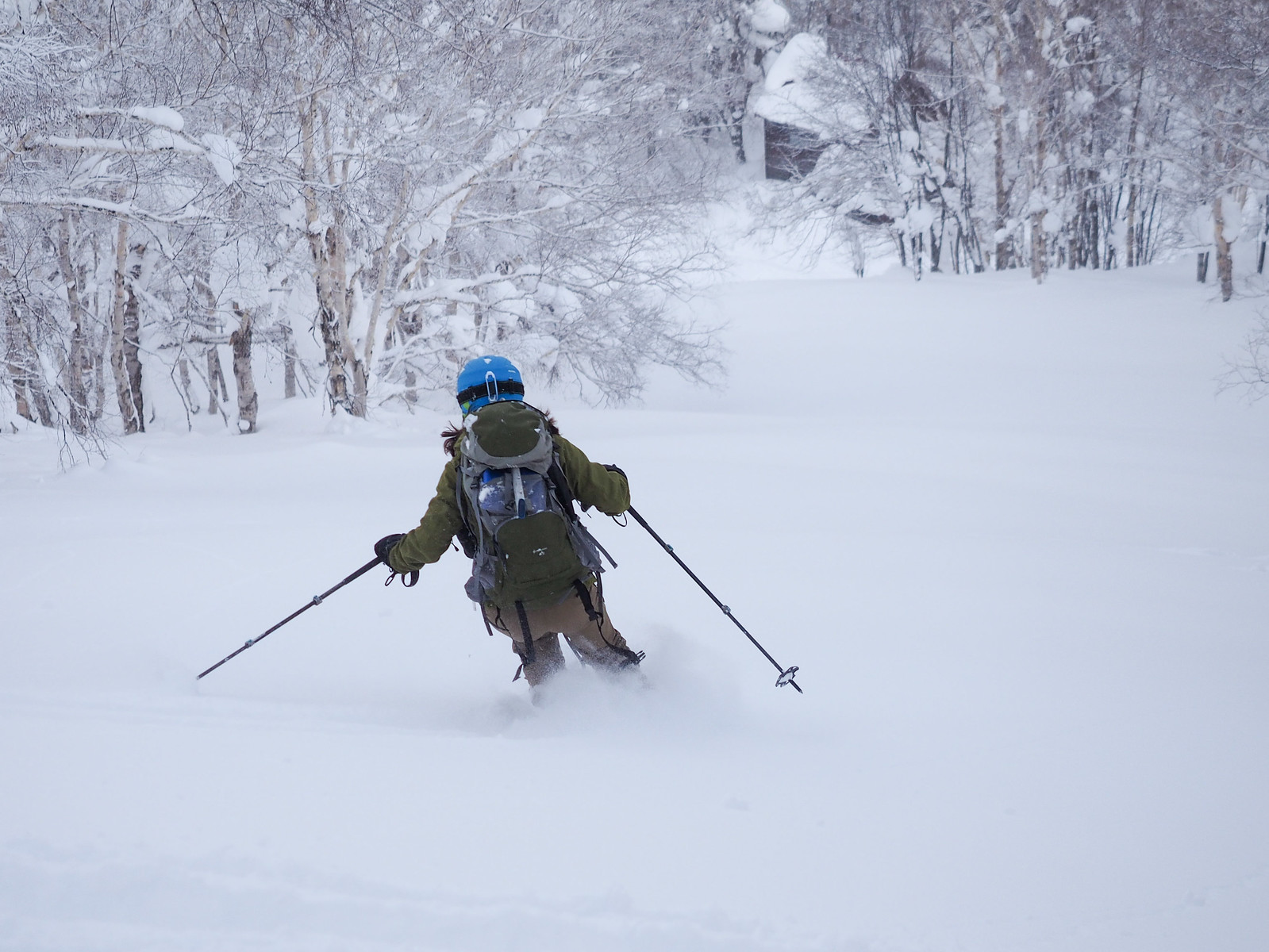
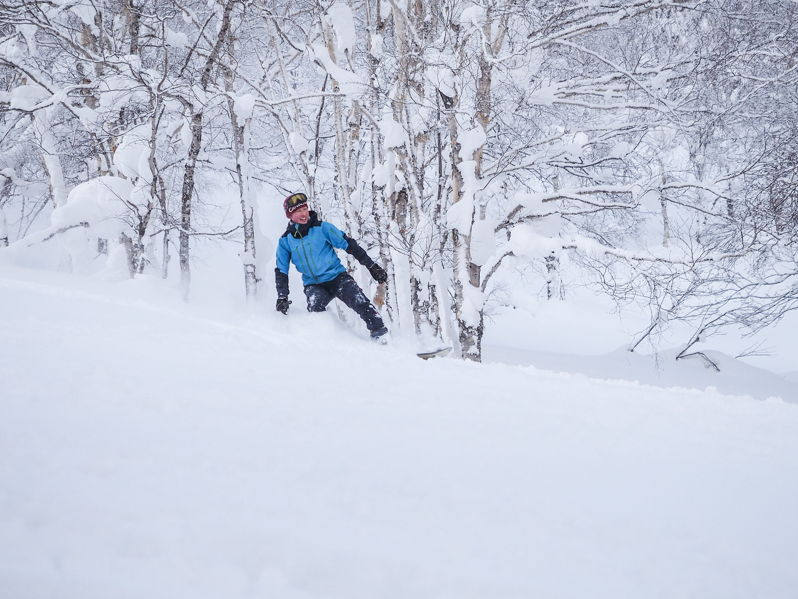
Hayato, a very capable skier in his own right, had found a snowboard in the hut that would attach to his ski boots. So he spent the better part of an hour post-holeing up the slope to give it a try.

Perhaps this one photo was worth it?

Okuteine Hut and Yutopia Piste (Hokkaido, Japan)

After a couple of hours doing a few laps, we all retired back to the hut for a break and to get ready to head back to the cars. Aiko led us with gusto in the hut-cleaning, wiping floors, hauling coal up from the basement, and clearing tables.

Of course we all signed the all-important visitor’s log also. It was great to see some entries from foreign visitors in there too.

Okuteine Hut and Yutopia Piste (Hokkaido, Japan)

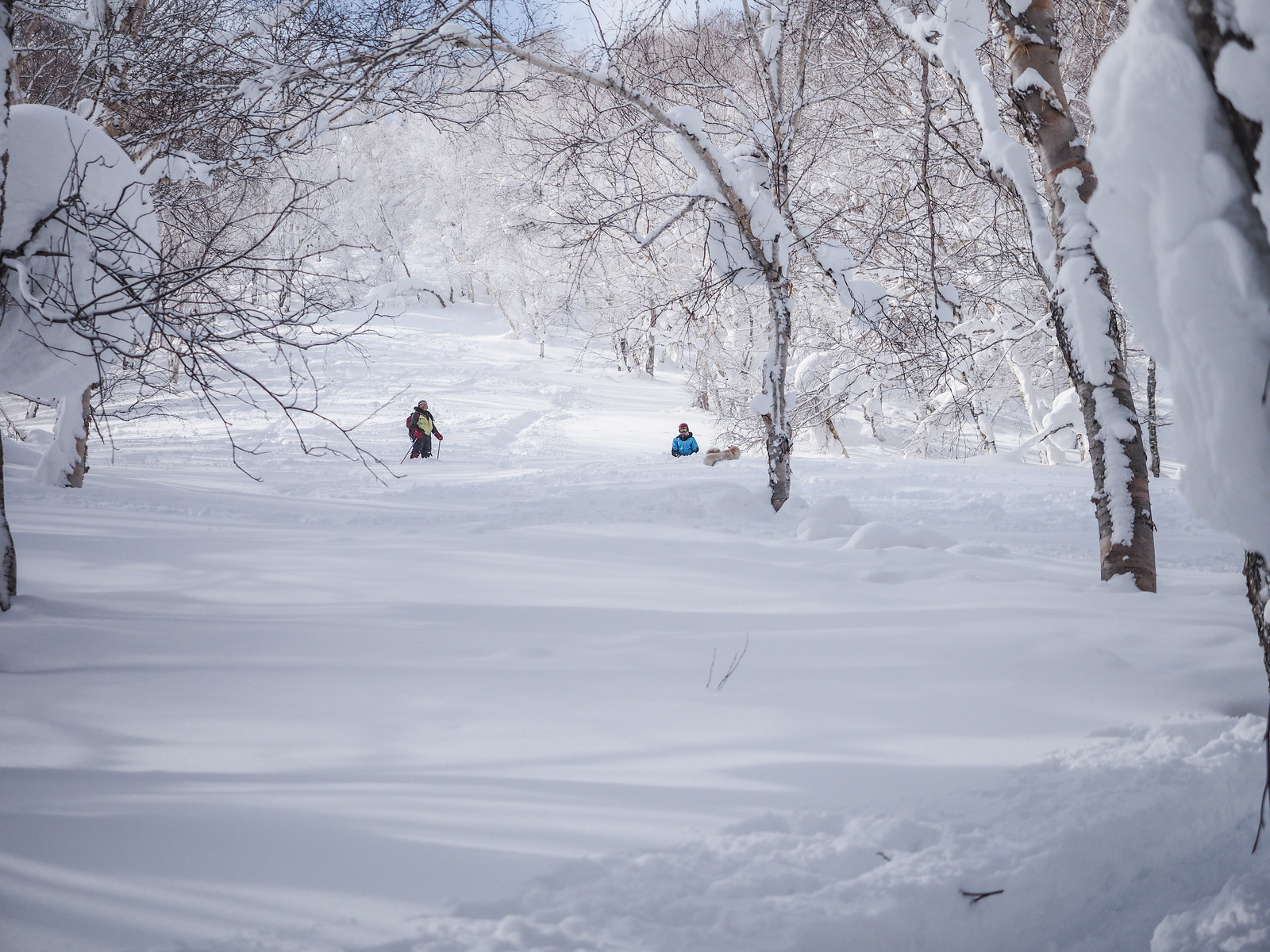
From the hut, it was a dash back along our skin tracks back to the trailhead. Besides a few sections of side-stepping up some rises, it was possible to ski the entire way back to the cars on the skin track without resorting to putting skins back on the skis.

We finished the weekend with a soak in the Jozankei Hotel onsen (location), but only because the first recommendation of Hotel Milieu with its ample parking (location) was closed to day visitors on this particular occasion.

Many thanks to the Laligurash Womens’ Outdoor Club (https://laligura.exblog.jp/) for such a fun and relaxing weekend away in the hills!

Comments | Queries | Reports

Done this route to Utopia Piste, or others nearby? Thinking of doing it? Please post any feedback, reports, or queries here. Thanks!

Leave a Reply

Your email address will not be published. Required fields are marked *

This site uses Akismet to reduce spam. Learn how your comment data is processed.

See More Like this

Printable Utopia Piste Topomap

TOPO DOWNLOAD (PDF, 0.9MB)

Download may take some time

Hokkaido Wilds Foundation

We’ve got affiliate links on HokkaidoWilds.org to help fund the Hokkaido Wilds foundation.

The Foundation gets a small commission on sales from affiliate links, but we only link to stuff we think is worth checking out for people keen on the outdoors in Hokkaido and Japan.

The Hokkaido Wilds Foundation is a fund where 100% of funds are donated to Hokkaido volunteer groups involved in sustainable, safe, and responsible access to the Hokkaido outdoors.

Learn more here

ADVANCED FILTERS

Filter by location

About Filters

REGION: The general mountain/geographical region the route is in.

BEST MONTH(S): Time of year a route is suited to visiting. Some pop all season, some are more limited.

DIFFICULTY: How strenuous a route is, and how technical it is. Full details here.

FREERIDE/SKITOUR: Very subjective, but is a route more-of-a-walk-than-a-ski or the other way around? Some routes are all about the screaming downhill (freeride), some are more about the hunt for a peak or nice forest (ski-tour). Some are in between. 

MAIN ASPECT: Which cardinal direction the primary consequential slope is facing, that you might encounter on the route. More details here.

ROUTE TAGS: An eclectic picking of other categories that routes might belong to.

SEARCH BY LOCATION: You can find routes near your current location – just click on the crosshairs (). You may need to give permission to HokkaidoWilds.org to know your GPS location (don’t worry, we won’t track you). Or, type in a destination, such as Niseko or Sapporo or Asahikawa etc.

Please let us know how we can make it easier to narrow down your search. Contact Rob at rob@hokkaidowilds.org with your suggestions.

Okuteine Hut and Utopia Piste via the Okuteine Valley Route Difficulty Rating

Category

Grade

Points

Strenuousness

Vertical Gain

C

30

Time ascending

C

3

Technicality

Altitude

B

6

Hazards

C

6

Navigation

C

6

Totals

51/100

GRADES range from A (very difficult) to D (easy). Hazards include exposure to avalanche and fall risk. More details here. Rating rubric adapted from Hokkaido Yukiyama Guidebook 北海道雪山ガイド.